Good Sunday, everyone. Toasty temps are back in the Commonwealth as the numbers climb into the closing days of August. This steamy setup will also be accompanied by some thunderstorms going up as we get set for a big change for Labor Day Weekend.
Temps today are generally upper 80s to low 90s as a little more humidity creeps in here.
Thermometers into Monday and Tuesday take off even more with 90-95 possible. Humidity levels will be up some, but shouldn’t get high enough for crazy high heat index numbers.
The threat for a storm or two will increase on Tuesday with a much better chance for storms Wednesday into early Thursday as a weak cold front drops in from the north…
A few of those storms may be strong or severe as they rumble through on the leading edge of the heat. This boundary will also knock the temps down some before it goes back to the north as a warm front late Thursday and Friday.
Friday looks toasty ahead of a much stronger cold front barreling in from the west and northwest into the start of the Labor Day Weekend. The evolution of this front sweeping through here is still a work in progress.
Showers and thunderstorms may be pretty active along and ahead of this boundary. Just how fast does this boundary push through? Does it just check up on top of us? Those are the questions of the week ahead.
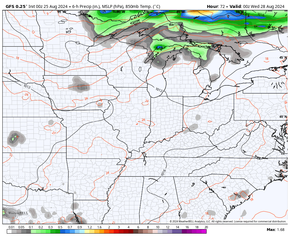
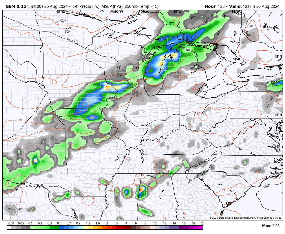
The GFS and Canadian Models are slow with this system, leading to holiday weekend storms…
GFS

CANADIAN
This likely kicks off another pattern featuring deep troughs diving into the eastern half of the country during the first week of September. We may also have a tropical system or two to deal with during this time, as well.
The AI version of the EURO is pretty gung-ho on these troughs…
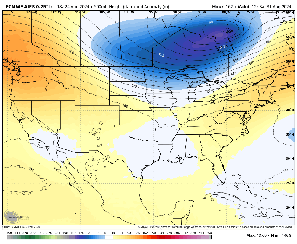
Y’all starting to sense a pattern? Troughs into our region have not been shy over the past few months and September looks to, at least, start with more of those.
Enjoy this final Sunday of August and take care.

No pattern sensed, yet.
I sense it, this past week weather was good t as it gets temps wise. The draw back is were lacking moisture hasn’t rain here since August 2 and and that wasn’t much. Haven’t had significant rainfall goes back to July
It’s the same weather pattern as we had at the beginning of the Summer. Getting very dry here in Maple. The rains we had earlier this month have evaporated. The troughs are mainly staying well to our North where there is a fast La Nina jet stream.