Good Tuesday, folks. The heat is on across the Commonwealth and surrounding areas as August ends on a very toasty note. This is ahead of a much cooler pattern sweeping in over the Labor Day weekend. A weekend that will also feature some showers and storms.
Temps out there today range from the low and mid 90s in the west and north to the upper 80s and low 90s across areas of central and southeastern Kentucky.
Thankfully, humidity isn’t a big issue today with the heat index numbers only a smidge above the actual thermometers. The core of the worst of the heat continues to stay away from most of our region…

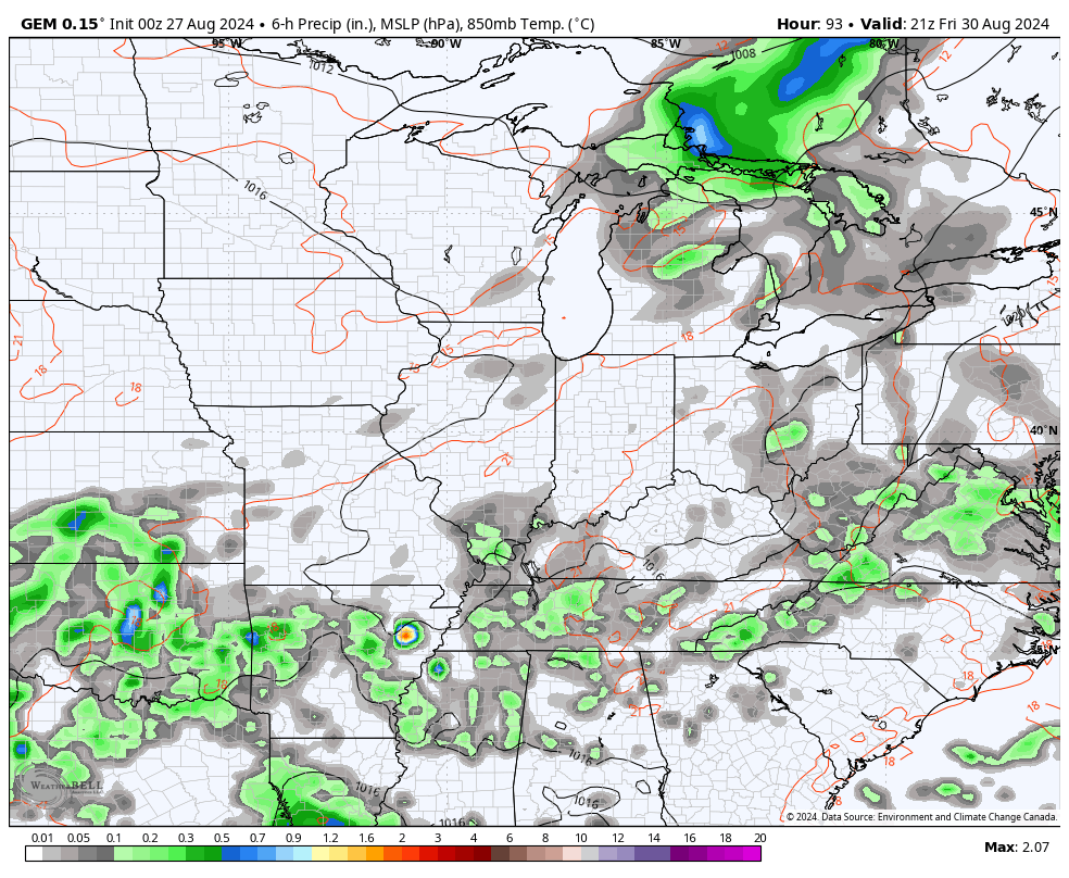
Most of the region is dry today, but there is the chance for a storm to go up north of the Ohio River. Here are your radars to follow these…

After another hot day Wednesday, a weak cold front drops in from the north. This touches off a few thunderstorms that can roll into parts of northern and northeastern Kentucky, especially. The Storm Prediction Center even has a low-end risk for a few severe storms…

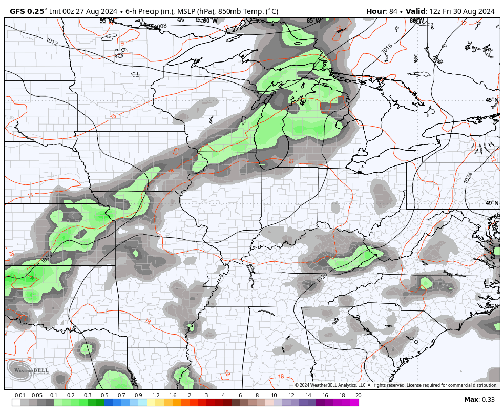
Thursday is another similar hot day as humidity levels come up a bit. Those humidity levels then climb even more on Friday ahead of a cold front dropping in from the northwest. This brings scattered showers and storms into Kentucky later in the day and those continue into Saturday before things improve Sunday and for Labor Day.
That’s, at least, the current thought process from the GFS…
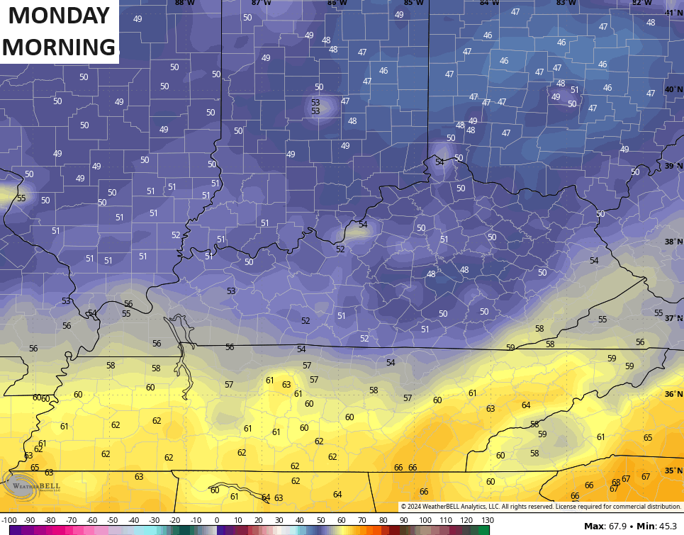
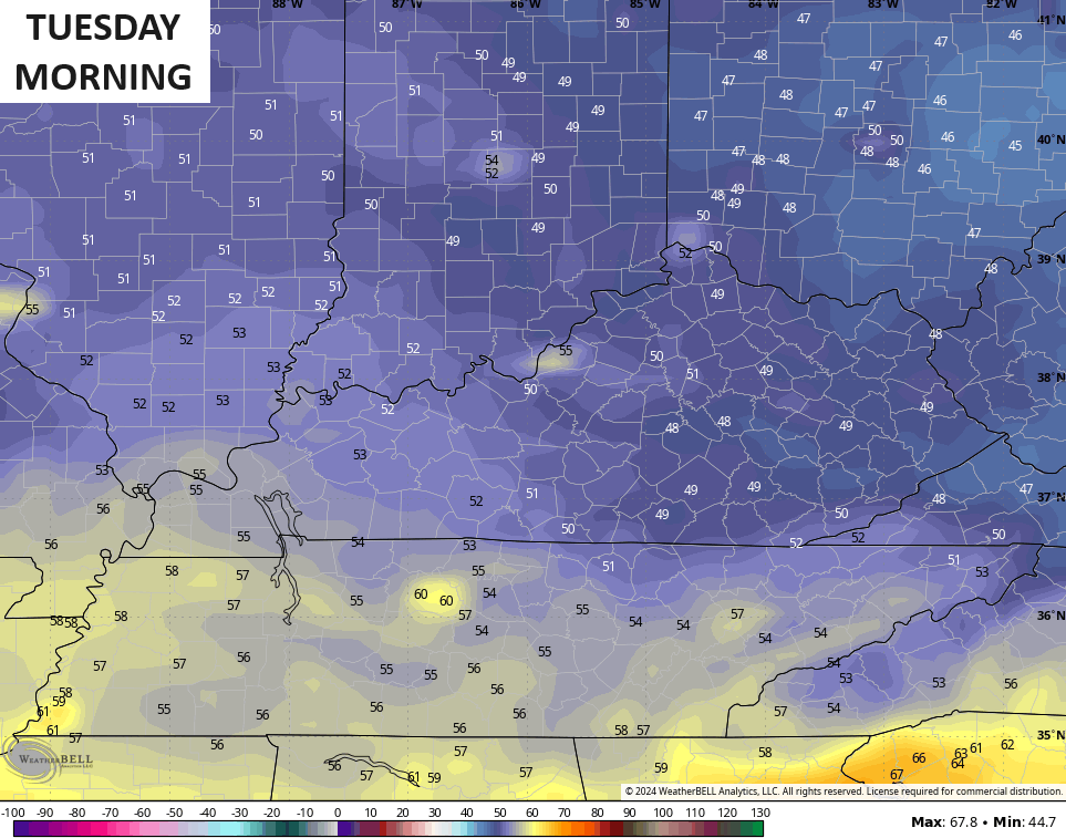
This brings another blast of fall weather behind it with temps going well below normal Labor Day into Tuesday…
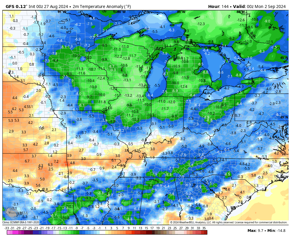
Lows will be back into the mid 40s to low 50s…
The Canadian is much slower with the overall front and would produce fairly widespread showers and storms that take us through Sunday into Labor Day…
There could be another hefty trough digging in later next week.
While the tropics continue to be unusually quiet, there’s a system of interest now in the Atlantic…

Have a great day and take care.

One more good heat surge will occur before true autumn sets in.
Was watching a video of someone who had lightning damage outside their house and I was thinking…. how long has it been since I’ve been in a storm where I heard that loud crash of thunder where lightning struck REALLY close somewhere…. I feel like it’s been FOREVER…. The storms we’ve had lately have been wind/rain… and you can see the lightning flashes… but that super loud thunder isn’t there….but it’s like thunder WAY in the distance… even though the storm is right on top of you…
Growing up in western NC… we would have daily afternoon thunderstorms.. I think they were enhanced because of the mountains… some days we would get hit… other days it would miss but regardless you could always heard thunder in the afternoon almost every day… (give or take)… But when the storm was on top of you… the lightning & thunder was insane! And I don’t even think these were considered severe storms…just pop up storms
My grandma would put her hands over her head and crouch down it would scare her so bad. I would get SO mad because when we heard thunder we would have to unplug the TV
Anyway… that is all…………
Those seem like good memories. My grandparents made us get off the phone and unplug the tv also. The last round of storms we had in Nicholasville had the crazy lightning and thunder. Some hit pretty close and had the CRACK then Boom lol. I’m definitely ready for more storms. Sunny days aren’t for me, give me rain and storms haha