Good Wednesday to one and all. Temps continue to take center stage with plenty heat and that continues for a few more days. Some storms also join the party for some areas today and Thursday with a much greater storm chance lurking for the big holiday weekend. That leads us into a much cooler pattern.
Temps today will be similar to what we had on Tuesday with upper 80s and low 90s in the southeast. The hottest weather continues to be in the west and north with mid and upper 90s showing up.
Humidity levels still aren’t very high, so the heat index numbers aren’t much higher than the actual air temp.
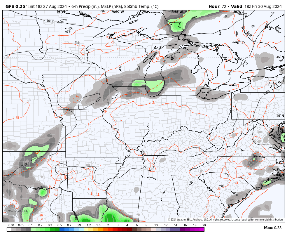
With a cold front dropping near the region, there’s the chance for a few storms to get into the northern half of the state. Some of these storms may be on the strong side and the Storm Prediction Center has a low-end risk for severe storms…

The 90s continue into Thursday and Friday with humidity coming up a little more each day. This means some isolated storms will be noted on Thursday with increasing storms later Friday into Saturday as a powerful cold front drops in from the northwest.
Showers and storms will have an impact on outdoor plans from Friday evening through the part of Sunday with better weather on Labor Day.
Here’s the GFS…
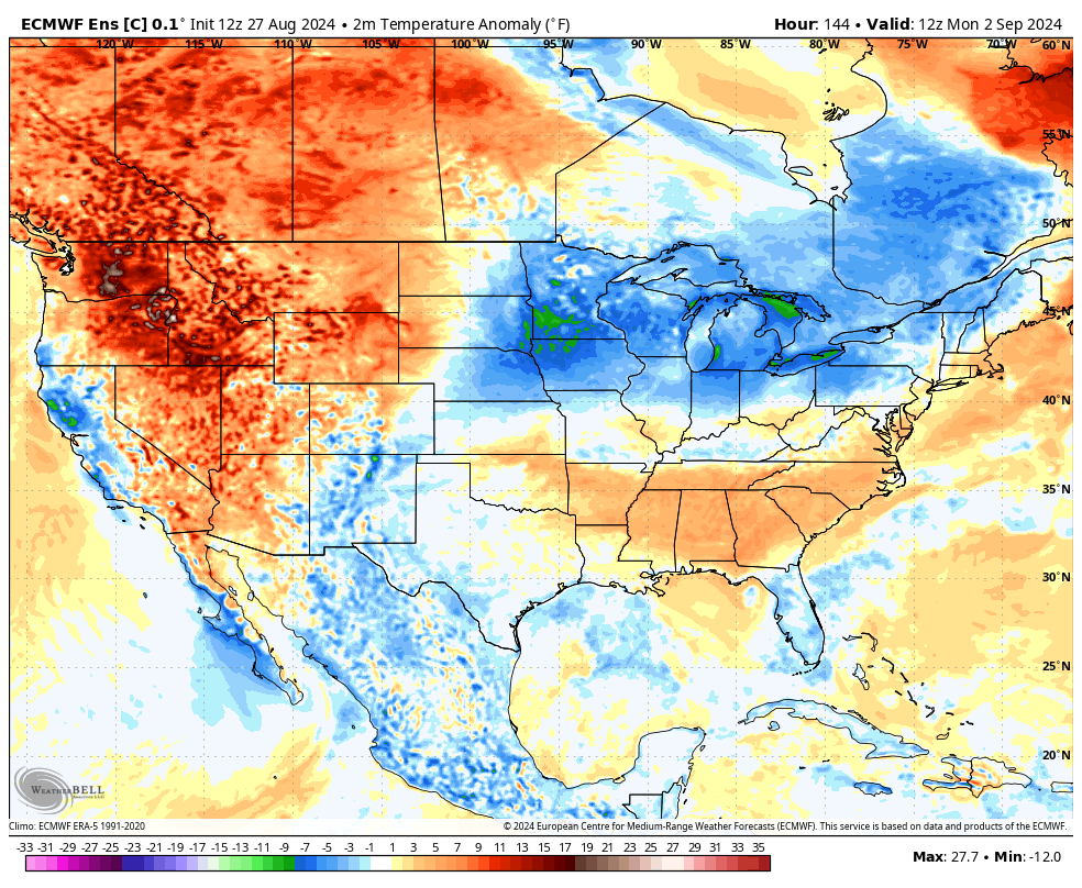
Temps come down starting Saturday and then go below normal from late Sunday into Labor Day.
I’ve mentioned the chance for another trough to dig into the eastern half of the country later next week and the models are picking up on this well.
The Control Run of teh EURO Ensembles shows our below normal blast early next week then you can clearly see the next round diving in late next week into the following weekend…
As usual, I have all your tracking toys to follow today’s strong to severe storms…


Current watches

Possible Watch Areas

Have a great day and take care.

The heat is still not over for the year.
The heat advisory should be extended to cover areas over most of Kentucky. Yesterday, we had our highest temperature of the Summer at 95 degrees, and I live in a very rual area of Taylor county. These very strong high pressure ridges keep appearing despite the declining daylight. I notice that the rainfall pattern we have suffered through this Summer has not changed. Just scattered showers. I’m concerned about the potential forest fire danger through the upcoming Fall and Winter.
Chicago’s O’Hare Airport set an all-time record high on Tuesday of 99 degrees, breaking the previous record of 97 set back in 1973. The maximum heat index was 115.
It reached 96 degrees at the NWS Forecast Office in the SW Suburbs with a maximum heat index of 117.
Thunderstorms developed over the area Tuesday evening producing much-needed rain. It’s only in the low 80s area-wide today, but humidity levels are still fairly high.
The 99-degree temp was the hottest of the summer here and the latest date we’ve seen a temp that high since 1985.