Good Thursday, folks. It’s another hot day across the state as we slowly start to change things up. These changes bring isolated storms in here today with a much greater storm threat over the Labor Day weekend as cooler air finally settles in.
Temps out there today back into the 90s statewide. The numbers will be hotter in the north and west and cooler in the southeast.
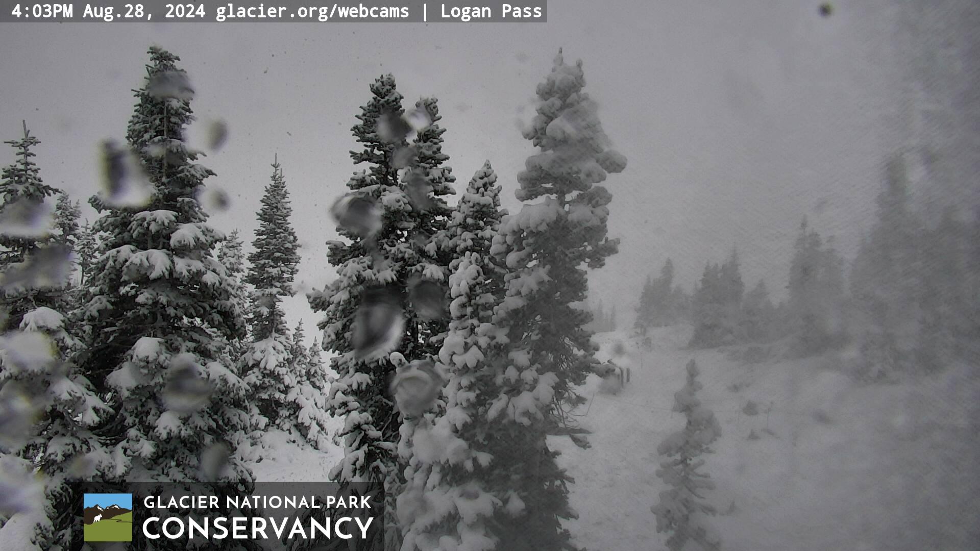
While we are backing, the high mountains at Glacier National Park in Montana are getting in on some rare August snows…
I’ll take that all day, every day compared to the heat.
Back to reality. Today’s heat will also be accompanied by a little better chance for a storm or two to go up this afternoon and evening. These can pop at any one location across Kentucky and will show up well on your Kentucky Weather radars…

Friday is another day in the 90s as a cold front inches closer to us from the northwest. This boundary touches off more in the way of scattered storms, especially during the afternoon and evening hours.
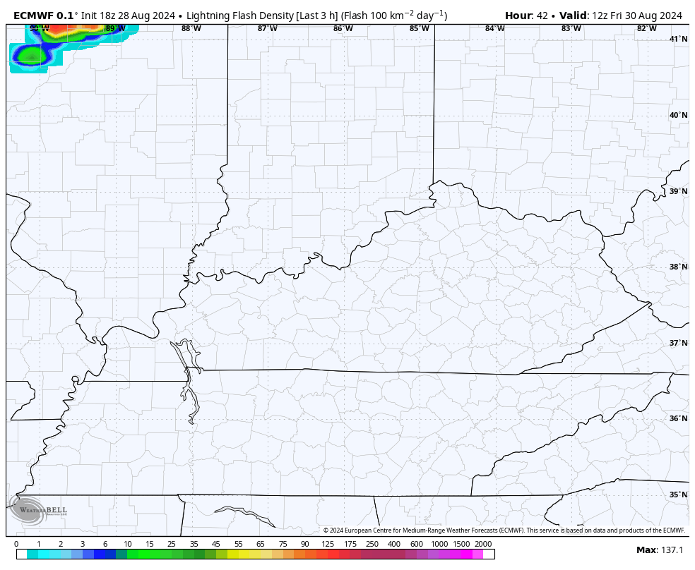
The lightning forecast from the EURO shows the potential for these storms…
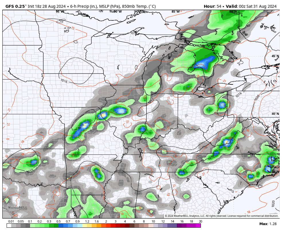
As the cold front move in on Saturday, showers and storms are more common and the lightning forecast indicates this…
With the kickoff of college football, we want no part of any lightning around here on Saturday. We can handle some showers, but lightning would mean some delays.
Saturday’s showers and storms are NOT all day. Highs are in the 80s.
This front may be slow enough that it keeps a few showers and storms going into Sunday, especially in the south. Dry weather looks to move in for Labor Day…
Temps come way down during this time and will go below normal, making for a very nice opening to the first week of September.
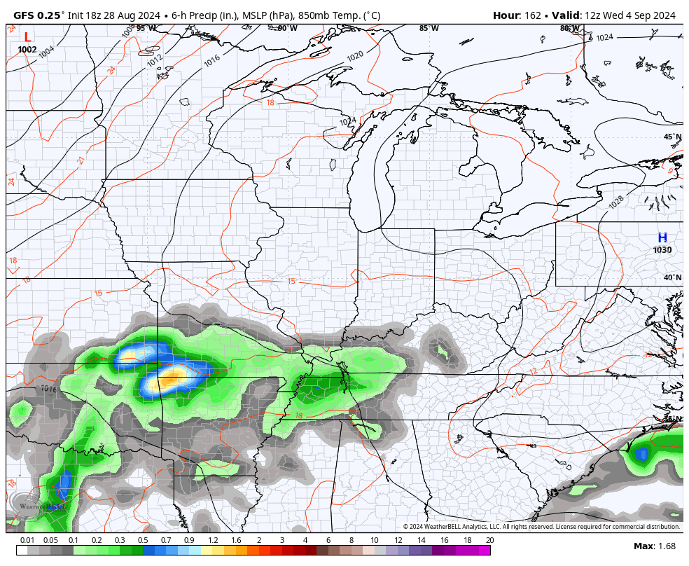
There’s the potential for another system to impact our weather with some rain by the middle and end of next week. Some recent runs of the GFS are showing this and then showing another massive dip in the jet stream coming in behind this…
Have a terrific Thursday and take care.

Give me heat over that snow any time.
Give me Snow over this heat any time.
Nah
I echo that Schroeder!
At 4:20 pm CDT, the temperature at my PWS just south of Bowling Green registered 100.4°F, which is the highest temperature recorded by the station in 2024. Fortunately, the dewpoint value at the same time was only 72°F, which is why the maximum heat index value topped off at 110°F. Our forecast today predicts a high temp of 102°F, which would break the current record high of 101°F set in 1925.
Thanks Chris, for displaying that photo of the giant fir trees in an early beautiful Snowfall. My Father always said that the ” best climate is out West. ” Yesterday’s high was a scorching 96 degrees here at my home in rual Taylor county. Hopefully, we will receive another brief relief sometime next week. The chances for any beneficial rains this weekend are decreasing with each run, and it really dry here. Same old precipitation pattern. Rains north of the Ohio River. I’m very concerned about young people playing Football in this hot weather. I wish they could play in an air condition indoor arena until we receive some real deal Fall weather.
Stay cool everyone !
The last two fall seasons have been so dry that aeration of turf was generally impractical. So, over-seeding had low returns. Really hoping for better conditions over the next month or so. Areas in full sun are really scorched.