Good Friday to one and all. We are on the last day of the final week of August heat wave. This heat breaks in a bit way over the Labor Day weekend as a cold front sweeps into the state with showers and storms and much cooler air behind it.
Temps out there today are back into the 90s with a little more humidity coming into play. Just like on Thursday, a few thunderstorms will blow up this afternoon and evening, and some of these may put down torrential rains and briefly go severe.
Here are your Friday storm trackers…


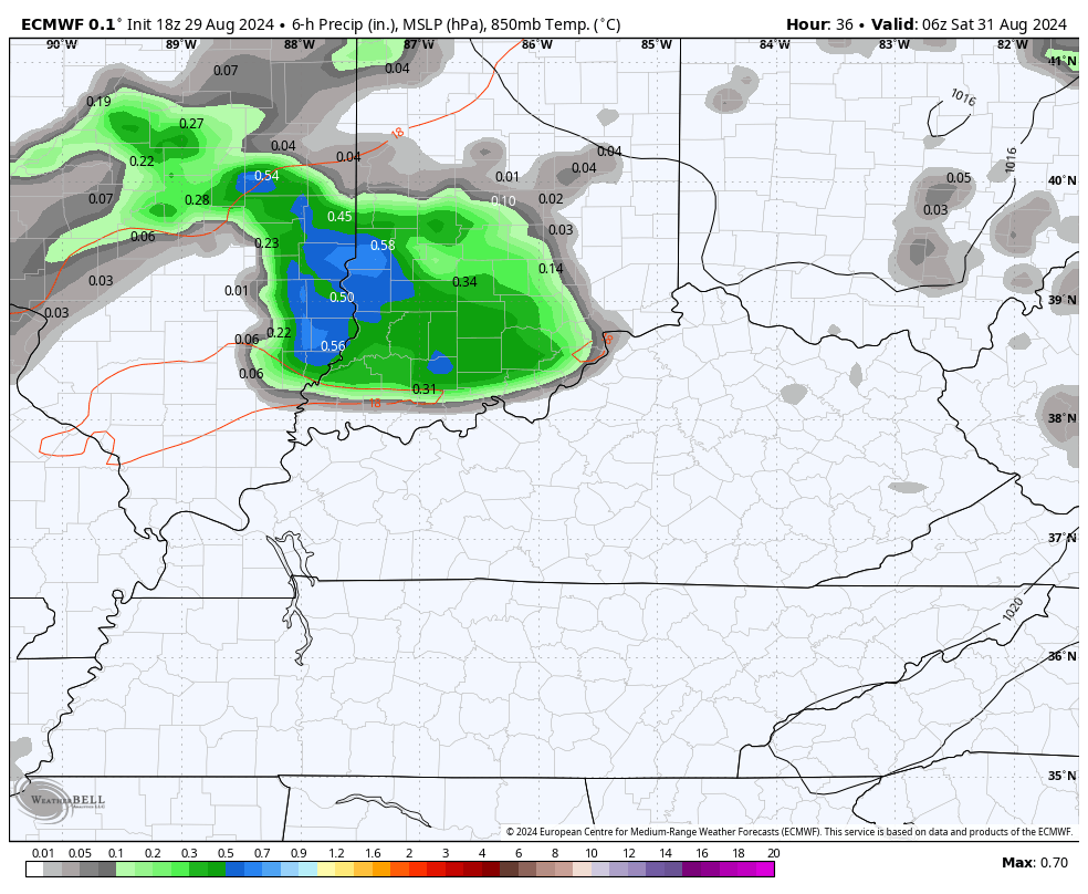
A cold front rolls in here later Saturday and brings an increasing threat for showers and storms. This won’t be all day rains, but clusters of storms will interrupt some outdoor plans Saturday and Saturday evening. This boundary lingers into Sunday with a few showers and storms leftover, especially across the southern half of the state.
This animation from the EURO runs from 11pm this evening through 8pm Sunday…
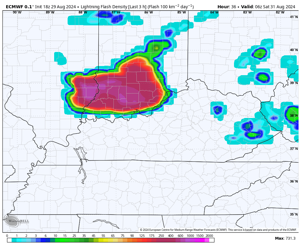
The lightning will be prolific with some of these storms, especially on Saturday. Here’s the lightning density forecast from the same run of the EURO through the same time period…
Much cooler winds start blowing behind this front from later Sunday into Labor Day. Highs for your Labor Day reach the upper 70s to low 80s in many areas with low humidity levels. These same numbers will be with us once again on Tuesday.
Temps will drop into the 50s. This won’t be anything like the cool air mass we had last week.
The setup for the middle and end of the week will likely feature another system coming at us from the southwest that will bring some rain into the region before another trough drops in from the northwest.
We are entering the traditional peak of the Atlantic hurricane season and things have been rather quiet of late. This is about to change as the National Hurricane Center is tracking two systems with the chance to develop over the next week…

We will see if anything pops from this and if it has any impact on the weather in the lower 48.
Have a fantastic Friday and take care.

The temperature reading at my PWS near Bowling Green exceeded the century mark for the second day in a row yesterday, hitting 101.4°F at 4:20pm CDT. Once again, the heat index exceeded that mark by only a few degrees, since humidity levels remained tolerable. The temperature reading was the highest recorded at my station for the entire year. I’m hopeful that this will be the last that we flirt with triple-digit temperatures for the remainder of 2024!
Ninety six degrees was the high temperature reading here in Maple. The dew points were tolerable, but I still could not stay outside too long. I plan to stay indoors today. With the declining day length I would hope that the horrid temperatures are over. My comment is that this was the hottest and most miserable Summer I have seen in my lifetime ( 73 years. ) As far as precipitation, both the Pacific Decadal and the Atlantic multidecadal oscillations indicate that the severe drought in the Southwest will continue through the Fall and Winter. It is now rated as the worst drought in twelve hundred years. To end this the PDO would have to go positive and the AMO negative, which would give us an El Nino in the tropical Pacific ( Nino three. four. )
I agree Schroeder but I am not one to like the heat anyway. I am looking forward to fall.
I still think we have one more good hot spell before fall fully arrives. That said, some rain would be good.
With this persistent precipitation pattern most of the good rains ( widespread ) will fall well to our North, where this Fall and Winter’s expected La Nina jet stream is establishing. In other words above normal temperatures and below normal precipitation for areas south of the La Nina jet stream.