Good Friday, folks. What’s left of Francine continues to push a few spiraling bands of showers and storms across Kentucky today. While not everyone will see rain from this, several areas are getting in on a good soaking.
Today’s action continues to be more prominent across areas of central and western Kentucky. Today’s bands of showers and storms are spinning from southeast to northwest as the ghost of Francine spins across the Memphis area.
This setup leaves much of northern and northeastern Kentucky on the outside looking in.
This super sharp cutoff on the rain shield sets up very close to the Lexington metro today and it’s going to be pretty cool to see.
Areas getting in on the rains can pick up some healthy totals and that can lead to a few issues in spots. Here are your Kentucky Weather radars for the day…

With this system settling farther southwest into Saturday, that pulls the rain chances farther west and southwest…
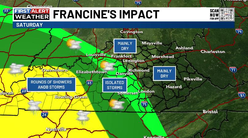
That leaves much of central and eastern Kentucky dry with highs in the low 80s.
Sunday is another mainly dry day with showers and some storms still in the west.
From here, we watch what happens along the Carolina coast as a tropical system tries to come together. This is one of the systems the National Hurricane Center is monitoring…

If this system does develop around Myrtle Beach, we will watch to see if this can work in reverse and bring some rain into central and eastern Kentucky early next week…

The longer range look on the EURO Ensembles is for a big block to develop across eastern Canada and into Greenland. That allows for a trough to hang around our region and the southeastern part of the state. You can see all that on this animation that runs from September 18th through the 27th…
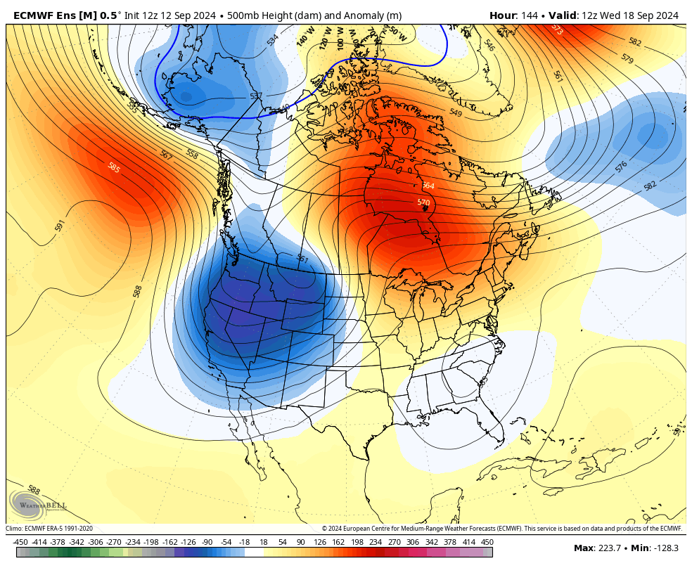
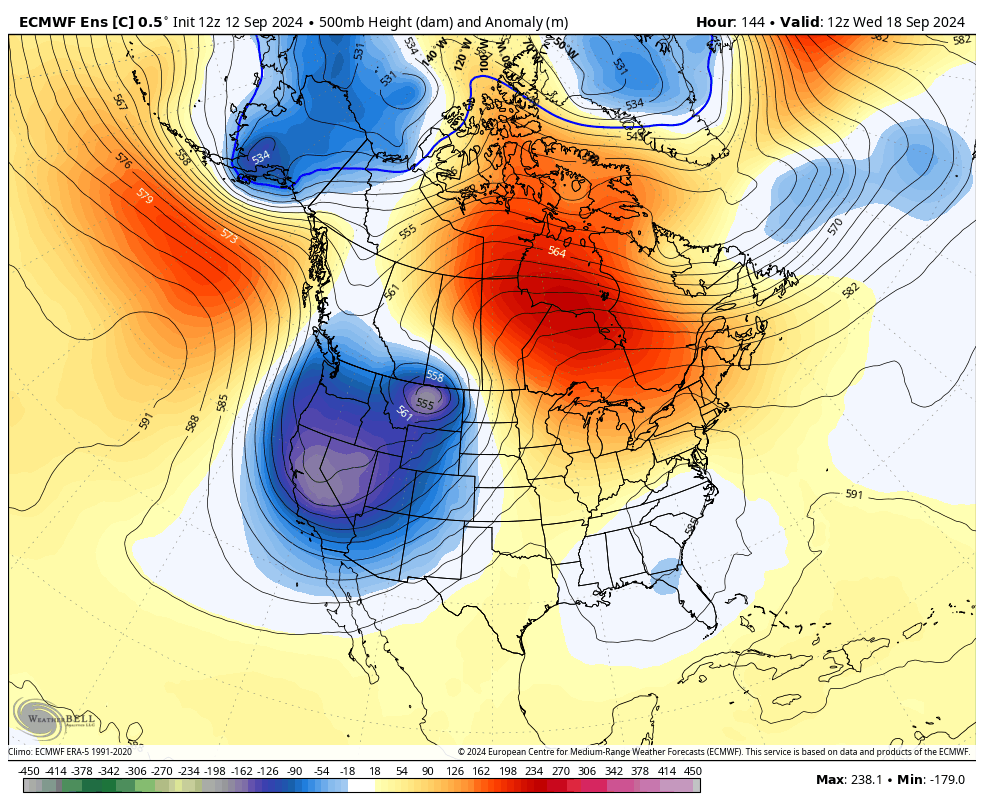
The Control Run of the Euro Ensembles also shows this well…
It’s time to start talking fall and winter, and this is exactly what we will be doing over the next few weeks. Woot!
Enjoy the day and take care.

Thanks Chris. Not much in the way of rainfall totals here in Maple. I will have to check my rain gauge later to get the exact amount. We will have to wait and see if any more falls later. I really enjoy viewing your ZoomRadar to follow the temperatures and precipitation patterns across the Nation.
Looking forward to your Fall and Winter discussions. I know you put a lot of work and time in preparing.
Enjoy and I hope it’s a lucky Friday the 13th !
The rain band is slowly drifting NNW, with barely a leaf turning. Perfect scenario for capturing every drop on this patch of moisture-starved earth. Joe mentioned a day or so ago about the concrete-like nature of our soil. Yup. It could really use periods of rain over several days. Seems unlikely, but we can hope.
Francine continues to underperform in the Bowling Green area, and a two day total of 0.01 inches of rain is all we have to show. Warren County has been stuck in the dry slot, as the vast majority of precip stays to our north and northeast. The local forecast shows an 88% chance of rain today, but I think that is wishful thinking, while the next series of tropical systems show little promise. Stress from lack of moisture is causing the leaves on several trees in our yard to begin showing color, and others are dropping their leaves. This allows more tinder dry fuel to accumulate, which is why the county-wide burn ban remains in effect until further notice.
Well, we were unlucky in the rainfall. Only 0.25 ” since 12:00 am. Not any more chances in the extended at this time. If anyone out there has plants that are not native you better give them a good soaking. Because,I think we will have another long period before rain chances return. A lot of areas, like two counties next to mine received up to 2.00. ” What I received around midnight will evaporate in less that hour. Evaporation without condensation just means more drought.
Guess I have spiders building in my PWS. We finally have rain and my PWS shows 0.00 all day long. I’m sure it was probably under an inch here at my place but it was a nice rain until just after noon. I’m happy with every drop.