Good Monday, folks. We are watching the weather go in reverse this week as a tropical system moves into the Carolinas today and heads toward the west. This system likely brings rain into the eastern half of the state over the next few days.
This system has been well advertised here on KWC as it’s been on our radar for nearly a week now. The current satellite loop shows how quickly this system is coming together today just offshore from Myrtle Beach…

This should become Tropical Storm Helene before coming ashore late today or tonight near Myrtle Beach. The center then rolls toward the southern Appalachian Mountains through Wednesday.
Here’s the latest information and track forecast from the National Hurricane Center…

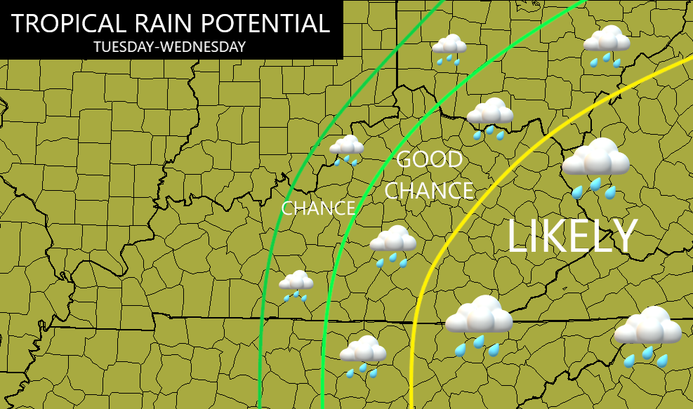
Here’s my current thinking on who has the best chance to pick up on some of the tropical rains from this system…
The NAM actually brings the remnant low all the way into eastern Kentucky, thus, keeping some showers spinning into Wednesday night. This animation goes from this afternoon through Wednesday evening…
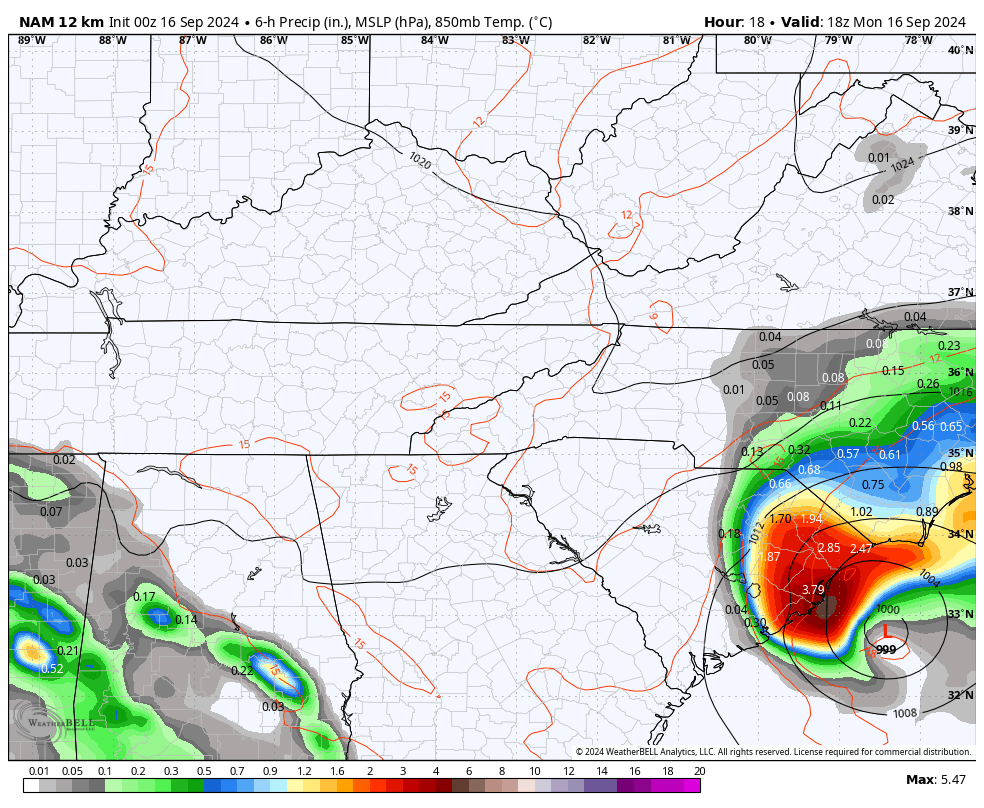
That would bring the best rains through eastern Kentucky with some showers going farther west toward Interstate 65.
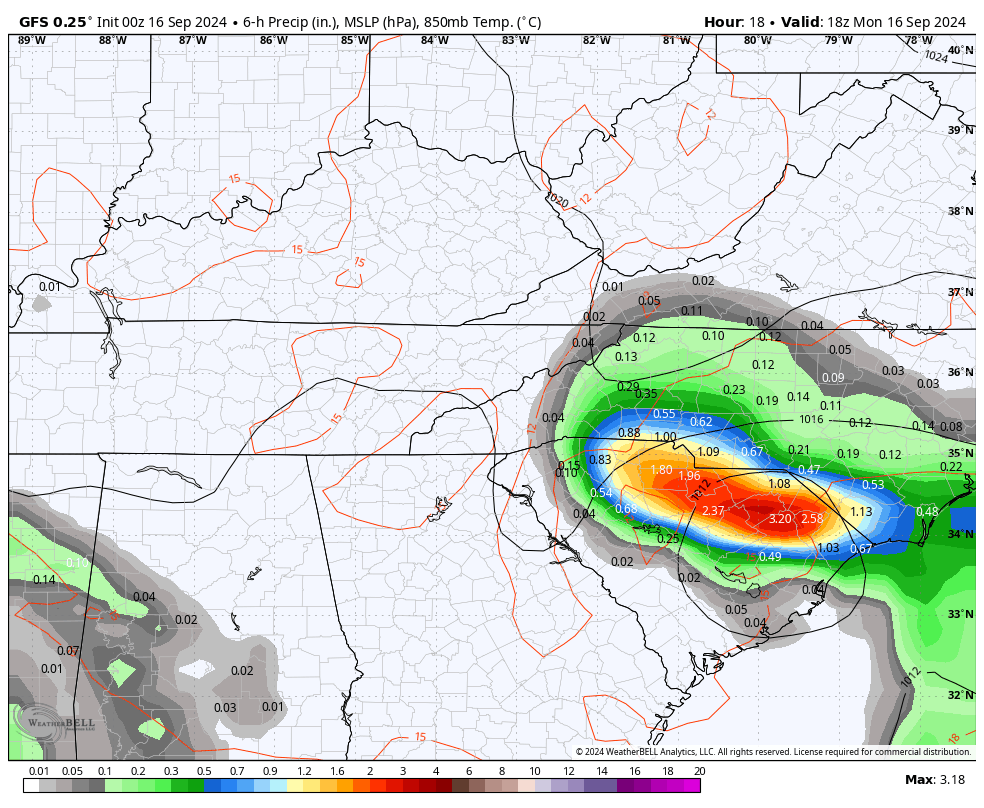
Other models aren’t as far west with this system. Here’s the GFS…
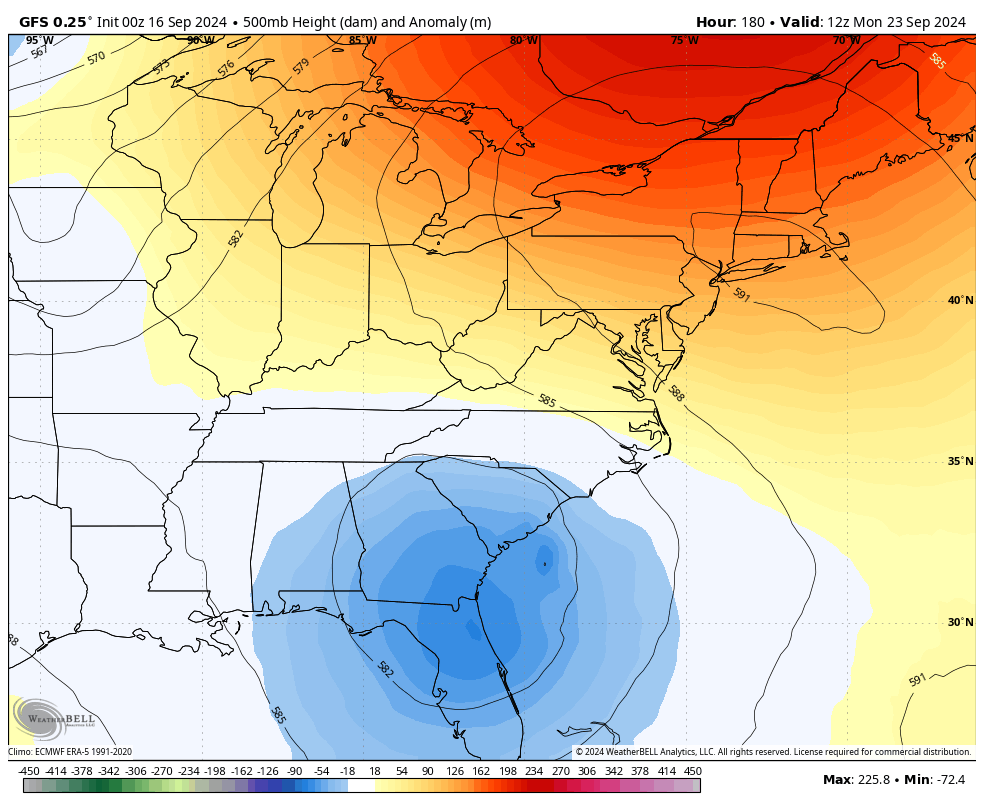
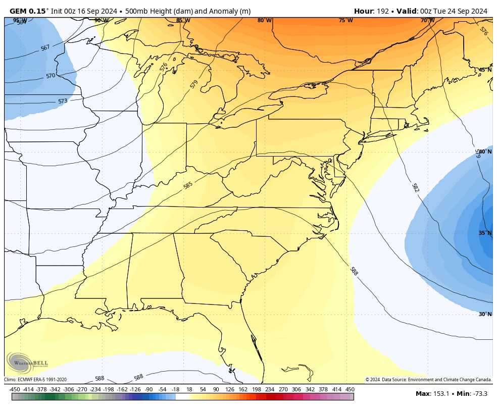
The pattern remains very blocky and there’s the chance for another system to develop in the Gulf or off the southeastern seaboard. With so much blocking going on during a seasonal transition of a month like September, some wild model swings are showing up as they struggle with so much action.
Still, we can clearly see lower heights across the southeast with additional energy trying to dive in from the northwest this weekend and early next week…
GFS
CANADIAN…
I will have the latest on WKYT-TV starting at 4pm today. Until then, here are your radars to track this system…

Have a magnificent Monday and take care.

Hope central and eastern ky gets a good soaking from this. Here in my world in western ky we got some moisture from the remnants. Just wasn’t enough put a dent to the drought.