Good Tuesday to one and all. We have another tropical shower making working close enough to the region for some scattered showers to impact parts of Kentucky. After we get rid of this system, summer isn’t quite done with us as temps go above normal.
Let’s start with today’s rain that’s coming in from the east. These showers are spinning across the eastern half of Kentucky with another sharp cutoff showing up on the western edge of this in central Kentucky.
Areas of eastern Kentucky will see the greatest concentration of showers with the chance for a rumble of thunder. That said, this won’t be constant rains by any means.
Here are your Kentucky Weather radars to follow along…

Leftover showers and isolated storms will show up across the east into Wednesday and even into Tuesday. A lot of dry times will be noted in the east during this time.
Temps over the next few days will show a big time range from east to west. Areas in the east will be much cooler because of clouds and scattered showers with highs mainly in the 70s, though some may not get to 70 today. Highs across the rest of the state will be in the 80s.
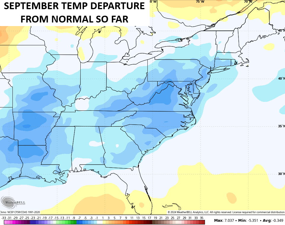
The 80s flex on us later this week into the weekend as we try to balance out the September temp pattern that’s averaged below normal, so far.
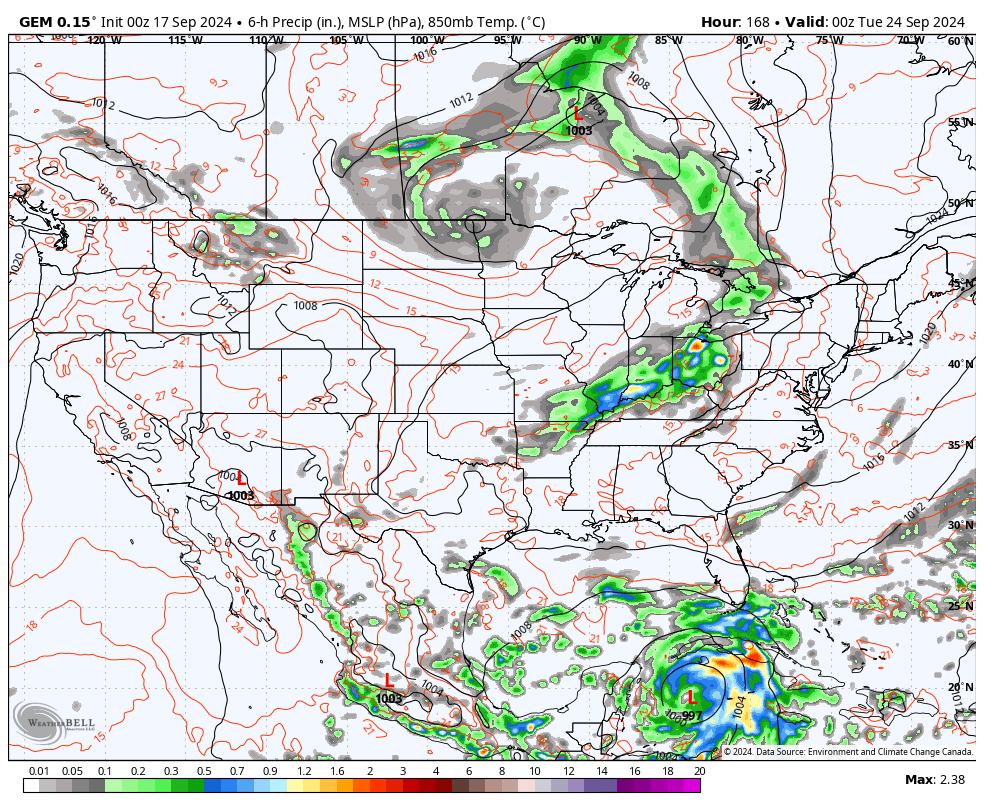
The setup early next week can bring a trough into the region from the northwest and that may be the first of a few systems dropping in from the northwest. At the same time, the models are really hitting the potential for a tropical system to develop in the Caribbean and work into the Gulf of Mexico.
If that happens, we will need to watch for a possible interaction with one of those troughs digging into the east.
The Canadian Model is pretty aggressive with this scenario next week…
The GFS has a similar thought but is a few days slower…
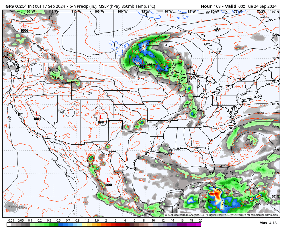
Those kinds of interactions can dramatically alter the overall pattern across North America. We need that to happen as we head into the fall forest fire season.
Enjoy the day and take care.
