Good Friday, everybody. We are putting the wraps on the week with summertime temps hanging tough across the region. This warm air takes us into the weekend with some scattered storms showing up before we turn the pattern much wetter next week.
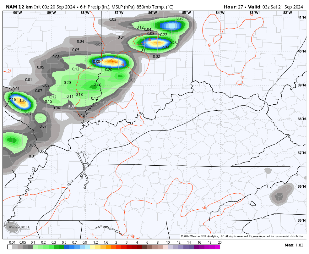
Today’s weather features some clouds dropping in from the northwest and there’s even the slightest chance for a late evening shower or storm in the north and west. This chance for a shower or storm increases a bit more into Saturday, but still doesn’t look terribly widespread.
Here’s the future radar from this evening through Saturday evening…
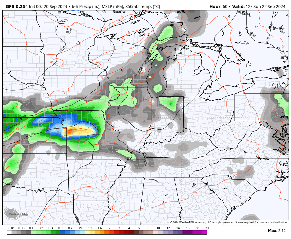
Showers and storms become a little more common later Sunday as a system rides in from the west and northwest. This gets in and slows down Monday and Tuesday, bringing an increase in the showers and storms for the entire area.
This animation shows what I’m talking about with the above-mentioned scenario…
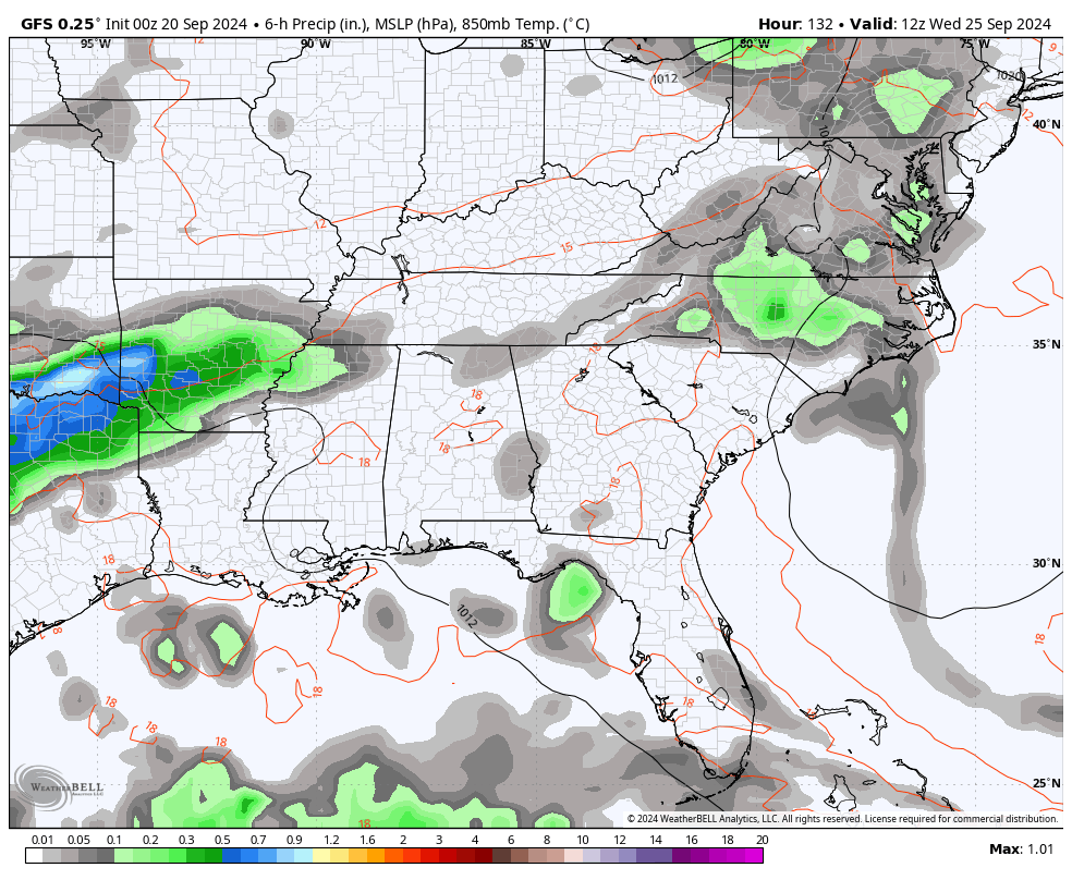
That may be followed up by another system working through here later Wednesday and Thursday of next week. This is where things get a little murky. Why?
A large tropical system is likely to develop and move into the Gulf of Mexico in the coming days. The National Hurricane Center is increasing the odds of this system developing…

The GFS shows our second healthy rain maker as our tropical system targets the eastern Gulf of Mexico. This run of the GFS keeps that system just to our south…
The Canadian takes a walk on the extreme side as it takes the Wednesday-Thursday system and turns it into a slow-moving cut off system and keeps it spinning on top of us for several days. Watch how that system draws up deep tropical moisture from the Gulf system…
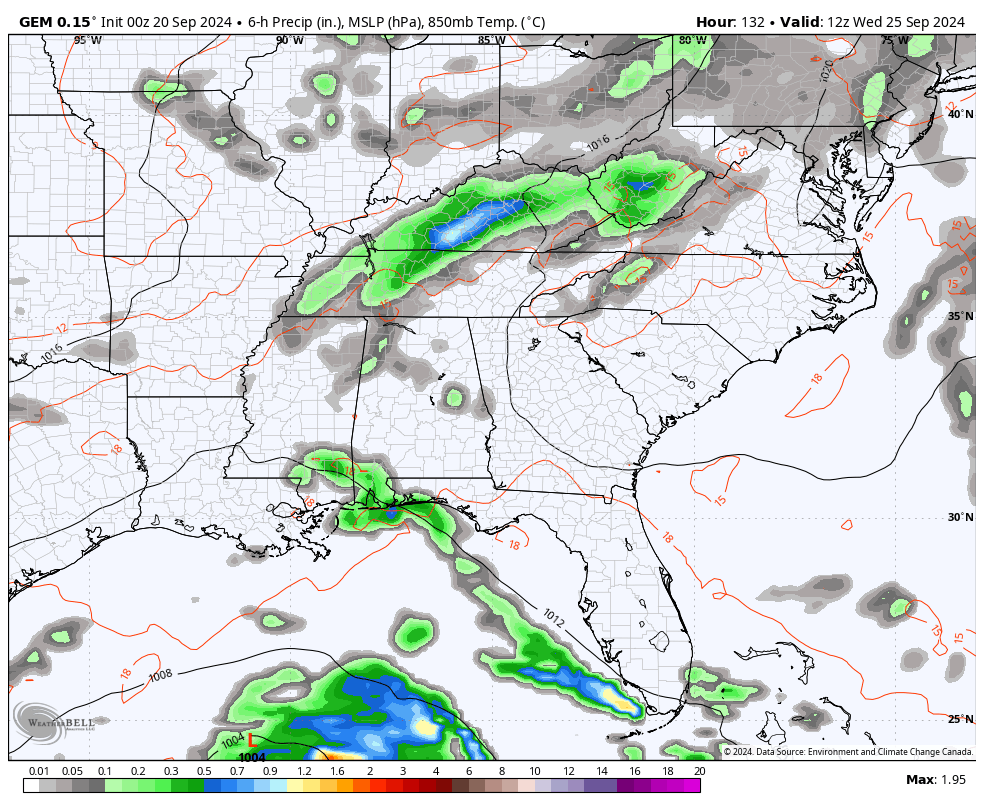
Overall, some healthy rain totals are likely in our region over the next week or so.
On a side note, NOAA is out with their probability forecast for the upcoming winter. They place our region in the “leaning above normal” and the “Equal Chances” categories for temps…
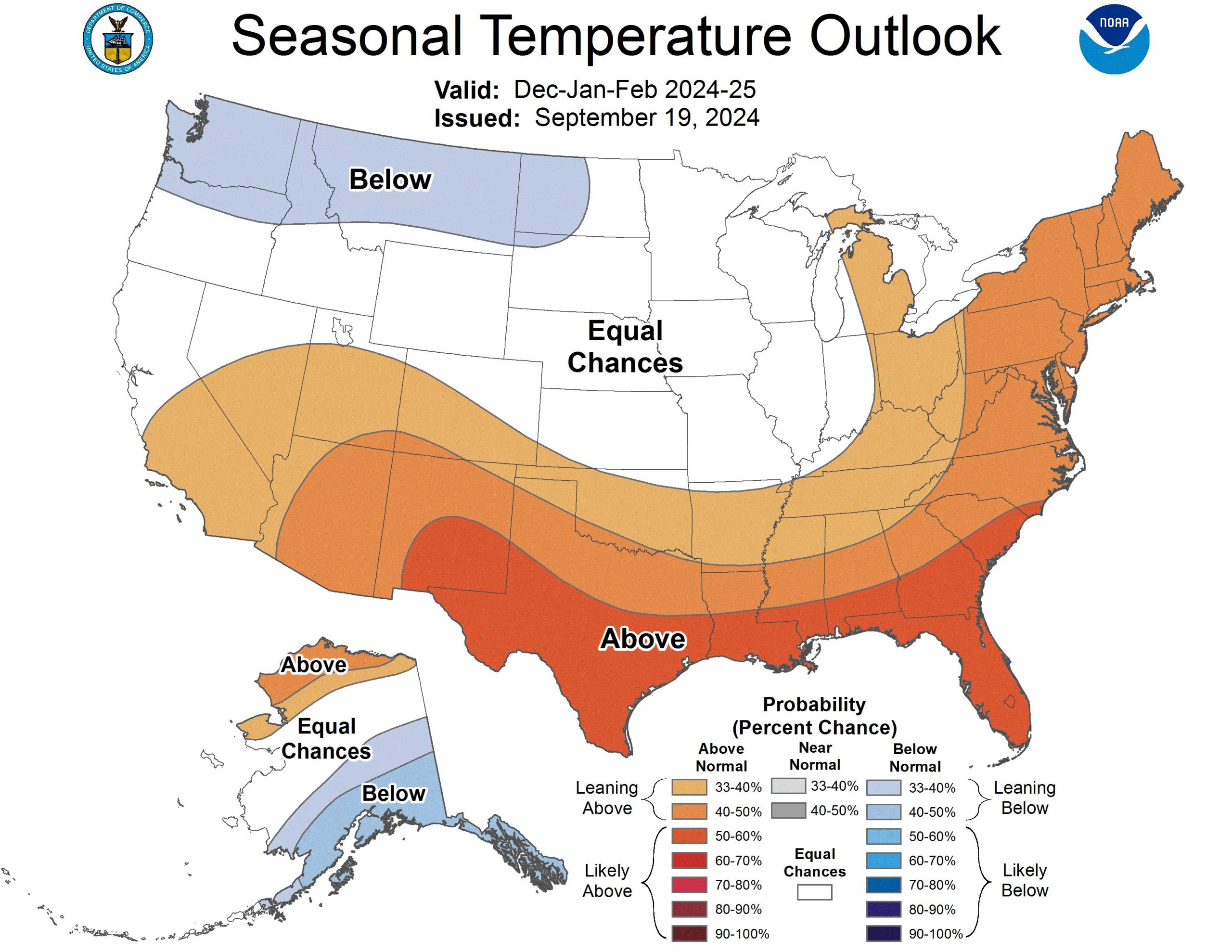
I always have serious issues with probability forecasts like this. Why? How far above normal? How far below normal? Less than a degree or 5 degrees?
The Precipitation Outlook puts our region in the “Leaning Above” and “Likely Above” categories…
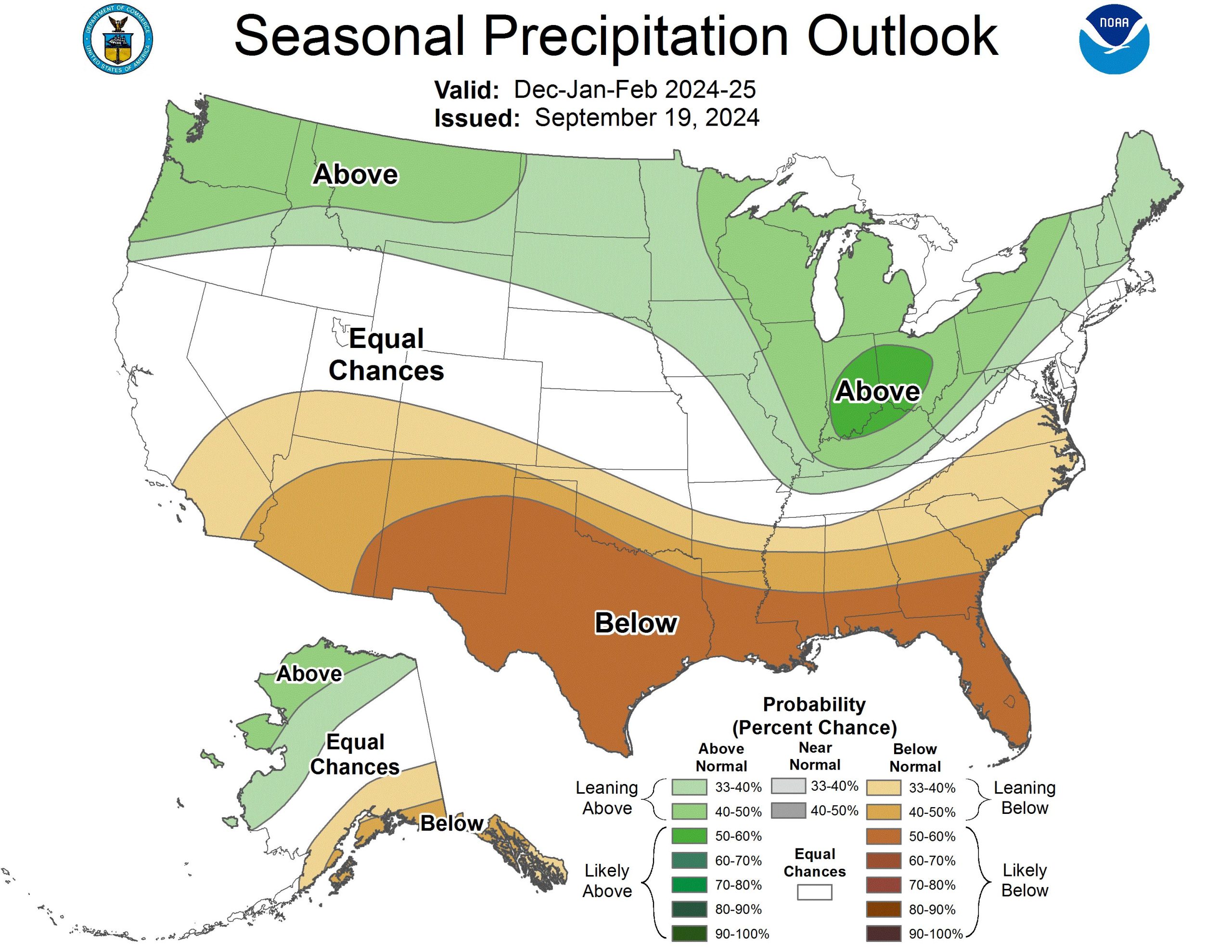
Again… is that 0.10″ above normal or 10″ above normal? Grrr
BTW… I don’t have too many issues with the spatial looks of the above maps as they aren’t too dissimilar from my winter thoughts. I like the above normal precip in all forms for our region.
Have a fantastic Friday and take care.

Did you post your winter thoughts here?
He puts out his winter outlook sometime in November.
That’s what I remember, but I thought I’d missed something when Chris wrote: “I don’t have too many issues with the spatial looks of the above maps as they aren’t too dissimilar from my winter thoughts.”
Looks Mild and Dry for my area of the state.
Thanks Chris. A typical La Nina Fall and Winter is what NOAA is saying in their forecast, ” all La Nina are not the same. ” Will see.
Take Care Everyone !
All the models that were right in summer will be wrong in winter. Ha! 😉