Good Saturday, everybody. It’s the weekend and we are tracking a few showers and storms making their way across the Commonwealth. This is ahead of a much wetter pattern that has the chance to bring some hefty rain totals to our region over the next week.
Today will feature scattered showers and storms rolling from northwest to southeast. This isn’t widespread stuff, but some hit and run heavy rain may be noted as we also watch for the chance for a strong storm or two.
Here are your Saturday storm tracking toys…


Temps today are deep into the 80s once again with a few locations pushing 90, especially those areas seeing more sun than anything else.
Sunday is another very warm day as scattered storms slowly show up from west to east by the late afternoon and evening. This is ahead of a system set to bring a big increase in showers and storms for Monday and Tuesday…
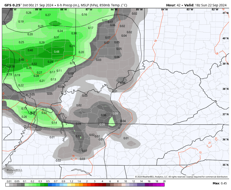
Locally heavy rains are a good bet during this time.
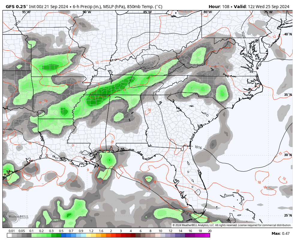
This continues to set the stage for a slow moving upper low to develop and try to work into our region later Wednesday into Thursday. As this happens, we will be dealing with a tropical system, likely a hurricane, down in the Gulf of Mexico.
Here’s the current area of interest from the National Hurricane Center…

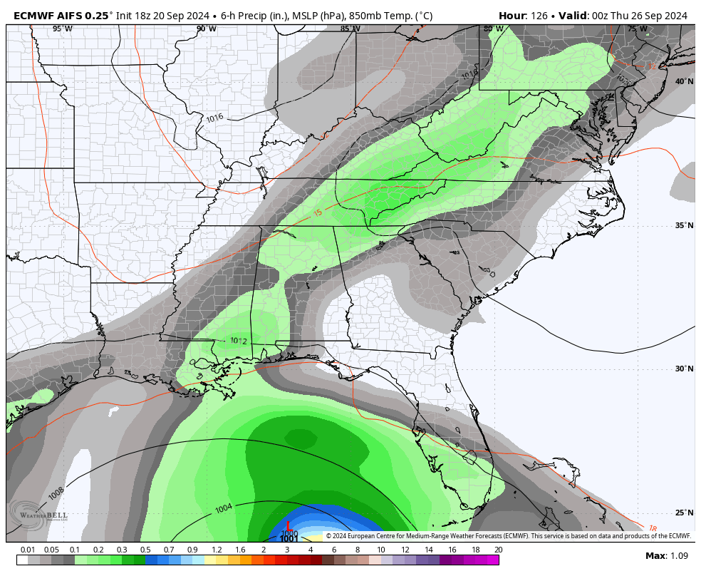
The models continue to exhibit a wide spread in what happens with this system.
The latest GFS has our upper system across this part of the world help steer what’s left of that hurricane into our region by next weekend…
All the models have shown that kind of a solution at one point or another of late, but most have been farther west like we see on the AI version of the EURO…
Have a great Saturday and take care.

Happy last day of Summer! 🙂
Thanks Chris. Not a September to Remember. Seems like July. I just wonder if this Summer weather pattern will end this decade ? Bound to have a reverse reaction some year, and we may not like that either.
Enjoy the Non – Fall like weekend everyone !
Clearly Chris has his poncho ready, so I’m going to follow his lead and coil up the garden hoses. Just to make sure we’re going to get wet, I might just wash and wax the missus’ car.
That’s like me. LOL… After last Spring’s rains I put up a new rain gauge, and it stop raining, and it hasn’t rain that much since. I’m now thinking about throwing away the two Snow shovels I have. Doctors told me Not to Shovel Snow, and I replied what Snow.