Good Monday, everybody. Rounds of showers and storms are with us out there today as we kick off a very active few weeks of weather across our part of the world. Much-needed rains will fall during this time, but there’s the chance for too much rain to fall as well.
Remember this blocky pattern I’ve been talking about and how it can cause some wild things to happen? Well, the chance is there over this week into next.
Let’s start with today’s breakdown and roll forward.
TODAY
- Storms are fairly scattered but should increase some late this afternoon and evening.
- You will get a lot of dry hours today, meaning you can get some outdoor stuff in.
- Storms have a lot of moisture to work with and that means heavy rains that can lead to local high-water issues.
- A few of the storms may be strong or severe with wind damage the main threat.
Here’s today’s Severe Weather Outlook from the Storm Prediction Center…

TONIGHT AND TUESDAY
- Rounds of showers and storms continue and should actually increase in coverage.
- Once again, this won’t be constant rains.
- Torrential rainfall will be possible in some areas. This again sets the stage for local flash flooding.
- I can’t rule out a few strong storms during this time.
Here’s the Tuesday Severe Weather Outlook from the Storm Prediction Center…

WEDNESDAY AND WEDNESDAY NIGHT
- A front slows down right on top of central and eastern Kentucky.
- This keeps showers and storms going in these areas.
- Locally heavy rain will again be possible.
- Low pressure develops along this boundary and rides in here through Wednesday night.
- That increases the number of showers and storms across the entire region.
What happens after this firmly depends on what happens with our developing tropical system coming out of the Caribbean into the Gulf of Mexico. Here’s a satellite shot of this system…

The National Hurricane Center is likely to give this system a classification today…

This will likely become a major hurricane as it barrels northward through the eastern Gulf of Mexico with a possible Florida Panhandle landfall late Thursday or early Friday.
I’m fascinated by the interaction between this hurricane and the upper level low/weak surface low that will be spinning across the lower Mississippi Valley around the same time. We may very well have a Fujiwhara Effect with this setup. This rare phenomenon occurs when two cyclonic systems move around one another.
You can clearly see this by looking at a combo of the upper levels and surface low pressure animation. Watch how the hurricane spins around the upper low, before the two fully merge…
That’s so wild to see and is a direct product of this blocking pattern across North America.
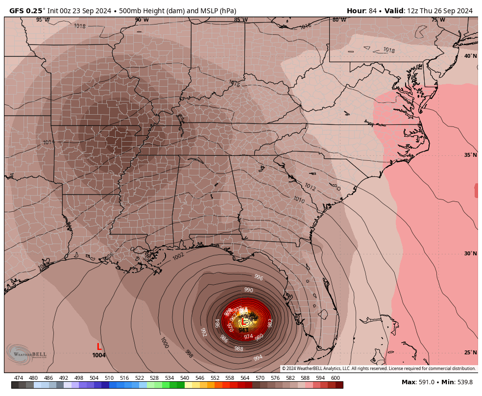
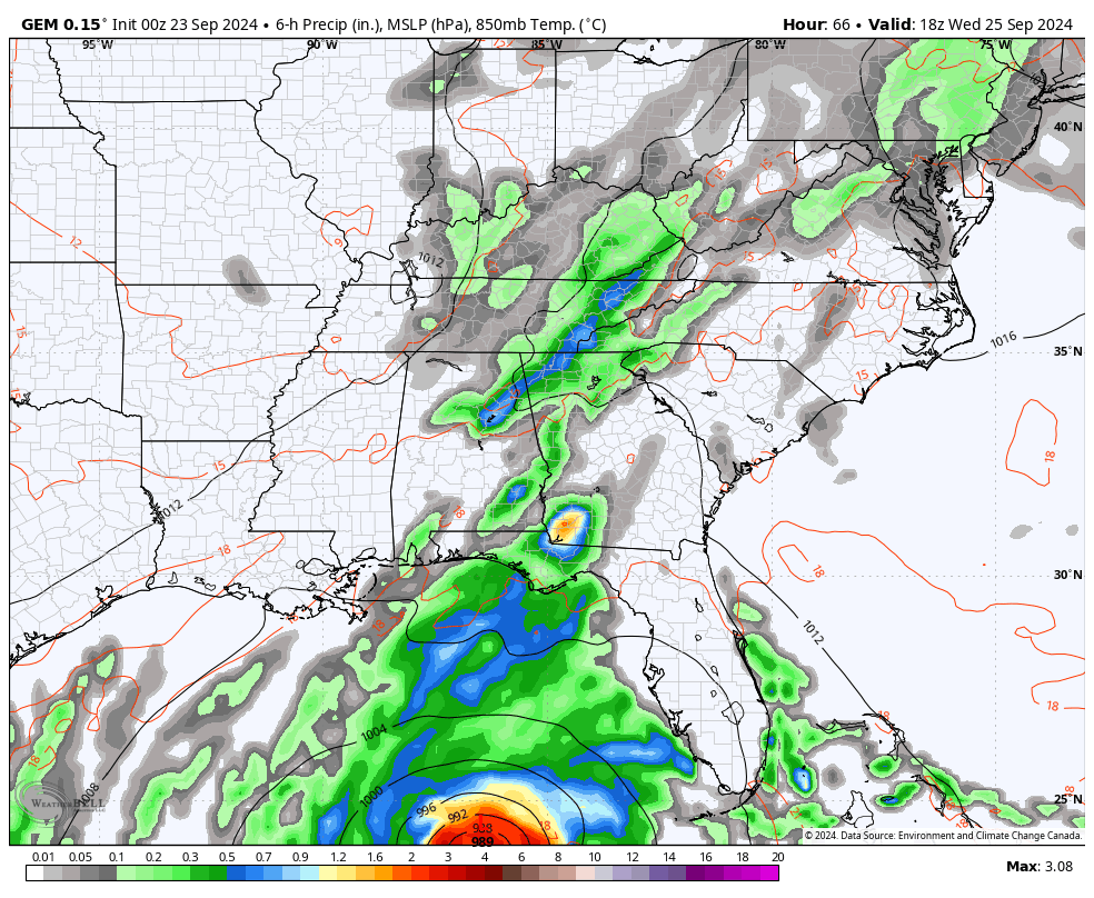
This is what it all looks like at the surface on the GFS…
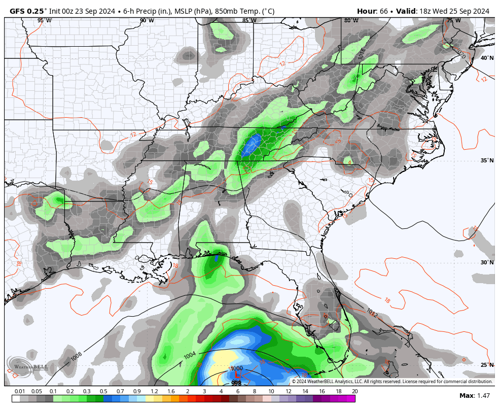
The EURO is pretty much identical…
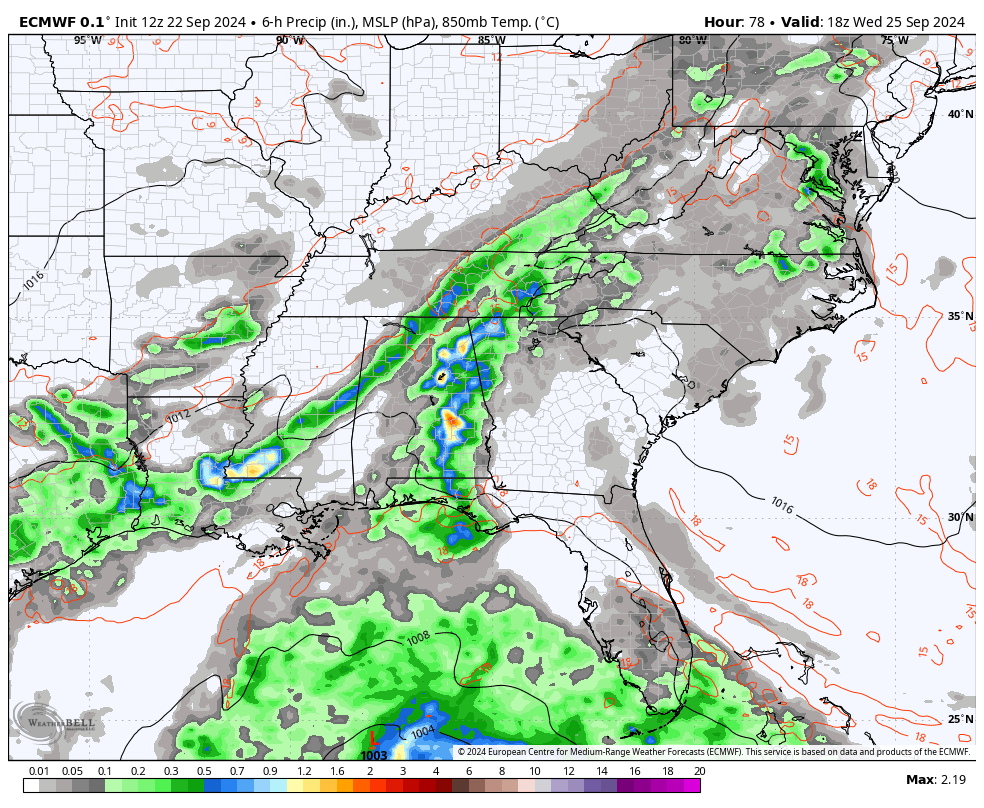
So is the Canadian…
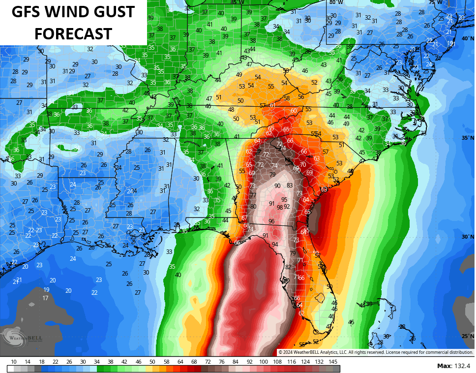
If the above scenario plays out as depicted by the models, heavy rain, strong storms and high winds would be possible across our region Thursday night through Friday night, at least.
The models aren’t shy about the wind potential with this all the way into Kentucky…
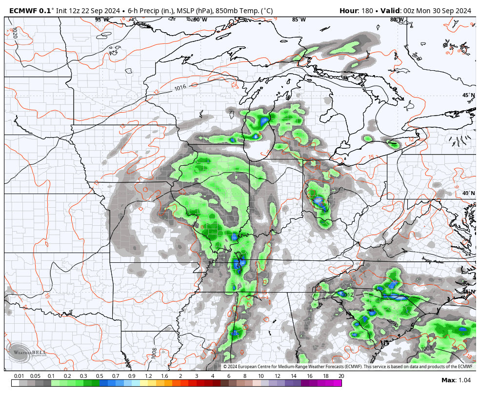
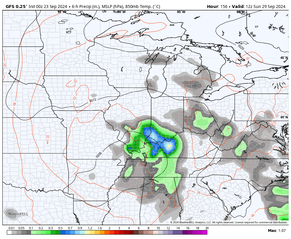
Once our systems merge, they spin slowly from west to east across the region with another system diving in behind it early next week. All of this would lead to additional rounds of heavy rain producing showers and storms, if it comes to pass.
The EURO and GFS are both seeing this possibility…
EURO
GFS
The next 7 to 10 days may feature way too much rain for parts of our region and this is something we will closely monitor.
I will have another update coming later today, so check back. Until then, here are your storm tracking tools to start the week…


Current watches

Possible Watch Areas

Have a great Monday and take care.

Thanks Chris. I just learned a new meteorological term Fujiwhara. Very interesting blog this morning, and I like the break down that may occur this week. Hoping we get too much rain to end the drought state wide. I looked up the Fujiwhara. Here’s more information on the phenomenon :
https://en.wikipedia.org/wiki/Fujiwhara_effect
Have a Great day Everyone !
My PWS just south of Bowling Green recorded 0.30 inches of rain yesterday evening from an extremely localized t-storm. Another weather station just 4 miles to the south picked up zero rain.
Tropical system 97L has the potential to strengthen into a major hurricane, but an area of shear to its north may stifle its development in the short term. It will probably come ashore as a strong Cat 2 storm, and the spaghetti plots are all indicating that tropical remnants are likely to impact western and central KY. Runoff from heavy rain on top of hard packed, dried out soil makes flash flooding likely, so an areal flood watch is likely to be issued for the region.
We had about .80 ” of rain so far this month. August was the driest in Taylor county in 130 years. Last week Taylor county was placed in D3 ( severe drought. ) Rain won’t run off that much in a heavily forested area. Forest fires scare me just as much as a tornado warning. I’m hoping the potential hurricane in the Gulf is the one that finishes the on going drought.
Here in Union Co. we just receive heavy rain and frequently lighting this morning. Any moisture will help
That will certainly help. Zero here in northern Taylor county. I kind of wonder now if we will continue to miss the rains. You know what the late Marcia Yockey use to say ” thoses that got will and thoses that don’t won’t. ” Hope the precipitation and temperature pattern changes by this time next week ?