Good evening, everyone. Showers and storms are rumbling across the region and this is a sign of things to come. Rounds of storms will be common this week and that’s before we get in on the remnants of what is likely to be a major hurricane in the Gulf of Mexico.
We have a lot to talk about, so let’s get after it.
The showers and storms out there this evening and tonight will be strong to locally severe at times. The Storm Prediction Center continues with the Marginal Risk for severe storms…

Damaging wind is the primary threat.
A little greater severe storms threat is with us Tuesday into Tuesday night. The Storm Prediction Center has upgraded to a Slight Risk across most of central and eastern Kentucky…

Damaging winds and large hail will be possible with these storms.
Torrential rains during this time may cause areas of flash flooding, so keep that in mind.
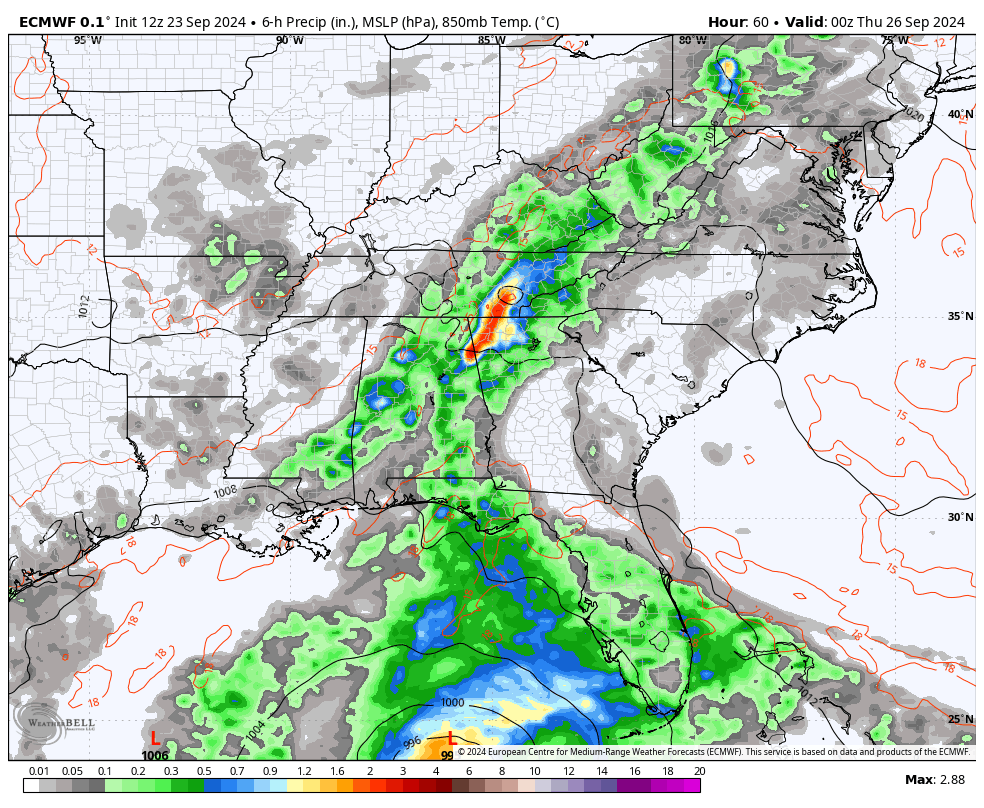
Additional showers and storms will be noted across the eastern half of the state Wednesday before this expands to the entire region Wednesday night and Thursday.
At the same time, we will likely be tracking a MAJOR hurricane into the big bend area of Florida. This storm will then lift to the north and northwest with the remnant low moving right over Kentucky.
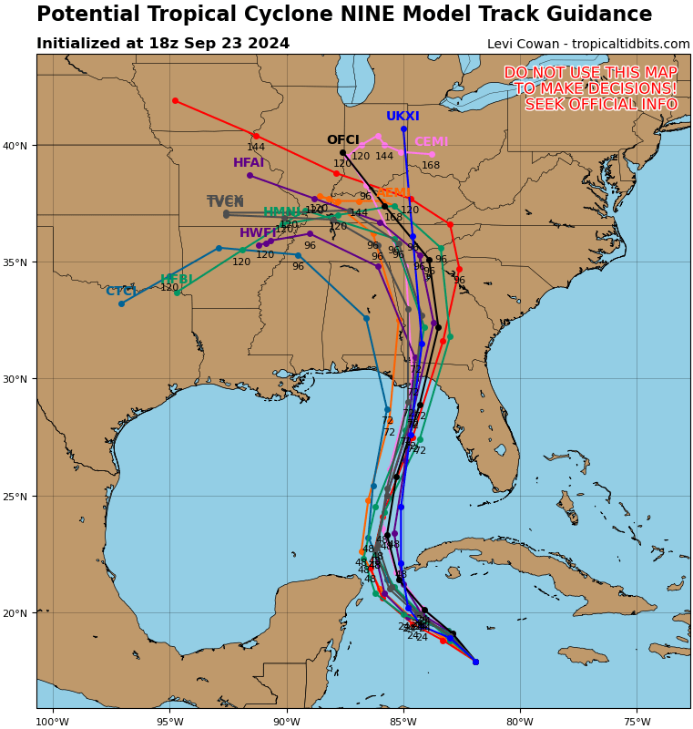
Here’s the latest information and track forecast from the National Hurricane Center…

The latest spaghetti plots showing the various hurricane model forecast tracks are pretty much in line with the NHC cone of uncertainty. You can clearly see many of the lines right into Kentucky…
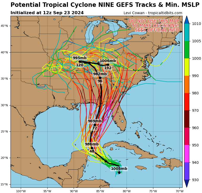
The GFS Ensembles have many more members so you get much more of a spread in track forecasts…
The upper level low spinning across the lower Mississippi Valley is still the key into just how great of an impact we have here in Kentucky. The Fujiwhara Effect is in full swing still with the Canadian showing a merger right on top of Kentucky…
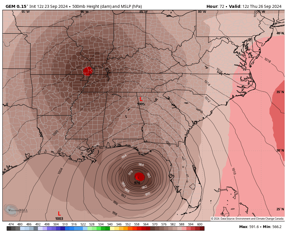
Here’s what that looks like at the surface…
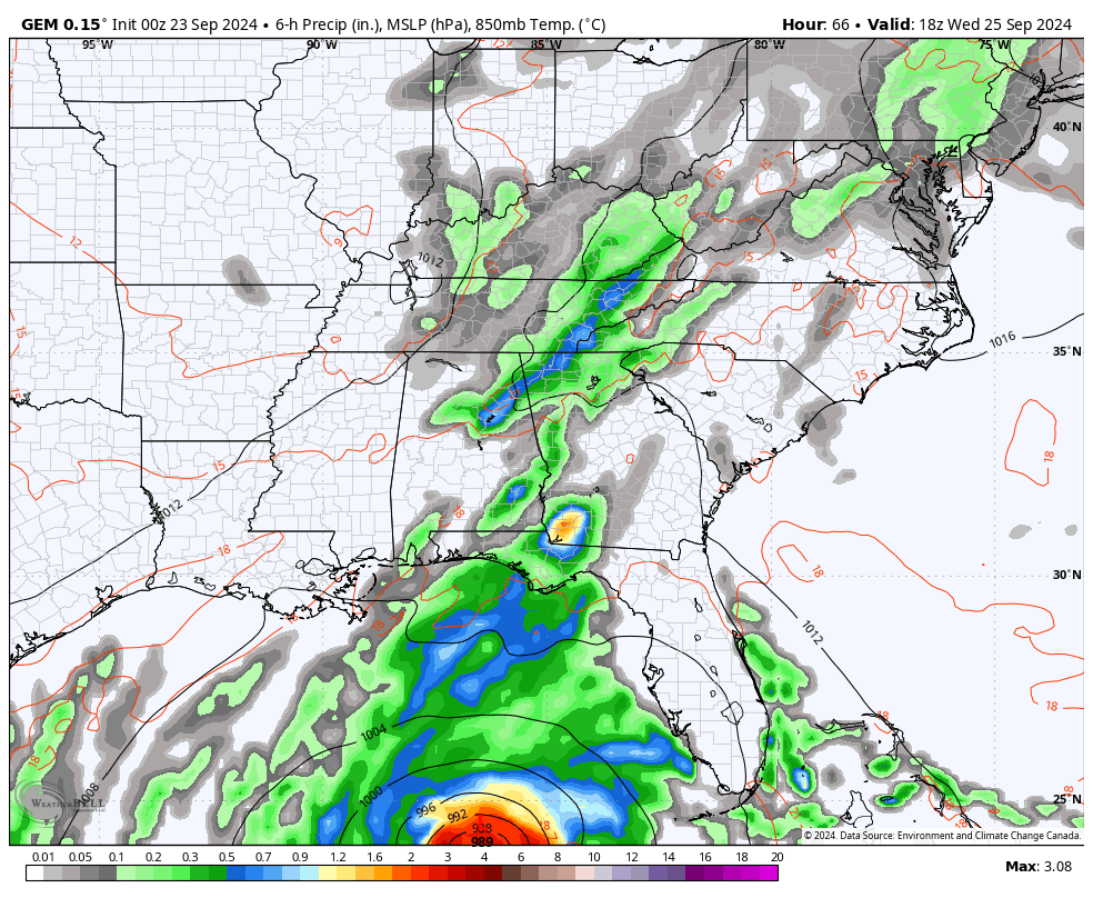
The EURO is similar…
The GFS appears to have lost its way with this whole setup, but that’s not too atypical for this model.
I’ll have your regular update later tonight. Until then, let’s track some storms…


Current watches

Possible Watch Areas

Have a great rest of your day and take care.

The rain gauge on my PWS stopped working so I had to take it apart and clean out a bunch of spiders. Now I’m ready for some RAIN!