Good evening, folks. It’s been a very busy day with severe weather across many areas of the Bluegrass state and this is kicking off a very active period. Soon to become Hurricane Helene will impact areas from the Caribbean to Kentucky in the coming days.
Severe storms out there today have spit out a lot of rain in several locations. These storms have also been severe with damaging winds and better than golf ball sized hail in some areas.
The severe threat continues this evening, but it’s lessening the deeper we get.
Here’s the Severe Weather Outlook for this evening from the Storm Prediction Center…

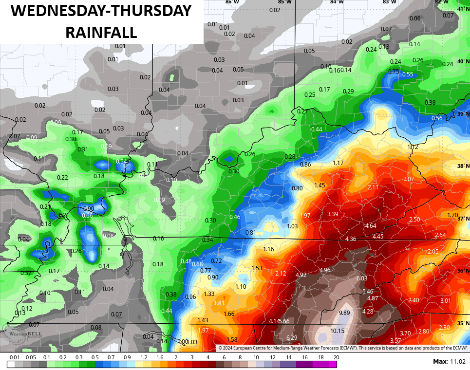
A cold front slows down across eastern Kentucky Wednesday and slowly heads back toward the west on Thursday. This scenario is likely to produce heavy rains across the east and southeast during this time and it may be enough to cause some flooding concerns.
Take a look at the numbers Wednesday and Thursday…
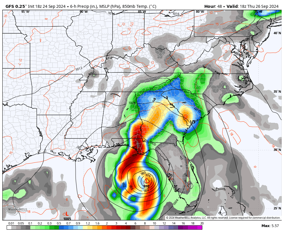
Soon to become Hurricane Helene is heading toward the Gulf and will waste no time to get to the big bend area of Florida for a late Thursday landfall. This will be as a major hurricane and the inland track on this will take it all the way into Kentucky by Friday.
Here’s the current information and the latest track forecast from the National Hurricane Center…

There’s a chance this is still classified as a Tropical Depression as it moves into Kentucky. Wild, huh?
The GFS is doing exactly what I said it would do and that’s fall in line with all the other models. This current run shows our system moving into Kentucky and merging with a strong upper low spinning across the lower Ohio Valley and hanging here through the weekend…
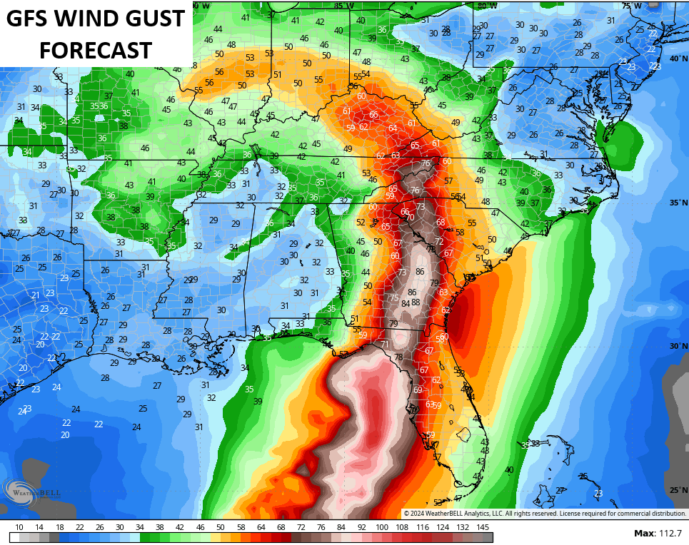
The high wind potential with this system is something we need to closely monitor. All the models are now seeing a swath of high winds with some of the runs having gusts of 60mph or greater.
The GFS is now one of those models…
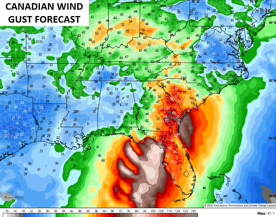
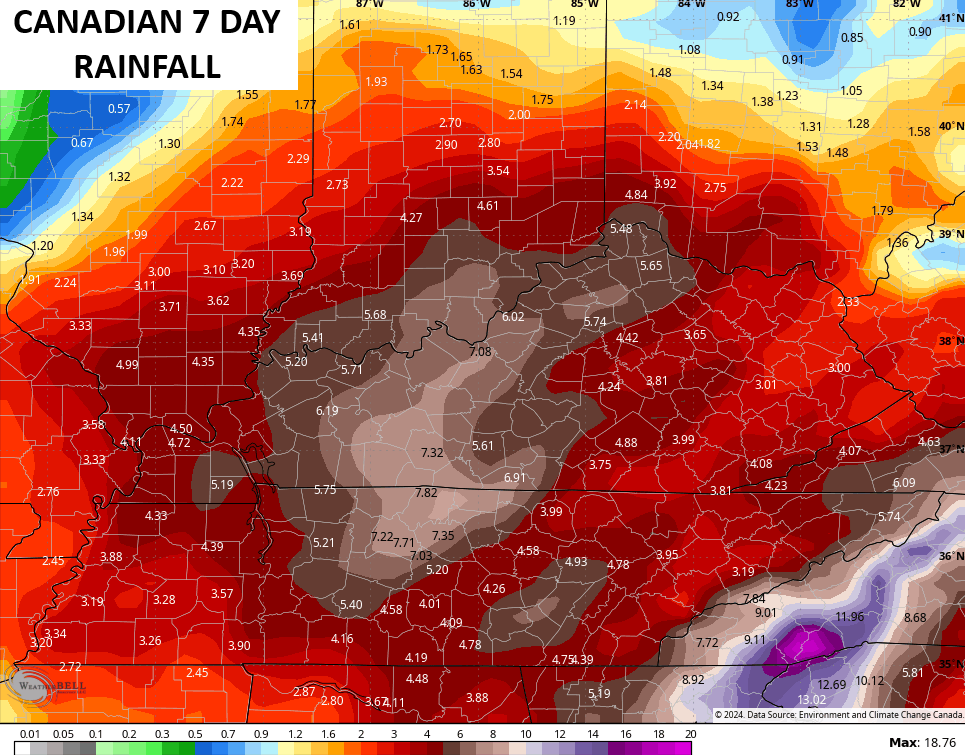
The Canadian has 50mph gusts…
The Euro is also showing gusts topping 50mph…
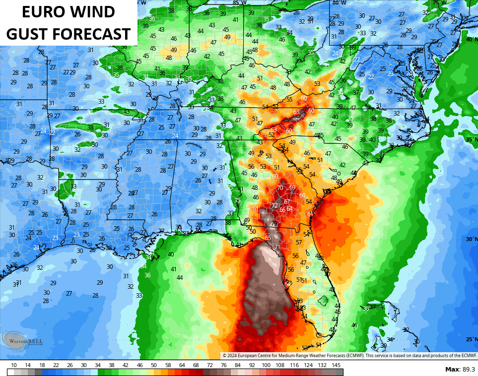
Those kinds of wind gusts would cause issues and will show up along and east of the track of the low.
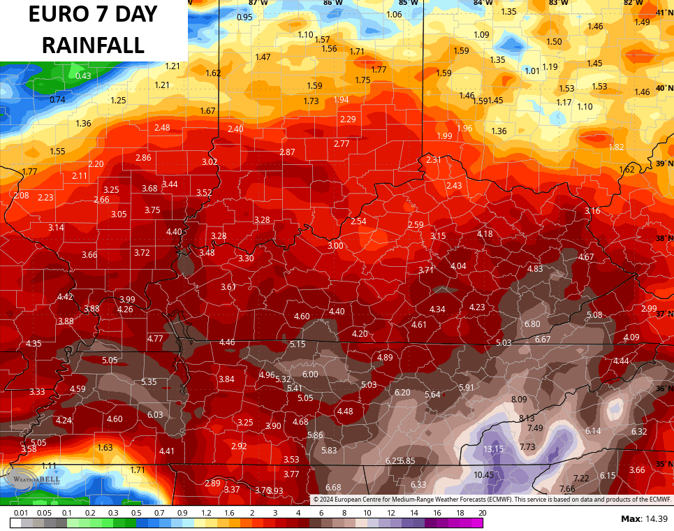
Heavy rainfall may cause flooding concerns through the weekend as this system spins on top of us.
Here’s a sampling of the latest 7 day rainfall numbers from the forecast models…
I will have the latest on WKYT News on the CW Lexington at 10 and on WKYT at 11. Of course, you will get another full update later tonight.
Here are your tracking toys for the remainder of the evening…


Current watches

Possible Watch Areas

Have a great rest of the day and take care.
