Good evening, folks. Powerful Hurricane Helene is about to slam into the big bend area of Florida and will race toward Kentucky overnight. This won’t be a hurricane when it arrives, but it’s going to produce high winds and bring the chance for flooding rains.
Helene is a monster storm and the satellite shot shows just how expansive this is…

There’s an outside chance this makes a run at Category 5 status before coming ashore before midnight. Here’s the latest information and track forecast from the National Hurricane Center…

Notice how this gets into Kentucky and slams on the brakes, lingering through the upcoming weekend. That’s concerning in terms of a general flood threat.
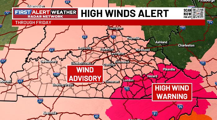
The winds with this will likely push 50mph at times for much of Kentucky with the potential for 60mph or greater winds showing up along and just northeast of the track of the storm. The High Wind Warning across southeastern Kentucky is likely to get expanded into central and northern parts of the state…
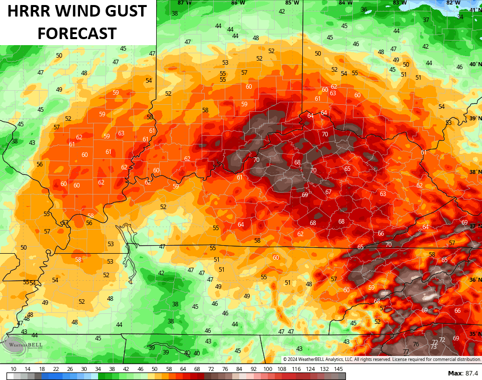
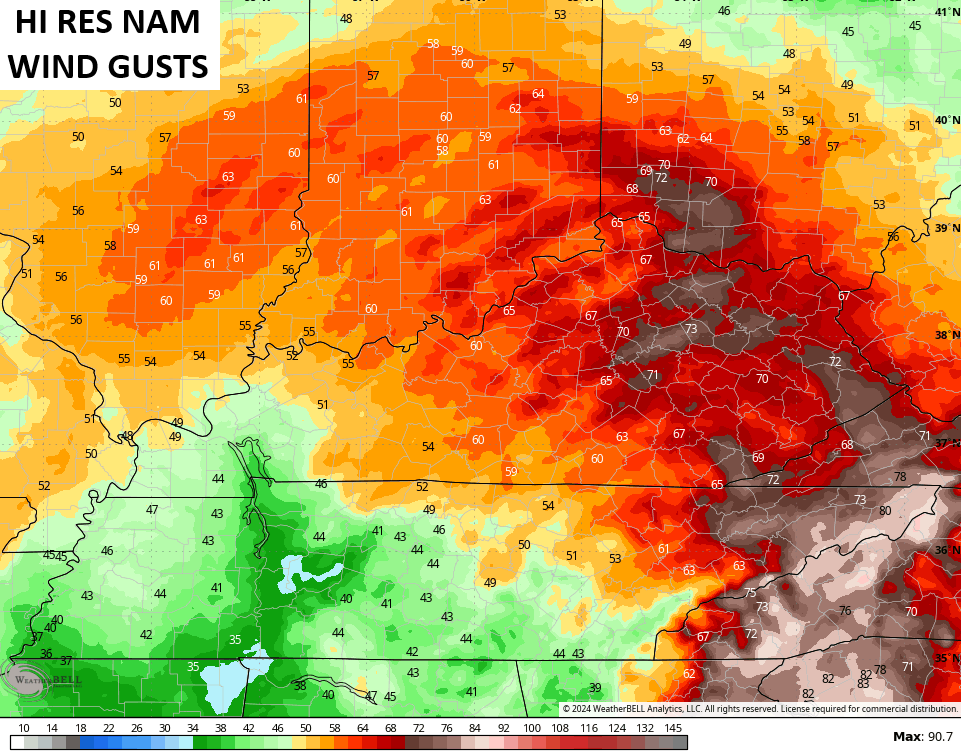
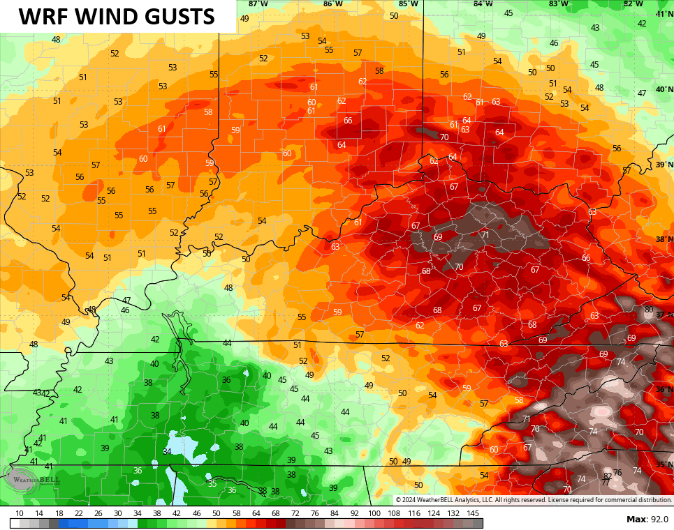
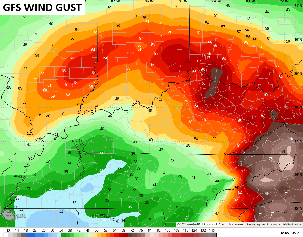
The hi resolution models are the ones REALLY cranking out the highest wind gusts, pushing hurricane force…
The GFS isn’t one of the hi res models, but it’s seeing gusts pushing 70…
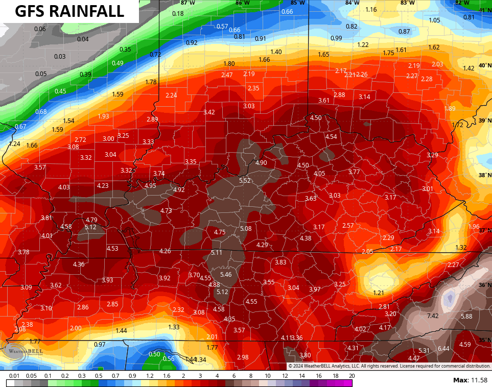
I have a problem with the orientation of the current Flood Watch across Kentucky as I think it needs to include the entire state…
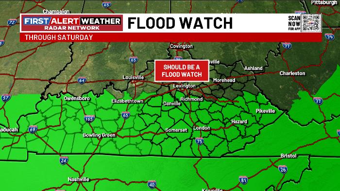
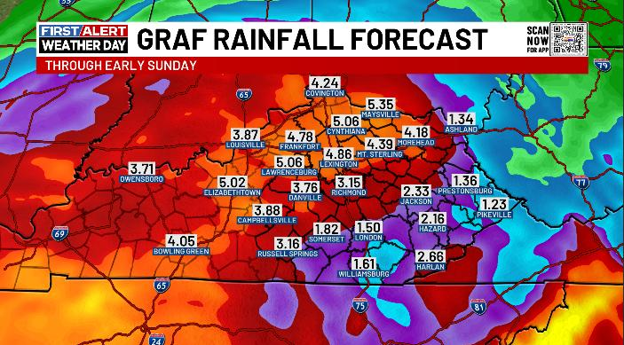
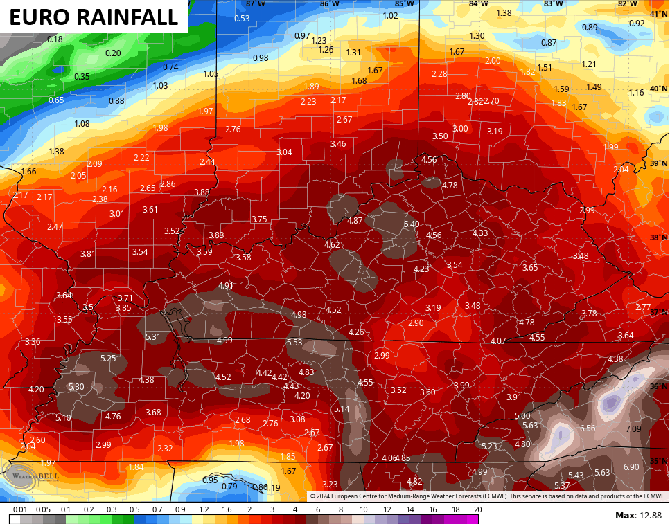
There is simply no data that suggests we shouldn’t have a Flood Watch for the entire Commonwealth right now as all the models show similar rainfall numbers through Saturday night…
![]()
![]()
You can clearly see areas not under the watch are in the same line of fire as areas in the watch. Not everyone pays attention to the weather and the forecast like those of you who come here. The reality is most people will look at a Watch or Warning map and if it doesn’t include their county, they think it’s not going to have a big impact on their lives.
We have to be consistent with messaging and be aware of the mindset of everyday folks who aren’t weather nerds (the overwhelming majority of people) following every discussion or forecast.
The Flash Flood Risk map from NOAA puts the entire state in the same risk area and even goes north of the Ohio River…
![[Image of WPC Flash Flooding/Excessive Rainfall Outlook]](https://www.nhc.noaa.gov/storm_graphics/AT09/refresh/AL0924WPCERO+gif/213335WPCERO_sm.gif)
The watch does not match up with that or even come close. Consistent messaging is the key for those of us in the weather world trying to get folks attention to serious weather. Of course, that’s the two cents of a Kentucky boy who’s been forecasting Kentucky Weather at WKYT for more than 26 years now. Geez, I’m old. ha
I’ll have another update later tonight and I’ll have the latest on WKYT News at 10 on the CW Lexington and at 11 on WKYT. Until then, here are your Wednesday tracking tools…


Have a great evening and take care.
