Good evening, folks. Helene blasted into the Bluegrass State today with damaging winds and flooding rains. The wind part of this system is slowly winding down, but the tropical rains will continue into the weekend, potentially causing more issues.
Winds today knocked out power to more than 200 thousand customers across central and eastern Kentucky. Lots of trees have been knocked down with many homes and businesses damaged. Lexington had the highest recorded wind gust of the day at 65mph.
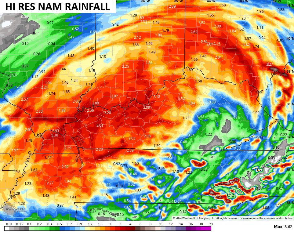
Helene is now a Post Tropical Cyclone spinning across central Kentucky and is stalling across the region…

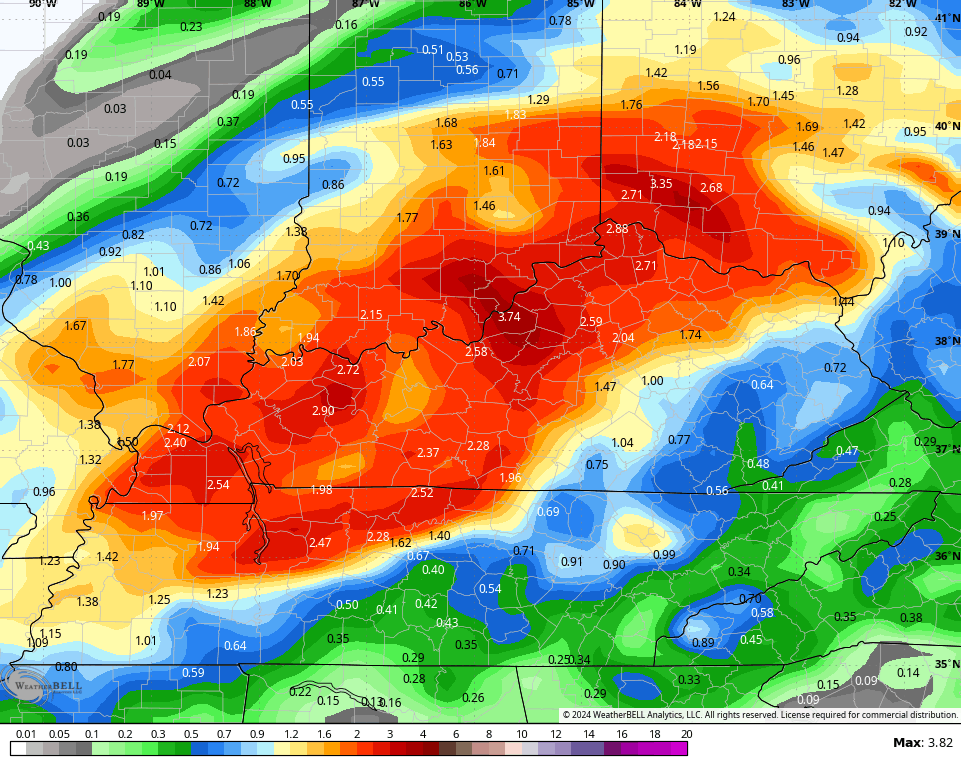
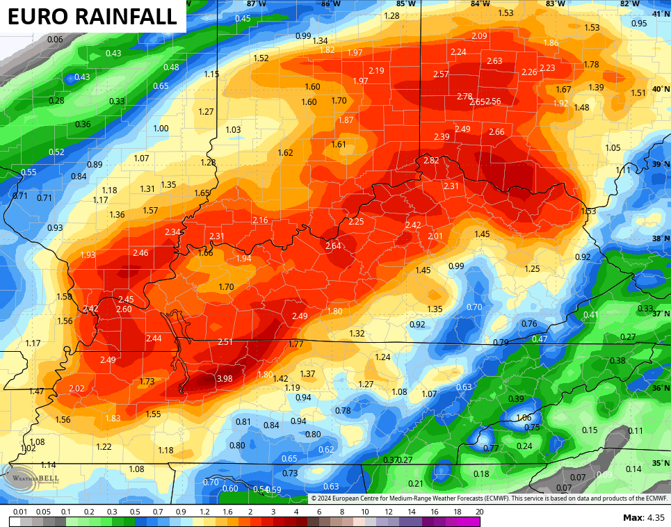
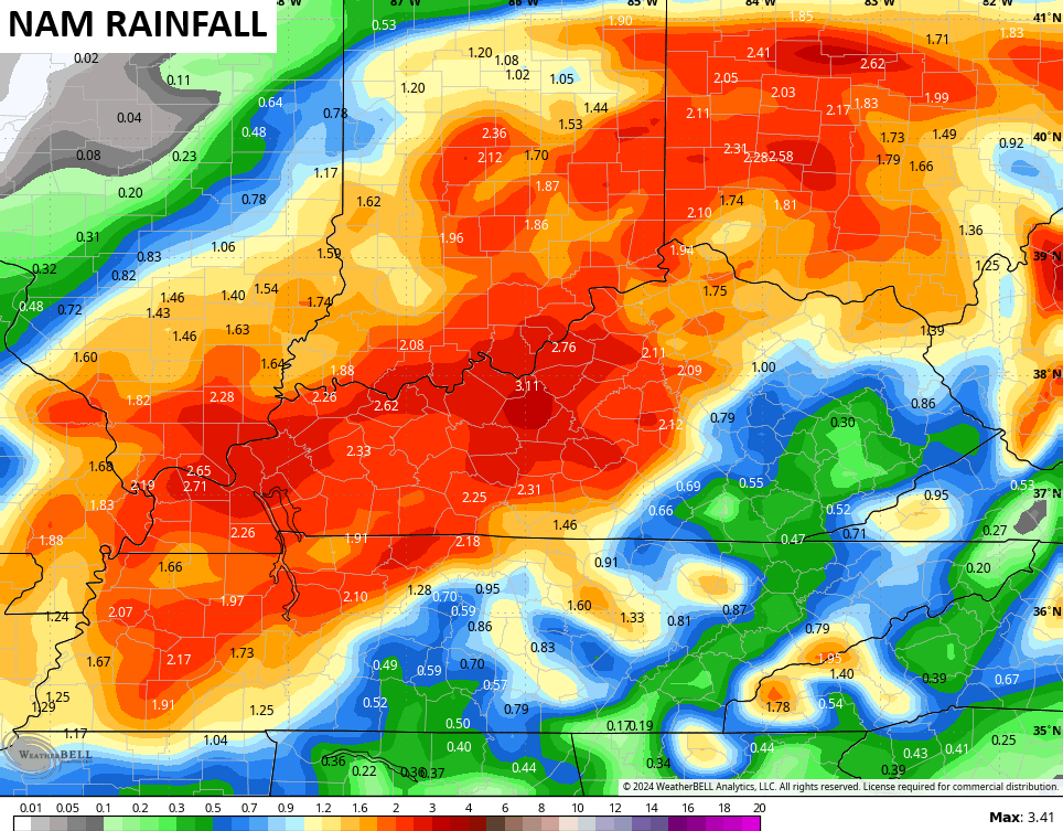
The spin on this brings more in the way heavy rains to areas of central, northern and western Kentucky. That’s where another a 1″-3″ of rain likely shows up tonight and Saturday…
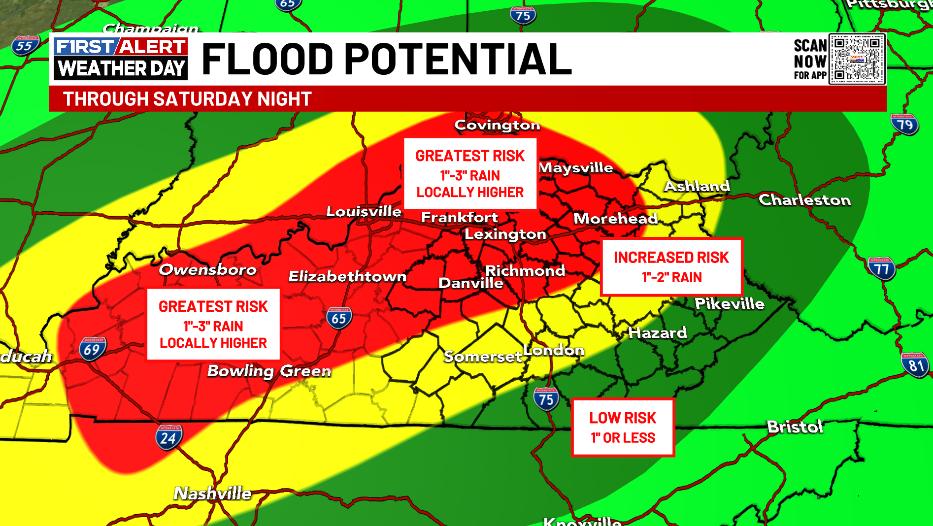
The models are in pretty good agreement with these areas having the chance for excessive rains…
![]()
![]()
NOAA continues to highlight the entire state for the excessive rain potential through Saturday…
![[Image of WPC Flash Flooding/Excessive Rainfall Outlook]](https://www.nhc.noaa.gov/storm_graphics/AT09/refresh/AL0924WPCERO+gif/213335WPCERO_sm.gif)
Here are your tracking tools to get you through the rest of the evening…


Stay safe and take care.

Thanks, Chris. This is very helpful under the current weather conditions.
Fortunately, my part of Richmond has not gotten the worst, though much damage is noted in other areas. Hoping all the best for my fellow KWC readers.