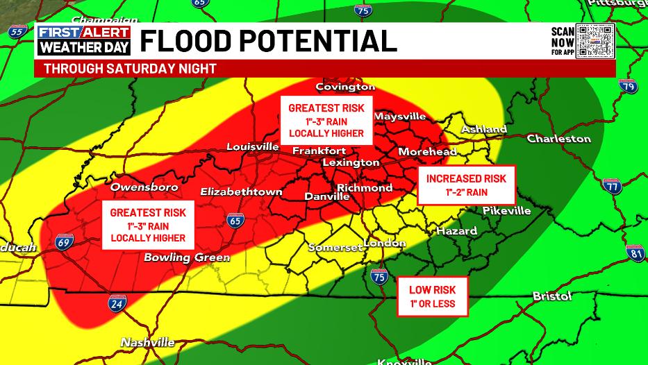
Good Saturday, everyone. The remnants of Helene have stalled across western Kentucky and will hang around for the next few days. This keeps tropical rains spiraling across the Commonwealth with additional heavy rains that can cause high water concerns for some.
We start the day with more than 100 thousand customers still without power across central and eastern Kentucky. This is a slow process to get the power back on in many communities as crews are facing quite a bit of damage. Those 60-65mph winds on Friday took down a lot of trees and lines across this region, folks.
The winds aren’t a big player but can still gust to near 30mph at times today.
The remnant low doesn’t really move much at all over the next 24 hours as those bands of heavy rain spin around it. This animation goes from this evening through Monday evening…
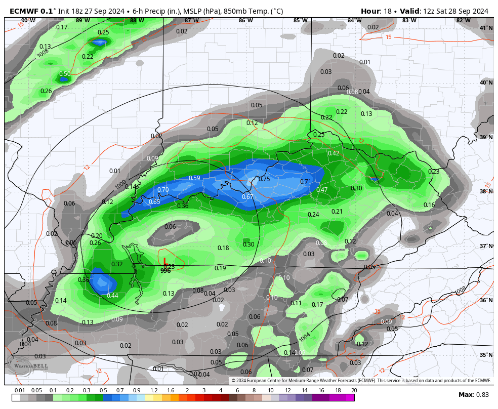
That’s pretty incredible to watch that L stay in the same spot for hours on end.
Some areas will pick up another 1″-3″ of rain with the greatest chance still being in the same areas I’ve been highlighting…
Lingering showers hang with us Monday and even into Tuesday before this system FINALLY leaves us alone.
A cold front moves in on Wednesday with some really nice looking and feel days for the second half of the week.
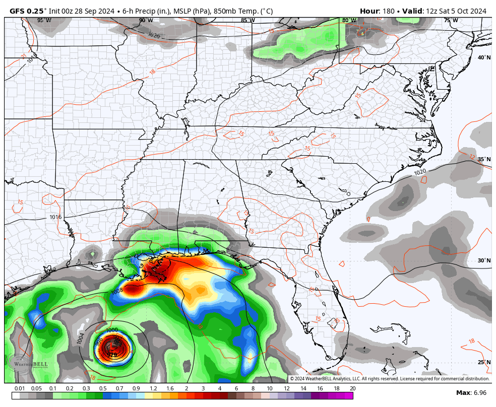
The tropics aren’t done yet as we have Isaac and Joyce out in the Atlantic. Isaac is a hurricane that won’t impact anyone and Joyce doesn’t look like a threat right now. That said, there are two other systems of interest and one looks a little familiar…

Another system will try to develop in a similar spot as Helene, but that doesn’t mean it develops like Helene.
That’s a long way out there but the GFS is trying to bring another tropical impact our way next weekend and a little beyond…
Before we even think about any future systems, we need to get rid of the stubborn one impacting our weekend.
Here is your daily dose of tracking tools…


Stay safe and take care.

Well I can’t get through to ANYONE I know in Brevard…Looking through Twitter it looks awful…from what I’ve heard… at the moment there’s no way out in or in to Brevard…every single road that leads out/in is flooded… and now I just saw where I-40 east between NC and TN is gone… My family isn’t in a flood area… but I worry about landslides.. I’m sure they have no power. Of the many heavy rain events growing up, I don’t ever remember THAT MUCH… this has to be the worst and definitely a record.
Mark, I pray that everything is Okay with your Family. I know you are very worried, and I wish I could help. It is a record breaking rainfall for Western, NC, over a foot of rain reported in Asheville.
Here’s what I can find on the Flooding and landslides :
https://www.wral.com/story/western-nc-braces-for-life-threatening-flooding-potential-mudslides-from-helene/21642070/
I’ve heard cell service is spotty so hopefully you’ll hear from them soon.
We need s break.