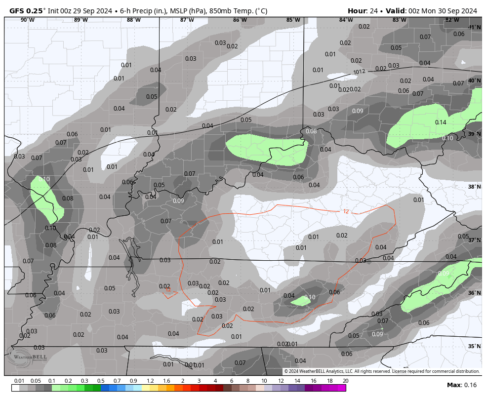
Good Sunday, everyone. What’s left of Helene are STILL spinning across Kentucky with more in the way of spiraling bands of tropical showers. Believe it or not, a few of these linger all the way into the first day of October. From there, we turn our attention to the Gulf of Mexico and another possible storm.
Today’s showers will be more in bands than the wall to wall stuff of the past few days. Narrow corridors of locally heavy rain will still be possible and that will be the case again on Monday. Tuesday finds some low-level moisture for the first day of October with the chance for a couple of showers and storms.
Watch this setup over the next few days…
A cold front arrives Tuesday night into Wednesday with dry and pleasant air coming in for the rest of the week. Bring. It. On.
As all of this is happening, we are watching another disturbance coming from the Caribbean into the Gulf of Mexico. This is likely to develop into another tropical storm or hurricane in the week ahead.
Here’s the area of interest from the National Hurricane Center…

This system gets into the Gulf as a couple of troughs sweep across the eastern half of the country. Can one of these pick up the Gulf system and lift it northward again to potentially impact some of the same areas hard hit by Helene?
That’s certainly something to watch for, but the overall pattern of this week compared to last week is totally different as things look much more progressive in general.
The EURO does try to play a game of hook up with the tropical system and the trough by next weekend…
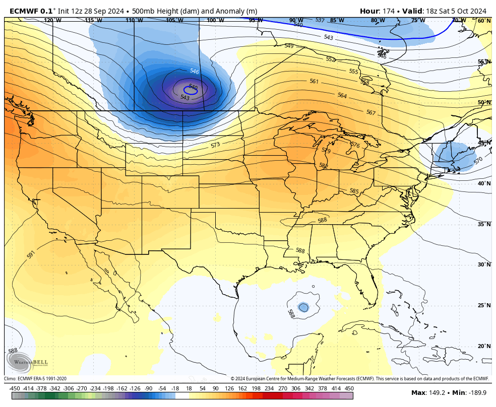
Here’s what that looks like at the surface…

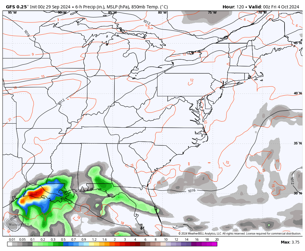
The GFS has less of a trough and a slower moving system once it gets inland…
The Canadian Model takes the tropical system across Florida, missing the hook up with the trough…

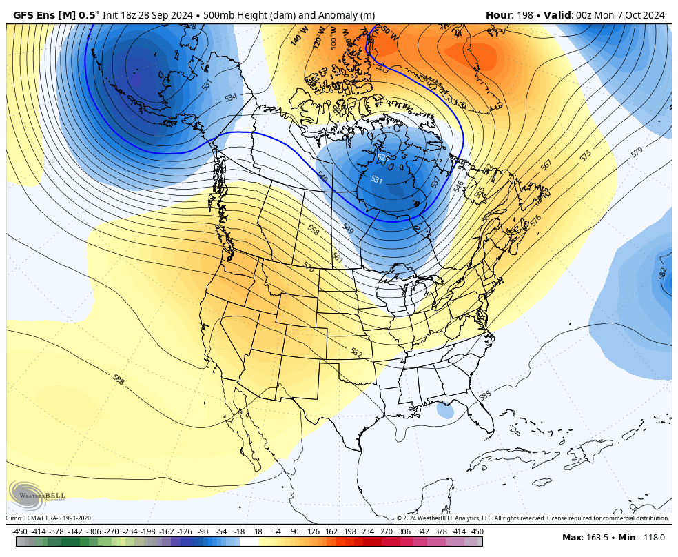
That trough is something the GFS Ensembles suggests starts more of a troughy look across the east into the middle of the month…
These type of troughs typically become more common as we get deeper into the fall months, but can we get some deeper than normal troughs to allow early season cold shots? Maybe.
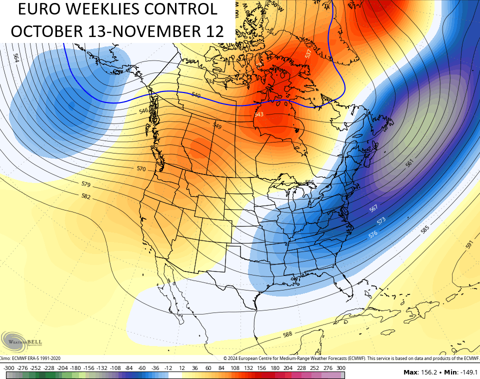
The Control Run of the EURO Weeklies thinks so. Check out the 30 day 500mb height anomaly map from mid October into mid-November…
Looking farther down the road toward winter, the CFSv2 has been trending toward a colder look as he get closer. The 3 month temperate departure map has our region near normal…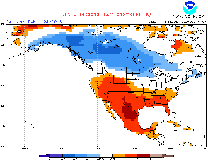
Unlike the past several winters, there’s a lot of cold air in Canada and the northern tier of states that’s available to come south. That’s also one heck of a temperature gradient showing up across North America which could make for some monster storm systems.
As always, I leave you with your tropical tracking tools for the day…


Have a great Sunday and take care.

It’s crazy…. that that dry period we had it felt like it went so long without raining… now that we’ve had all this rain… I took a look at the yearly precip for Lexington to date and it’s ABOVE normal… With over 4 inches of rain, the drought has to be completely erased (I’m guessing)
Still can’t get through to anyone in western NC except 1 person. My cousin who lives in Mills River just outside of Brevard. She’s fine but said it was bad but that she didn’t think Brevard got it quite as bad as Asheville/Hendersonville… but I did hear that it could be 2 weeks without power… I was without power for seven days in the 2003 ice storm. I couldn’t imagine being without power any longer. After 7 days you’re literally ready to break down emotionally..
Mark. Getting through to someone must be a relief and ease the worry. I read that I-40 near the Tennessee / North Carolina border was wash out by the flooding. Worse Flooding in Asheville since 1916.
The longest power failure I’ve been through was after the 2009 Ice Storm. Fourteen days wihout power. My Brother and I nearly froze to death.
Thanks Chris. I feel guility that some areas of the state received the damage and power outages from the remnants of Hurricane Helene. Here in Maple we received 5+ inches. That’s not counting the 2 inches that fell before the remnants arrived closer to the state of Kentucky. We didn’t received the high winds, just a slow soaking rain that lasted three days. I followed the storm as it made it’s way North and the center went just to the East of Maple. The merging of the upper level low to our West, and the remnants of Hurricane Helene did take place, and it’s still raining this morning. Best rain I’ve seen in years, but I am sorry that others had to deal with trees down and power failures.
God Bless to All
I am eagerly awaiting the drier, calm weather later this week into next weekend.
The wind field from the Hurricane made it all the way north to the Chicago Metro area on Friday, as winds gusted from the North between 40-50 MPH all day. Even on Saturday winds gusted near 30 MPH. We missed the rain though, except for a brief shower Saturday morning. Last week Sunday and Tuesday the area got a good soaking rain to end the short-term drought we were experiencing.
Hope you guys in KY and surrounding states can get some dry weather for a few days so the power crews can continue to work to get the power back on and things can dry out.
Mike, Always interesting to here what the weather is in the Chicago area. Sometimes it’s almost the same as the weather here in Kentucky, but can be as different as night and day in the Winter. This coming Winter we are expecting a weak La Nina where the jet stream will be south of your area. That means you will have many opportunities of Snow shoveling. Areas south of the La Nina jet stream will have a mostly mild and dry Fall and Winter. That’s my bold prediction for Fall and Winter 2024 -25. But there’s always that chance that Arctic air will make it into our area, and the return flow from the Gulf could produce an Ice Storm during La Nina Winters. Quite a common occurrrence here in Kentucky. Last Fall and Winter we had an El Nino Winter that I thought would bring our area a Snowy and Cold Winter, but it didn’t pan out.