Good Monday, everyone. We are wrapping up the month with more in the way of tropical showers, courtesy of what’s left of Helene. This system finally rolls out into the first day of October with a fairly calm start to the month on tap.
But can we keep things calm? That depends greatly on what happens in the tropics, specifically the Gulf of Mexico.
Let’s start with this final day of the month and roll into month 10 of the year.
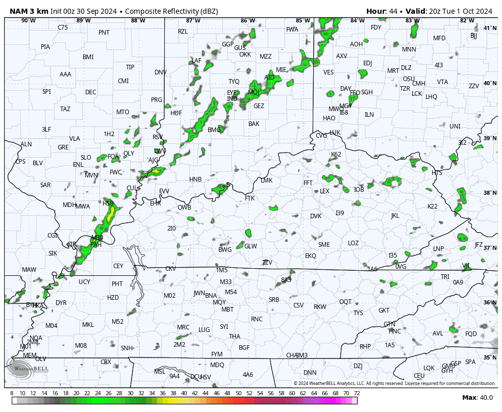
Once again, spiraling bands of showers and a few thunderstorms will be working across Kentucky. Not everyone sees rain, but those who do know the drill. Locally heavy rains are a good bet once again.
Let’s also watch for the possibility of a few funnel clouds trying to develop in these bands. One of those formed in Campbell County in nothern Kentucky Sunday evening…
Hey @spann @ReedTimmerUSA @Kentuckyweather what do you all think of this? This was in Campbell County, KY. #KYwx pic.twitter.com/48yqqUImbC
— Chad (@ChadBlue83) September 29, 2024
Here are your tracking tools to follow anything that goes up today…


Some leftover showers will noted on Tuesday as that low-level moisture hangs around. We do have a cold front sweeping in Tuesday night and early Wednesday, bringing much better weather iun here for the end of the week into, at least, part of the weekend. This front has a narrow band of showers and storms ahead of it…
Pleasant temps and dry skies rule!

That whole area looks to become fairly disturbed and I’m wondering if we might just wind up with two different systems initially. Here’s what all this looks like on Satellite…

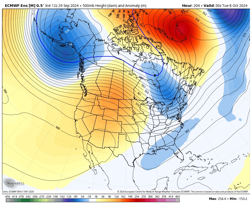
As we know, October is a transition month as we go deeper into fall and that means we get some pretty wild model swings. I think we are going to see that with whatever happens in the Gulf of Mexico.
Throw in the chance for a trough or two into the east, and the swings may be a little more dramatic so keep that in mind.
As we currently stand, the EURO has backed off on the intensity of the development in the Gulf and keeps it around that area, allowing the trough to miss it…

At the surface, you see a cold front moving through here with that trough and you also see what looks like two systems in the Gulf…
The longer range look of the EURO Ensembles continues to indicate the potential for troughs in the east with the ridge trying to build across the west…
Have a great final day of September and take care.

Power went out 9:58 a.m. Friday. Still dark. KU outage map indicates they hope to have repair work done sometime today. That would be a good thing. I thought all the susceptible trees in our area had fallen in previous wind events. Not so. Plenty more came down or sustained significant damage.
Looks like our last shot at 80 comes later this week. I’ll be ready for a good freeze soon after.
First freeze typically occurs last week of October or early November. May be later this year ?
My wife finally heard from her best friend who lives in Hendersonville, N.C. and she describes the situation there as truly catastrophic. Helene’s effects on people’s lives is immeasurable, and the damage to infrastructure is beyond belief. The best analogy for the devastation I’ve heard is to imagine the destruction left by a tornado, a tornado whose path was over 150 miles wide.
Regarding the tropics, most model runs show Joyce continuing north, then northeast, but TD12 near the Cape Verde Islands bears watching, as the Euro models favor it taking a west to northwest track.
Bad news is that NWS may have to extend the Atlantic Tropical Storm Season past the usual end ( December first. ) The climate is just all **** up these days !
That would follow in the same vein as is the case with other “seasons”, such as tornadoes, which can show up every month of the year, or west coast fire season. Even the southeast Asia monsoon has shown substantial variability.
Yeah Joe, It’s a Global change in the world’s climate. The End Times I feel are in our near future ?