Good Tuesday and welcome to October! Our 10th month is off and running with a cold front ready to cross into the region. The air behind this isn’t anything out of the normal, but it will give us some very pleasant weather for the rest of the week.
Temps ahead of our front are into the 70s today with the chance for an isolated shower or thunderstorm going up. The front arrives from northwest to southeast this evening and brings with it a broken line of showers and storms.
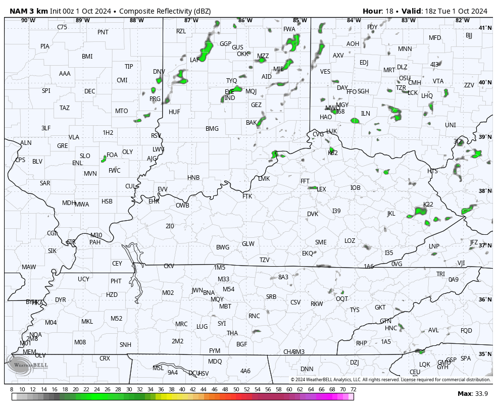
Here’s the future radar from the Hi Res NAM…
The air coming in behind this is pretty darn comfy for the next few days and that lasts into the start of the weekend.
The tropics continue to be alive and kicking, but the Gulf of Mexico threat is a little lower and slower to develop. NO ONE will complain about that. Still, that system or a couple of systems should develop in the coming days. At the same time, we have Kirk and a new candidate for a name well out in the Atlantic…

The scenario in the Gulf isn’t nearly as clear cut as with Helene as we may have multiple centers kinda fighting to be the big daddy… or big momma. As we wait for that to work itself out, we are likely to see a couple of cold fronts dropping in from the northwest this weekend and early next week. The second of which appears to be the stronger of the two…
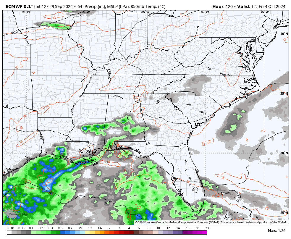
That’s being pushed by a deeper trough into the east…
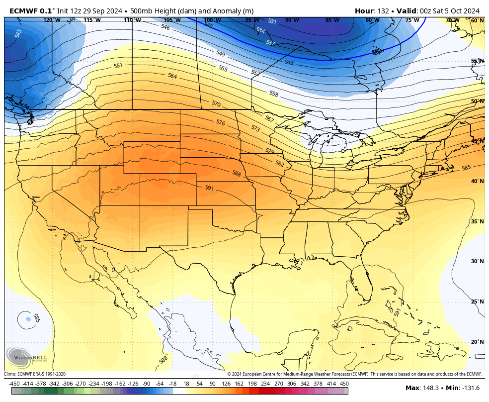
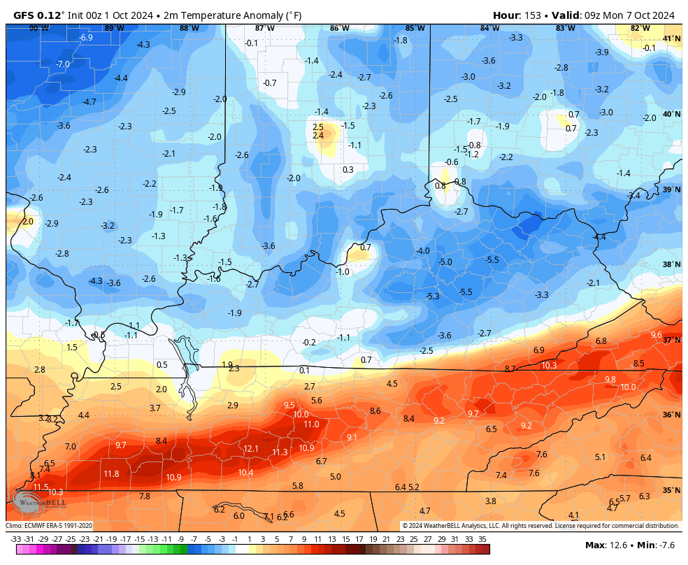
Check out the below normal temps coming in with this trough on the EURO…
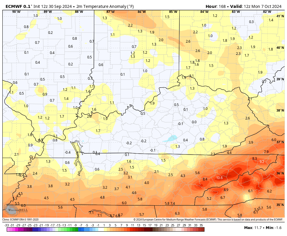
The GFS is even deeper below normal…
Here are your Tuesday tracking tools to keep you company on this first day of October…


Have a terrific Tuesday and take care.

Thanks Chris. I will enjoy the mild and dry period this week, but it seems really abnormal not to have frost. All I’ve notice so far this Fall is the declining day length. It feels like late August with the high humidity this morning and fog. Something to watch is a Tropical Storm that may be developing in the Caribbean Sea. If it does form, I hope it stays in the Western Gulf and moves as a Rain Maker into the desert Southwest, where the drought is very serious.
Be Safe Everyone !
Both tropical storm Kirk and the tropical depression to its southeast bear watching, as shear is low in this area and sea surface temperatures are +90°F. Both have the potential to become major hurricanes, and although Kirk will probably get caught up in a north-northeast steering current and end up in the central Atlantic, I give that depression a better than 50% chance of becoming a threat to the US.
With the in coming cold front coming through it may steer it off the east coast. Hope so!
NOAA’S outlook for October 2024. Doesn’t look very Autumn like weather for our part of the country, but it doesn’t surprise me at all. The great soaking rains we had last week will really help, as we enter the normally dry month of October.
https://www.cpc.ncep.noaa.gov/products/predictions/long_range/lead14/