Good Wednesday to one and all. A weak cold front is passing by to our south and southeast today with two more fronts on the way. The good news is these boundaries won’t have much in terms of rainfall with them. The second front will also bring a blast of October chill early next week.
Today is a slow-starter for areas of central and eastern Kentucky as clouds linger into the afternoon. There’s even a few showers hanging around early today, especially in the east.
Here are your Kentucky Weather radars for the day…

Temps start Thursday with upper 40s to low 50s with some pretty dense fog in some areas. Sunshine and 70s take over for the afternoon.
A weak front grazes the area on Friday and may spit out an isolated shower or two, but most of the region looks to stay dry…

That dry weather continues into Saturday with temps running above normal to start the first weekend of October.
Before we get to the second front, let’s go to the tropics where we continue to watch the Gulf of Mexico for another possible system going up in the coming days. The evolution on this continues to be pretty slow…

I do think this system eventually develops but just hangs around in the Gulf for several days. Given the slower movement of this system, the next cold front sweeping into the east on Sunday really doesn’t have anything to pick up from down there.
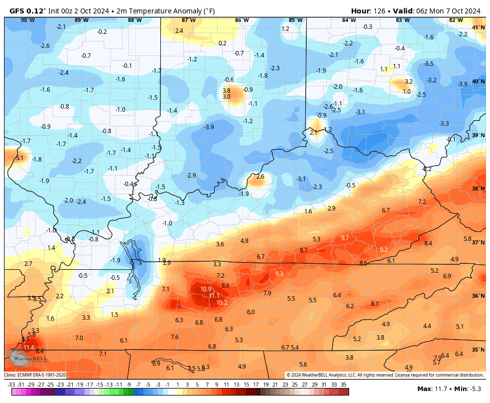
It will bring the chance for a shower or storm to us by late Sunday with below normal temps coming in behind this early next week…
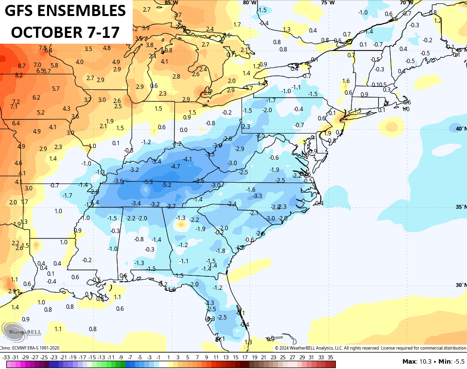
The 10 day temp anomalies from the GFS Ensembles for October 7-17th show the core of the below normal on top of us…
Get out there and make it a wonderful Wednesday and take care.
