Good Thursday, everybody. It’s another really nice day across the Commonwealth as we turn our attention toward a couple of cold fronts. The first brushes the region with a Friday shower chance with the second set to really chill us down by early next week.
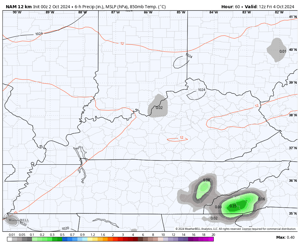
Today starts with fog for parts of central and eastern Kentucky before burning away with afternoon sunshine taking over. Highs are in the 70s.
A little bit of moisture moves in overnight and Friday as a cold front drops closer from the northwest. This can spit out isolated showers and storms, especially across eastern Kentucky.
You can see this on the Future radar from the Hi Res NAM tonight into Friday…
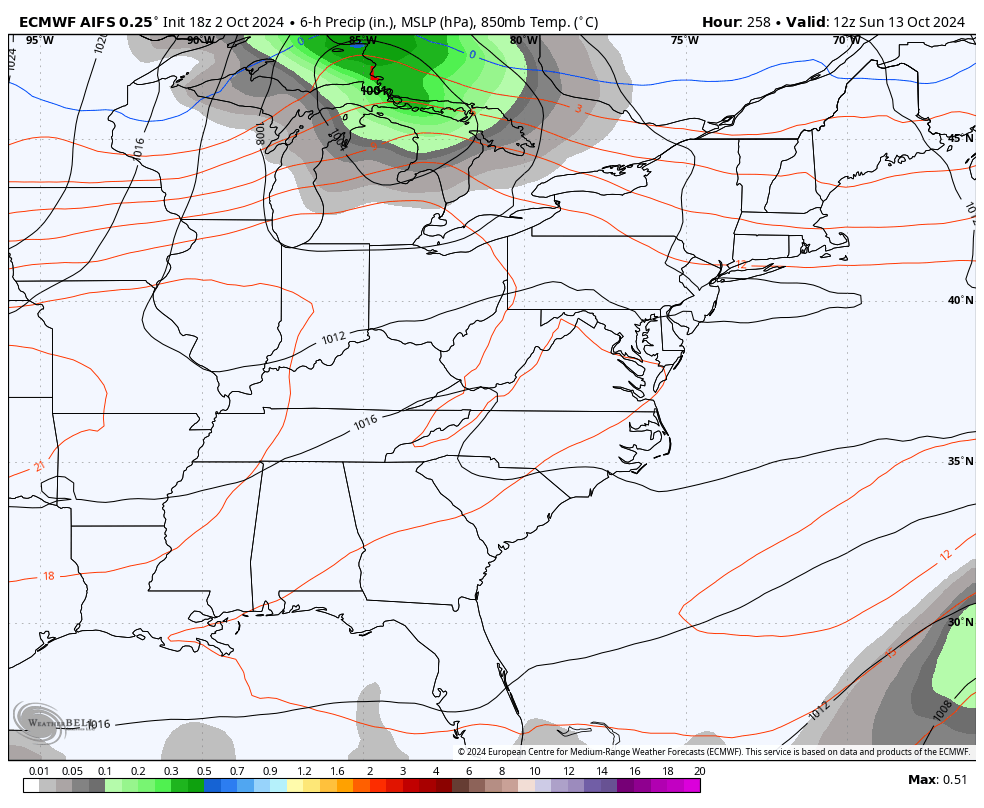
Temps this weekend are generally in the 75-80 degree ahead of another front dropping in here late Sunday and Sunday night. That brings a small chance for a shower or storm with a seasonal brand of chill showing up early next week.
I like what the EURO AI is doing with this blast…
The system heading into the Gulf of Mexico continues to be a slow developer and the National Hurricane Center continues to adjust to this slower scenario…

That system likely impacts Florida over time with only a small chance it gets pulled farther north.
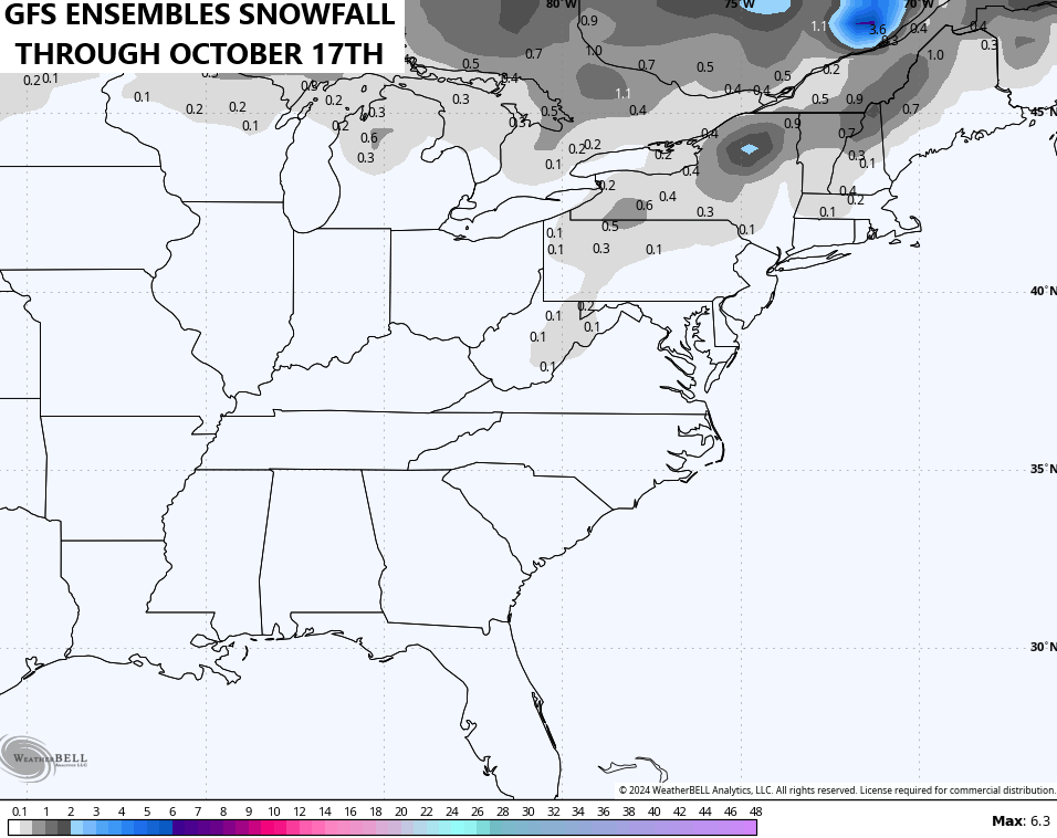
With the potential for a couple of healthy troughs to swing into the eastern half of the country into the middle of the month, the GFS Ensembles are showing the chance for some high ground flakes from the West Virginia mountains into the northeast…
Even some recent runs of the operational GFS show a pattern conducive for this. The overnight GFS actually shows some fantasy flakes in eastern Kentucky…
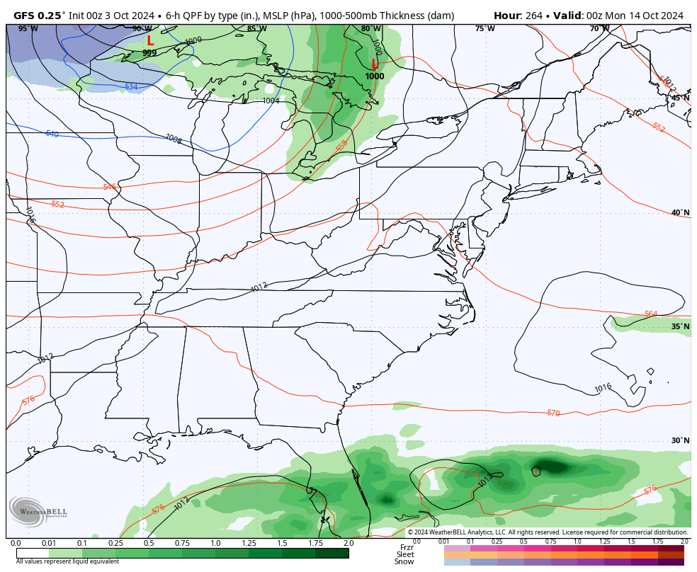
That’s interesting to see for the middle of October, but it’s happened many times before. I’m just not sure this is the October for that.. Yet.
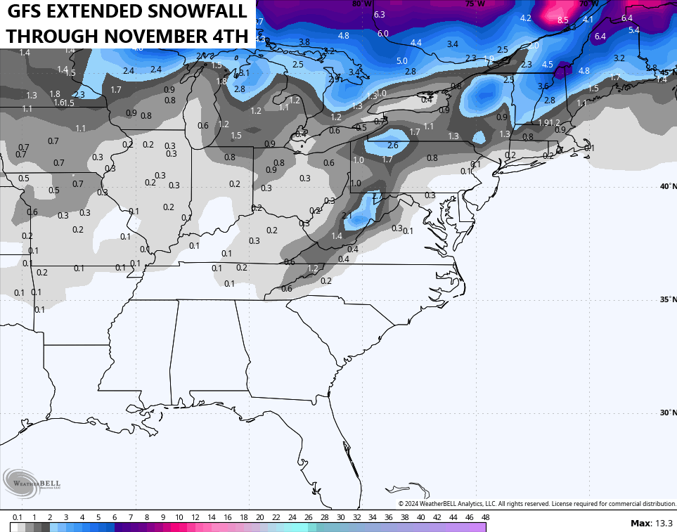
The GFS Extended goes through November 4th and is hinting at the chance for some early season flakes into the Ohio Valley…
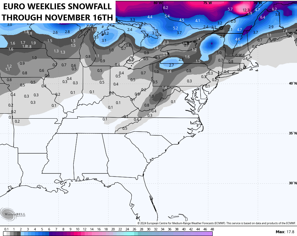
The EURO Weeklies go through November 16th and see the flake chance…
It’s almost that time of the year, folks!!!
Make it a great Thursday and take care.

I’m here for it.
For the first time this season, it’s interesting to see the 540 line drop through the Commonwealth on the 17th. Shape of things to come!
I still can’t believe some of the docuseries people are doing on youtube from western NC… out walking and looking at unreal damage… it’s so crazy to think that I grew up in western NC and have never even been to many of those small communities… I think (relatively speaking) that Brevard was REALLLLY lucky! I can totally imagine they were all thinking what I would have been thinking… that this is just another heavy rain event and the usual areas would flood…. not having a clue that it would rain 20 to 30 inches