Good Friday, folks. We’ve made it to the end of the week and into the start of the first weekend of October, For the most part, the weekend is very mild and dry, but a crisp cold front changes that in a hurry by Sunday night and Monday. That’s when a seasonable brand of chill invades the region.
Today’s temps are mainly in the in the 75-80 degree range with a spot of two coming on a bit above.
There’s a little bit of moisture pushing across southeastern Kentucky and that means the chance for a shower or storm to go up. Here are your Kentucky Weather radars to track whatever shows up…

The weekend has a lot of mid-September in it with highs ranging from the upper 70s to low 80s with a mix of sun and clouds.
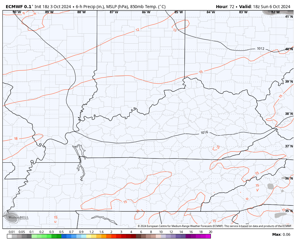
There’s another cold front ready to slam in here Sunday night and this will have a broken band of showers and storms across the eastern part of the state, especially.
Most folks look to stay dry…
I’ll get to the chill coming in behind that in just a second, but I want to update you on the slow development in the Gulf of Mexico. The National Hurricane Center continues to watch this area…

That should eventually develop into a named storm in the coming days and it’s likely to hang around the eastern Gulf for a while.
Watch how the EURO brings the Sunday front through and keeps whatever is in the Gulf spinning…
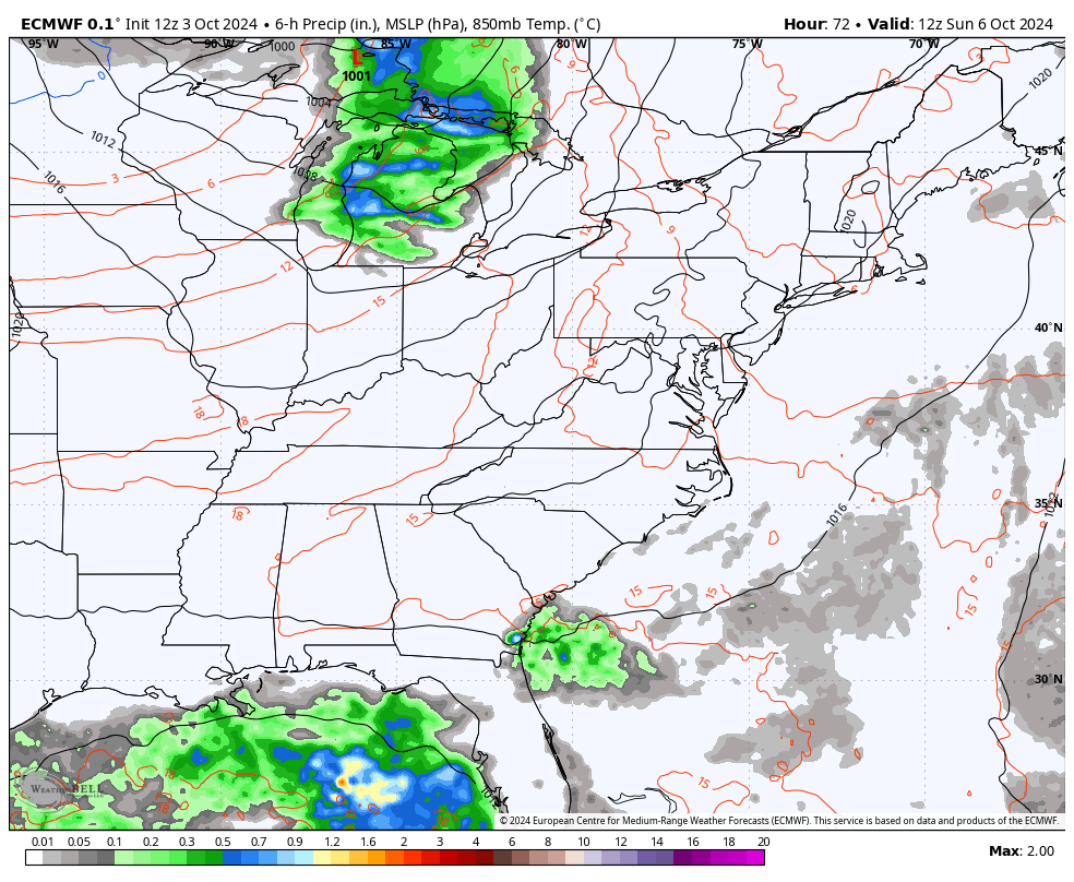
I wouldn’t be surprised if we actually see a couple of systems out of this same disturbed area.
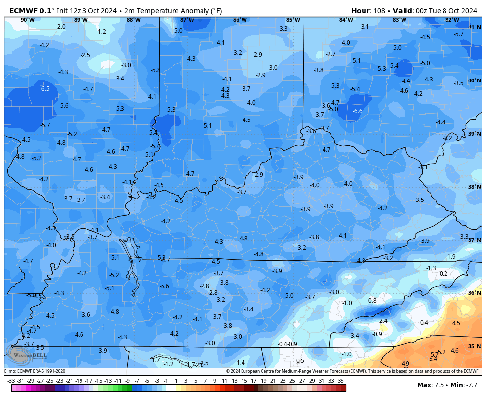
For us, the pattern takes our temps below normal from Monday through next weekend.
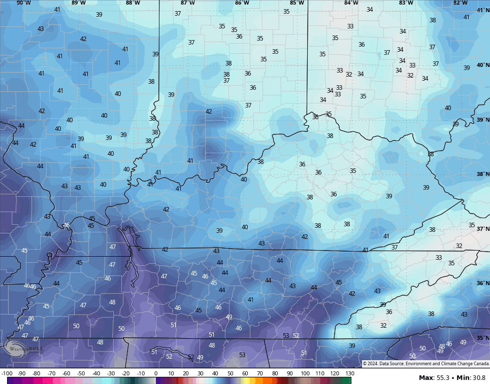
Check out the temperature departures from the EURO…
The Canadian is even deeper into the below normal range…
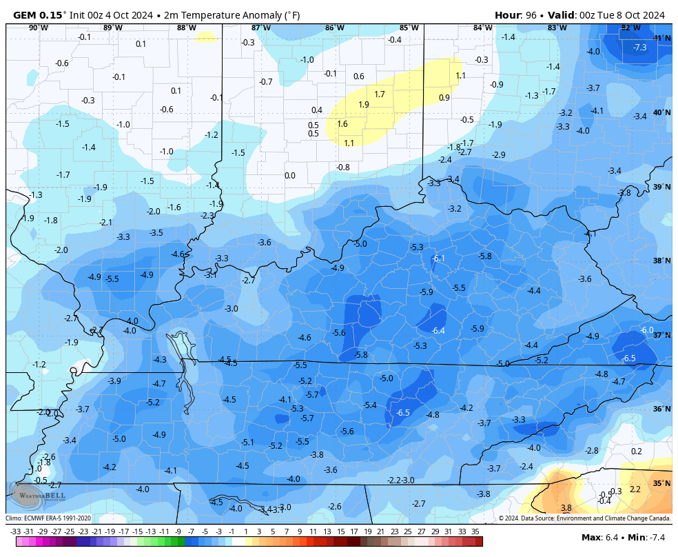
That model even gives us an outside shot at some patchy frost later next week…
I’m not convinced of that just yet.
The GFS is having a number of issues with this pattern, so it’s not really a model seeing things very well at the moment.
Enjoy your Friday and take care.

I’m ready.
Interesting: https://www.weather.gov/media/lmk/DGT/DGT_LMK_10032024.pdf
What a difference a hefty tropical system can make, but we’re back to the same story, as our local forecast is showing less than a 10% chance for rain over the next ten days!