Good Saturday, everyone. It’s another mild day across the Commonwealth but our pattern is about to throw some real deal October chill our way. This pattern will also be accompanied by another hurricane down in the Gulf of Mexico. This one looks to target more of Florida than anywhere else.
I’ll get to the tropics in a bit, but let’s start locally before expanding out.
Temps today are upper 70s to low 80s in many areas with a few spots coming in above. Skies are partly to mostly sunny.
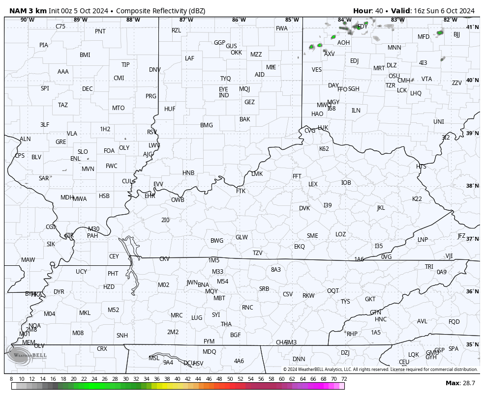
This surge of mild is ahead of a strong fall cold front dropping in here late Sunday into Sunday night. This won’t have much moisture with it, but it should still have a narrow band of showers and storms rolling through here.
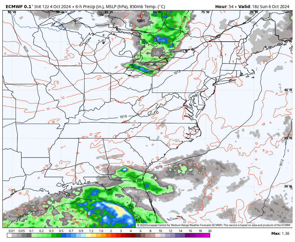
This is the future radar from the Hi Res NAM from Sunday afternoon through 8am Monday…
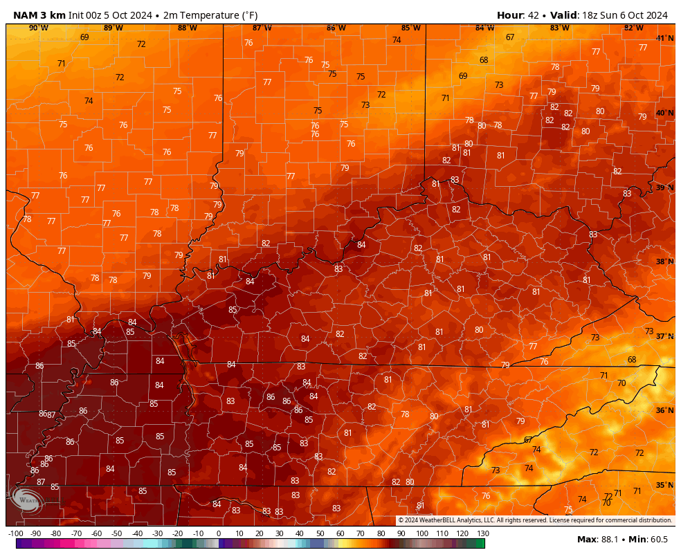
Temps ahead of this front hit 80-85 on a strong southwest wind flow Sunday afternoon before crashing Sunday night. Watch how we go from the 80s to the 40s as the front slams through…
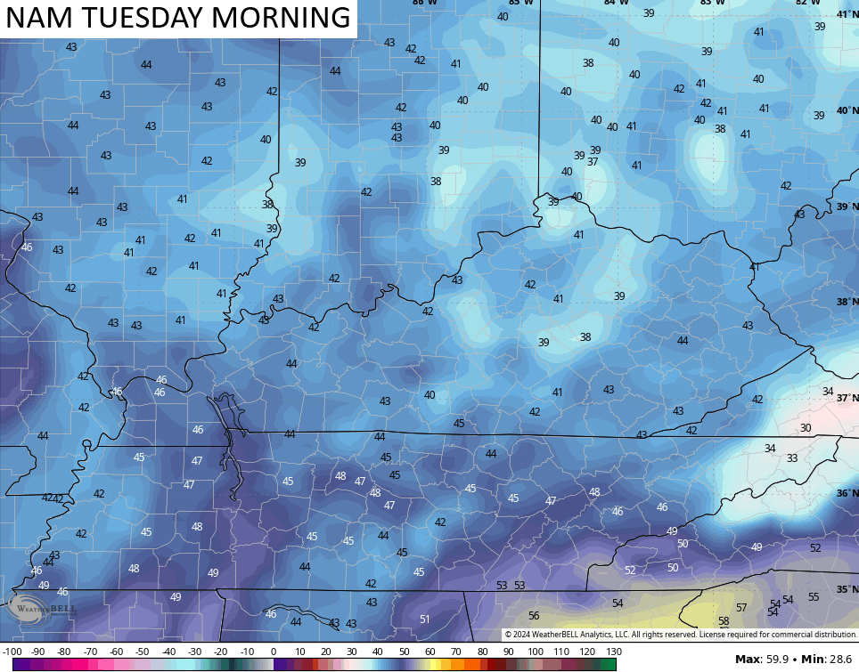
Highs for much of next week should be in the 60s and there’s the chance for lows to reach the upper 30s on more than one occasion. The NAM suggests the first chance is Tuesday morning…
A touch of frost can’t be ruled out in the week ahead. Woot!!
Now, let’s take a look at the tropics. We have Hurricane Kirk, Hurricane Leslie and another disturbance way out in the Atlantic. The area of concern continues to be in the Gulf of Mexico and this is likely to develop over the next few days…

Hurricane Kirk has been a monster way out there in the Atlantic, but its heading north and then will get caught up in a flow that takes it all the way to France and Great Britian as a Tropical Storm. Wait. What?
Yep. Check out the track from the National Hurricane Center…

Hurricane Leslie is a slow-mover and looks like a fish storm…

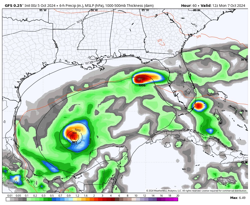
The Gulf of Mexico is a different story as we have two systems trying to form…

The lead system probably doesn’t amount to much other than a big rain maker in Florida. The system behind it likely becomes a hurricane as it moves from west to east across the Sunshine State.
Here’s the GFS with it…
The EURO is similar…
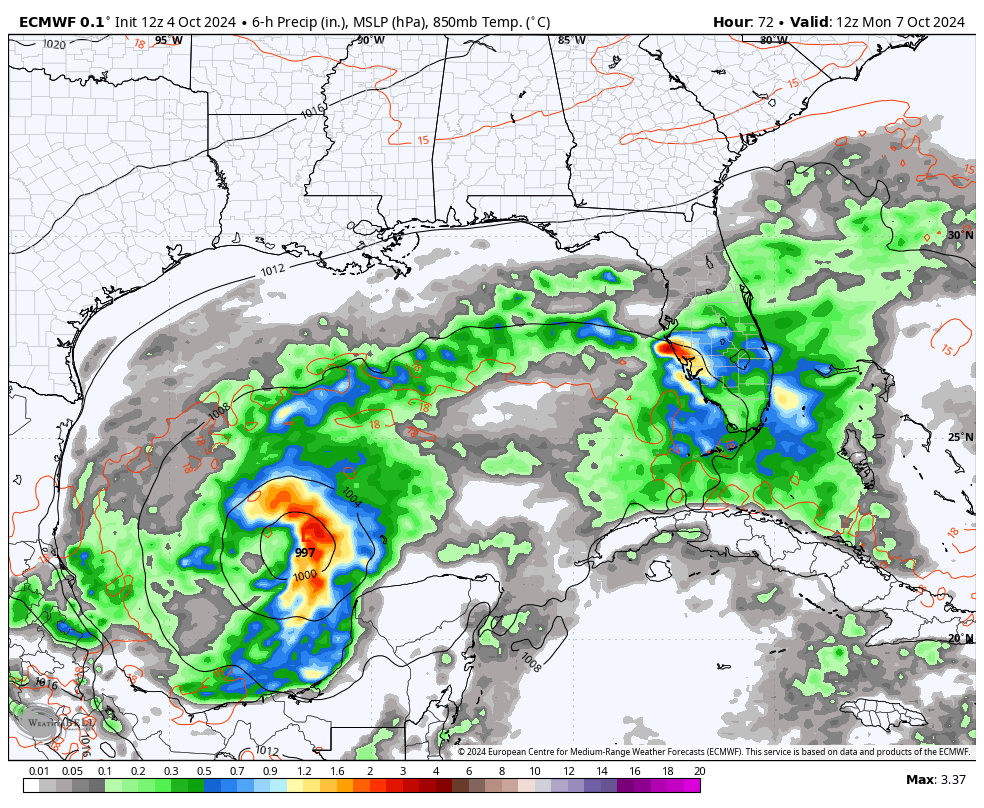
That may very well become another large hurricane impacting that part of the country. As of now, this does not look to have much of an impact on any other state.
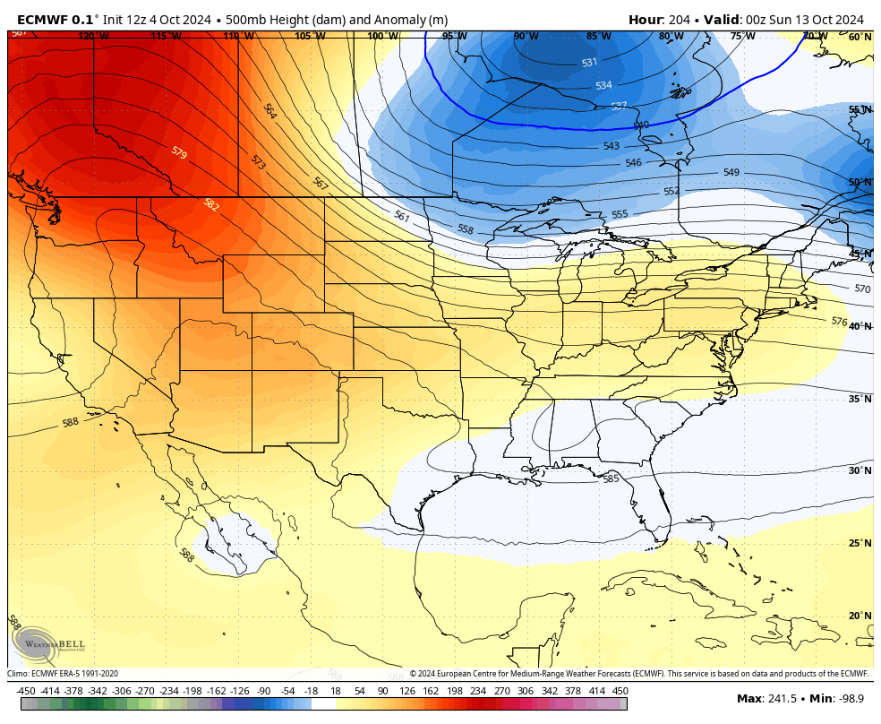
One of the reasons for that is that big trough digging into the eastern half of the country…
After a bit of a pause, we are going back into another very blocked up pattern and it can create some more extremes across North America. For a while now, there’s been a signal for a major trough digging into the eastern half of the country toward the middle of the month.
This will come and go on individual model runs, but some of the runs are going a little wild with it. Here’s the EURO for late next weekend…
Here’s the look at the surface…
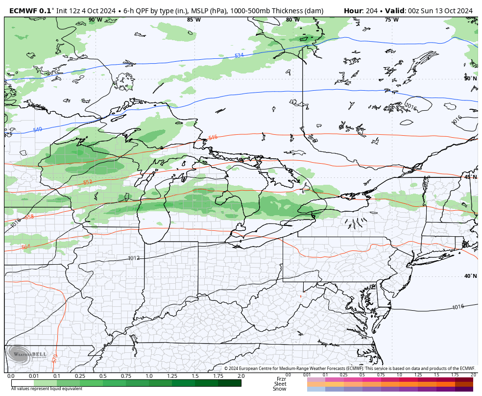
Things can sometimes get interesting underneath big upper lows like that.
Enjoy the day and take care.

Thanks Chris. Very beautiful weather these past few days, but I’m ready for those bright blue skies of Autumn along with colorful foliage and frosty mornings. Last week’s rain has really helped in restoring the vigor in the lawn and the trees. Kind of concerned of what may happen in the Gulf. I have Family on the west coast of Florida, and they have had a very rainy Summer down there. Lots of flooding occured from Hurricane Helene’s storm surge just south of where they live. Winter weather will occur in our part of the world from time to time, but there are signals that most of the south and southwest will have above normal temperatures and below normal precipitation. With the predicted weak La Nina, I just hope we don’t have an Ice Storm like we had back in 2009 La Nina Winter. Big Snows may be common in areas that are north of the La Nina jet stream. We shall see.
Have a Great weekend Everyone !
One of the most dominant drivers of weather on our planet is the Sun, which among other things supplies the energy that supports atmospheric convection and wind. We are fortunate that our Sun’s output is relatively stable but like most things in the universe, it is susceptible to variations. One measure of solar variability are sunspots, which can have a significant affect on the amount of energy it emits, especially the role they play in the generation of solar flare and CMEs. Sunspot activity wil rise rise and fall during an 11 year cycle, currently reaching peak, during which activity has been particularly strong, and the presence of spectacular aurora this past May are an example. This is a current image of the Sun, which exhibits one of the largest outbreaks of sunspots we have seen in many years!
The direct effects of solar activity on our atmosphere can lag days to weeks behind a specific event, so it will be interesting to see what kindnof action these sunspots hold in store for our weather.
https://soho.nascom.nasa.gov/data/synoptic/sunspots_earth/mdi_sunspots_1024.jpg
That’s very interesting Joe. Thanks for sharing. I remember way back in the 1960’s we saw a brilliant display of the Northern Lights. I was living in South Central Indiana at that time. The next day we didn’t have school because of a complete power failure from an electromagnetic pulse. Sometime this may happen again over the entire Earth. Speaking of what effect this has on the climate, it could raise the temperature of the Earth. Every mild Fall and Winter is during a Solar maximum, but other factors also come into play to cause this.