Good Sunday, everyone. We have a cold front ready to cross the region, bringing a broken line of showers and storms and some seasonable October chill behind it. At the same time, Milton is cranking in the Gulf before slamming into Florida as a major hurricane by the middle of the week.
Temps out there today reach 80-85 in many areas on a brisk southwest wind. This wind is ahead of our cold front arriving this evening with that broken line of showers and storms. Not everyone sees rain with the greatest chance across the east.
Here are you’re regional radars to track this front into town…

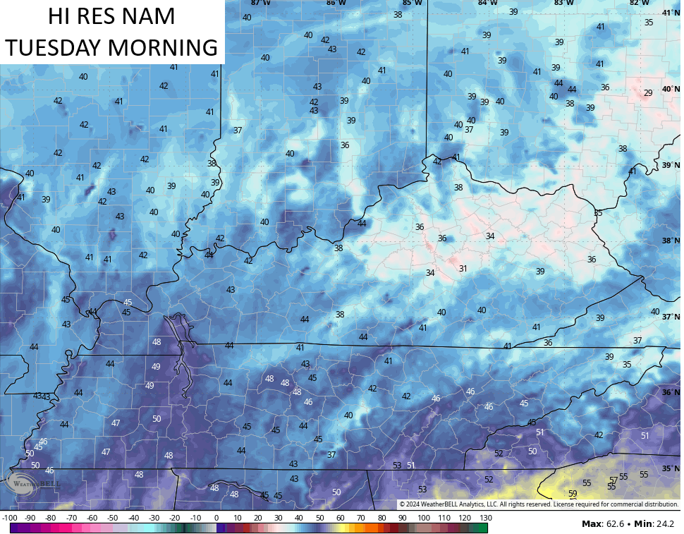
Temps crash quickly behind this front with most areas in the 40s by Monday morning. Afternoon highs stay in the 60s with a mix of sun and clouds and a bit of a nip in that northerly wind.
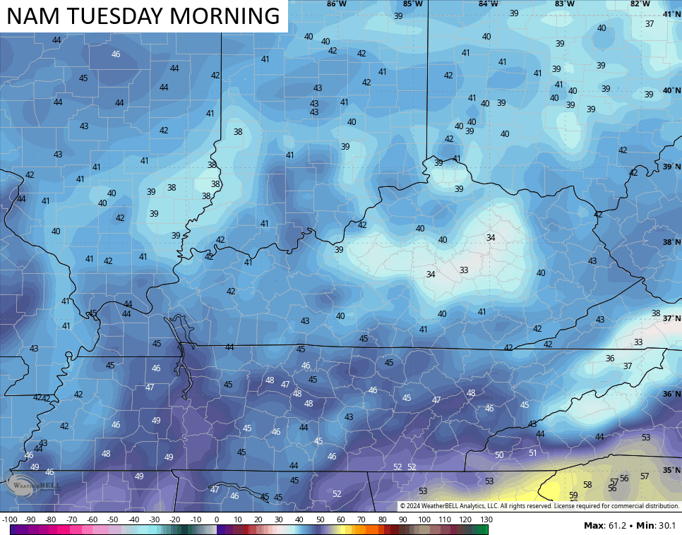
Temps by Tuesday morning can drop into the upper 30s and low 40s in some areas. The NAM fam suggests some patchy frost in the valleys…
Temps for the rest of the week hang into the mid 60s to low 70s for highs. Lows each morning are 40-45 with another morning or two with the chance of going back into the upper 30s.
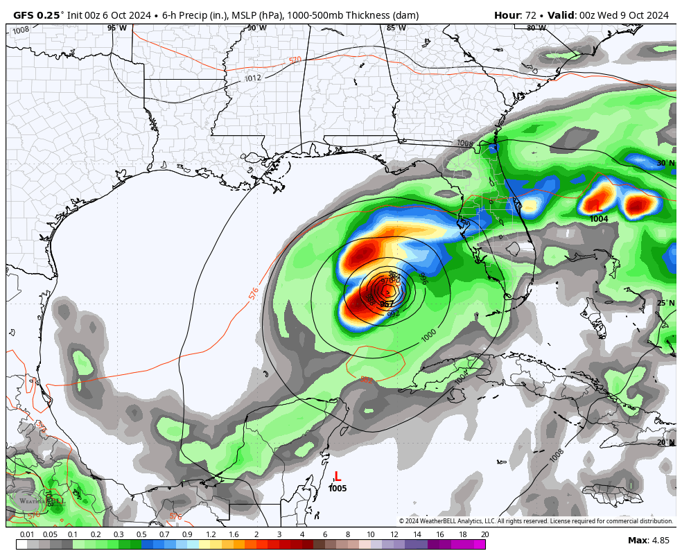
Ok, let’s get to the Gulf of Mexico where Milton is in the process of becoming a Hurricane. This system is spinning in the southwestern Gulf with a tropical disturbance about to move into Florida. You can see both of these on the satellite shot…

This storm is likely to become a MAJOR hurricane that makes landfall along the Gulf Coast of Florida, not too far away from Tampa on Wednesday. Here’s the latest track forecast and information on Milton…

If you’re thinking that’s a rare track, you’re absolutely right. I searched through the record books and could only find two hurricanes that developed in the same area of the Gulf and made landfall within 100 miles of the Tampa Bay area.
Both of those were from the 1800s…
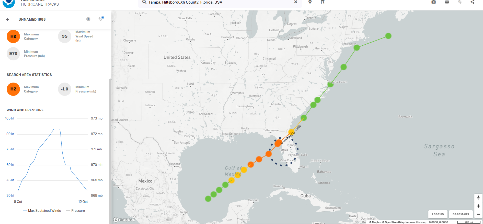
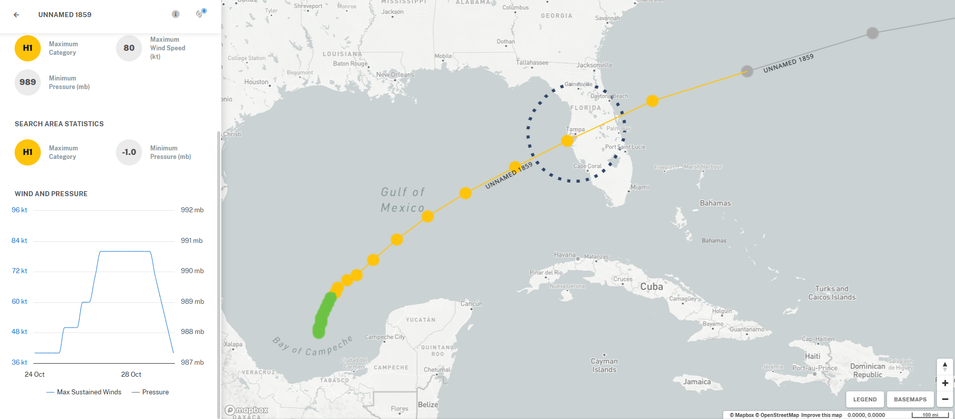
That’s pretty wild, folks.
The GFS is ugly for the Tampa Bay area…
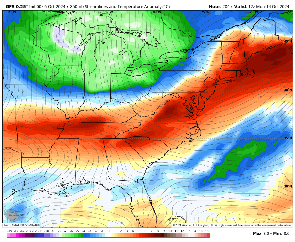
Milton won’t impact our weather, but another system does drop in from the north later next weekend, but it remains to be seen exactly how that plays out. It will have a push of frosty air coming in behind it…
Looking farther down the road, the pattern is still very blocky and there could be yet another system trying to form in the Gulf of the Caribbean.
Enjoy the day and take care.

Thanks Chris. Hoping that Tropical Storm Milton doesn’t become another problem for the Nation, but that’s wishful thinking. Next week’s weather sounds delightful here in Kentucky.
Have a bless Sunday Everyone
Latest on Tropical Storm Milton. Looking at the current satellite, I would say that T S Milton is not far from Hurricane status. Here’s the Link :
https://www.weatherstreet.com/hurricane/2024/Milton.htm
Some model runs have hurricane Milton North of Tampa Bay..Another nightmare unfolding if correct..
Hurricane Milton’s path on the Ventusky’s weather site. The path is always subject to change, Here’s the link :
https://www.ventusky.com/?p=26.6;-85.3;4&l=temperature-2m