Good Monday to one and all. We have a much more typical brand of October air blowing across Kentucky this week as we also watch the Gulf of Mexico. That’s where we have Hurricane Milton strengthening into a Major Hurricane as it targets Florida in a few days.
Chilly winds from the north have settled into the region today with highs only in the 60s under a good looking sky. Temps tonight drop toward the 40-45 degree range and there’s the chance for a few upper 30s in some of the valleys…

Temps the rest of the week are generally in the 60s with some low 70s at times. Overnight lows reach the low and mid 40s for the most part, but some upper 30s will show up from time to time, especially Friday morning.
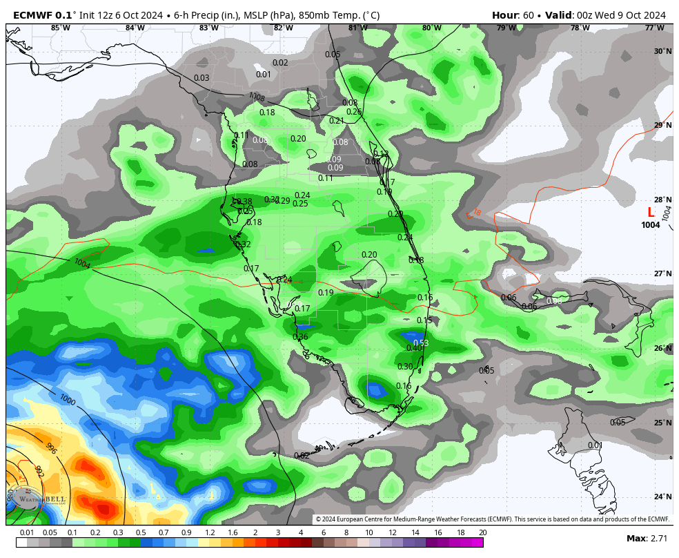
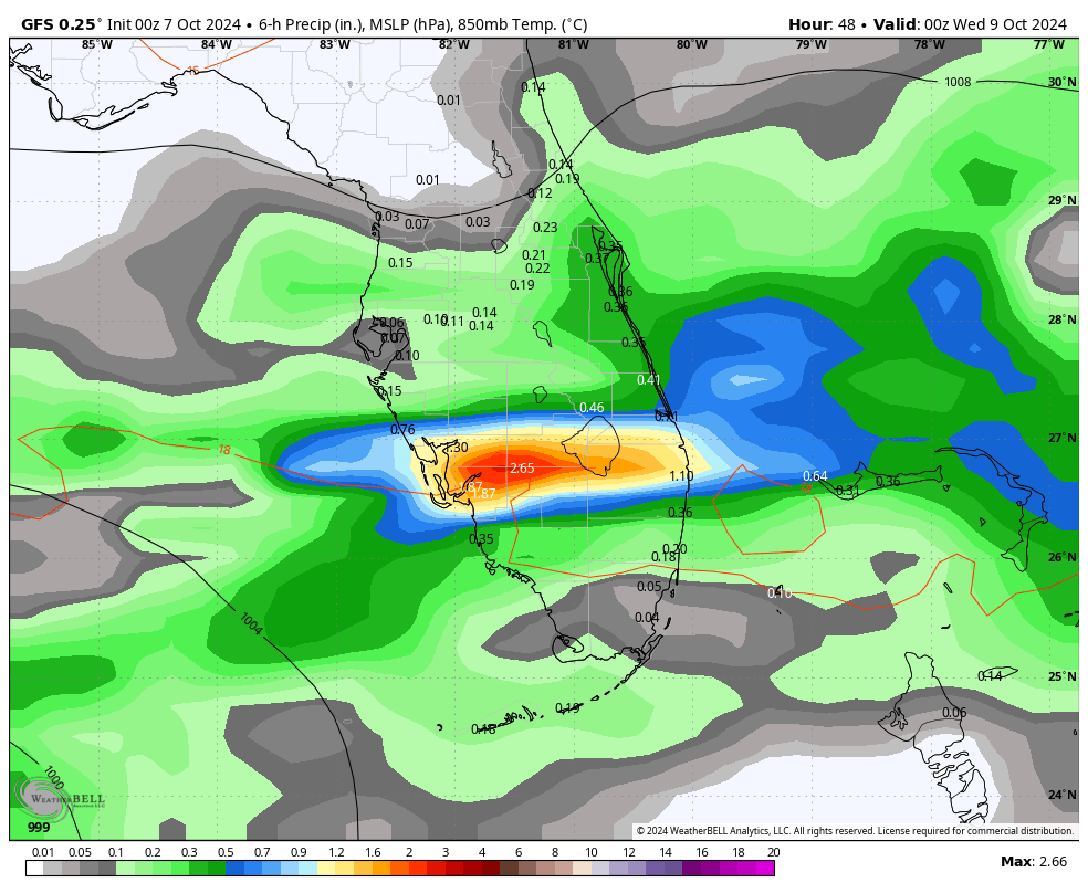
Hurricane Milton continues to crank down in the Gulf of Mexico…

Milton is likely to become a Category 4 Hurricane with the potential to reach Cat 5 status as it barrels toward Florida for a Wednesday evening landfall. This will likely be within 50 miles or so of Tampa Bay.
Here’s the latest information and track forecast from the National Hurricane Center…

The EURO is straight into Tampa Bay with a devastating hit…
For our weather, another deep trough looks to sweep in here behind a cold front late this upcoming weekend. That front won’t have much moisture with it, but it brings the chill behind it…
GFS
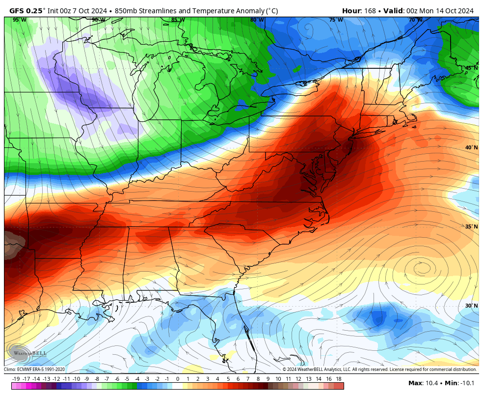
EURO
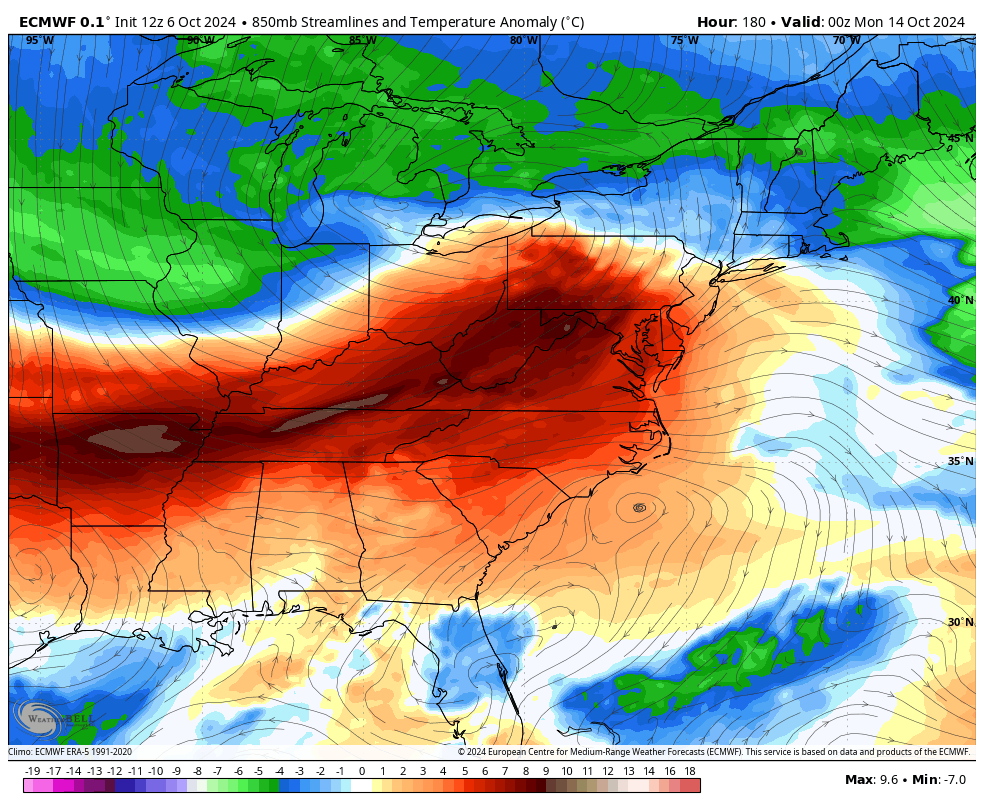
Frost is a good bet with this setup early next week.
There’s the chance for another system to develop in the Caribbean and sneak into the Gulf of Mexico. We’ve talked about this in recent days and some of the models have been seeing this coinciding with another deep trough swinging into the eastern half of the country.
The EURO AI has a healthy look…

Have a magnificent Monday and take care.

Thanks Chris. Delightful, is the only adjective that I can think of to describe this week’s weather here in Kentucky. However, what Hurricane Milton does is the BIG story ? !
Everyone, Enjoy the Day !
Yea because what else is there to talk about? The weather is literally doing nothing here other than temps.
October is living up to it’s name as the driest month of the year, but in my time I’ve experience some very warm, and very cold Octobers. I can only remember one accumulating Snow event ( 4 inches ) up in Indiana, and a very rainy Halloween.
I remember the Halloween we had some snow one year too. Thinking of Florida tonight that looks bad Schroeder I hope your family doesn’t live in the worst area of Florida.
Thanks Crystal. I tried to talk to them about leaving yesterday evening, but they plan to stay in their home and ” ride out the storm. ” I told them that they are in the PATH of the Hurricane and must leave. I’m hoping the storm weakens to a category 3 at landfall. It’s still dangerous, with the predicted Storm Surge of 10 to 15 feet !