Good Monday, everyone. Our gorgeous and mild fall weather rolls into the start of the week but a few cold fronts look to sweep in here later this week into the weekend. We will take a look at those and the longer range picture.
Before we look back, let’s check where we currently stand for October.
In terms of precipitation, we are on pace for one of the driest Octobers on record. For instance, Lexington has picked up .22″ of precipitation for the month and we are currently rolling toward the 2nd driest October on record. I do think some showers get in before the month is over, so we will see where we finish.
Temps across Kentucky so far have been below normal across Kentucky and surrounding areas…
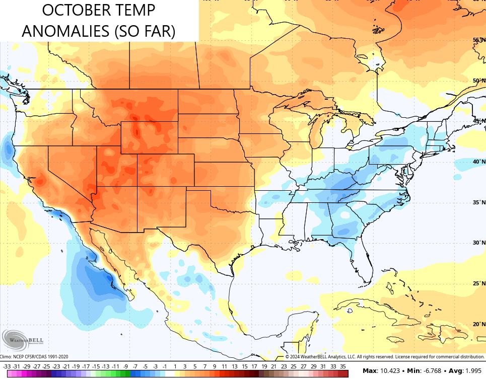
This has been a very stable temperature pattern across the country since the start of summer. If we look back at the last 120 days, we find a very similar looking temperature anomaly map…
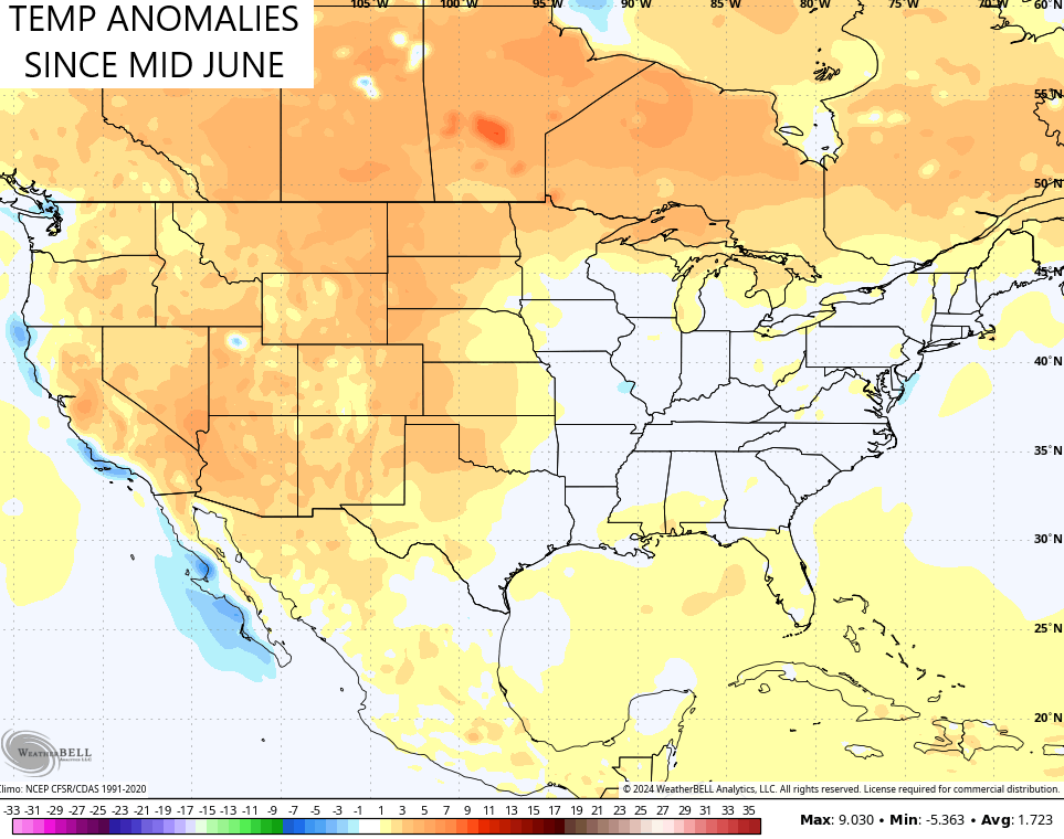
The western US and Canada continue to be much above normal with temps while our region sees temp swings that balance everything out to near normal. Do we ride that same pattern all the way through the upcoming winter? Say it with me… Wes shall see.
In terms of the weather this week, it’s milder than normal with highs in the 70s with lots of sun. There is a weak cold front rolling in here late Wednesday with no precipitation and only a glancing blow of chillier air. That’s followed up by another front over the weekend. This one may actually bring some showers in here with temps coming down some…
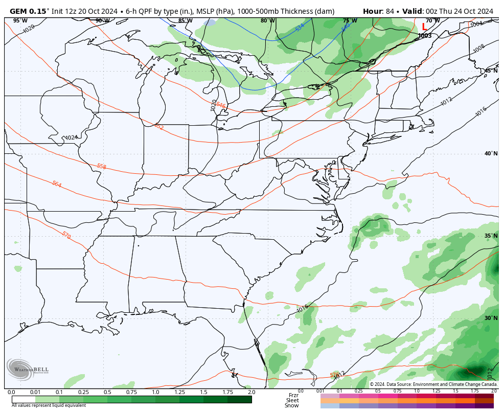
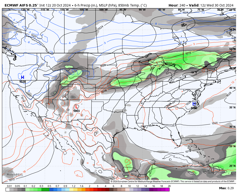
The system coming in here Halloween week continues to be a bit of a mystery. The Canadian Model brings that system in here on Halloween…
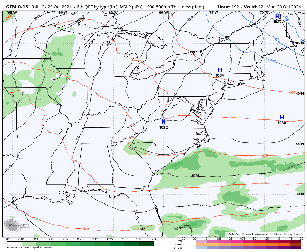
The AI version of the EURO continues to be slower with that system and throws a few more our way into early November…
We need to watch the Caribbean over the next few weeks for additional tropical development.
In the current tropics, Oscar hit the eastern tip of Cuba Sunday and this system is losing steam as it slowly heads to the northeast…

Have a magnificent Monday and take care.

Thanks Chris. I believe you showed this map from NOAA sometime ago, but they have more information on their Winter outlook 2024 – 25. It’s just what I expected for a La Nina Winter. In my opinion, I don’t believe we will have interesting Falls and Winters until the Pacific Decadal Oscillation phases into the positive, and the Atlantic Multidecadal Oscillation phases into the negative. This scenario happened back in the Fall of 1976 to 1978. Our last really Cold and Snowy Winters. NOAA failed to mention ( probably forgot ) ” that no two La Nina’s are the same. ” We shall see…
Here’s NOAA’s outlook in detail : )
https://www.noaa.gov/news-release/us-winter-outlook-warmer-and-drier-south-wetter-north
Enjoy the Beautiful Weather Everyone !
Adding to the above, my area of Kentucky has seen zero precipitation for the month of October. I’m hopping this will end soon, as the leaves fall, and add more fuel to a potential forest fire.
Everything I have read says above normal temperature this winter I will wait what Chris says for our area but that’s frustrating if your a snow lover but as Chris says we shall see.
Crystal, Your area and the eastern part of the state has the best chance of receiving the most Snows no matter if it’s a La Nina or an El Nino Winter. Geographically, your in the best area for the most Snow events. On the weathercams, Jenkins has the best fall foliage of any part of the state this year. Our foliage here in South central Kentucky is turning a very ugly shade of yellow. No bright colors anywhere. Just too dry.