Good Wednesday, everyone. It’s full steam ahead toward an early season blast of winter weather over the next few days. This comes with the first light accumulating snow of the young season and some pretty cold wind chills.
Let’s begin with today and roll forward.
A cold front crashes through from west to east with a quick-hitting band of gusty showers before sunshine takes over. Temps start in the 50s and 60s across the east then drop quickly into the 40s from west to east.
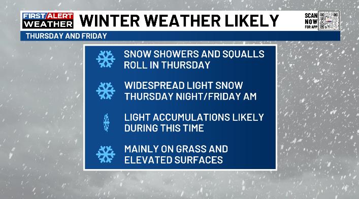
That sets the stage for winter weather Thursday into Friday. Here’s a quick breakdown of what to expect…
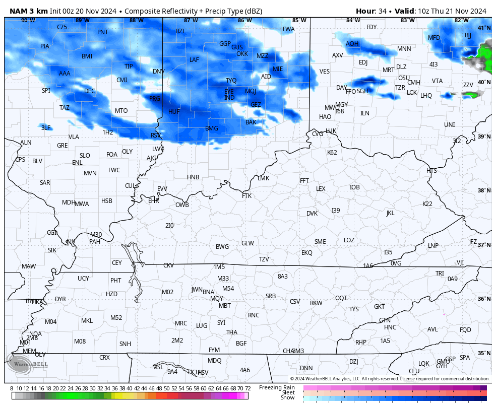
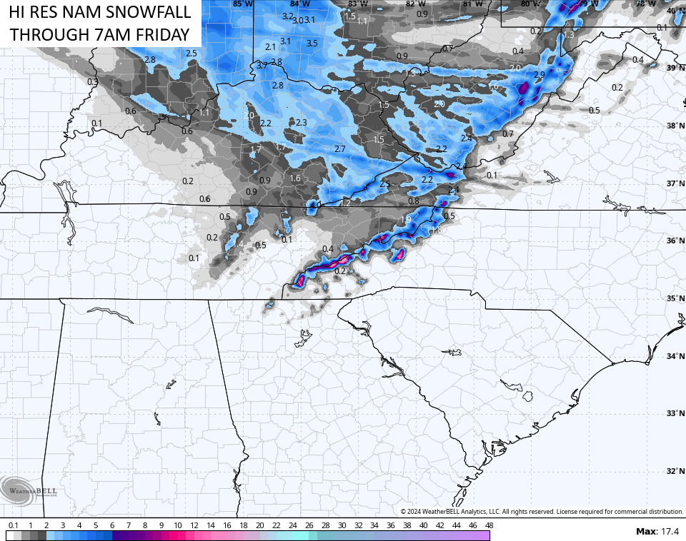
The future radar from the Hi Res NAM seems to have a good handle on how this whole scenario plays out. This animation goes from Thursday morning through Friday morning and shows the snow showers and squalls to be followed by the band of light to moderate snows…
I will have a First Call for Snowfall map out around Noon or so today. I’ve broadened the area with the best chance to see a light snowfall out of this…
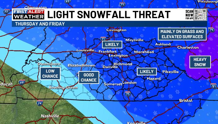
Again… much of what falls will melt, but some sticking snows will likely show up after sunset Thursday through Friday morning. Most of this will be on the grass and elevated surfaces like cars and rooftops.
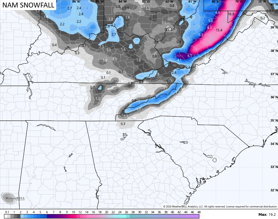
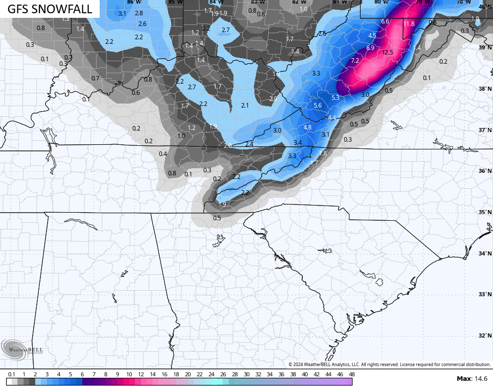
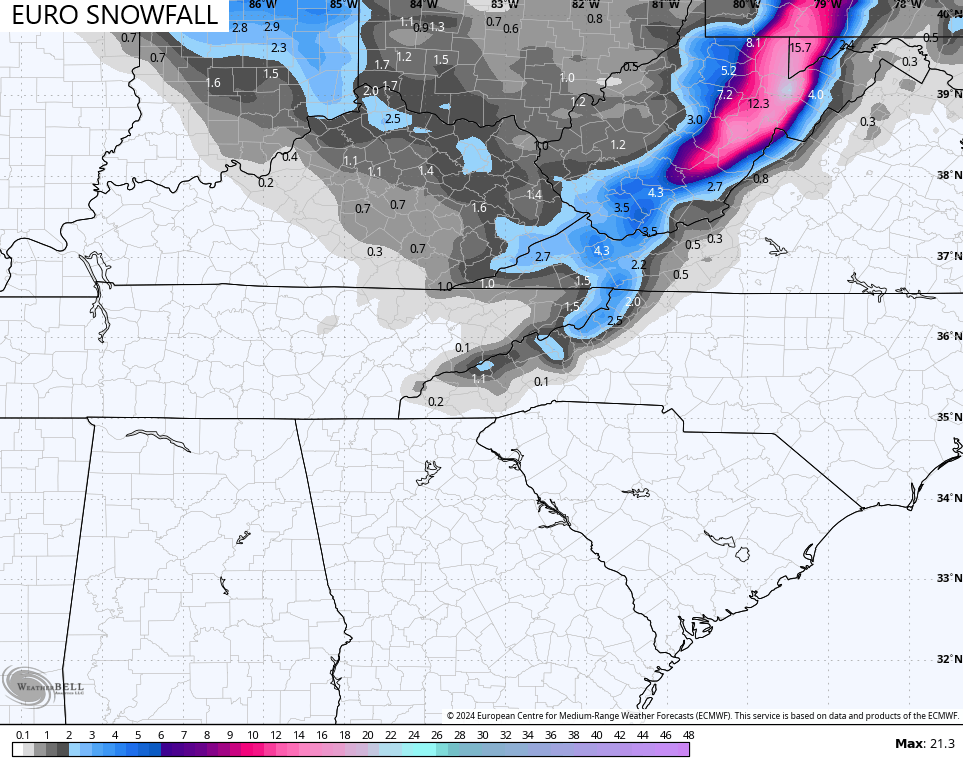
The forecast models are all in pretty similar shape in terms of the areas getting in on the best snows. Keep in mind these models are NOT showing a snow depth, instead, they’re showing snowfall as warm grounds will keep the totals down.
That said, it’s impressive to see a snowfall like this showing up on the models…
![]()
![]()
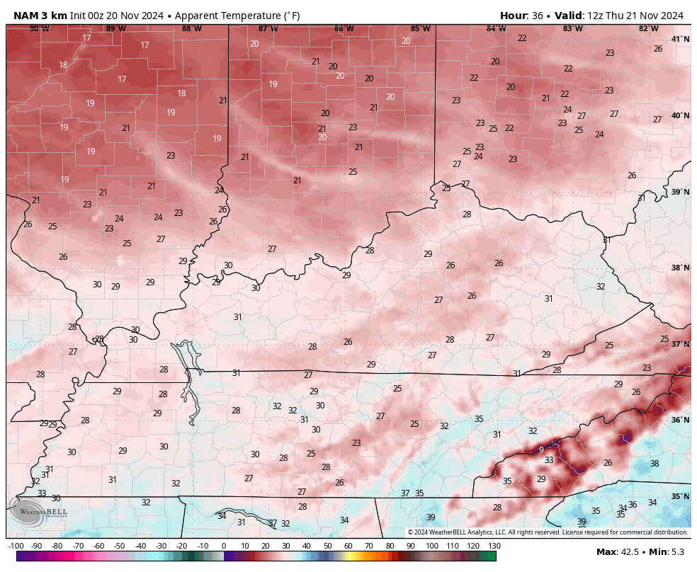
Gusty winds and temps in the 30s will combine to make it feel much colder Thursday into Friday. Check out the wind chill forecast from Thursday morning through Friday morning…
Temps slowly rebound to seasonable levels over the weekend with calm conditions returning. That calm weather won’t last long as our Thanksgiving week and Weekend will feature arctic air getting into the United States with an active southern storm track.
This is a REALLY cold pattern engulfing much of the country over the long Thanksgiving Holiday Weekend and into the start of December. As I pointed out a few days back, the coldest air relative to normal in the entire Northern Hemisphere is forecast to be across Canada and the United States. We just have not seen that very much at all over the past several years, during any month.
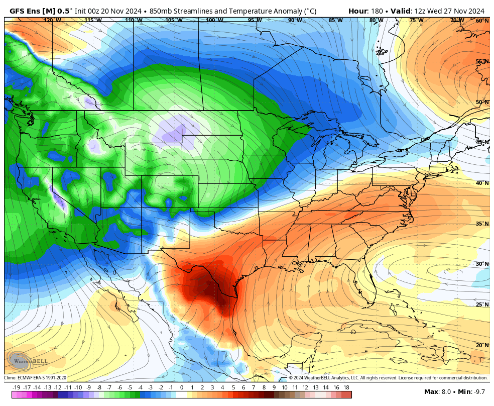
The cold on the ensembles is growing…
GFS ENSEMBLES
EURO ENSEMBLES
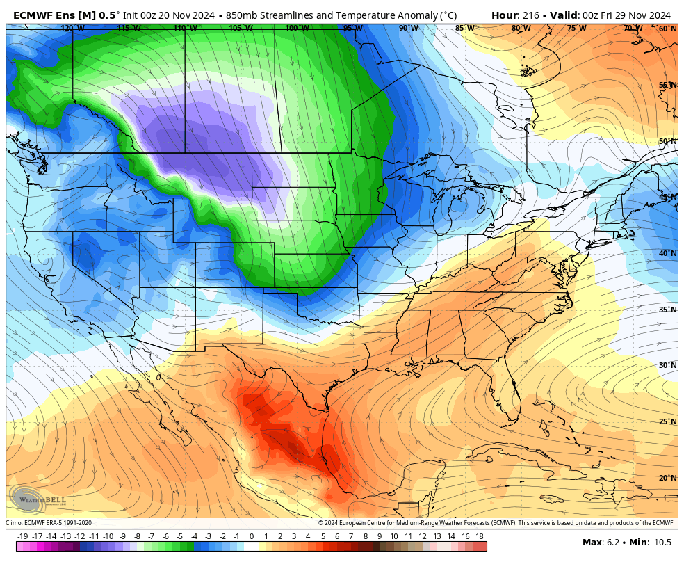
Operational models are going to struggle with the combination of the arctic air and the southern storm track. From time to time, they’re likely to show some big time disruptive storm systems similar to what the last run of the GFS shows for Thanksgiving…
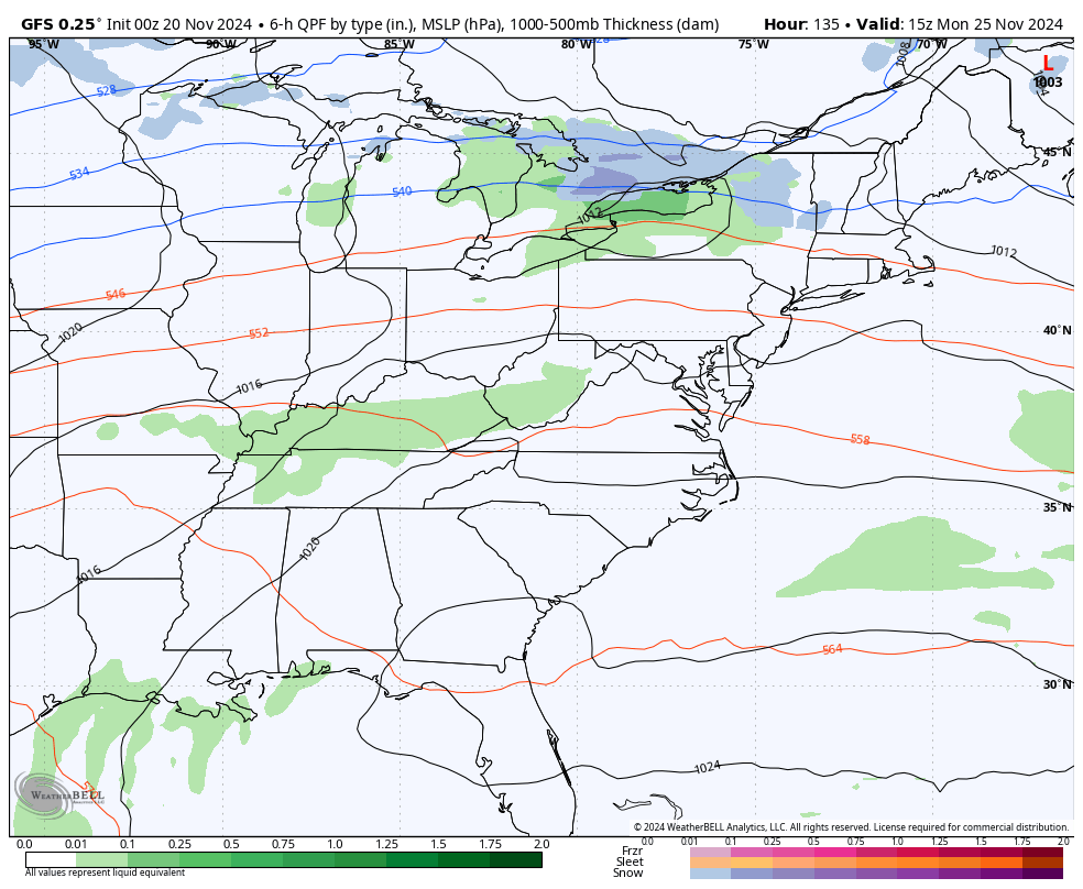
You will see a lot of the models showing a storm then losing it and vice versa in the coming days.
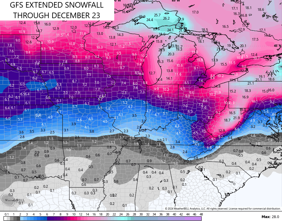
With the cold air looking more and more likely as we end November and roll into December, we are seeing the GFS Extended picking up on more snow chances over the next month…
I’ll have that First Call for Snowfall around Noon or so today so check back. Until then, I leave you with your radars to track today’s quick-hitting showers…


Make it a wonderful Wednesday and take care.

I’m afraid that Western and South Central KY will be on the outside looking in, once again.
Thanks for the update Chris. Hope your Winter forecast pans out.
Have a Great Day Everyone !
It’s early to get exciting history our big snows don’t come tell January. Hopefully this winter will provide us the big snowfall that we been lacking for the last several winters.