Good evening, folks. The first snowfall of the season was recorded earlier today and it’s snowing again in many areas. This is just some slushy stuff sticking to the grass and elevated surfaces, but it’s pretty cool to see for so early in the season.
I don’t have a lot of time, so let’s hit the high notes.
A Winter Weather Advisory is out for much of central and eastern Kentucky tonight…
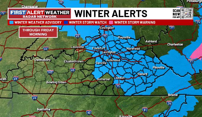
Slushy accumulations of coatings to an inch or two will be noted on the grass and elevated surfaces with a little more into far southeastern Kentucky…
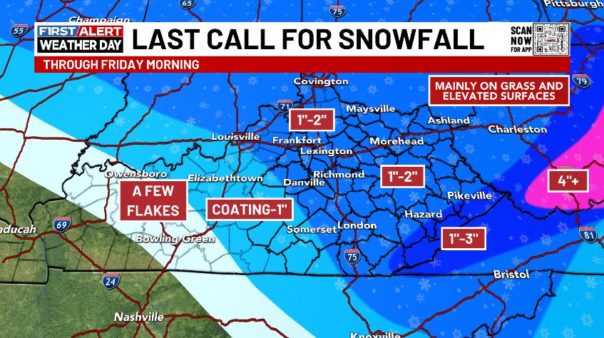
This moves away fairly quickly Friday morning with a little rain shower and snow shower action through the rest of the day as the snow melts.
The long range pattern for Thanksgiving week into early December continues to look rather loaded with several systems impacting our region. Rain and/or snow will be possible during this time as the models change a bit from run to run as they try to grasp the tracks of each individual system…
I’ll update all that later tonight.
Don’t forget to click on our Kentucky Weather Cams to watch the flakes flying across different parts of the state. Here are your tracking tools for the first blast of winter…


Have a great evening and take care.

I have really enjoyed the snow today I was pleasantly surprised with the big flakes. The only place it stayed was on my car but man it came down heavy for awhile and still snowing the last time I looked out.