Good Friday, everyone. Old Man Winter has officially arrived in the Bluegrass State with a nice snowfall to kick off the season. This is likely a sign of things to come as the overall pattern looks to be locking into one that we haven’t seen much of in recent years… Very cold and, potentially, snowy.
Our snows from Thursday into early this morning did what we thought they would do, giving most of central and eastern Kentucky coatings to up to 2″ of snow with higher amounts in the far southeast. You can see all the pics and videos from my Kentucky Weather Twitter Feed
Morning light snows move out of the state with a lot of low clouds and a few showers with some flakes mixed in at times.
Don’t forget to click on our Kentucky Weather Cams to watch the flakes flying across different parts of the state. Here are your tracking tools for the remaining flakes of this first blast of winter…


Temps this afternoon reach the upper 30s to near 40 for central and eastern Kentucky with 40-45 in the west. Winds will continue to be gusty, making it feel much colder.
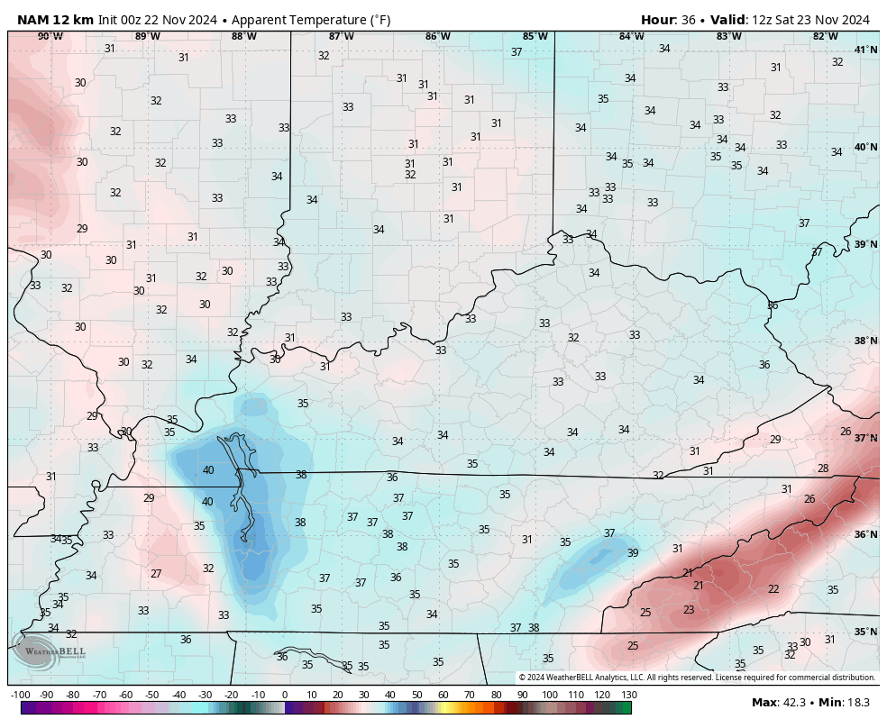
Clouds will be very slow to break for many of us on Saturday. The west will see sun, but central and east may find sunshine hard to come by and the temps will be notably colder in these areas. That’s also reflected in the hour-by-hour wind chill forecast from 7am through 11pm Saturday…
Sunday is a much better day as temps return to the 50s and this carries us into Monday as we get ready for another cold front to move through the region. Gusty showers will sweep through here later Monday into Tuesday morning, ushering in colder air…
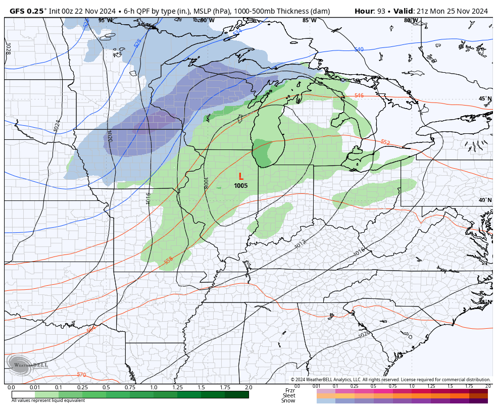
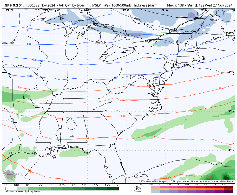
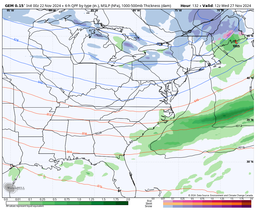
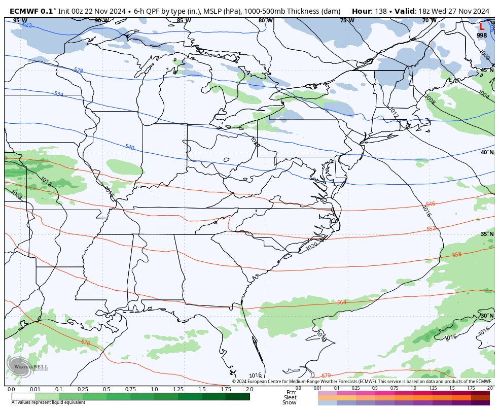
That leaves a west to east boundary across the region with additional storm systems likely to roll along it over the long Thanksgiving weekend. As expected, we find the operational models having issues with which system to focus on and where to put it.
Here’s the latest GFS from Wednesday through December 2nd…
The Canadian has a much bigger Thanksgiving system…
The EURO has our Thanksgiving system with two clippers dropping in behind that through early December…
It will take a few days for the models to get a better handle on this rather extreme late November and early December setup.
This is one remarkable pattern setting up into the first half of December, at least. The Ensembles are about as cold as you will ever see them for this time of year. Watch how stable this pattern is with the trough just staying in the east with a bit block around Greenland and another Block around Alaska…
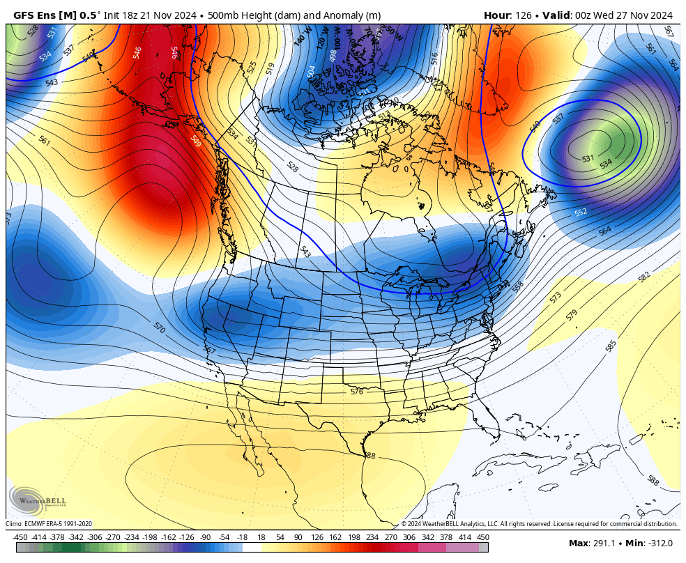
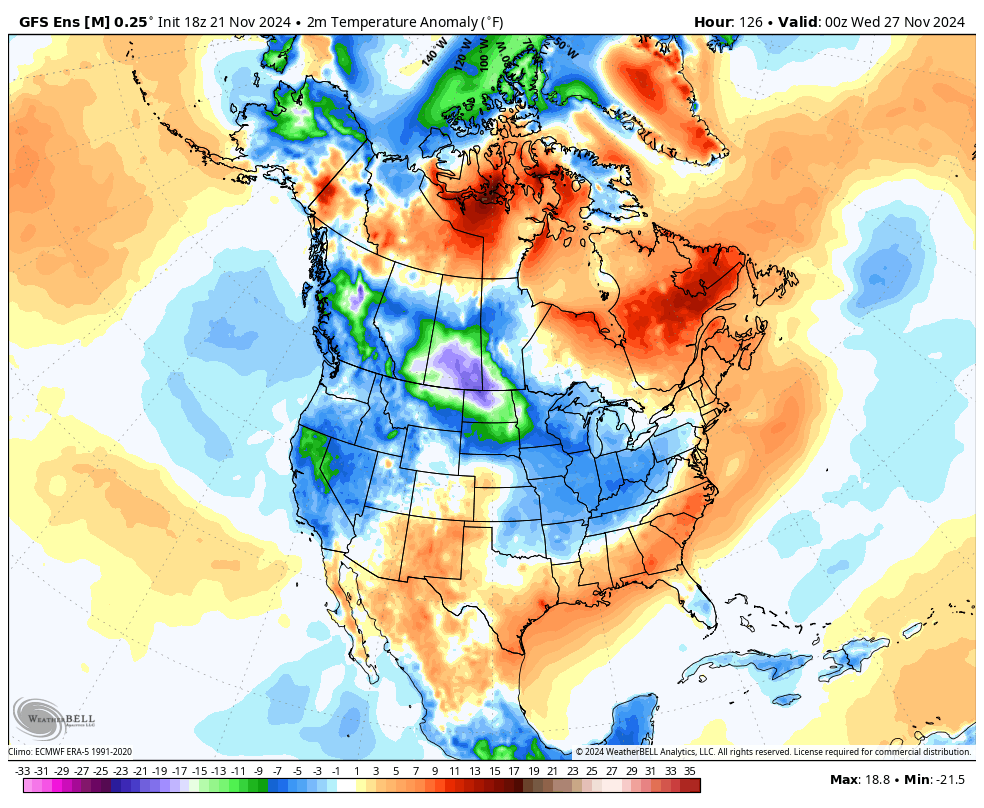
The temp departures are insane with the coldest air relative to normal in the entire Northern Hemisphere right on top of the United States. This animation goes from November 27th through December 7th…
I mean… Wow!
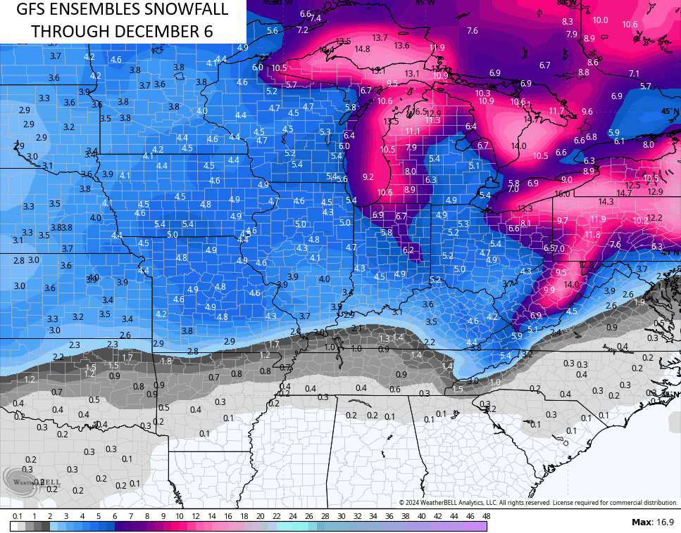
The same GSF Ensembles sees more snow chances over this next two week period…
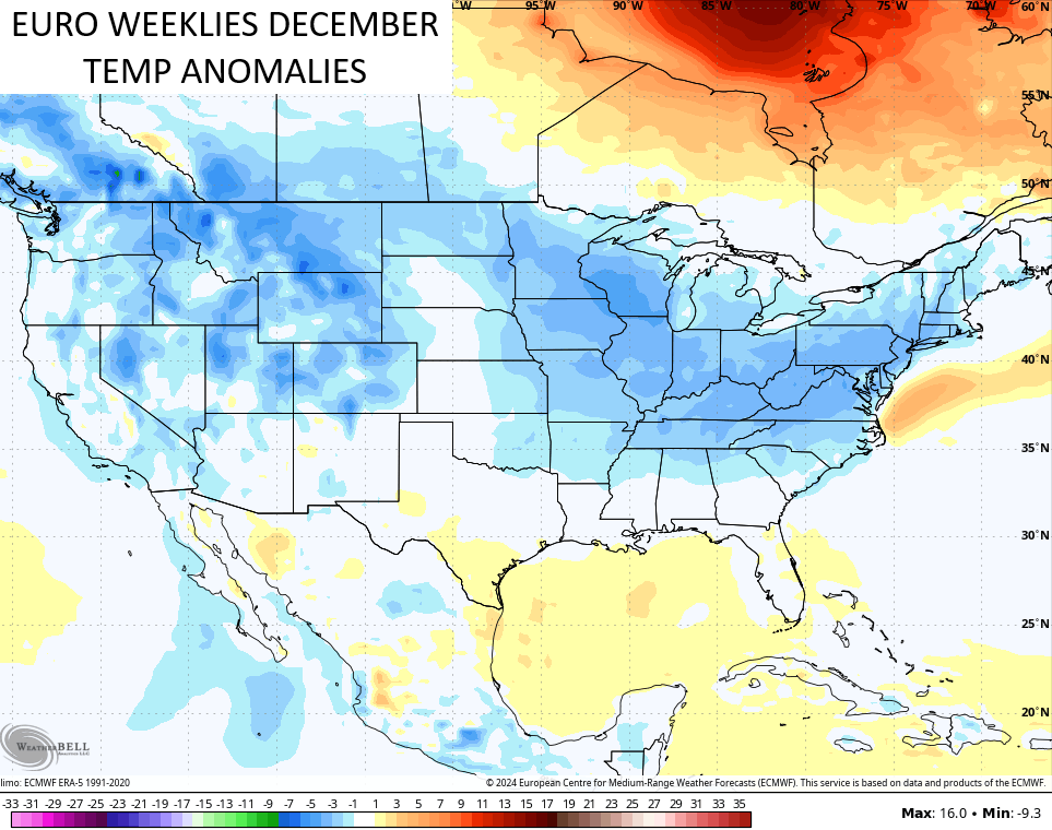
The EURO Weeklies have been giving us a signal for a colder pattern over the past week, but the latest run is now REALLY catching on. Look at the average of about 100 members in showing the temperature departures from normal for December…
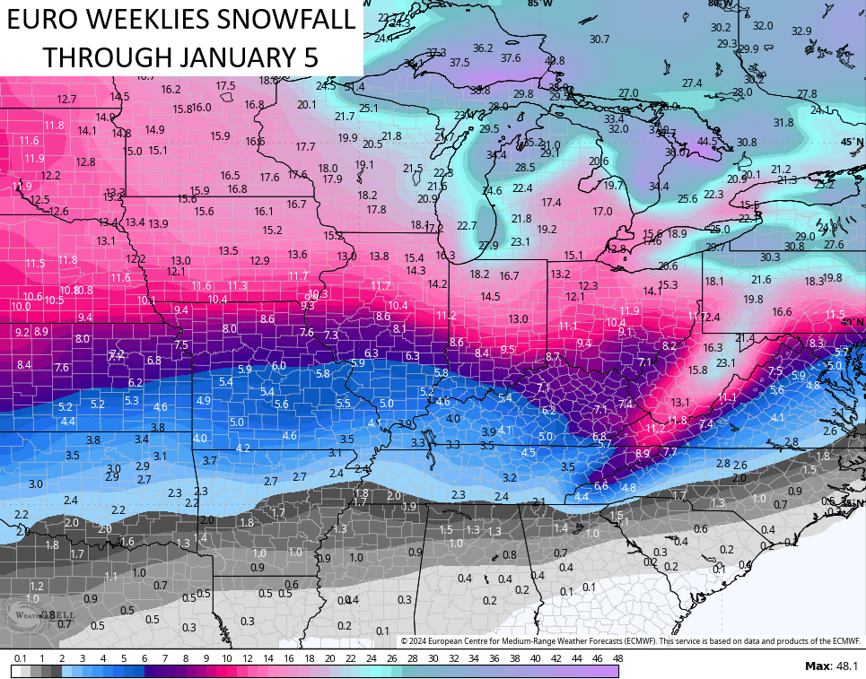
The average from those same 100 members through the first few days of January…
Impressive.
I’ll have another update later today so check back. Have a fantastic Friday and take care.

Maybe this is going to be one of those winters where winter starts early, lasts through Dec… then there’s a Jan thaw… then winter comes back….. OR………. maybe it starts early and stays winter all season? It’s 2024… the weather is whacked so who knows?
I do like Chris’ bold prediction.