Good Saturday and welcome to the weekend. It’s another mainly dreary day as low clouds hang tight into the eastern half of the state. We do have better stuff coming in for Sunday but two systems show up into Thanksgiving week, potentially causing some travel issues.
The clouds today may still have some mist and drizzle with them, especially early on and across the east. Most of this won’t show up on radars, but we have them ready to go just in case…

Temps are mainly in low to middle 40s in the areas with the clouds. Gusty winds make it feel like the 30s for much of the day.
Sunday is a nice one with a mix of clouds and sun as highs hit the 50s. This milder flow is just ahead of another cold front sweeping in here late Monday into Monday night. That has another shot of cold air surging in behind it for Tuesday and will bring gusty showers along and ahead of it…
That boundary becomes stationary from west to east allowing for low pressure to develop along it and roll through along it Wednesday through Friday with another potential system moving in a day or two later.
The track of the first low may bring the rain/snow line right on top of us with some flakes coming in behind it. The second system will have more cold air to work with and may very well become a snow maker to end the long Thanksgiving weekend.
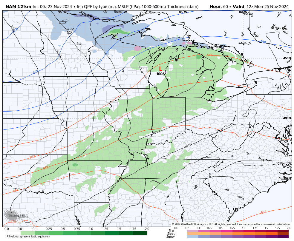
The forecast models continue to have issues dealing with the combination of arctic air getting into the country and a very active southern storm track.
The GFS sniffed this pattern out first but it lost the systems over the past few days because that’s what the GFS does when we get within a certain window of time from any one event. It’s a tradition unlike any other.
Well, the GFS is being true to form in finding our system once again…
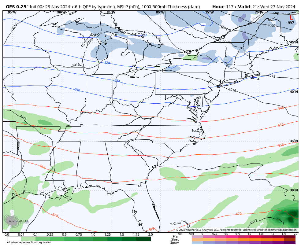
I think that’s too flat and too progressive still so we will watch for it to correct stronger with the first system and the one behind it.
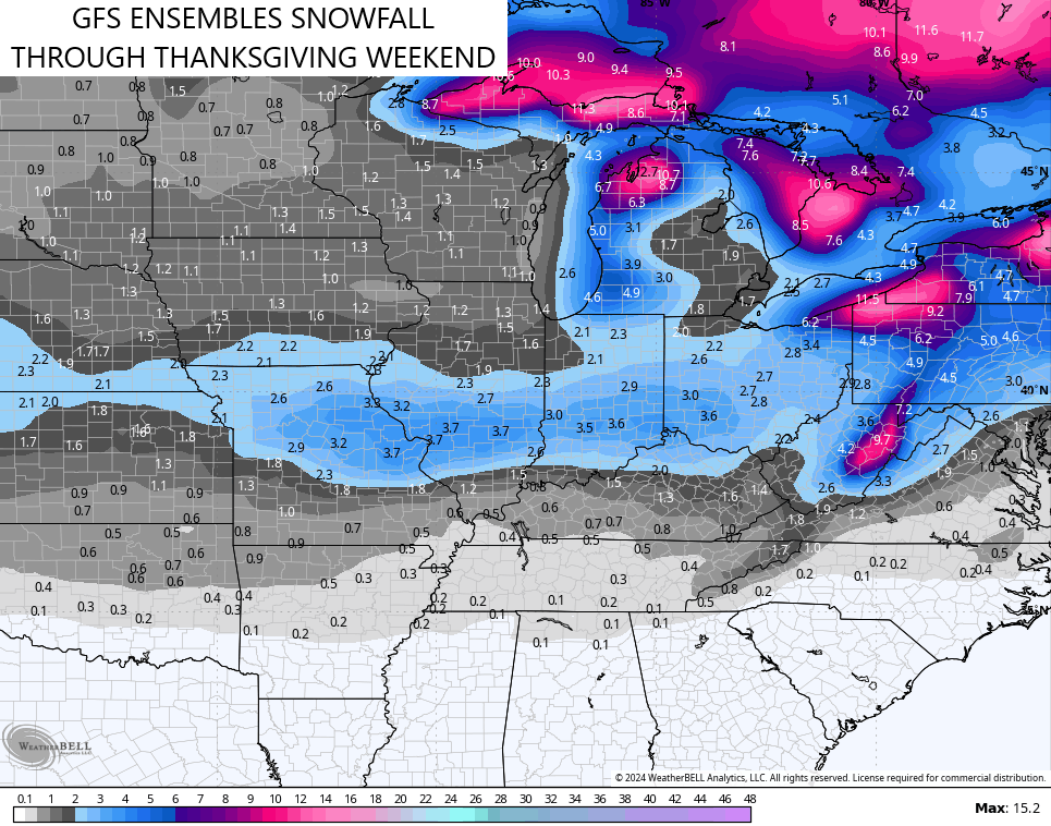
The GFS Ensembles seeing the setup much better and that shows up on the average snowfall map of the 21 different members through the Thanksgiving weekend…
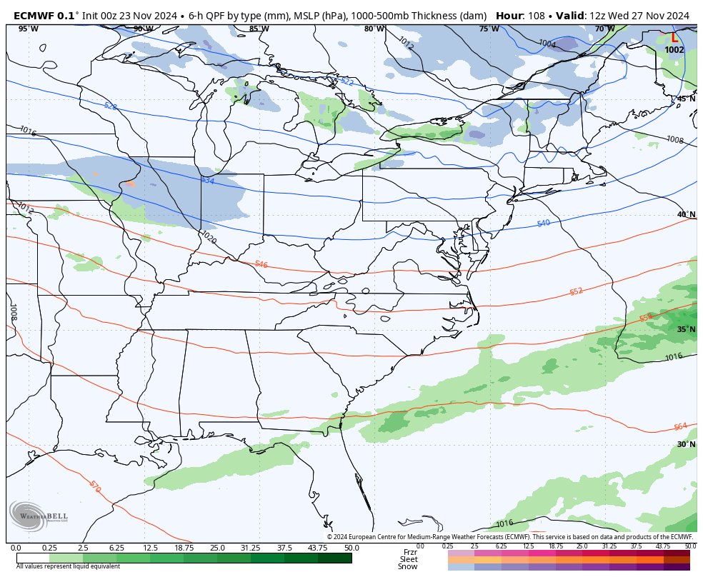
The new run of the European model is going a much stronger first system with more of a snow maker look with the second system arriving late in the holiday weekend…
My current thinking on how this plays out:
- The first system brings a cold rain in here late Wednesday into Thanksgiving, but the snow and mix line has a chance to be on top of us.
- Winds are gusty with this as temps drop quickly Thanksgiving night and Friday.
- Some light snow showers and flurries may show up on Black Friday.
- The next system sweeps in from the west and may become a snow maker as early as Saturday night and Sunday.
- A shot of arctic air then follows that into early the following week.
Now, those are just my initial thoughts and I assure you they won’t be the last. ha
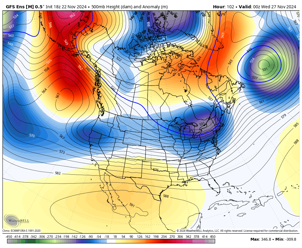
The GFS Ensembles continue to show a deep trough into the central and eastern US for an extended period as we end November and go into early December. This is impressive…
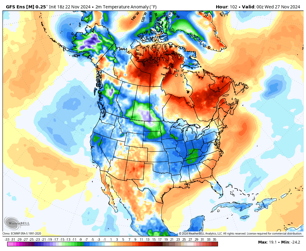
The MUCH colder then normal temps just keep coming…
I’ll have another update later today. Make it a good one and take care.

We’ll see about “much” colder than normal.