Good Wednesday, everyone. Old Man Winter is back in the Bluegrass state with a light snowfall for parts of the east this morning and snow showers and squalls coming later in the day. This continues to be part of the back and forth pattern set to carry us through the next week or so.
A quick-hitting band of light snow zips across central Kentucky early this morning before it increases when it hits the east. Rain there will change to a period of moderate snow that can put down light accumulations. Here’s a look at how this may play out early this morning…
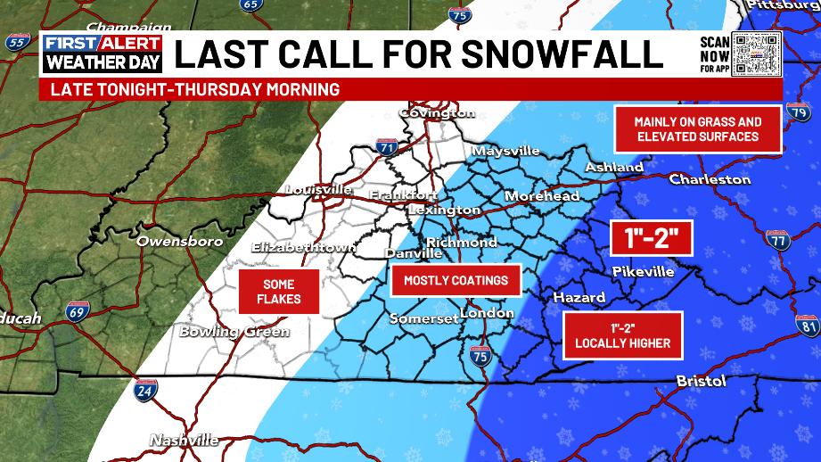
Most of whatever sticks would be on the grass and elevated surfaces. The snow in the southeast is coming less than 24 hours after thermometers were near 70 degrees. Wow.
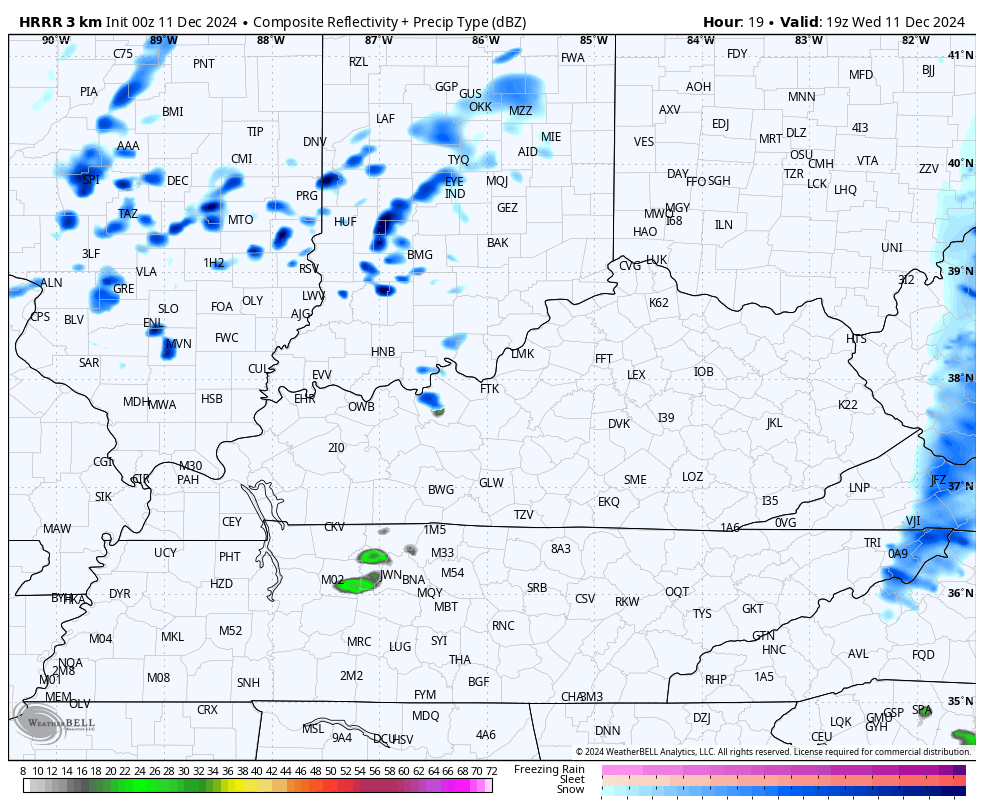
This light snow moves out quickly with a little sunshine showing up from west to east. That will combine with a pocket of pretty cold air aloft to produce snow showers and squalls during the late afternoon and evening.
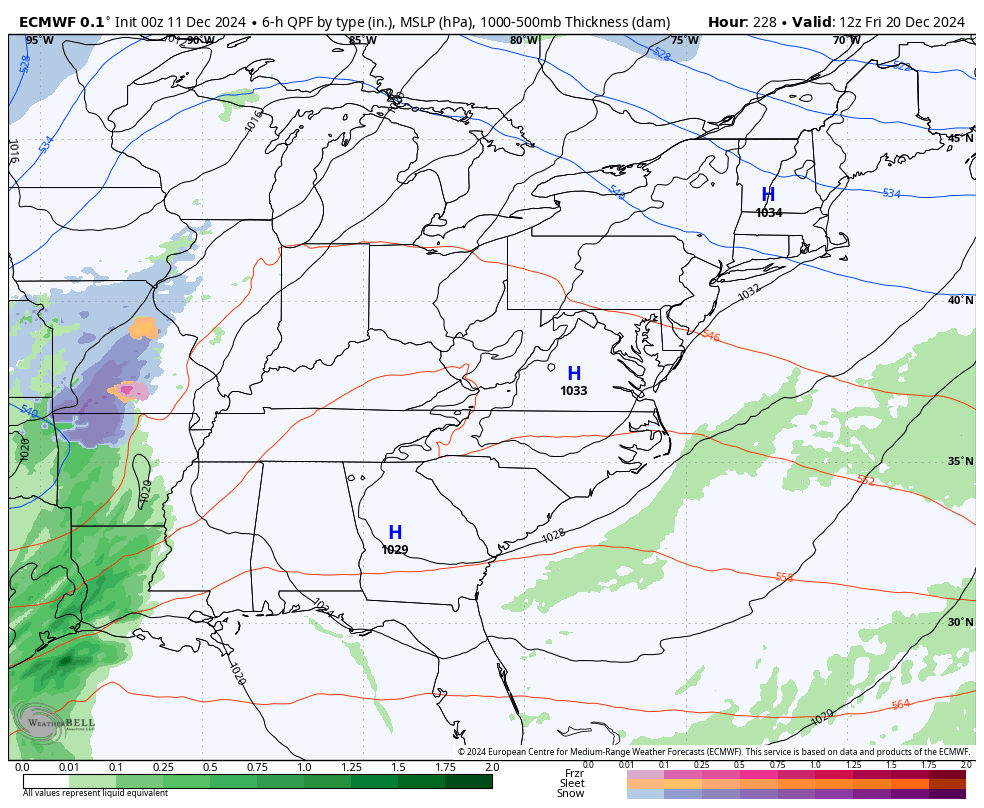
These will move from west to east, reducing visibility and putting down hit and run light accumulations. Here’s the future radar from the HRRR from late this afternoon into the wee hours of Thursday…
Morning flurries move away with cold winds and some sun taking control for Thursday.
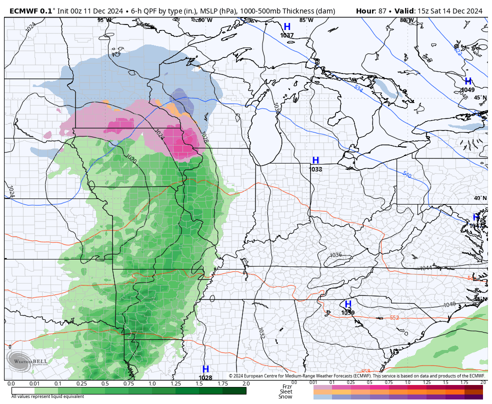
Temps rebound Friday as we get set for a rainmaker to move in over the weekend…
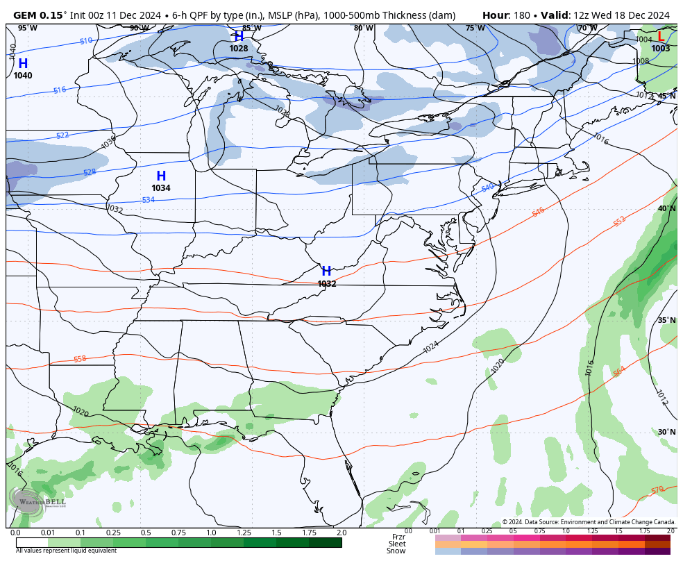
Temps rebound behind that ahead of another cold front likely moving in on Tuesday. Temps come down behind that as this up and down pattern continues. The signal for a bigger storm system with a much bigger blast of cold behind it is there by late next week into the weekend before Christmas.
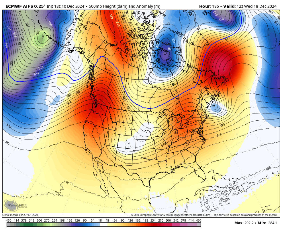
The Canadian is seeing this…
The EURO is seeing something around the same time period…
The AI version of the EURO has been consistently showing some pretty good troughs digging into the eastern half of the country from the middle of next week through Christmas week. It does so by redeveloping that blocking ridge along the west coast and toward Alaska…
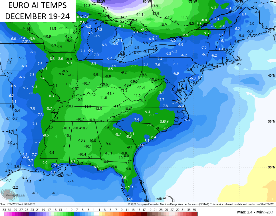
Check out the colder than normal numbers in the 5 days ending on Christmas Eve…
I will have updates later today. Until then, I have your tracking tools including our Kentucky Weather Cams to watch the flakes flying across different parts of the state…


Have a wonderful Wednesday and take care.

I just hope the cold gets here before the moisture is gone maybe we will have some more flakes in the evening as Chris said.
Wonder who will get a white Christmas ?? Any guesses???
https://fox56news.com/news/kentucky/will-kentucky-see-a-white-christmas-map-shows-which-areas-have-best-chance-of-snow/
Thanks Schroeder