Good evening, gang. Light snows from early today have ended and now we are dealing with a touch of freezing drizzle with snow showers and flurries taking control. This setup taks us into the start of this weekend that kicks off the long Christmas travel period.
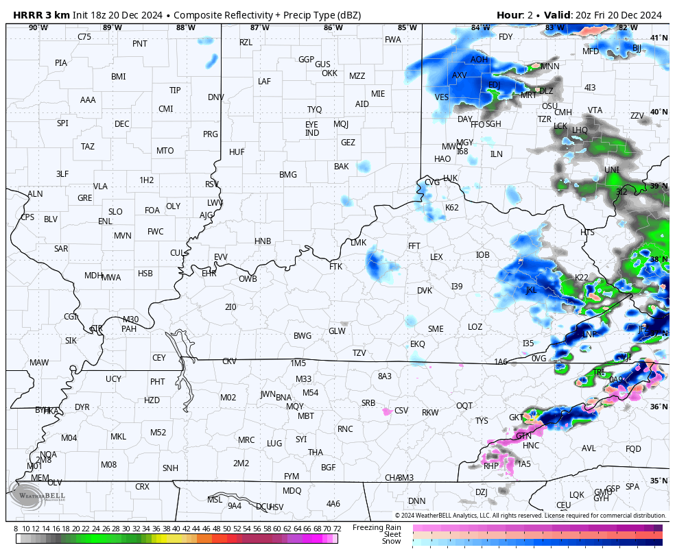
Watch for a light glaze out there this evening as that freezing drizzle puts down an icy coating into parts of the area. Snow showers and flurries then take control and the future radar from the HRRR shows this well and keeps a few going into early Saturday…
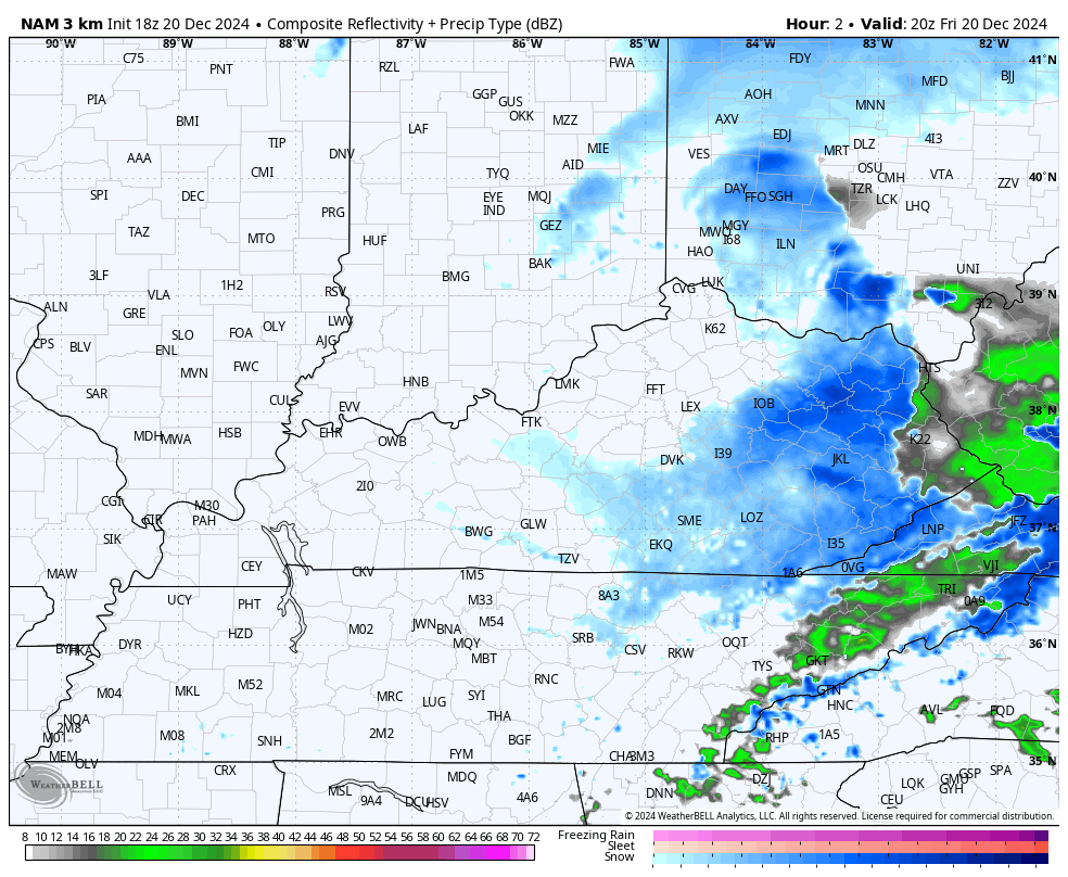
The Hi Res NAM shows the same thing…
Hit and run coatings are likely tonight with the greatest concentration of an inch or two being along those counties in far southeastern Kentucky. That’s where we continue with a Winter Weather Advisory…

Things still look wet for Christmas Eve into part of Christmas Day as our pattern goes warmer later next week into the start of the last weekend of the year. This has a chance to bring some pretty good thunderstorms in here before we turn things around in a hurry right around the New Year.
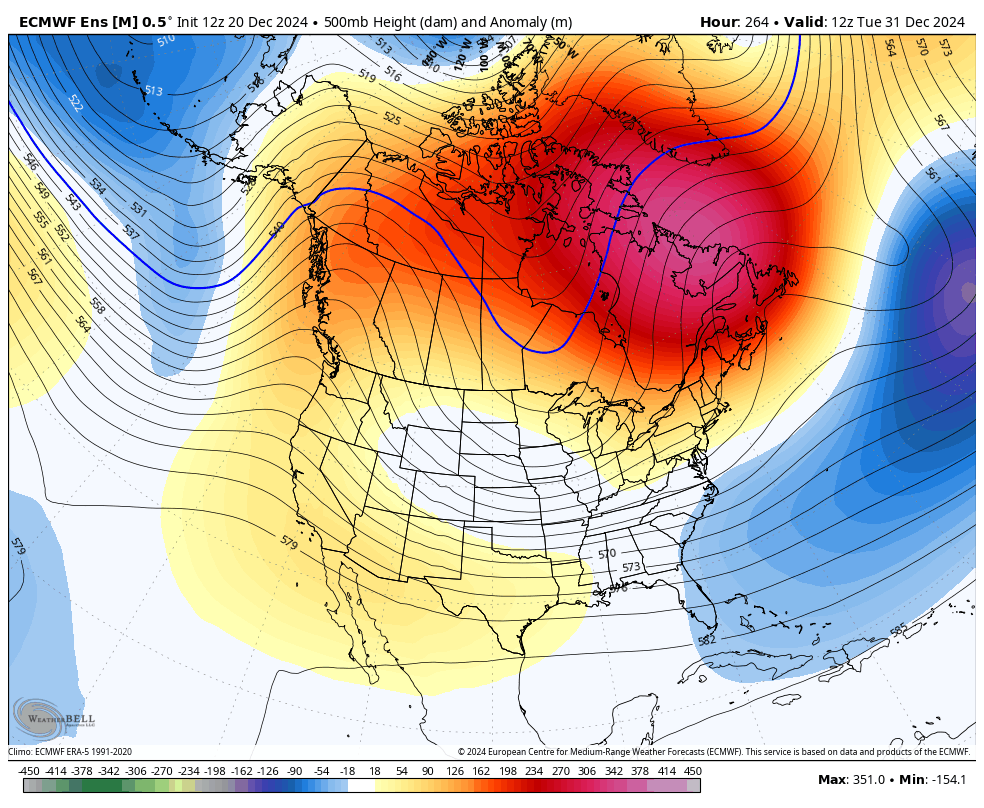
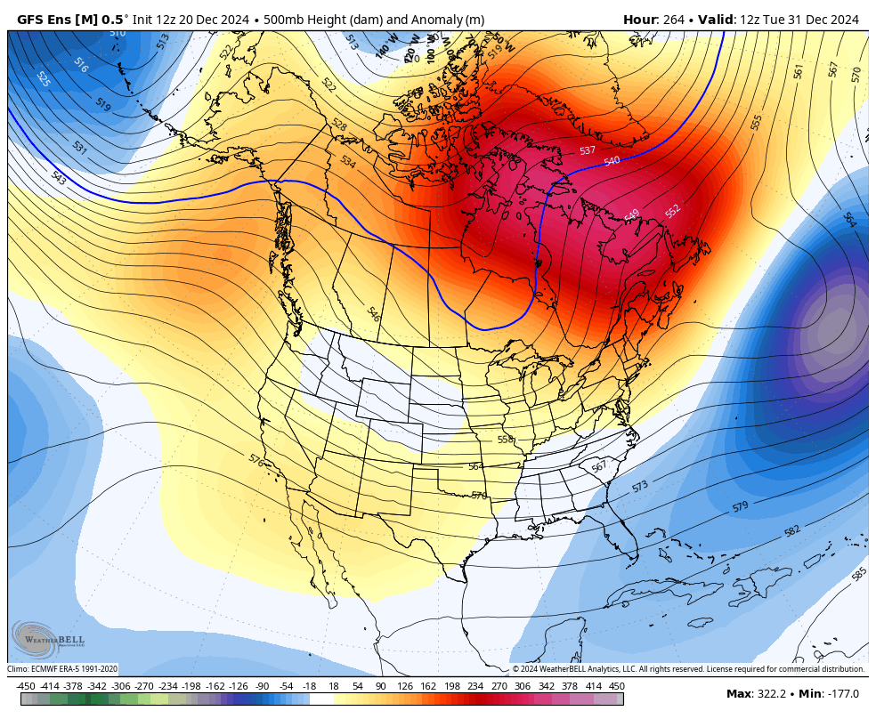
I’ve been pretty open with my views on a harsh winter pattern developing for much of January and now the start of this period is withing range of the Ensembles and they are going all in…
EURO Ensembles
GFS Ensembles
Canadian Ensembles
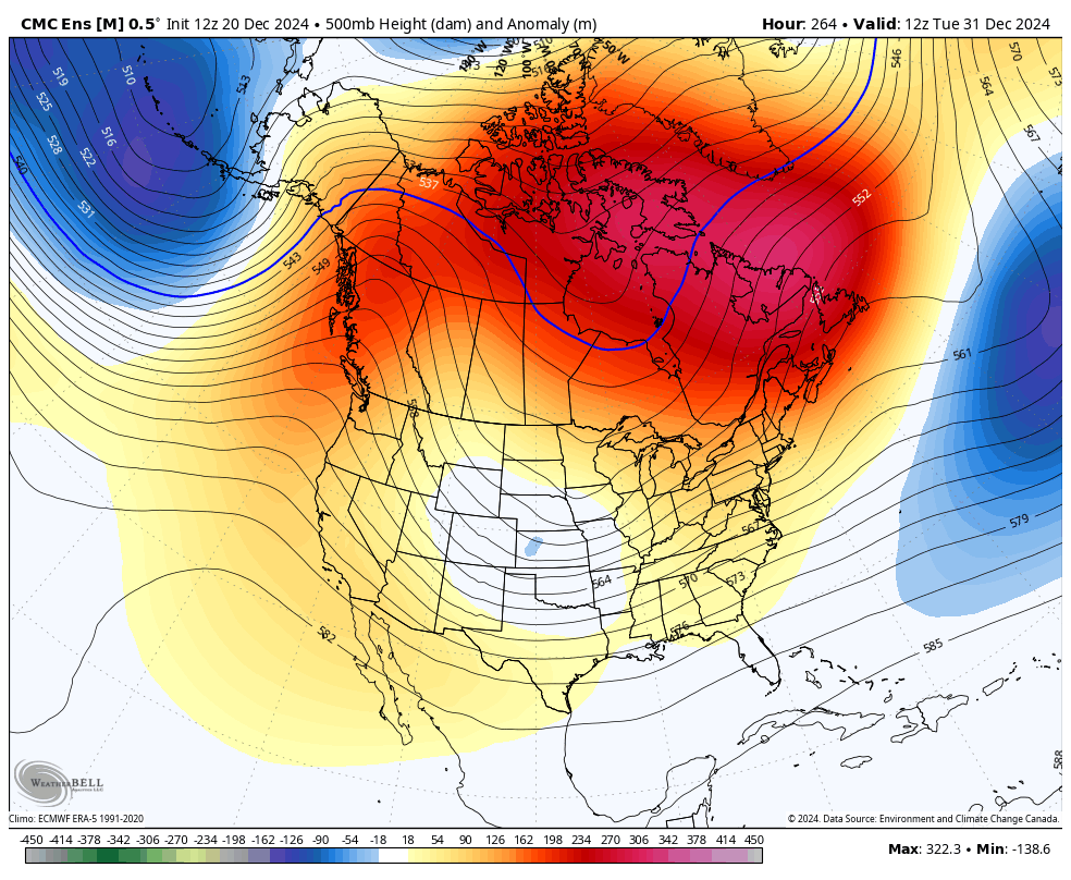
Buckle up for a harsh January! I’ll get into more on that later tonight.
I have your tracking tools including our Kentucky Weather Cams to watch the flakes flying across different parts of the state…

Have a great evening and take care.

Thanks. Chris sorry to say so far we have just seen a cold rain but the temp is down now if we can get anymore moisture we might see a few flakes tonight if not I will wait till January but the cold is definitely here tonight with the winds. Stay warm everyone.