Good Sunday, everyone. It’s a busy weather day with rounds of heavy rain, early strong storms, and big winds blowing across Kentucky. This active pattern is about to turn on a dime as we head into a harsh winter pattern that’s likely to last through much of January.
Our day starts with strong thunderstorms racing across central and eastern Kentucky and rounds of heavy rain elsewhere. Winds gusting topping 40mph will also be possible in some areas, especially across central Kentucky.
Here are the current watches, warnings and advisories in our region…

Gusty showers will be noted this afternoon as temps fall into the 40s from west to east. These gusty showers linger into the first half of Monday.
The next system moves in with gusty showers for the final day of the year on Tuesday. That makes for a windy and wet New Year’s Eve with temps in the 40s.
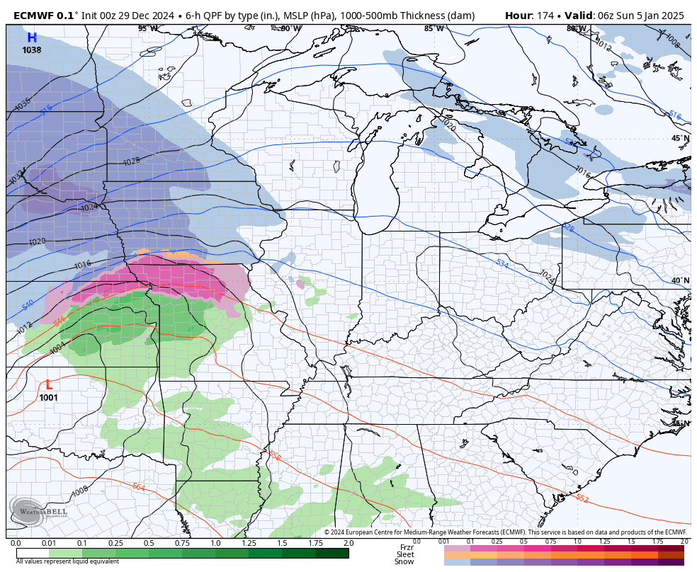
Colder air then filters in for New Year’s Day with the chance for morning rain and snow showers to give way to some snow showers and flurries. The NAM shows this switch to snow showers happening by 7am New Year’s Morning…
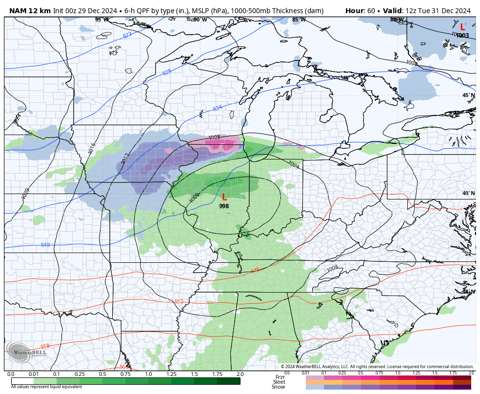
The Canadian was the first to show the potential for New Year’s Day flakes and it continues to do so. That will then be followed by a light snow maker arriving Thursday night and Friday with lingering flakes into the start of the weekend. Here’s the Canadian with the New Year’s System and the one behind it…
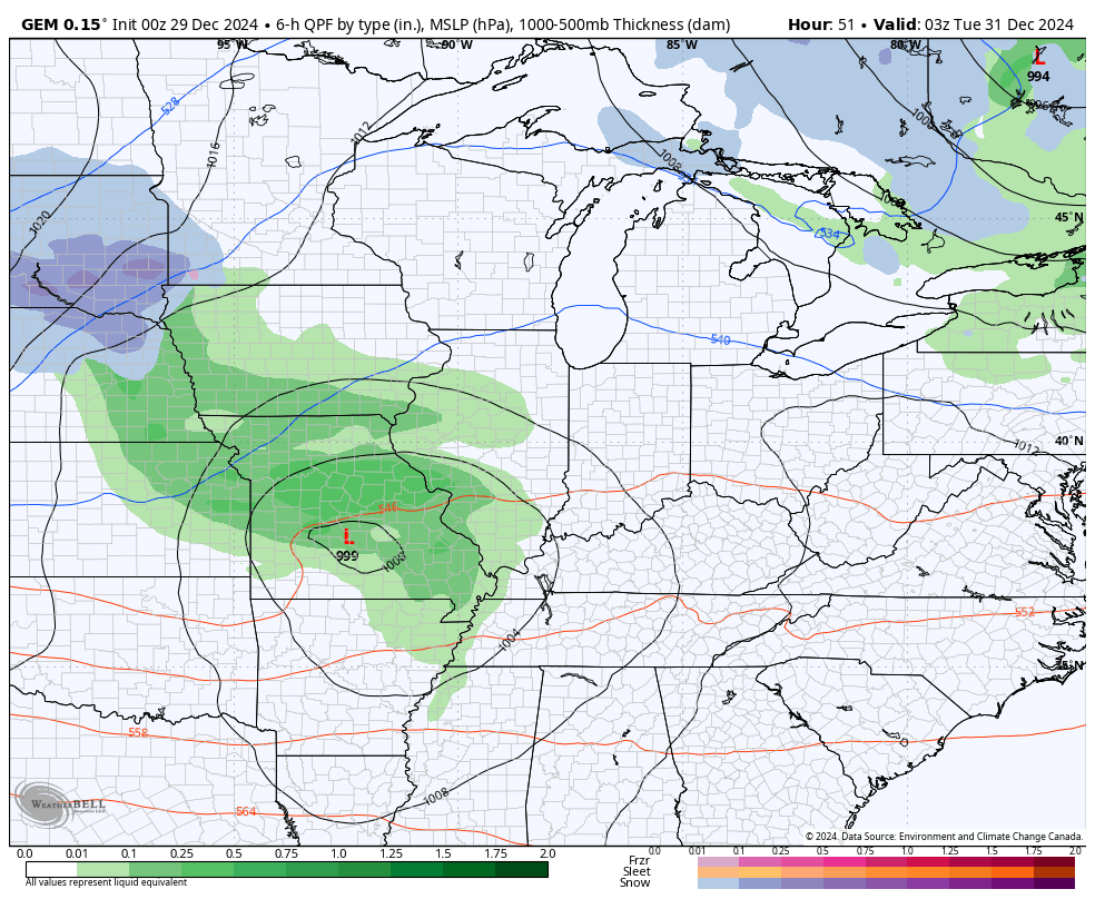
There’s a really good chance for a light snowfall with that end of the week system.
This is the point where we will see some massive model swings from run to run, so don’t freak out with each run. That’s just the nature of the beast, but the important thing to note is that we will LIKELY see several snow makers impacting our region. The pattern has been indicating this for weeks now as you regular readers know.
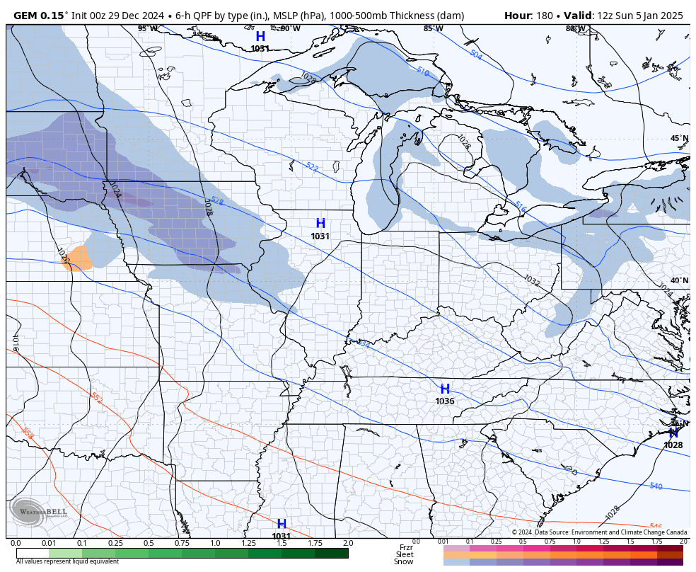
The Canadian has a weaker storm next weekend into early the following week, but it still has a system…
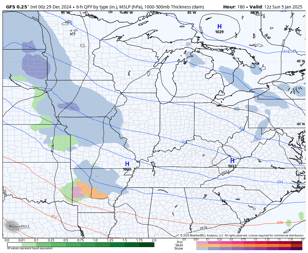
The GFS has a more significant storm…
The EURO has the strongest and farthest north system, but it’s coming south with each run and that will continue. It also follows that up with another storm…
Again, operational models will show something different with each run until we get within 3 or 4 days of any one event.
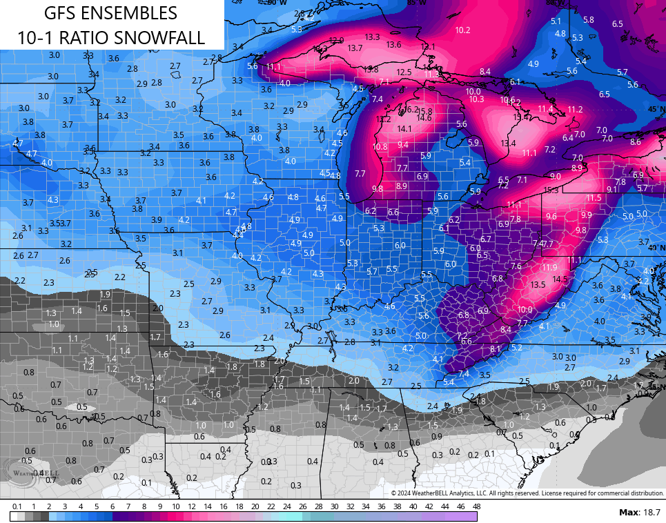
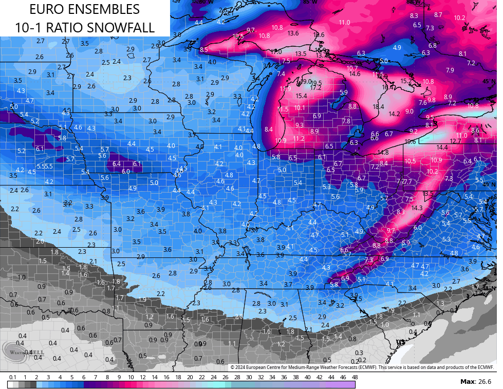
The Ensembles are all VERY bullish on the snow potential over the next two weeks. The Ensembles only give 10-1 snow ratios which means they will be on the low side. It’s also important to note these are the AVERAGES of many different members that make up each Ensemble group.
The GFS Ensembles show the average of 21 different members…
The EURO Ensembles show the average snowfall from 50 different members…
The EURO Weeklies were the first to jump on this harsh winter weather pattern and they did so weeks ago. They continue to be all in on a brutal January for much of the country and even into early February.
The EURO Weeklies is also on a 10-1 ratio and show the average of 100 different members…
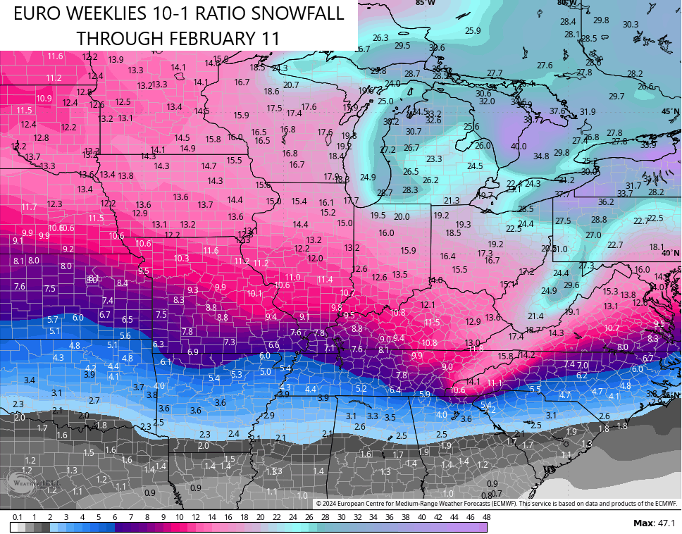
That’s beyond impressive.
In the overall scheme of things, this pattern is likely to become a headline maker for much of the country. Prolonged bitterly cold temps and above normal snowfall will get a lot of attention. So will the chance for snow and arctic air all the way into the deep south!
Updates come your way later today, so check back. I leave you with all your Sunday tracking tools…

Current watches

Possible Watch Areas

Have a great Sunday and take care.

Is the winter we finally get a thumper or the usual no show. Time will tell
Ovee the past 24 hours we picked up 1.10 inches of rain in the BG area, and chances are good that we’ll get another half inch before the day is over.
I’d say that our chances for “meaningful” snow in Warren County are better this year than they’ve been in quite a few years. The storm track from a weak La Nina usually trends warmer than usual, but adding its moisture load into a “stretched polar vortex” intrusion definitely changes the rules.
I’ll buy in when it shows up less than a week out.