Good evening, everyone. I’m not ready to pull the trigger on a Winter Storm Threat for Sunday and Monday, but I’m darn close. The harsh winter pattern you’ve been reading about here on KWC for weeks is just about upon us as we roll into the brand spanking new year.
Day one of that new year will feature a few flurries and snow showers on a strong northwest wind flow. Watch these snow showers on the future radar from the HRRR…
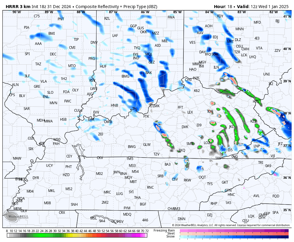
Some hit and run coatings will be possible.
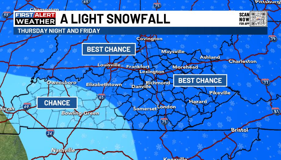
The Thursday night and Friday light snowfall is still on track with the potential for coatings up to 1″. I’m rolling with the current map for the Best Chance of picking up on this action…
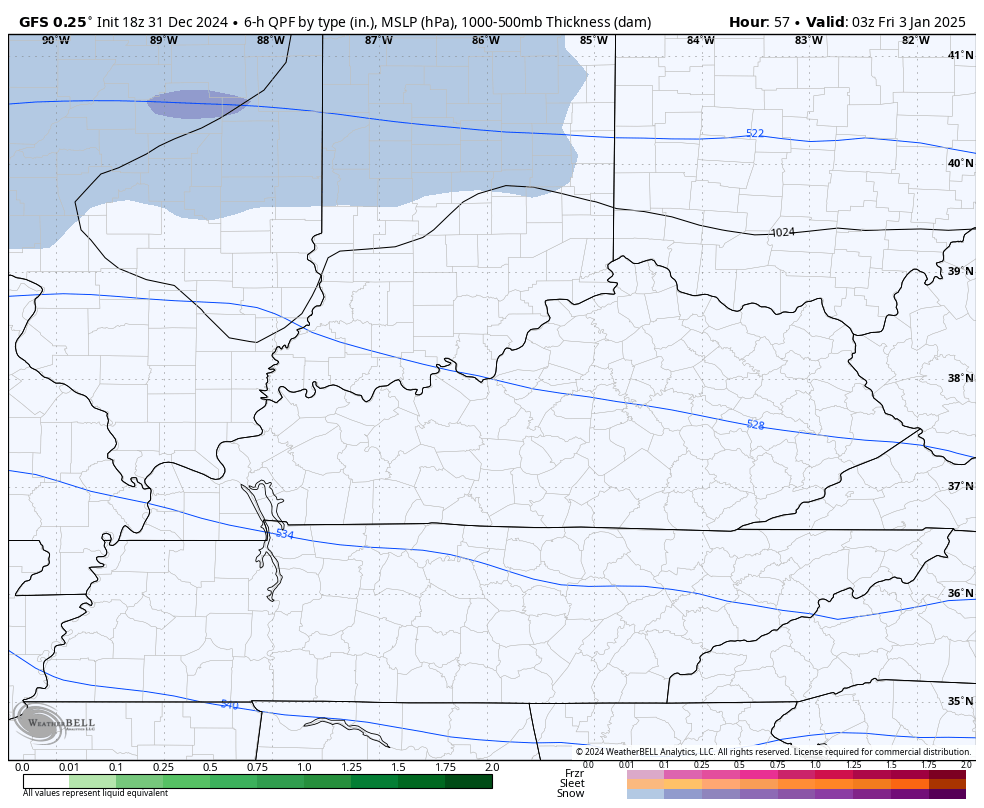
You can see this quick hitting round of light snow…
Temps drop quickly as the snow moves in with wind chills dropping into the teens. Wind chills in the low single digits are possible Saturday morning with wind chills staying in the teens all day long.
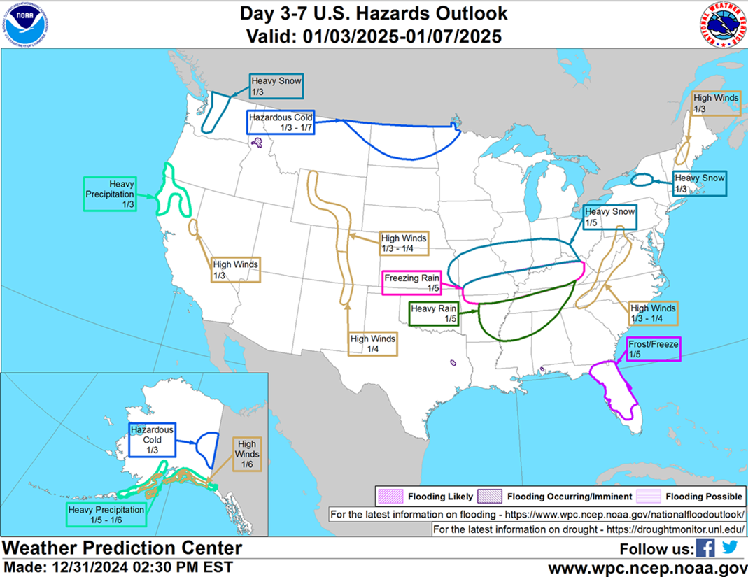
The Winter Storm Potential is growing for Sunday and Monday. This is the map I made a few days back and it’s still in good shape…
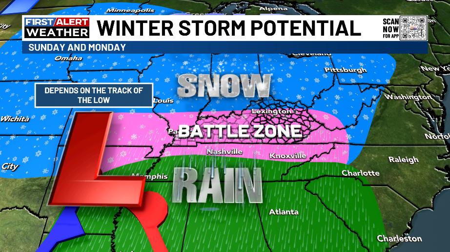
The Weather Prediction Center now has something similar as the areas to watch…
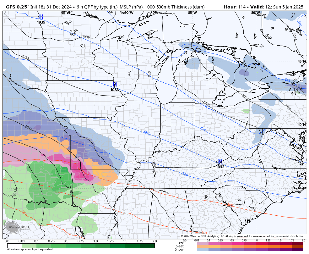
The EURO is concerning as it hammers the state with significant amounts of snow and ice. Watch how the low tracks west to east along the Tennessee border…

30mph winds would also be possible in that scenario.
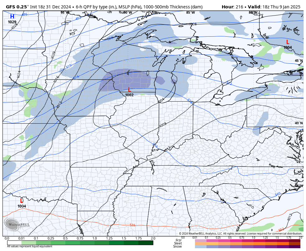
The late afternoon run of the GFS trended to look a little more like the EURO…
Again, specifics are still a few days away from being known, a significant winter storm impact is expected Sunday and Monday.
The hits won’t stop there as this is just the beginning of a harsh month of January. The GFS brings another snow event ahead of the Polar Vortex later next week…
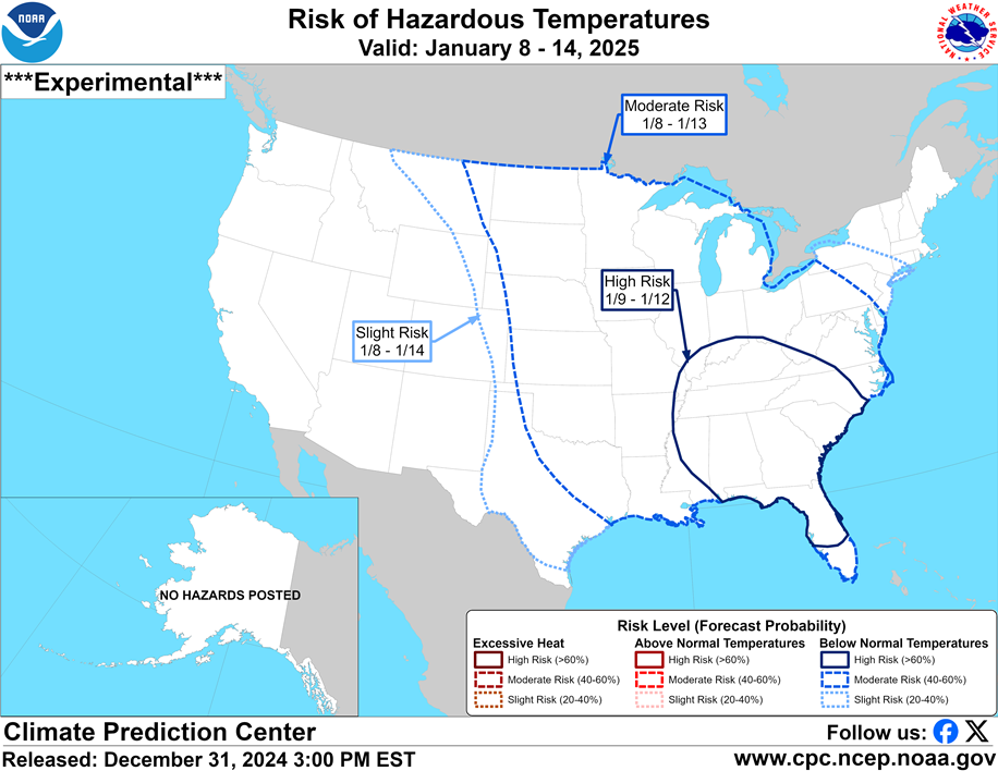
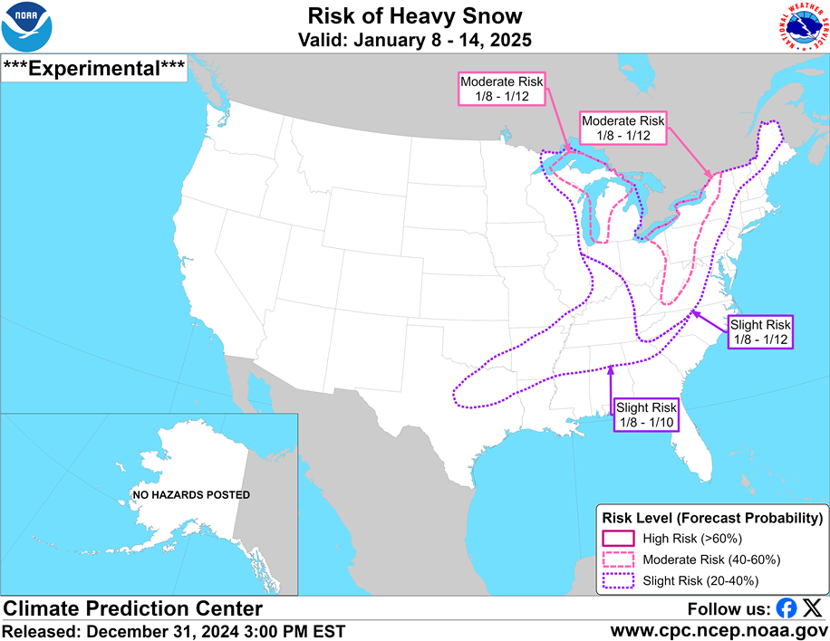
The Climate Prediction Center continues to highlight the week two snow and cold potential…
As I keep saying… Buckle Up.
The latest tonight on a special WKYT News at 10pm and then again with the normal update on KWC tonight. Here are your tracking tools for the rest of the day…


Enjoy the rest of the day and take care.

I’ll believe it when I see it.