Good Thursday, everyone. Our active winter weather pattern is kicking in with a very light snowfall for some of us tonight and Thursday with the bigger system on deck. A Winter Storm THREAT continues for Sunday and Monday as a potent system takes aim at our region.
Let’s start with the light system before we get to the winter storm.
It’s a fast-moving clipper dropping in from the northwest late tonight and Friday. This has a quick-hitting band of light snow along and ahead of it with some flurries behind it. This looks to mainly impact areas of central and eastern Kentucky where some light accumulations will be possible. These should generally be coatings to MAYBE 1″ in a spot or two.
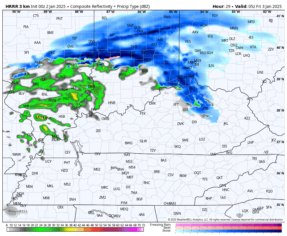
The Future Radar from the HRRR shows this system well…
This may cause a few slick spots as it moves through. Gusty winds and temps hanging in the upper 20s to low 30s for much of the day will combine to make it feel much colder. That colder win will then knock the wind chill numbers down to the upper single digits at times on Saturday.
Our Winter Storm THREAT continues with no real changes in my overall thought process. That’s especially true at this point of the process because this is where the models show minor deviations, and we can’t really go chasing those until it becomes a clear trend.
My Winter Storm Threat map I made New Year’s Eve still stands…
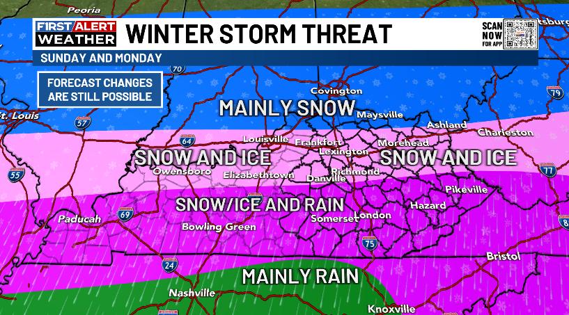
I feel really good about that map going into today.
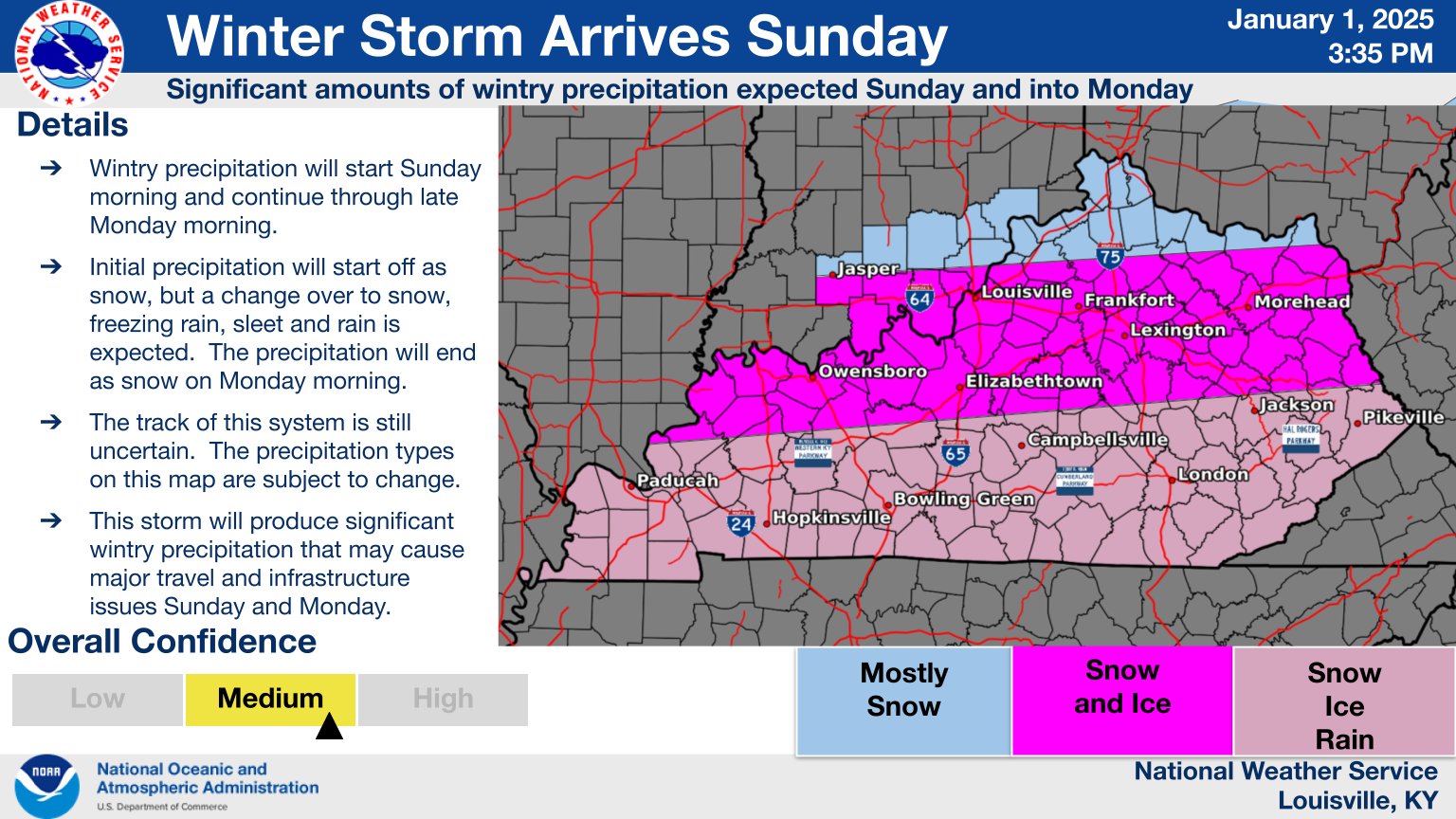
The NWS seems to have a similar thought process on this system and put out this graphic Wednesday afternoon…
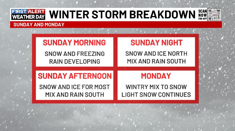
Here’s a quick timeline on how this winter storm likely plays out…
A few things to watch for:
- This storm will have a MAJOR impact on travel.
- Given the amount of freezing rain and winds gusting to 30mph at times, some power issues may also develop.
- That said, I do not expect this to approach the levels set by historic ice storms of the past. Of course, it doesn’t have to even get close to cause some issues.
- Snowfall totals are going to be interesting to watch across the northern half of the state as ANY sleet and freezing rain can cut those down.
- If any one area can somehow manage to stay all snow from start to finish, totals will be way up there. IF is the key word. ha
So far, the models have been pretty well behaved with only the normal bouncing around with the low track and intensity. I maintain we see the surface low track from around Memphis to near Pikeville and then toward southern West Virginia Sunday into Monday.
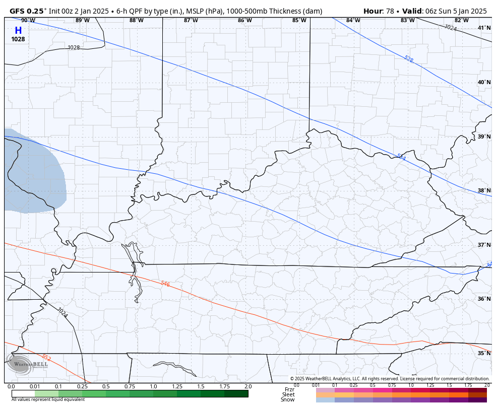
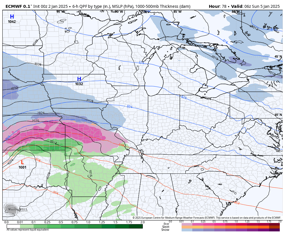
The models all have this same general idea which puts down a lot of snow and ice across Kentucky and surrounding areas. Here’s the latest GFS…
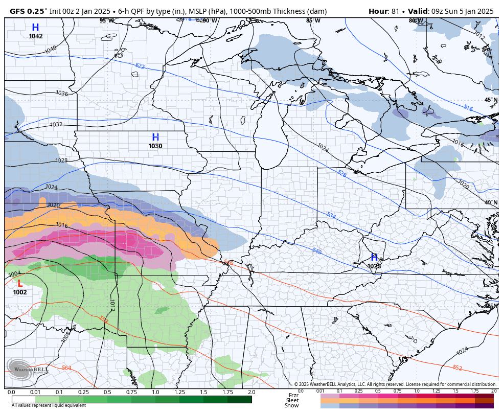
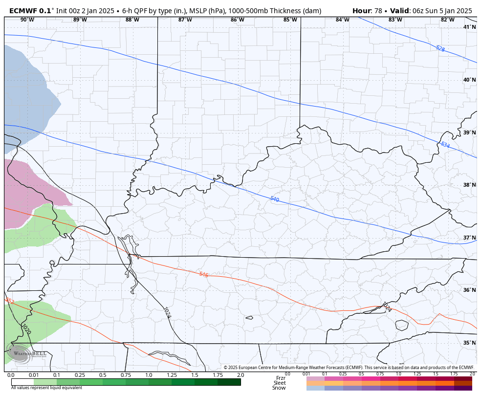
Here’s the Kentucky view of that same GFS run…
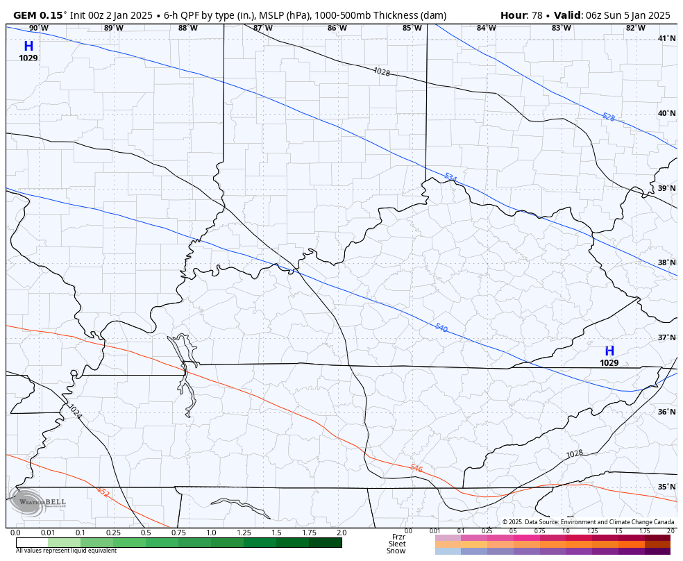
The Canadian is similar, but has more in the way of lingering snows behind the departing storm…
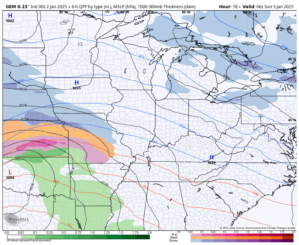
Here’s the Kentucky view…
The European Model had a hiccup on the afternoon run as it was too strong and, thus, too far north with the surface low. The latest run went right back to what the model has pretty much been showing all along…
The Kentucky view…
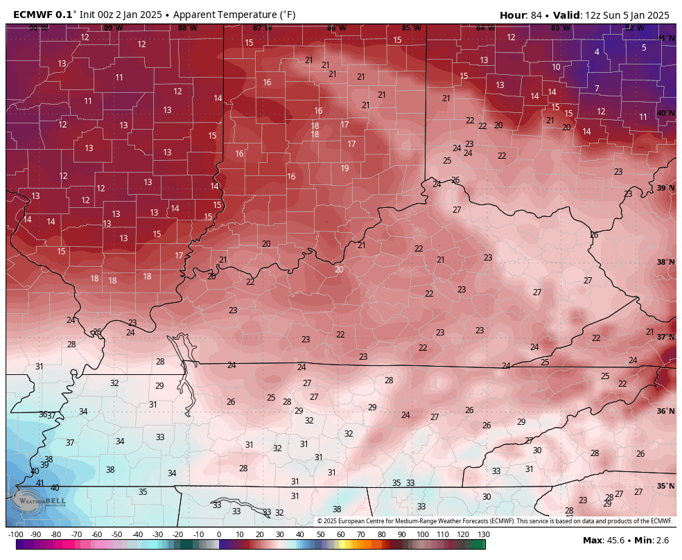
I mentioned how the winds are going to be a player with this and that’s really something to keep an eye on given the potential for significant ice accumulations. That wind spiraling around the surface low tracking across the Tennessee border counties will also set up some brutal wind chills at the height of this storm.
This wind chill animation from the EURO starts at 7am Sunday and ends at 7am Monday. Watch the bubble of milder air that skirts across far southern Kentucky…
That’s pretty wild to see as we may have wind chills in the single digits and low teens for much of the state while a small bubble of 50 degree temps briefly rolls across far southern Kentucky.
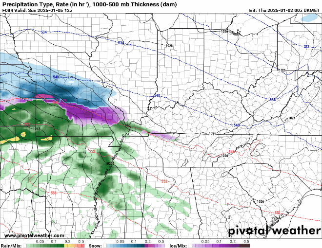
One of the models I also look at often in the winter months is the UKMET. This is a really good model, but I just don’t know how good it is with precipitation types. Regardless, the latest run of that model is more snow and less ice…
Bitterly cold temps surge in behind this with lows making a run at zero or below for areas with the deepest snow and ice pack. Tuesday, Wednesday and Thursday mornings may all give it a run. Wind chills would be even colder, obviously.
I’m already eyeing the setup from late next week into the following week for additional snow makers with another storm threat or two being possible.
I’ll have your normal updates through the day so check back. Until then, let’s follow the round of light snow in from the northwest…


Have a great Thursday and take care.

I’m calling it now….this will be a mixture to the rain train for WKY as it always is.
I think it underperforms.
Regardless, let’s meet at the grocery store and clear out the bakery and dairy sections.
Hopefully UKMET is right. No ice please.
Lex Yard Guy Milk, Bananas and Bread….
Winter lover amen no ice!