Good Wednesday, folks. Today is another frigid day across Kentucky as we get ready for a brief break from this harsh winter pattern. This break lasts about a day and a half before we go right back into a harsh winter pattern for much of the country this weekend into next week.
Temps this morning are generally in the single digits with a few areas checking in below zero. Wind chills in many areas will be below zero to start the day. Highs this afternoon range from 20-25 for those with a deep snowpack to the mid and upper 20s for those with a bare ground in the south.
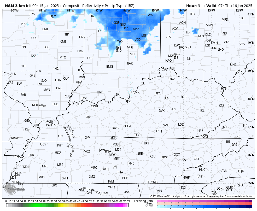
A system dropping in from the northwest on Thursday brings a period of light snow and flurries into central and eastern parts of the state…
Nothing has really changed with the setup from the weekend into next week as arctic cold air dives into the country and puts a lot of folks into the deep freeze. Some headlines:
- Arctic cold front drops in Friday night and Saturday with showers along and ahead of this boundary.
- As cold air crashes in, we get a change to some snow Saturday night.
- The first wave of low pressure develops along this on Sunday and may be close enough to produce snow to, especially central and eastern Kentucky.
- Northwest winds can keep some snow showers and flurries going into Monday.
- Temps are frigid and may not get out of the teens for highs Monday and Tuesday. Lows can reach the singles.
- Wind chills during this time will be MUCH colder.
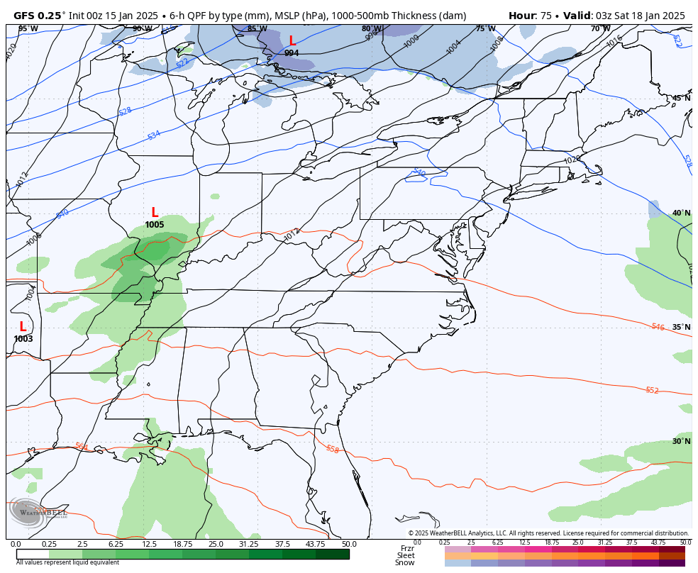
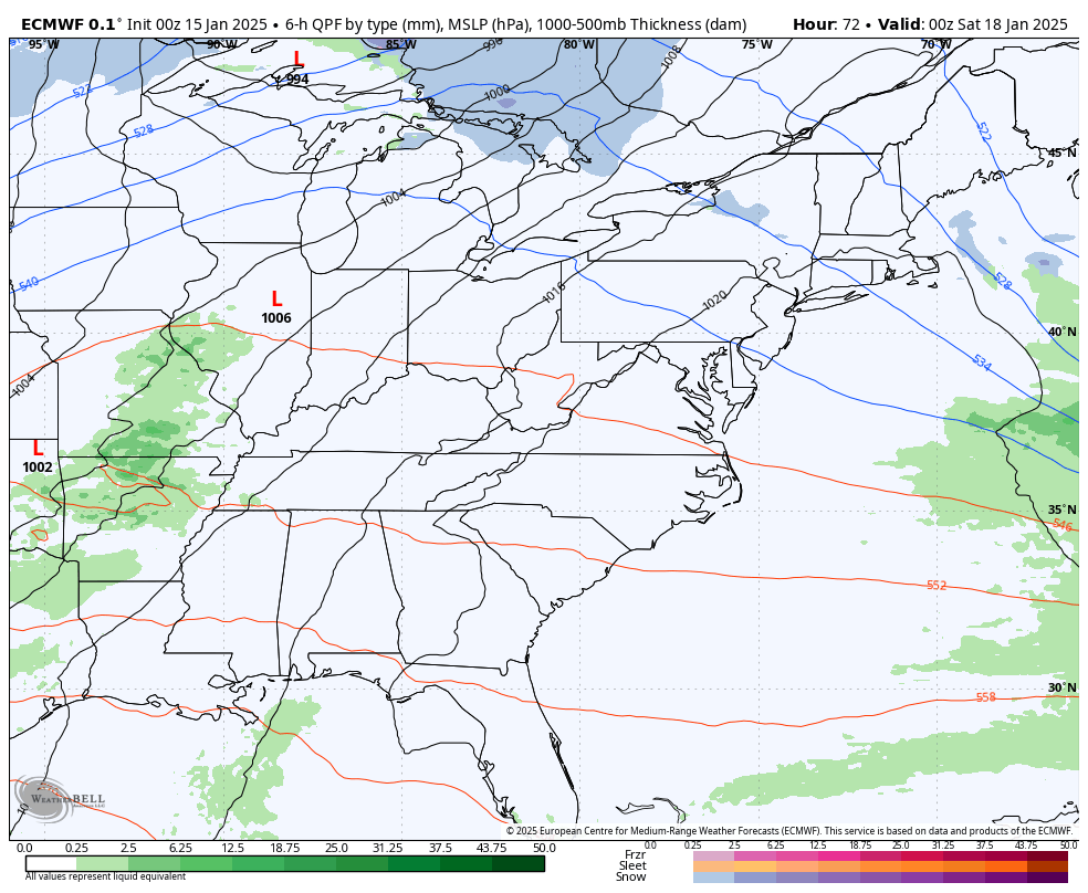
- Another storm system develops around Texas and rolls to the northeast Tuesday into Wednesday.
- The track of this low will be the determining factor on snow or now snow around here.
- A path farther north, obviously, would bring significant snows in here.
- A farther south tracking low would mean a snow and ice storm for the deep south with just some flakes and frigid temps here.
- Overall, next week is a brutally cold week around here and for much of the country, including the south.
The Canadian model continues to track closest to what I think the reality is with all these systems…
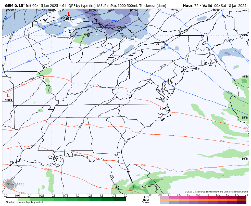
The GFS is trending more in line with the Canadian…
The EURO is having issues with the energy coming from the southwest. The bias of the model is to hold on to too much energy…
We will have a few days before the models finally figure all this out.
Looking toward February, the EURO Weeklies show a pattern that’s likely to be super active around here. As I’ve mentioned before, they have been trending cooler the closer we get and that’s something we saw them do for January.
The current weeklies show February at or just a bit below normal…
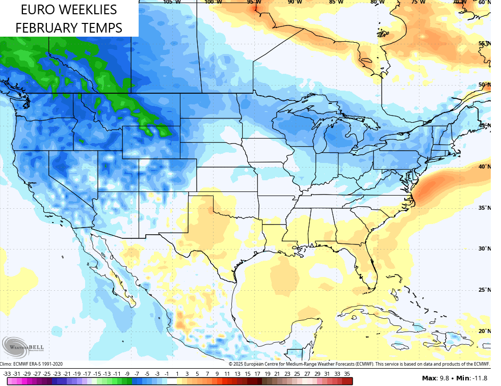
That warmer than normal look across the southeast and the frigid conditions to our west likely mean the storm track cranks around our part of the world, bringing above normal precipitation…
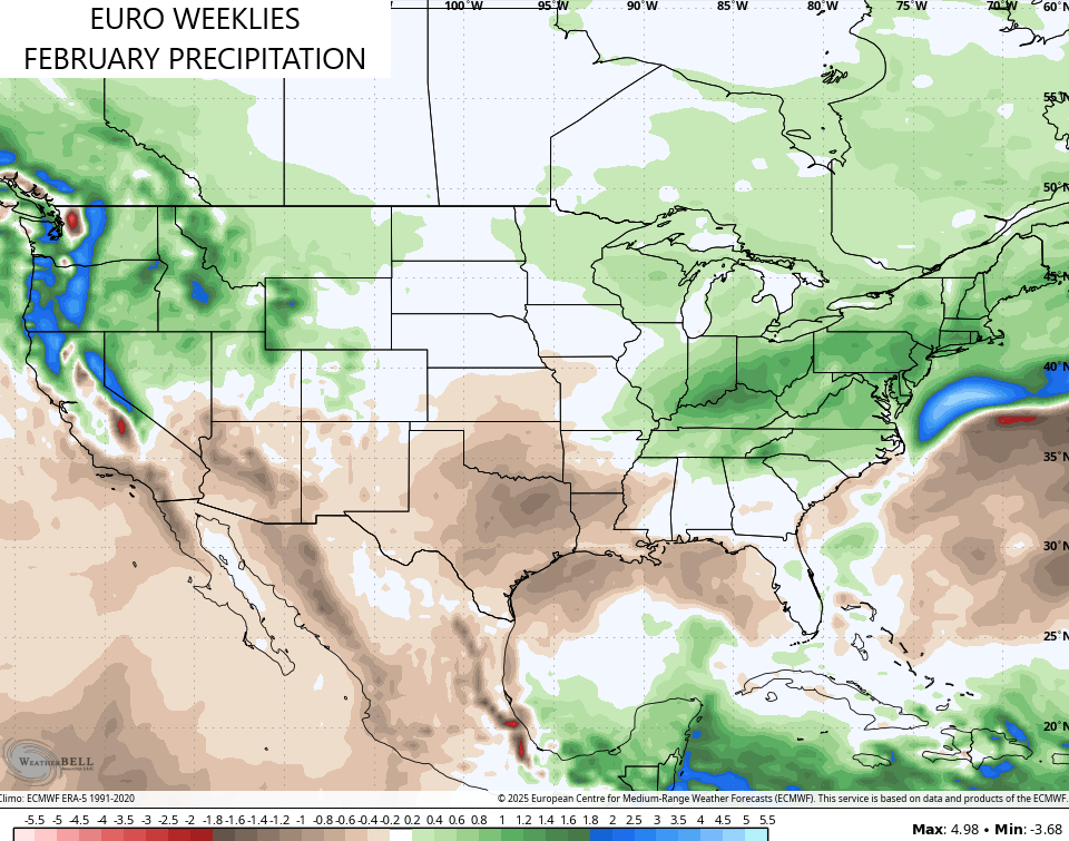
Above normal rains, above normal snows, and the potential for early season severe storms are all on the table for February!
I’m going to start looking toward spring and summer over the next few weeks. My preliminary thoughts… near normal temps and above normal rainfall.
I’ll have updates later today so stop back in. Make it a wonderful Wednesday and take care.

Chances are strong that we could see severe weather start to pop as early as mid-February, and could extend through mid-May. This is partly due to an extensive and deep layer of very cold air parked over Canada, combined with an active Southern storm track, courtesy of La Nina. This could be a bad one.
My preliminary thoughts are much above normal temps and slightly below normal precipitation.