Good Saturday to one and all. It’s a normal brand of cold across the region this weekend, but that’s enough to make it feel like a relative heat wave compared to where we’ve been. The overall pattern is changing as we close out January, but don’t sleep on February because it has a lot of potential.
Temps today range from the upper 30s across the north to the middle 40s in the south. A mix of sun and clouds will be noted before clouds thicken tonight and Sunday with a weak front blowing through. That MIGHT be able to spit out a flake or two as it knocks temps down several degrees for Sunday.
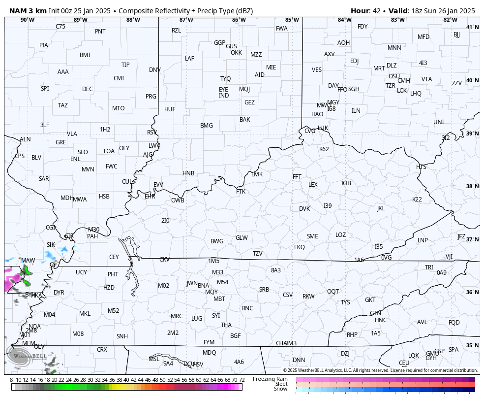
The Hi Res NAM is back to showing a quick-hitting band of light snow across southern Kentucky…
The numbers from Monday through Wednesday climb deep into the 40s with a 50 for some in the west and south. That’s ahead of a big blast of arctic air aimed more toward the Great Lakes and the northeastern part of the country. This delivers a glancing blow of cold and may even spit out a few flurries or snow showers Wednesday night and Thursday.
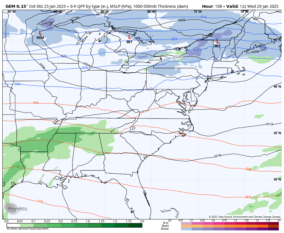
As that moves way to start February, temps really surge for a few days ahead of low pressure working in here from the southwest. The Canadian is a little colder with that system…
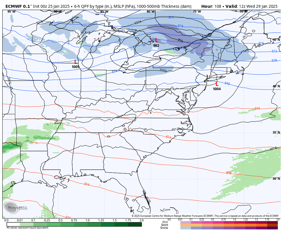
The EURO sees the snow showers with the midweek cold blast but is farther west with the storm behind it and has mainly rain from that…
Once into the first full week of February, we watch for the increasing potential of winter flexing again across much of the country. Cold starts out in the west and northwest and slowly spreads across the rest of the country as a series of storm systems rolls through here. What kind of weather it brings depends on the tracks of the individual storm systems.
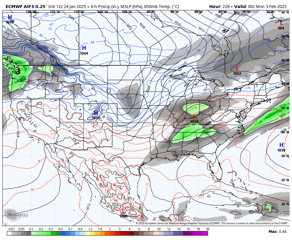
The EURO AI doesn’t show precipitation types, but it shows the pattern I’m talking about…
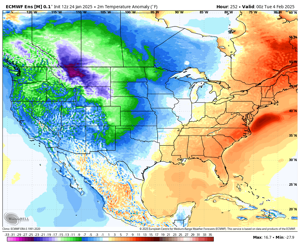
The EURO Ensembles shows the cold spreading out from west to east as we get into that first full week of the new month…
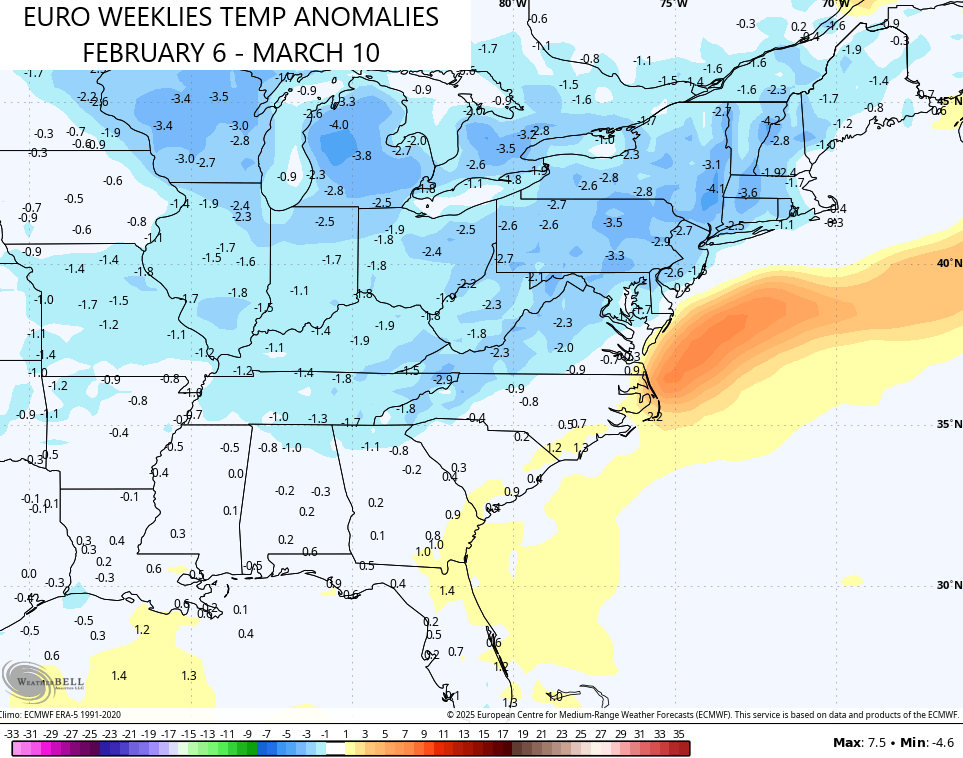
The EURO Weeklies are turning colder from that point on as they now show a colder than normal period going into the first 10 days of March…
Snowfall during this time is also increasing on the Weeklies…
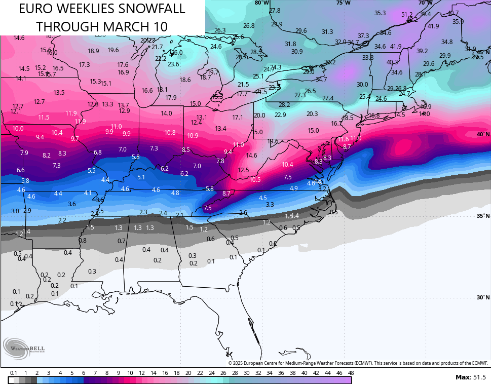
I will be surprised if we don’t have a snowstorm or two during this time period.
Another update comes your way later today. Make it a great Saturday and take care.

Those weeklies have been wrong before.
The weeklies have performed weakly.
To be fair, I probably still won’t believe them when they show 90s in April. 😉
Good one JoeD
” February has the most Snow, on average, compared to any other month. “