Good evening, everyone. We continue to track one huge temperature gradient across Kentucky, and this continues into Wednesday ahead of a potent storm system. That kicks off a busy pattern that will feature rounds of heavy rain with winter weather waiting in the winds next week.
The Storm Prediction Center continues to target areas of central and south central Kentucky in the low end risk for a few severe storms later Wednesday into Wednesday night…

There’s just enough shear available for a quick tornado spin up…

If any storm does go severe, damaging wind would be the primary threat…

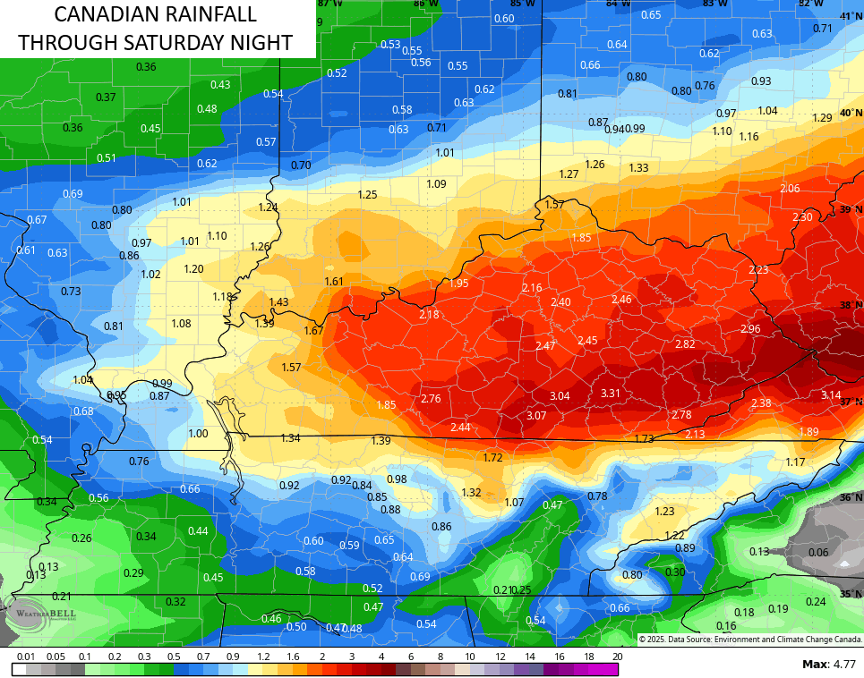
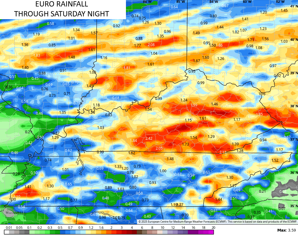
Rounds of showers and storms Wednesday night and Thursday will put down quite a bit of rain in some areas. After a Friday break, we get in on another round of heavy rain producing showers and storms Saturday and Saturday night.
This can produce some local high water issues…

The models are still spitting out some pretty hefty rain numbers from these two systems…
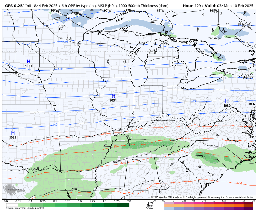
Colder winds blow in behind all this for Sunday as our front checks up just to our south. This targets our region with potential winter weather as the storm track sets up just to our south.
We’re starting to see the GFS catching on to this idea…
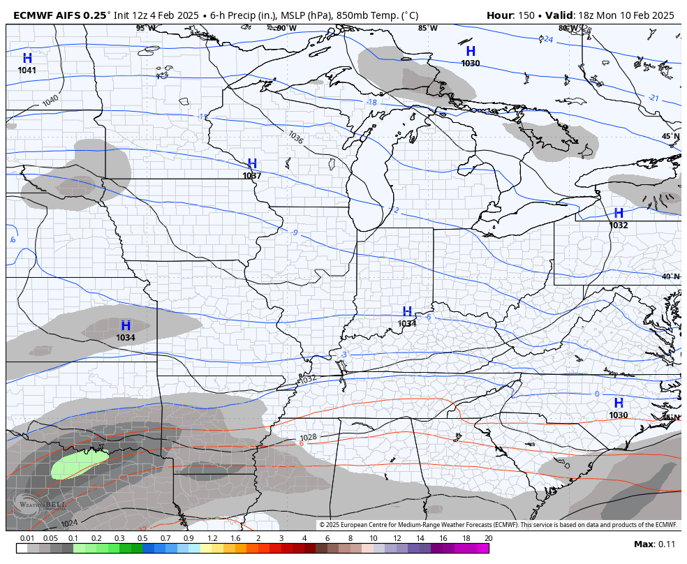
The same for the EURO…
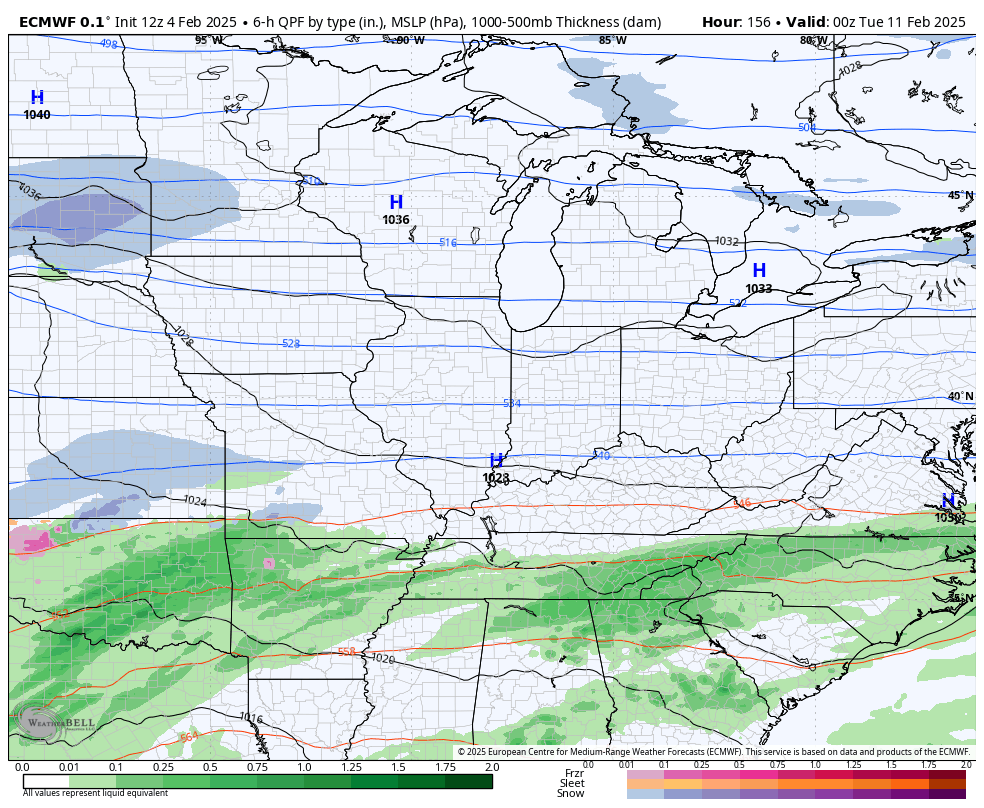
The EURO AI doesn’t give precipitation types, but it appears to have a colder overall look than the operational EURO from above…
The GFS Ensembles have a good snow signal through next week…

Make it a great evening and take care.
