Good Wednesday to one and all. We have a big temperature gradient taking shape today as the first of several storm systems rolls into the region. This brings the chance for strong storms and heavy rain through Thursday with another storm and heavy rainmaker for Saturday.
That will set the stage for a winter storm system to potentially impact our weather early next week. Yep… It’s busy, folks.
Temps today are in the 30s for the northern half of the state with the 40s in the south. Temps start to climb from south to north this afternoon into with most areas hitting the 60s by Thursday morning.
As this warm front lifts northward, it opens us up to a quick surge of unstable air, especially across south Central Kentucky. This is where a few severe thunderstorms may develop from late this afternoon into the overnight.
The Storm Prediction Center continues to highlight this potential in Today’s Severe Weather Outlook…

With just enough shear available, there’s even the risk for a quick tornado spinup…

That damaging wind threat is also there…

Thursday will feature some storms in the morning then a mild and windy break with more storms cranking later in the day across central and eastern Kentucky. I can’t rule out the chance for a few more strong storms.
Here’s the Thursday Severe Weather Outlook from the Storm Prediction Center…

The next wave of showers and thunderstorms arrives late Friday night into Saturday with more in the way of heavy rains possible. That could lead to additional high water concerns, especially across the eastern half of the state.
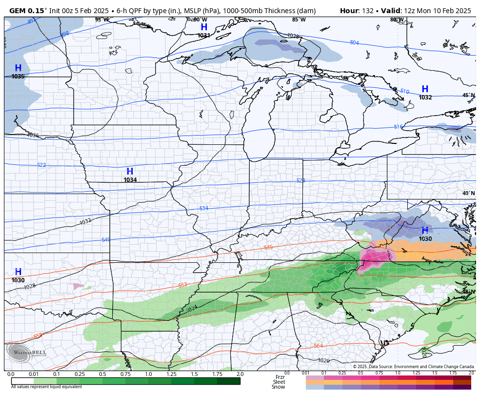
This boundary gets pushed farther to the south by Sunday into Monday as we watch waves of low pressures develop along it and roll from southwest to northeast. The exact tracks of each of these systems means all the difference between heavy snows and flooding rains in our region.
The operational forecast models continue to flip around from run to run, but they are indeed showing the potential for next week.
Here’s the Canadian…
The GFS sees the first system but not much after that…
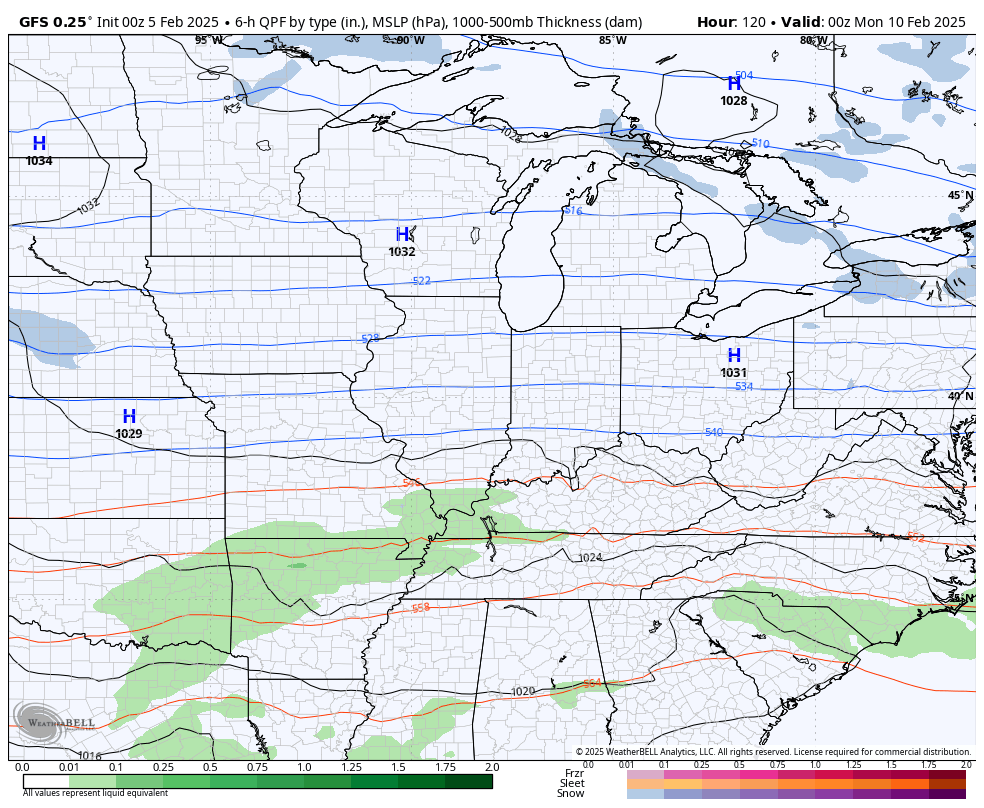
Of course, yesterday, the GFS had that same system going to our north.
The EURO has jumped a bit west compared to earlier runs and is the most concerning of all the models because of this…
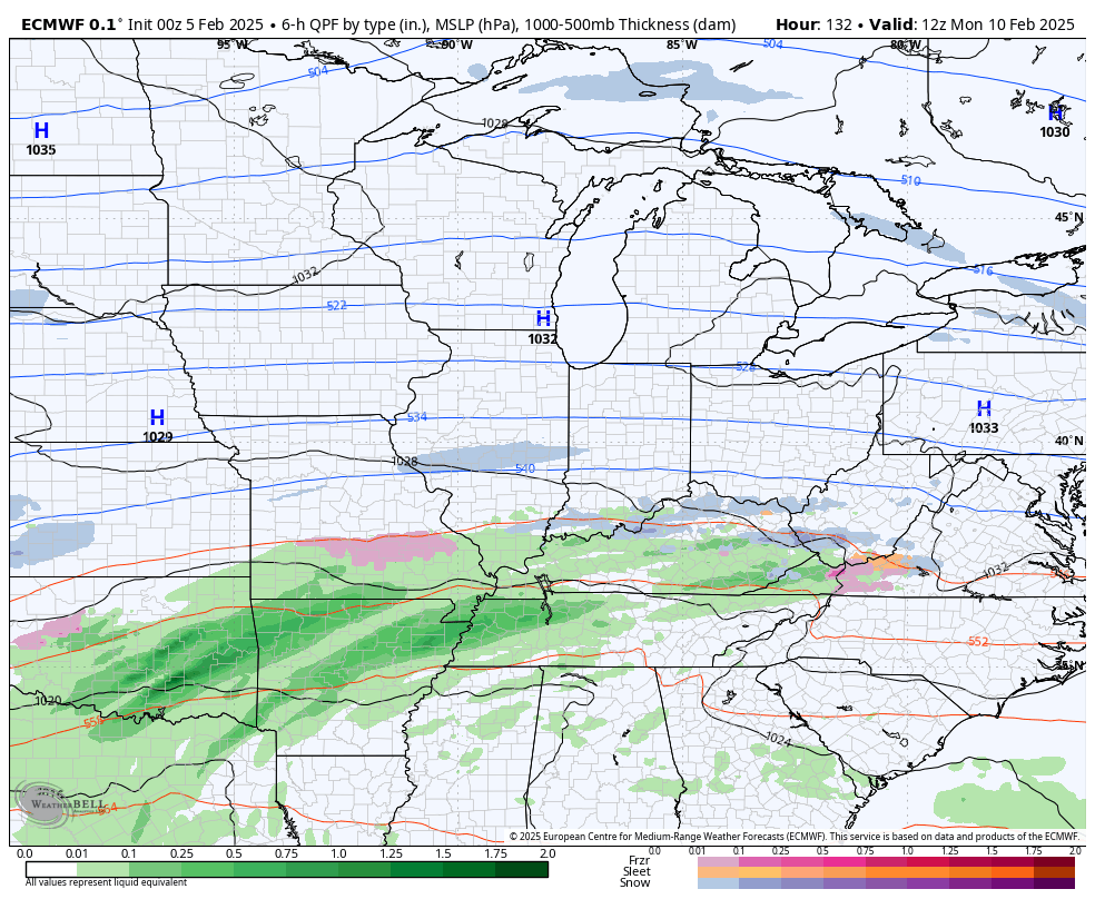
If the EURO were to verify, we are seeing major flooding issues.
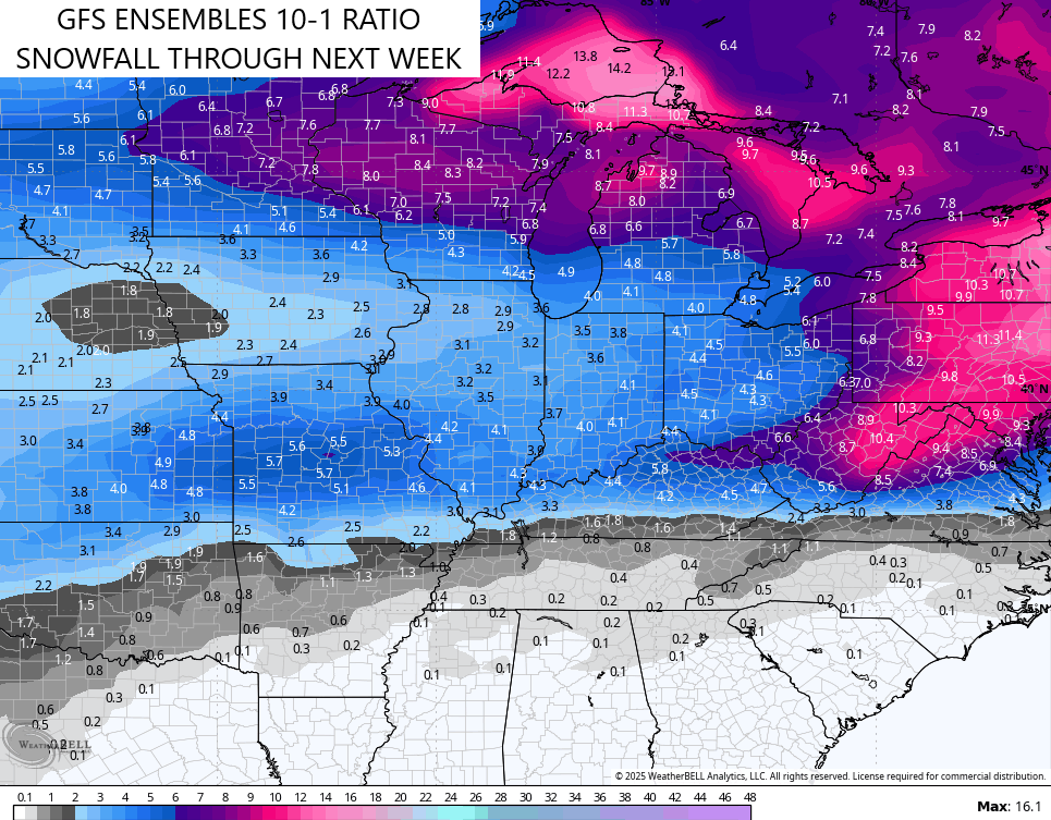
The GFS Ensembles show the average of 21 different members and they like the winter weather potential next week…
The February 10-16 time period is on the EURO Weeklies have been focusing on for the greatest potential of winter weather. They are becoming more emphatic as we get closer…
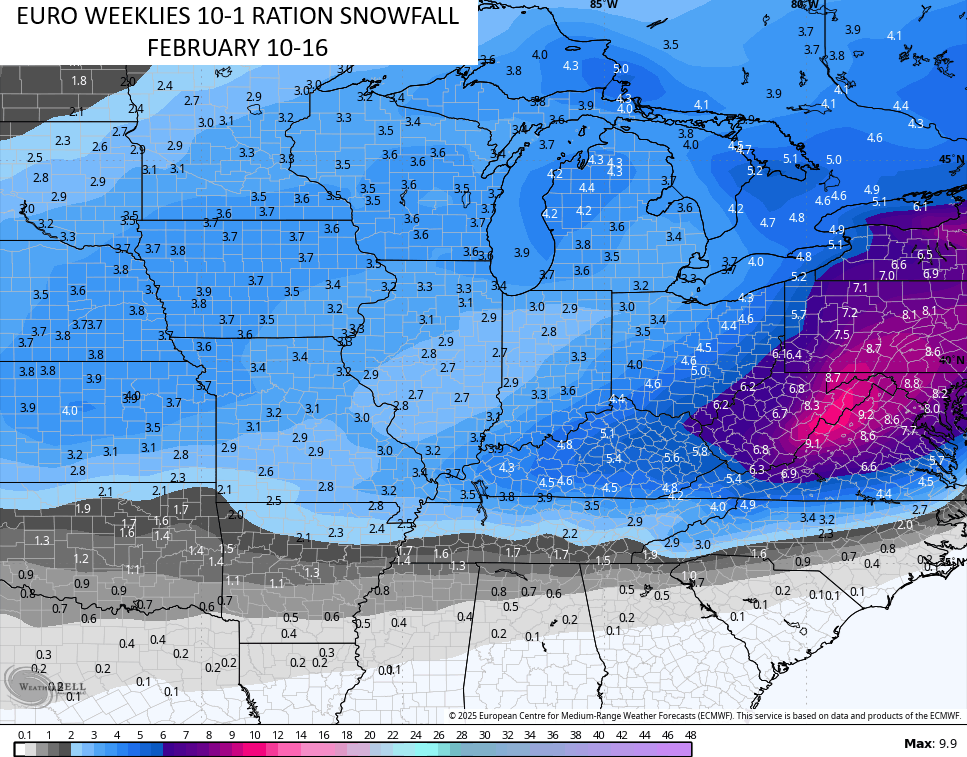
Again, this is a super busy pattern loaded with a ton of precipitation. I went on record back in mid-January in saying I thought this pattern would feature the threat for flooding, strong storms and heavy snows. I still think the same way.
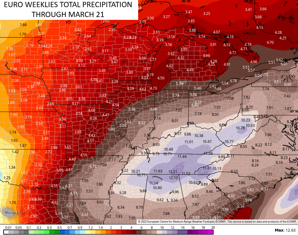
The bullseye of the heaviest precipitation continues to be right on top of us well into March…
I will have updates later today, so check back. Until then, I have all your storm tracking tools for the day…

Current Warnings

Current watches

Possible Watch Areas

Make it a wonderful Wednesday and take care.

I vote for an underwhelming snow.
I would like to receive more Snow, because my area of the state didn’t accumulate that much last month. Just very cold and dry.
Thanks Chris, and Happy Weatherperson’s Day. Weather starting to get more interesting agin. Hoping that anyone area doesn’t receive the severe weather in the next 48 hours, but it’s that time of the year.
Have a Great Day Everyone !