Good evening, everyone. Rounds of showers and thunderstorms are rolling across Kentucky this evening with additional storms later tonight and early Thursday. Some of these storms may be strong or severe and put down too much rain in some areas.
A Flood Watch is now out for areas of eastern and southeastern Kentucky through early Thursday afternoon…
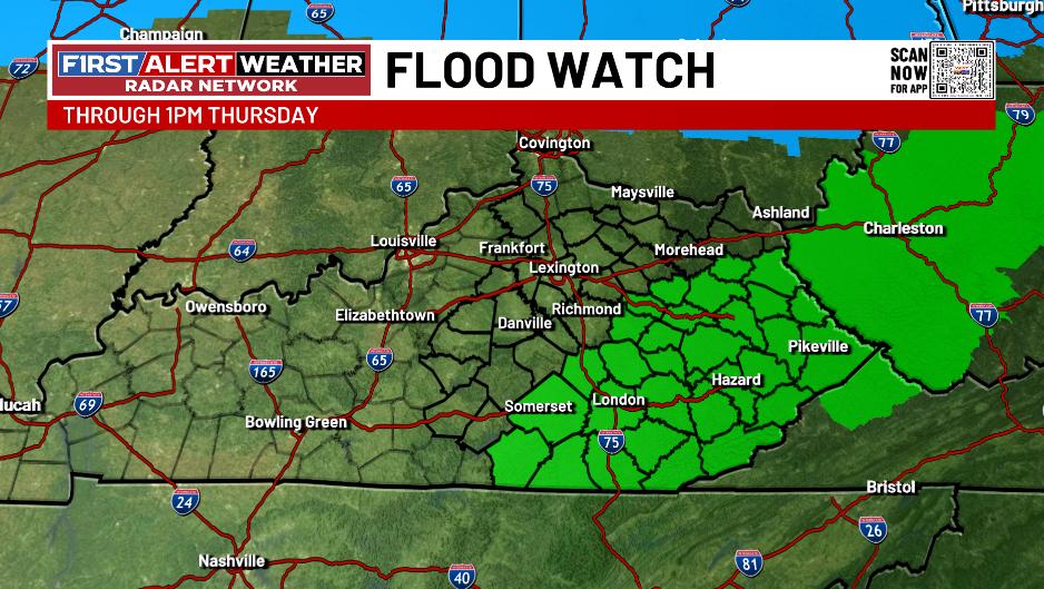
Those are some of the same areas that were hard hit just a few days ago, so it won’t take much more to produce some high water issues into Thursday.
The Storm Prediction Center continues with the low end severe threat out there tonight…

With just enough shear available, there’s even the risk for a quick tornado spin up across south central parts of the state…

That damaging wind threat is why the low-end severe threat was expanded…

The severe threat early Thursday is confined to far southeastern Kentucky and is low-end once again…

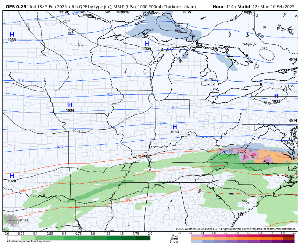
The setup for next week continues to be one for us to keep a very close eye on as a number of lows spin just to our south and east. This puts Kentucky in the line of fire for potential heavy snow and heavy rain with the first threat coming late Monday into Tuesday.
The signal from the models is still there, even as the details change from run to run…
GFS
EURO
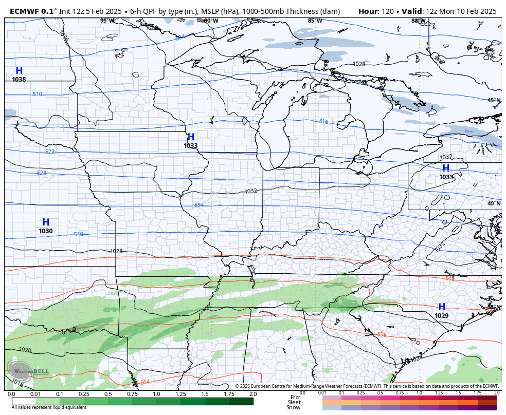
Again, this is a setup we hope for snow as opposed to rain or else we will find ourselves in a world of hurt with flooding issues.
I’ll go more into all that later tonight with the full update. Until that time comes, I have all your storm tracking tools for the day…

Current Warnings

Current watches

Possible Watch Areas

Enjoy the rest of your evening and take care.
