Good Thursday, everyone. Heavy rain and severe storms are with us to start the day as our very active February. This pattern is likely to turn downright ugly next week with snow, ice and flooding rains all on the table across our region.
Today starts with the severe weather threat across the southern and southeastern parts of the state. This is where the low-end tornado risk is and the Storm Prediction Center continues to highlight this with today’s Severe Weather Outlook…

In addition to the severe threat, flooding rains are also showing up across central and eastern Kentucky. This map will show all the current watches and warnings for our region…

Another round of showers and storms will develop and race across the southern half of the state later today into this evening. This could put down additional heavy rains in some areas.
We catch a break on Friday as temps come down, but another shower and thunderstorm maker arrives Saturday into Saturday night…

That won’t be the severe weather maker like the one exiting the region today, but it can put down rain amounts up to 1″ across parts of central and eastern Kentucky. That could lead to additional high water issues for some.
This boundary settles to our south and essentially becomes the train tracks for several storm systems to roll in from southwest to northeast. This looks to put our region in the zone for some nasty stuff, including potential snow, ice and flooding rains…
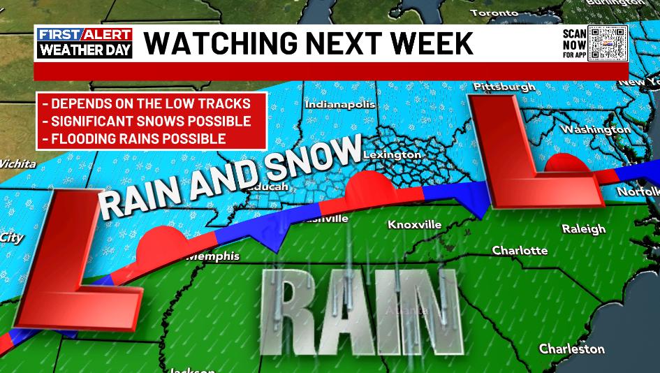
As we get closer, the models are growing more emphatic on a ton of precipitation impacting our region as multiple storm systems move through. Again, each model differs from run to run and that trend will continue for a few more days before we start to see better continuity.
The GFS is actually the model showing the best run to run constituency right now. Here’s what it looks like from Monday through Friday of next week…

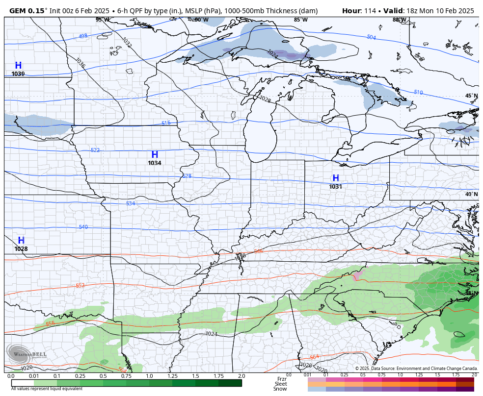
Here’s the Canadian for the same period…
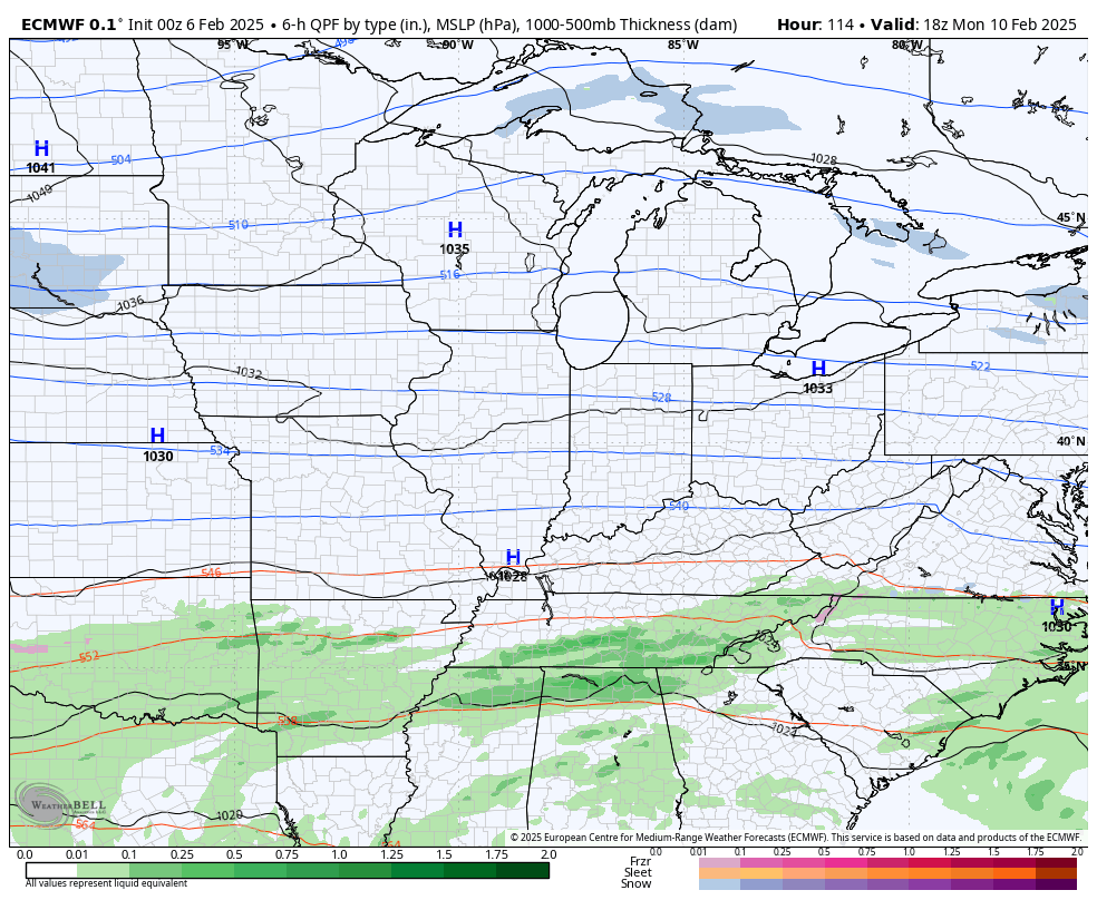
The EURO continues to track these systems a bit farther north and west compared to either of those two models…
Next week has the potential to be ugly, folks.
Updates come your way later today. Until then, I have all your storm tracking tools for the day…

Current watches

Possible Watch Areas

Enjoy your Thursday and take care.

2.85” of rain since it started barely 12 hours ago. Lightning storm like we haven’t had in our neighborhood in a while. A bolt must have hit a nearby transformer around 12:15 a.m. Generator came on and we fell asleep. Woke a couple hours later to quiet. No generator and no rain pelting the windows – until roughly 5:30 this morning. Still raining big drops.
Let’s hope for as little winter precipitation next week as possible.
Thanks Chris. Severe thunderstorms with lots of lighting and loud thunder early this morning. Did not get much sleep last night. I don’t know how much rain fell, but I bet it was over 2 inches. The track of the low early next week is a bit too far north to give my area one of those heavy wet Snowstorms. The kind of Snow that is best for the making of Snowmen.
Stay Safe Everyone !
Tornado watch remains in effect for much of south central Kentucky until 10:00am CST. About an hour ago a funnel cloud was spotted near Oakland, KY, but as of now the line of tornadic storms has cleared the Warren County area.
Overnight, just 0.07 inches of rain was recorded here in BG.
EF1 Tornado touched down just south of Magnolia, Kentucky. This is just a few miles from my home. I didn’t know that this part of Taylor County is in the middle of ” Tornado Alley. “