Good evening, everyone. Additional rounds of heavy rain producing showers and thunderstorms are pushing across the area, bringing another local high water issue. The pattern behind this calms down for a moment before it turns even more active into next week.
Watch those creeks and streams this evening across areas along and south of Interstate 64 as up to another 1″ of rain may fall through midnight. Some hail and high winds are also possible in these same areas.
Here’s a look at the current watches and warnings…
Friday looks like a good day before another rain and thunderstorm maker blows into town Friday night into Saturday. This will bring another local high water threat during this time before our boundary finally drops to to the south.
From there, this boundary turns VERY active with waves of low pressure moving through here. I have no changes to my thoughts on this as it will bring a ton of precipitation into the region. This precipitation will be in the form of rain, ice and snow, depending on where you are.
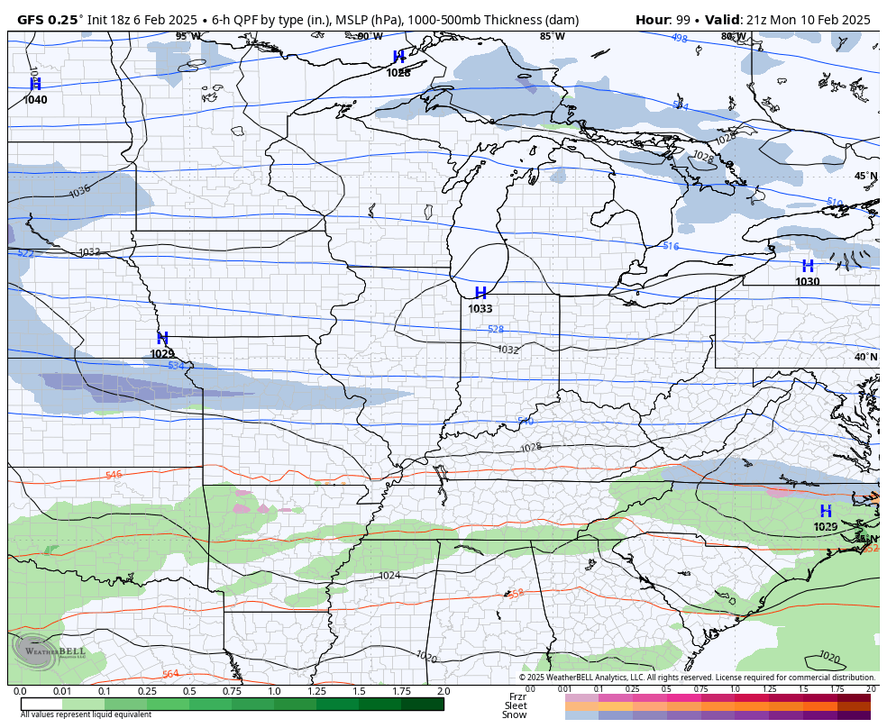
Here’s the GFS…
And the EURO through the same time period…
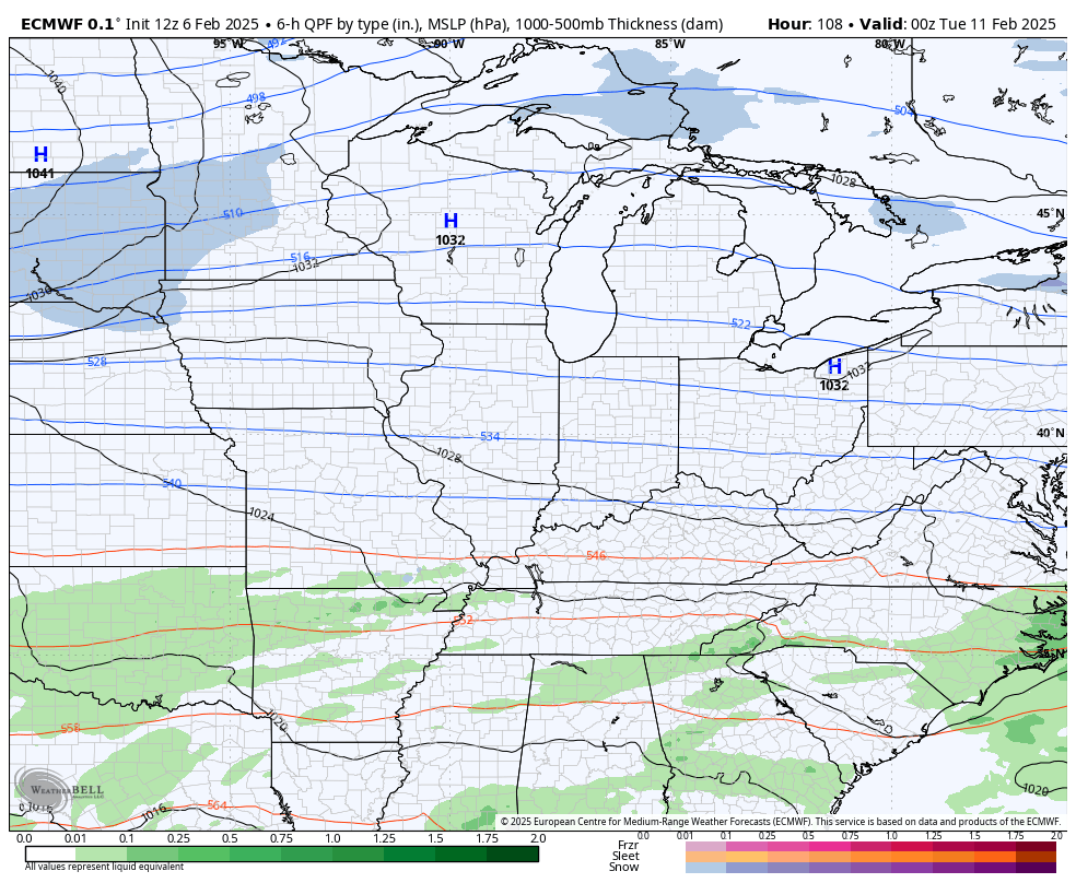
That’s not a good look as it’s one that can produce some significant issues in our region, both with flooding and winter weather.
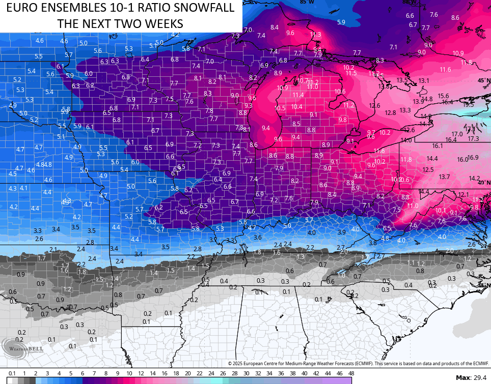
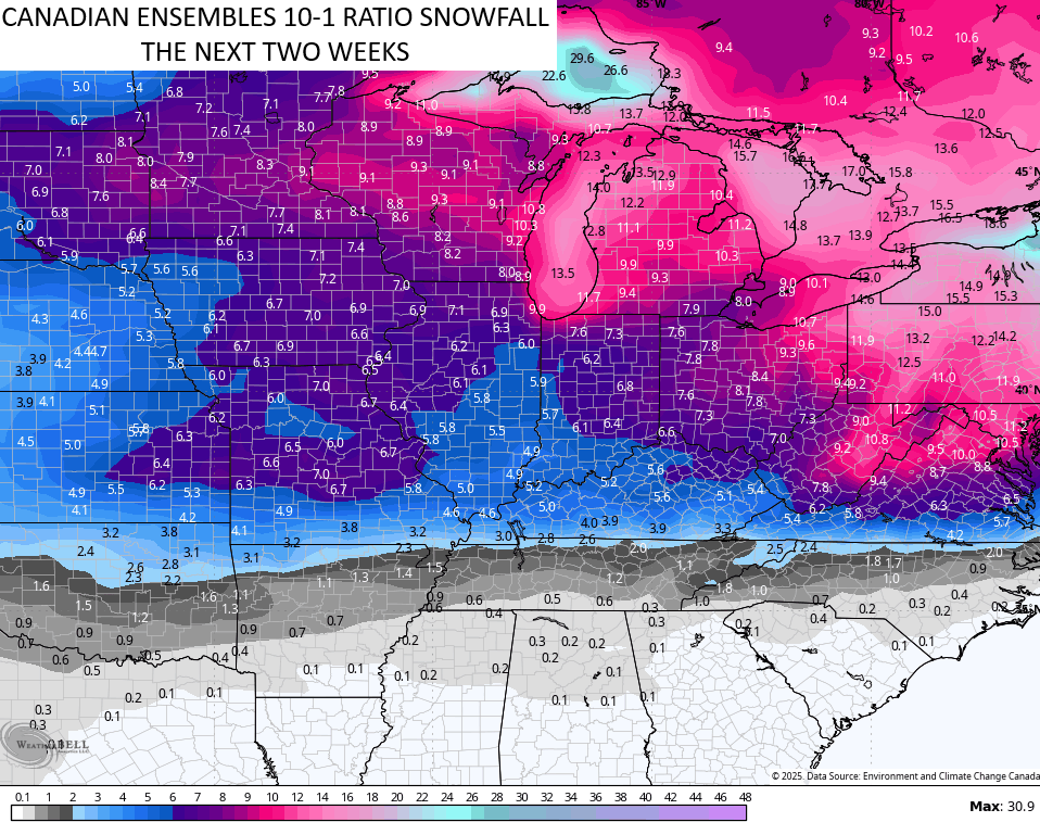
The overall pattern continues to feature some pretty good winter weather chances over the next few weeks…
I have you all set to track the showers and storms across the state…

Enjoy the evening and take care.
