Good Friday to one and all. We have a much calmer weather day taking shape but this isn’t going to last long. Another shower and thunderstorm maker moves in here tonight and Saturday with a much more concerning pattern for next week. That’s when flooding rains, snow and ice all impact our region.
Today features temps coming down into the 40s for many areas with a mix of sun and clouds. Those clouds are ahead of showers moving in tonight ahead of another cold front moving in. That touches off another steep north to south temperature gradient for Saturday and this helps to fire up showers and some thunderstorms.
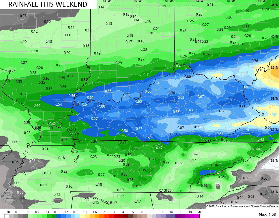
Locally heavy rains will accompany this action through Saturday night when the cold front finally clears the area.
The threshold for flooding is now really low so rainfall from a half to 1″ this weekend would be enough to cause more in the way of local high water concerns. Those are the numbers coming from the Canadian Model…
That front settles into the Tennessee Valley as seasonably cold air takes u residence in Kentucky. This boundary will then feature several storm systems developing and riding northeastward along it from Monday night through next weekend…
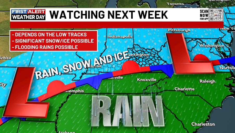
This leads to a nasty setup for Kentucky and surrounding areas with flooding rains, snow and ice all possible for our region. Here’s a quick breakdown…
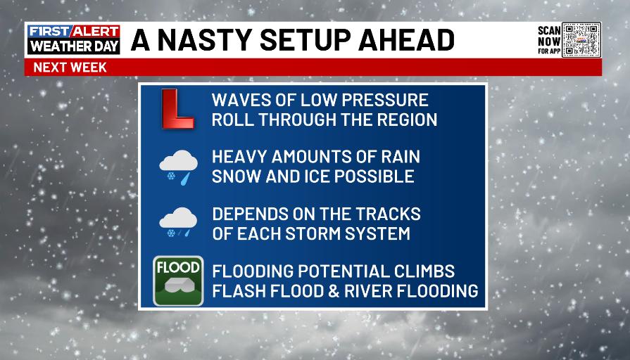
Does this mean it’s wall to wall nonstop? Of course not, but it does mean several systems are set to blast through here from Monday night through next weekend.
The operational models all have these systems, they just differ on strength and placement.
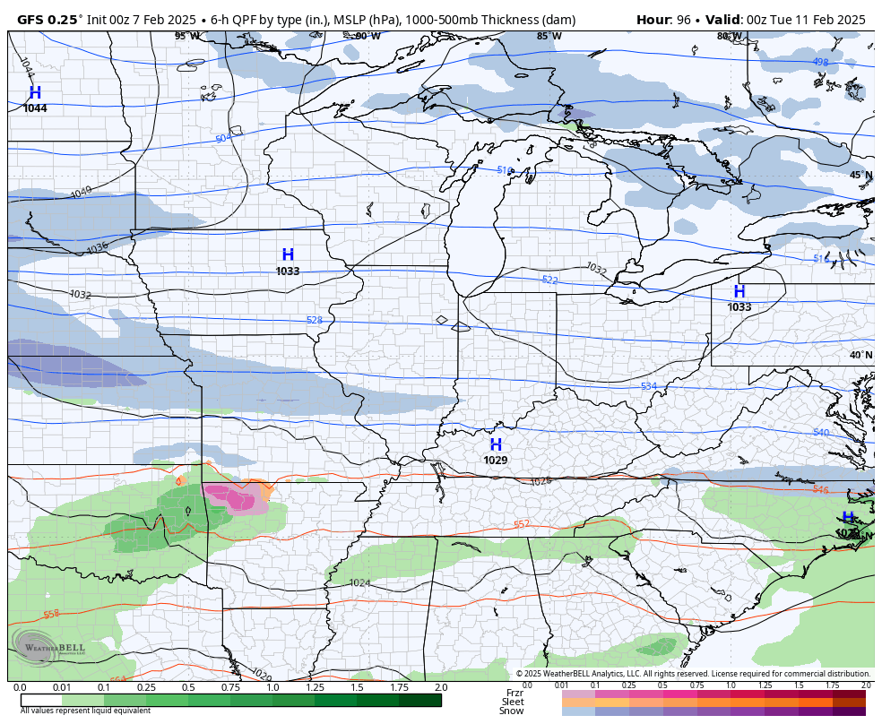
Here’s the GFS from late Monday through the following weekend…
The Canadian…
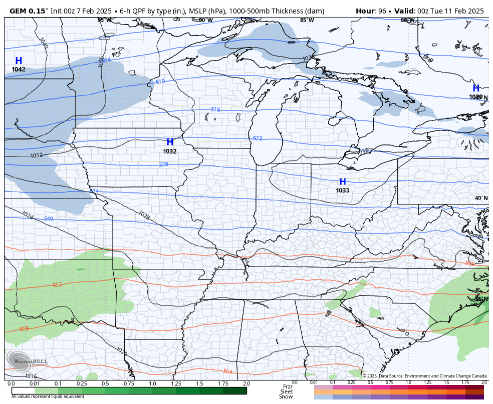
The EURO at the same time…

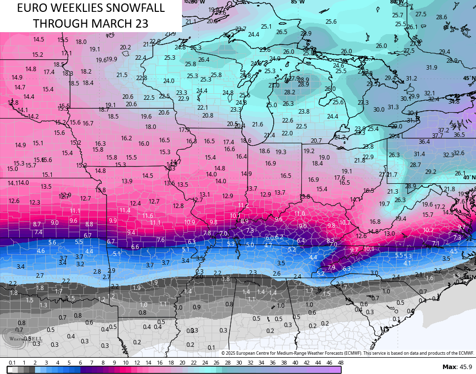
The EURO Weeklies continue to advertise the threat for winter weather deep into March. This is a snowy forecast…
I’ll have updates later today so check back. Make it a fantastic Friday and take care.

Let’s hope these models end up not verifying.
Thanks Chris. Hope the lows track farther south, so we may get on the all Snow action. Looks like north of the Ohio River, there could be some significant Snow totals next week. We shall see.
Have a Great Day Everyone !