Good evening, everyone. We have rain rolling back into the region and it brings along the chance for mor high water issues into the start of the weekend. This pattern will really kick into high gear next week as multiple storm systems target us with heavy rain, snow and ice.
The showers moving in this evening may even start out as a touch of sleet. This may also be in freezing rain form across far northern Kentucky late tonight and early Saturday.
For the rest of the region, showers and some storms fire up with the chance for locally heavy rains. Those locally heavy rains will fall on areas where we have a soaked ground that can’t hold much more. Here’s the area I’m highlighting for local issues…
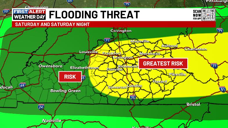
Once again, this region finds itself without a Flood Watch from the NWS in Jackson, even as the NWS in Charleston, WV has one out for one Ky county…
I’m not trying to pick on the NWS in Jackson, but my goodness we have had a lot of flooding the past week without watches OR warnings. I said the same thing one week ago today… That just can’t happen.
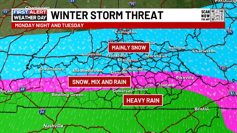
Looking ahead to next week, the pattern remains loaded with storm systems and precipitation. The first one arrives Monday night and Tuesday with snow, some ice and some heavy rain. Here’s the early look at how that may play out…
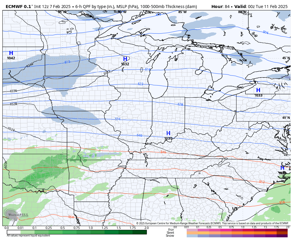
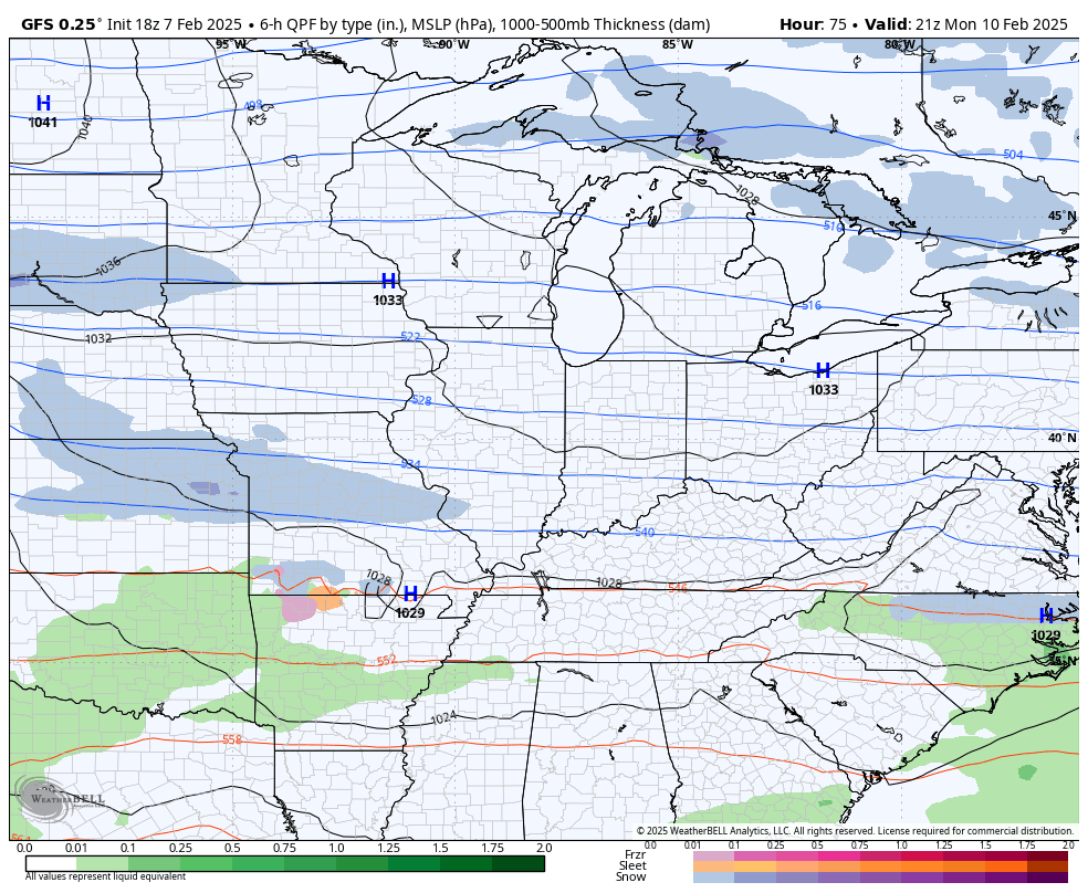
That’s the first in a series of storm systems blowing through here through next weekend. These animations from the EURO and GFS start late Monday and go through next weekend…
EURO
GFS
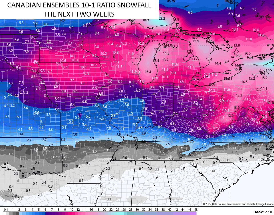
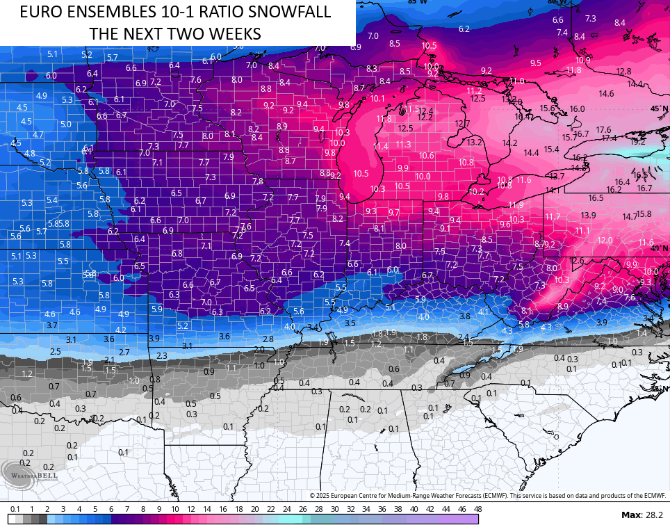
This busy pattern won’t end there as the overall pattern turns much colder. This will lead to additional winter weather threats for the following week and all this shows up very well on the Ensembles…
We will get into all this tonight with the full update. Until then, let’s track some Friday evening showers…

Enjoy the rest of the day and take care.
