Good Saturday to one and all. A few showers and storms are pushing across the region today and have the chance to create local high water issues. Beyond this comes a very active pattern that includes a Winter Storm THREAT for Monday night and Tuesday.
Let’s start with what’s going on out there today.
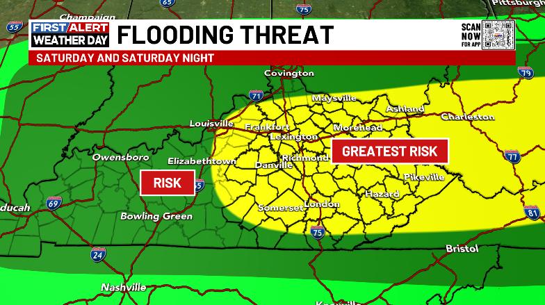
Scattered showers and a few thunderstorms are rumbling across the state today ahead of a cold front. Locally heavy rains are possible across central and eastern Kentucky and this may be enough to cause some high water issues to develop…
Here’s a look at the watches and warnings for the day…

As the front sweeps through here this evening, it will have a line of showers and storms along it. This isn’t like the setup from a few days ago, but there’s still the chance for a strong storm or two.
Temps ahead of today’s fronts may touch 70 again across the south and southeast before crashing behind the cold front. Winds are also a big player with gusts that can reach 40mph at times.
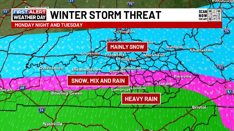
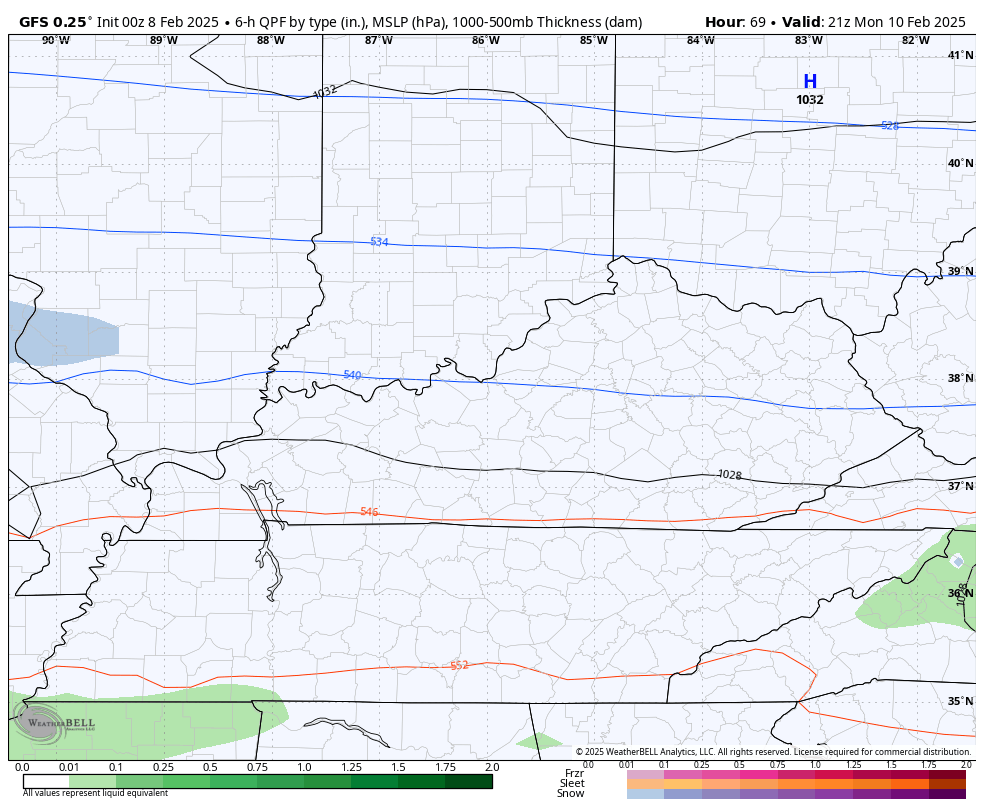
Our Winter Storm THREAT is for Monday Night and Tuesday as the first in a series of storm systems moves into our region. This will bring a swath of accumulating snows, mixed precipitation including some freezing rain and plain old heavy rain that can bring another flood threat.
Here’s my early call on how things try to play out…
Obviously, a lot can change in terms of the track of the low and with the various precipitation types and this is something I will be updating through the weekend. It’s still way too early for anyone to be talking totals.
This will then be followed by another system Wednesday into Thursday that looks to bring a lot of precipitation with it.
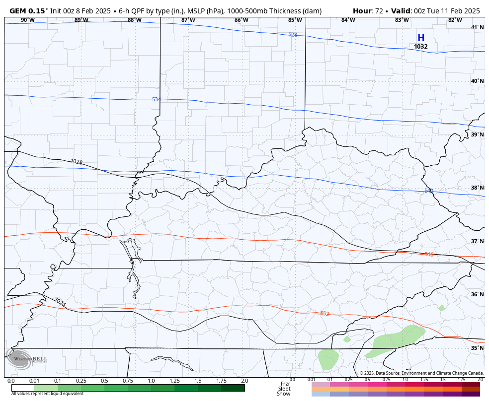
The Canadian Model has the most in terms of winter weather with both of these systems…
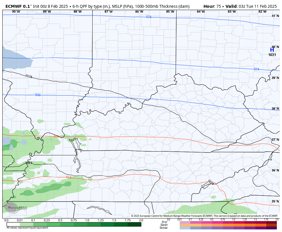
The EURO is getting more wintry looking with this initial system but is mainly a heavy rainmaker with the second storm…
The GFS is more widespread with the initial winter storm potential…
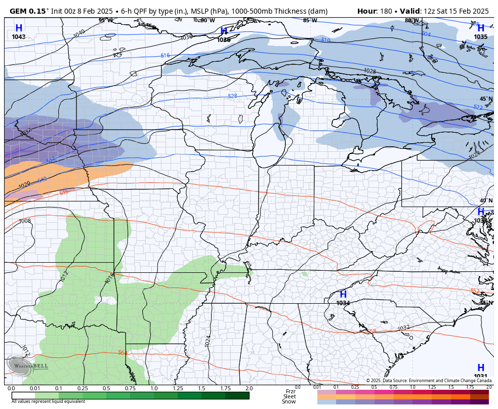
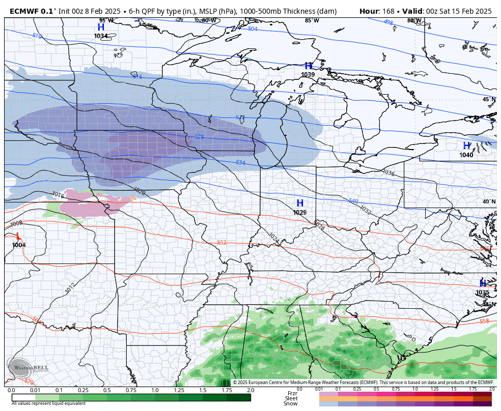
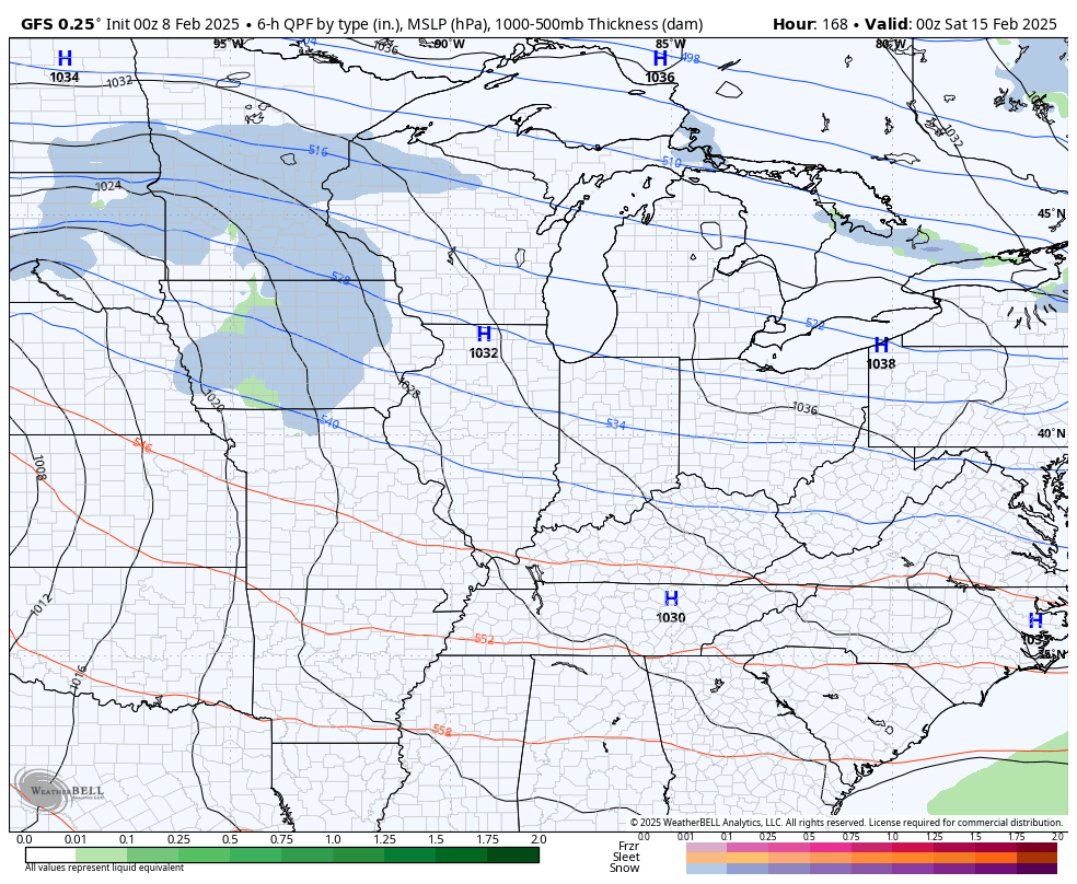
After a small break in the action on Friday, another big storm system targets the region next weekend. Once again, we find the models showing a fairly large spread in terms of the track of this system.
We have the Canadian and EURO models both showing a low tracking across Kentucky with widespread heavy rains and flooding, followed by some snow…
Canadian
EURO
The GFS seems to be an outlier in taking this low across Chicago…
The potential for significant flooding is with us from the middle of the week through next weekend. I’m not only concerned about flash flooding, but the potential for general flooding and river flooding will really go up. Please stay alert to the forecast in the coming days.
This won’t stop there as several more systems likely sweep in here the following week, threatening our region with heavy rain and heavy snow.
The latest EURO Weeklies continue to show a pattern evolving toward a very wintry look from mid-February through mid-March. Look at this deep trough setting up over that month long stretch…
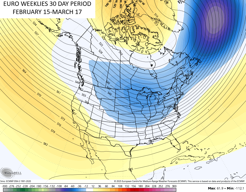
It’s also showing a lot of snow opportunities through the middle of March…
I’ll have updates coming your way later today, so check back in.
As always, I leave you guys with your shower and storm tracking tools for the day…

Current Warnings
Current watches

Possible Watch Areas

Enjoy your Saturday and take care.

Rooting against the EURO weeklies.
Thanks Chris. Looks like a few more weeks of lossy weather. I will be surprise if we have any accumulating Snows in my area of the state next week, but the cold, dry weather will occur later in the week. One good thing, I don’t have to worry about flooding, as I’m a long way from any river, but I hope there’s not any flooding anywhere.
Enjoy the Weekend Everyone !
I do have to worry about flooding. The river is already high. I am sure they are holding some water back. Looks like it will be ice or cold rain for me.I just hope not enough to flood we will see where the heaviest Rain sets up.
Basically we are getting 3 heavy rain makers.. Lovely! Come on Spring!