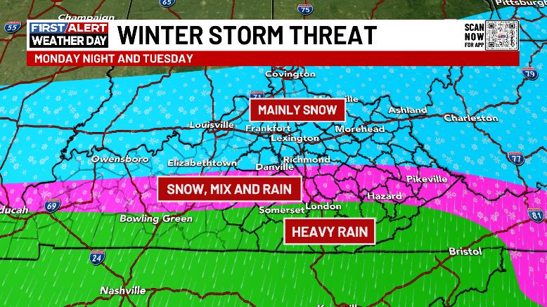
Good afternoon, everyone. Another round of flooding is ongoing across parts of the area s we get set for more heavy rain producing showers and storms to go up. Some of these storms may be strong or severe. Oh yea, our Winter Storm THREAT continues for Monday night and Tuesday.
Torrential rains developed along and just south of Interstate 64 early this morning with a corridor of 1″-2″ rains on the Kentucky Mesonet sites…
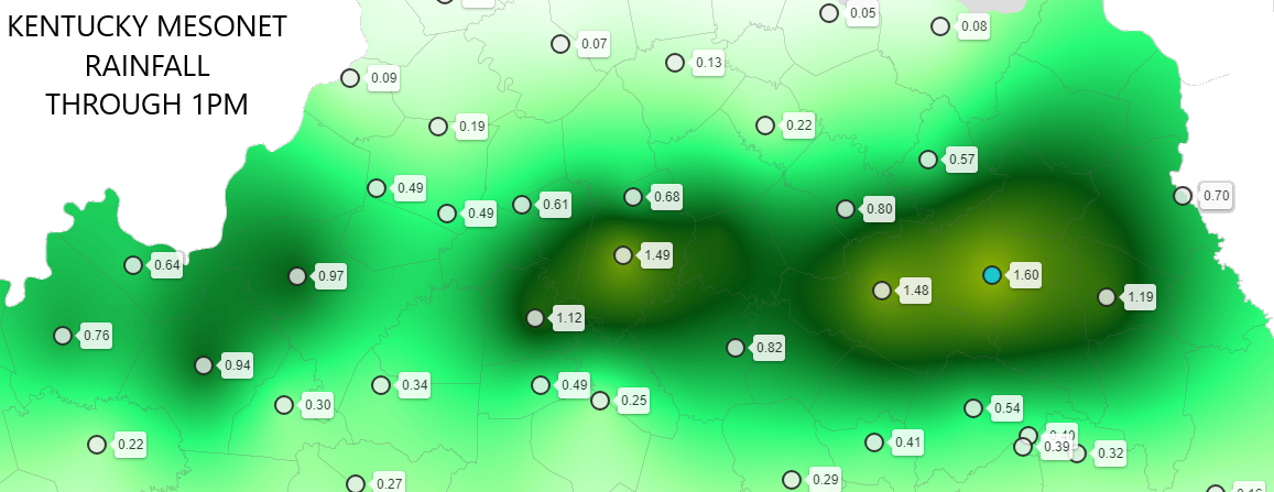
This falls right in the middle of the zone I’ve been highlighting for additional flooding issues…

This flooding is coming off of severe flooding just a few days ago and our local NWS offices have STILL not issued a Flood Watch with the exception of the NWS in Charleston, WV. That office has done a very good job with watches and warnings in the past few weeks. Our Ky offices have been really subpar.
With a surge of mild and slightly unstable air lifting northward through the state this afternoon, more showers and storms will develop. These can put down local 1″ rains and there’s the chance for a few strong or severe storms.
The Storm Prediction Center now has central and eastern Kentucky in the low-end risk for severe storms through this evening…

Damaging wind is the main player.
I have no changes to the Winter Storm THREAT Monday night and Tuesday…
I’ll be updating that later tonight into Sunday and will likely be out with a first call map at some point during that time.
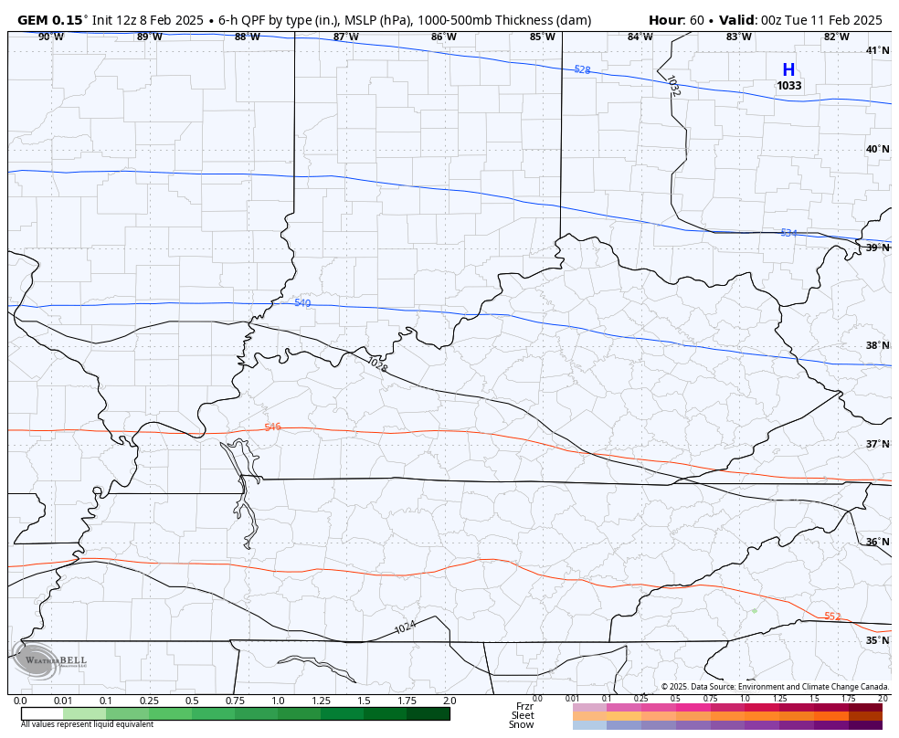
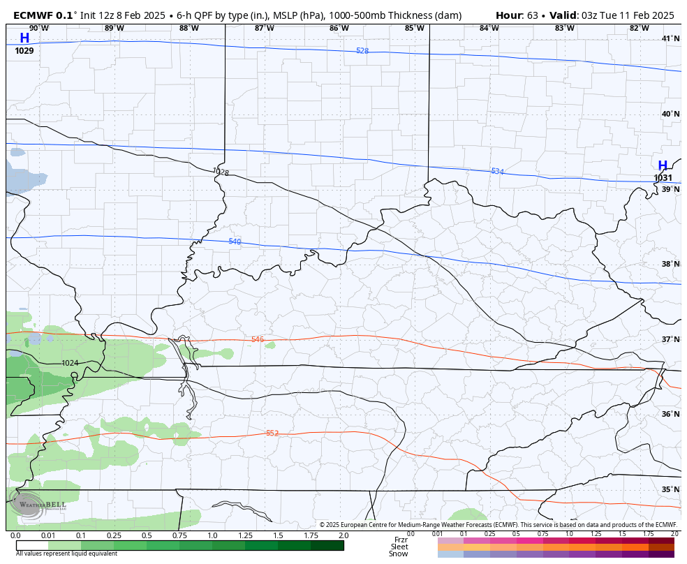
The forecast models continue to show a pretty good hit, but have enough differences to wait a bit and that includes the system behind it for Wednesday and Thursday.
The GFS is the most widespread and heaviest with the snows with this first system…

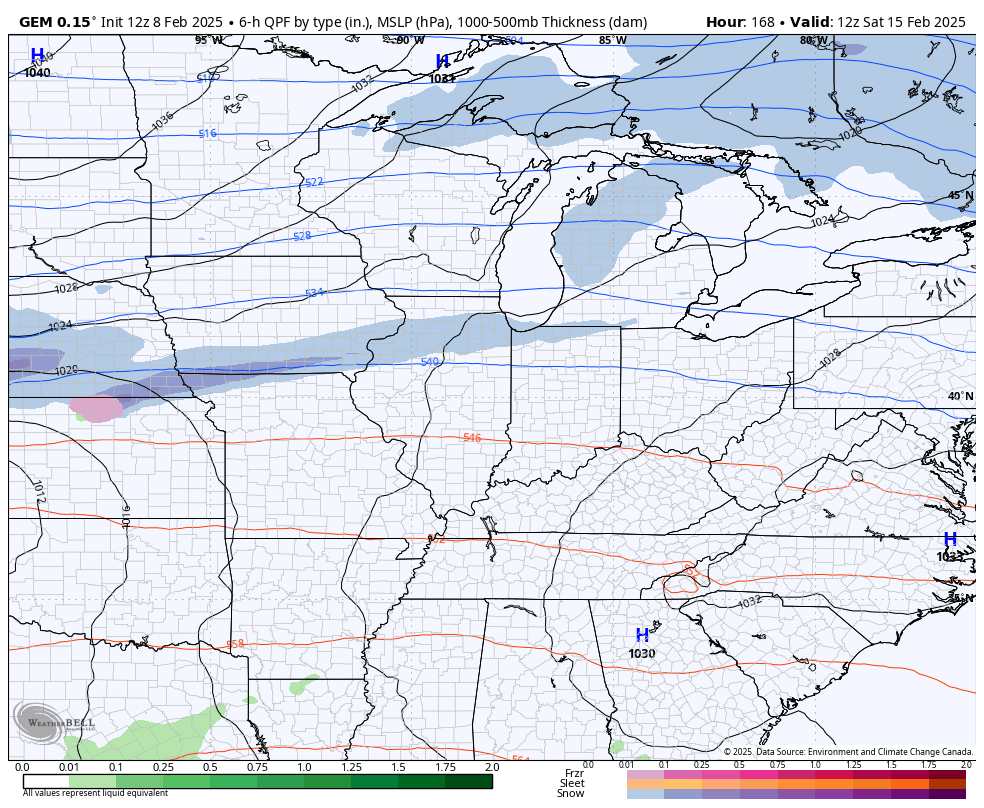
The Canadian isn’t too far off but has more of a mixed bag with the second storm…
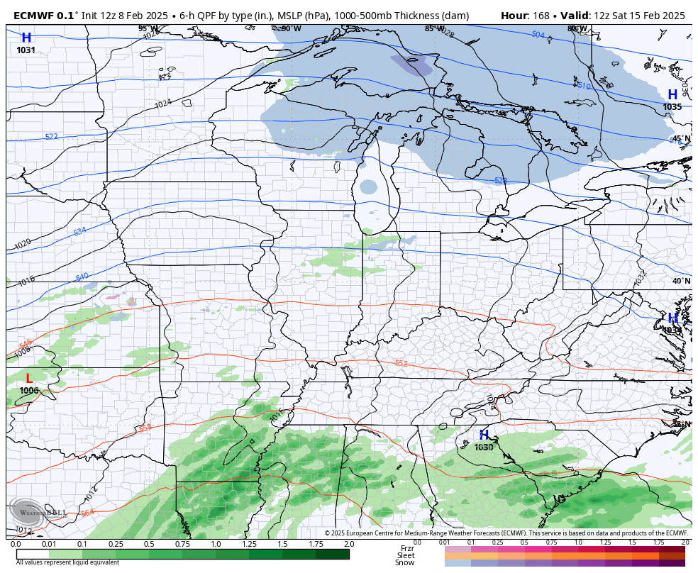
The EURO is in pretty good agreement with the Canadian on this first system…
A swath of several inches of snow with some freezing rain will likely show up with this Monday night and Tuesday system. Heavy rain in the far south and southeast will lead to another flood threat with the second system more of a heavy rain and flood threat areawide.
This gets followed up by another potent system over the weekend. Flooding rains, gusty winds with wraparound snows and a temp crash are the themes of the models…
EURO
GFS

CANADIAN
Another update or two comes your way later today. Until then, I leave you guys with your shower and storm tracking tools for the day…

Current Warnings

Current watches

Possible Watch Areas

Enjoy your Saturday and take care.

Chris can I return this forecast for the southeast and replace it with snow instead asking for a friend lol ???? Happy Super Bowl weekend. Really I just mostly watch the halftime shows.