Good evening, everyone. We’re putting the wraps on another day of flooding rains across parts of central and eastern Kentucky. As this tapers off tonight, we turn our attention to a Winter Storm THREAT Monday night and Tuesday and the potential for significant flooding.
A line of showers and storms is sweeping eastward across the state as a cold front pushes through. Winds reaching 40mph or greater are possible along and ahead of this boundary and there’s still the low-end risk for some strong to severe storms…

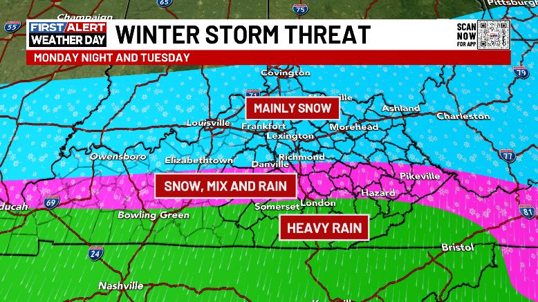
The Winter Storm THREAT continues for Monday night and Tuesday as the first in a series of storm systems impacts our region. This will bring the potential for a west to east swath of several inches of snow, some mixed precipitation including freezing rain, and heavy rains that can cause more high water issues.
My threat map remains unchanged…
The forecast models continue to show slight differences in how they handle this system and the potential for a second wave of precipitation Tuesday night and early Wednesday morning.
The GFS is still the coldest, most widespread and farthest south with heavy snows…

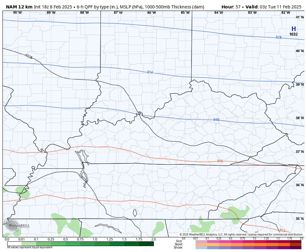
This setup is now within range of the NAM, but we know the NAM has been really bad this winter, so there’s that. Still, here’s what the model is seeing…
The Short Range Canadian is the strongest with our system and also jogged a bit north…

The new EURO also has quite a bit of precipitation showing up with this…

That will be followed up by another system later Wednesday into Thursday with another strong system arriving behind that this weekend. Both of these systems have me VERY concerned about the flash flood and general flood potential during this time.
Here’s the GFS…
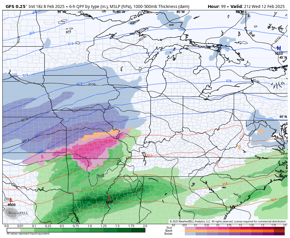
Folks, these systems are LOADED with precipitation and we really need them to produce as much snow as possible. If they wind up being more rainmakers than anything else, we are going to be in some trouble and that flooding will extend to our rivers.
I hate the look of this setup.
I’ll have a full-blown update later tonight with updates on the expectations from the Monday night and Tuesday winter storm and the overall flooding potential.
I lave you crazy kinds with your storm tracking tools for the evening…

Current Warnings

Current watches

Possible Watch Areas

Enjoy the rest of your Saturday and take care.
