Good Sunday, everyone. It’s a much calmer day across Kentucky but this isn’t going to last very long. We have one heck of a week of weather taking shape with a Winter Storm Threat and the increasing potential for significant flooding issues.
Temps out there today range from the mid 30s to mid 40s in most areas with a mix of sun and clouds. Monday looks rather similar to what we have cooking out there today.
Low pressure develops in the Mid-Mississippi Valley Monday and scoots eastward through the Tennessee Valley Monday night through Tuesday night. This brings a swath of accumulating snow that can put down several inches with a stripe of mixed precipitation south of that. Farther south is heavy rain that can cause flooding.
The exact track of that low means all the difference between heavy snow and heavy rain for any one location. I put together this map back on Thursday and I still haven’t found much of a reason to change it…
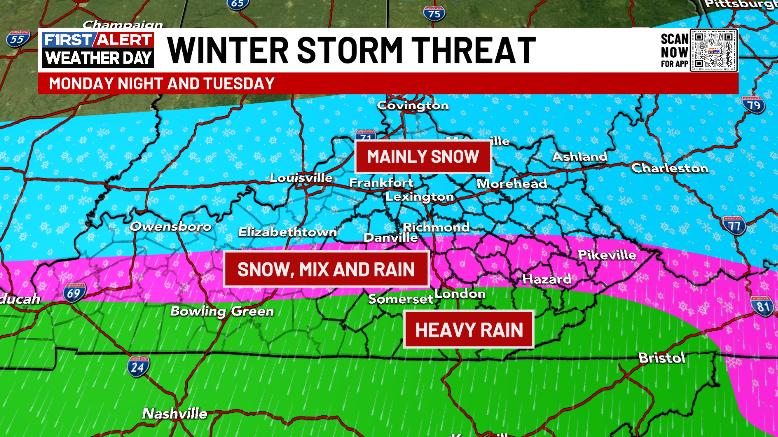
I’m going to put out a First Call map later today, but I do expect it to have a west to east based swath of snows that can reach 4″ or more. Where do I put this? How narrow of a swath is it? Those are just a few of the questions I have to tackle today. That and do we get enough mix and freezing rain to cause some issues. Never a dull moment, folks.
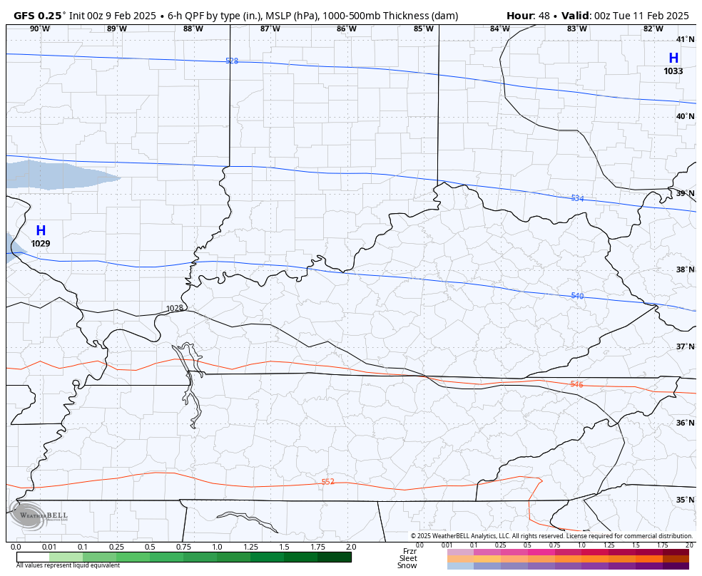
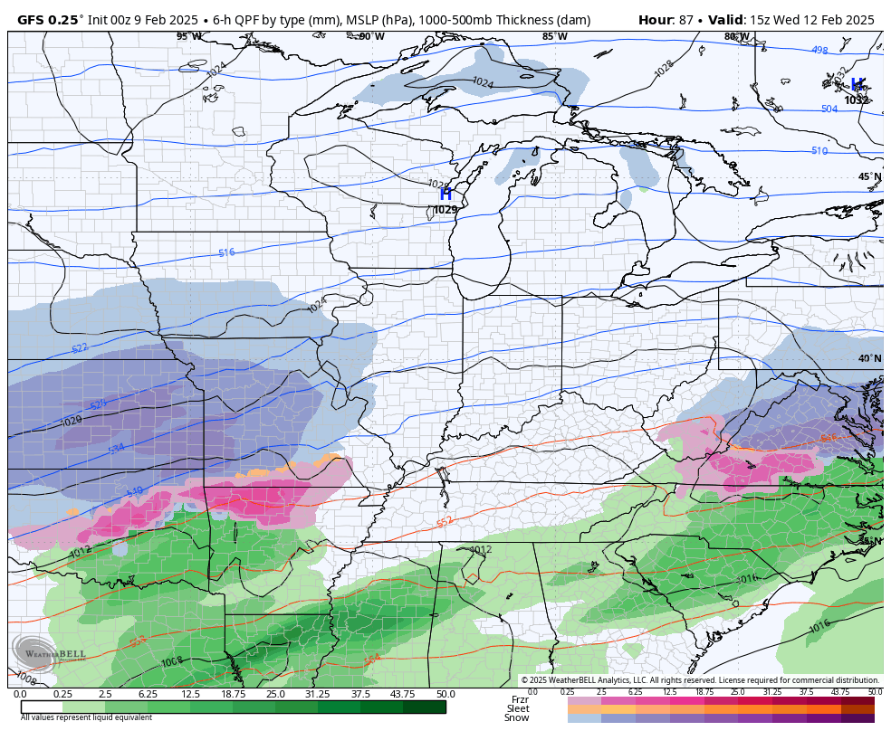
If you’re a snow lover, the GFS is still your model of choice as it produces a wide swath of VERY heavy snow for much of the state…
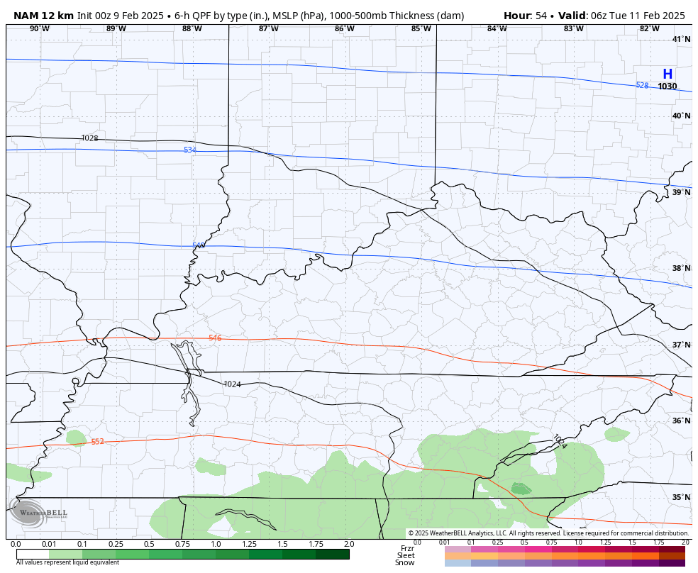
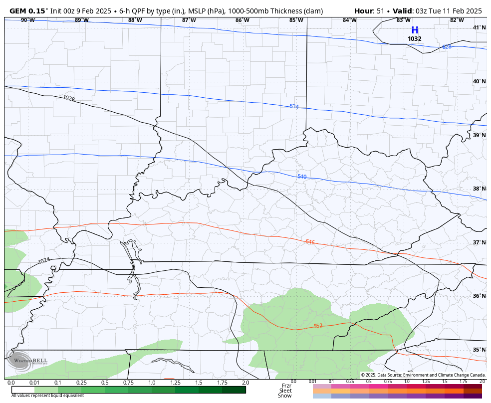
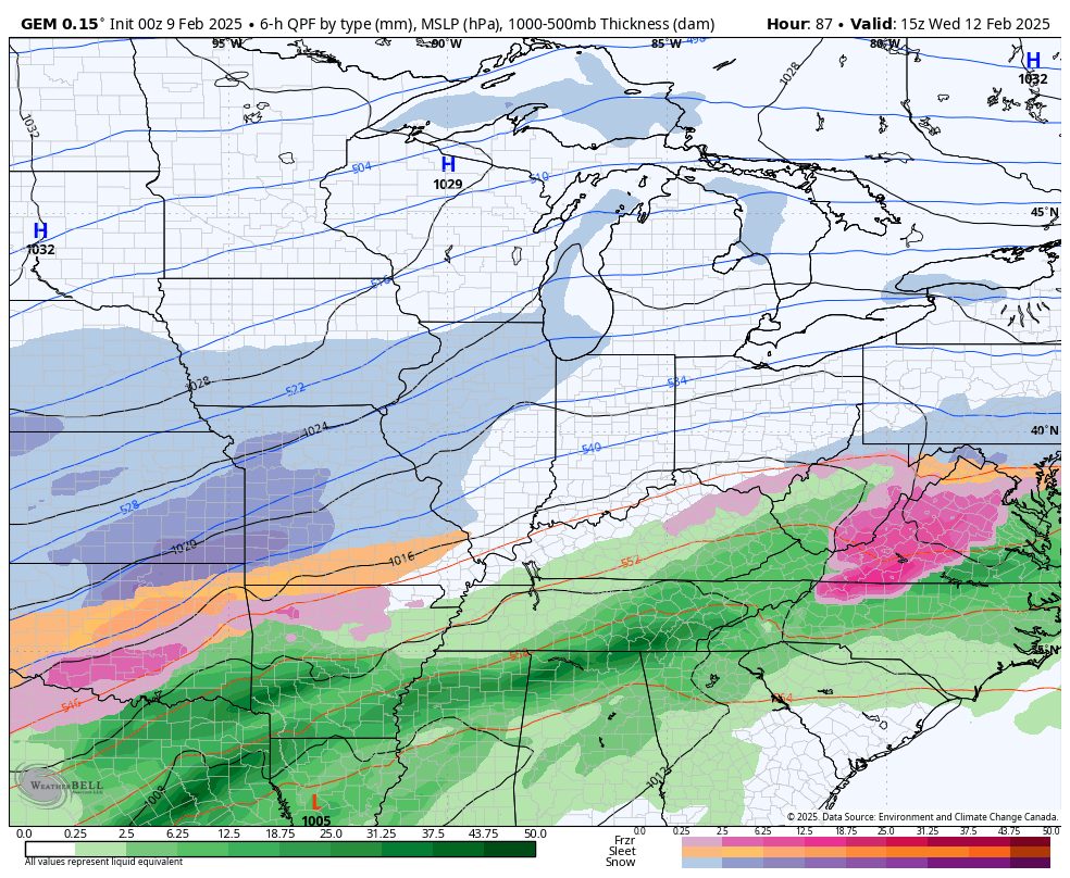
The NAM isn’t too far behind, but it’s farther north and actually looks a lot like my Threat map with the overall placement of everything…
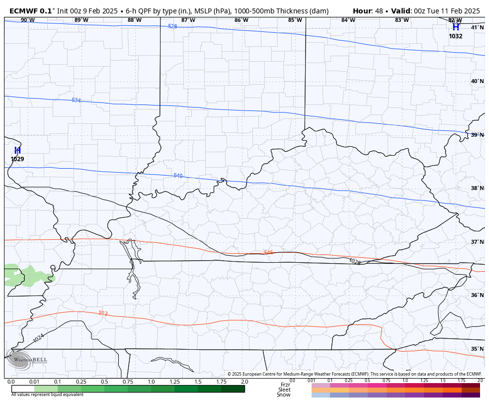
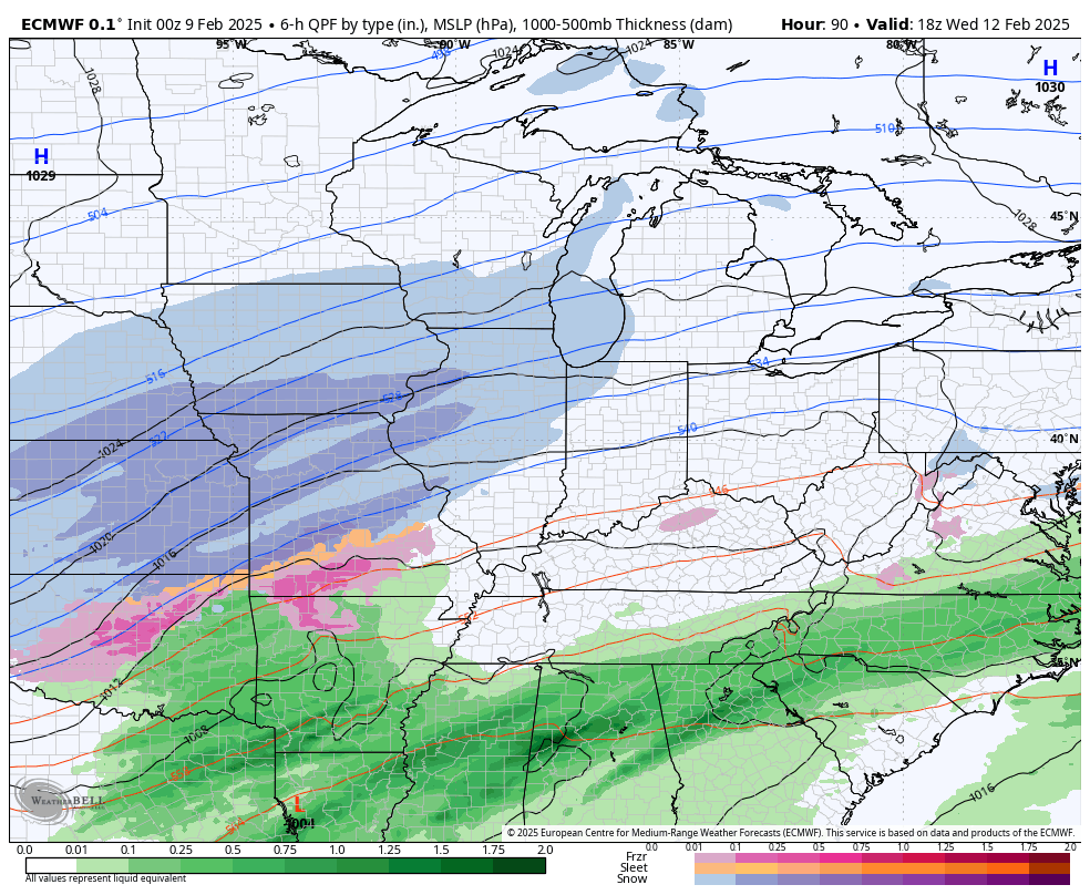
The EURO is very similar…
The Canadian Model has the most overall precipitation and is a bit north…
This will be followed up by two more big storm systems. The first one moves in later Wednesday into Thursday with the second system moving in over the weekend.
The GFS is too weak with the first system but seems better with the second one over the weekend. That one brings a lot of rain and wind before ending as snow as cold air crashes in…
The Canadian Model has more of a winter look with both of those systems…
The EURO has the same general look but is even stronger with the weekend storm system. That would bring a ton of rain and high winds before a switch to snow…
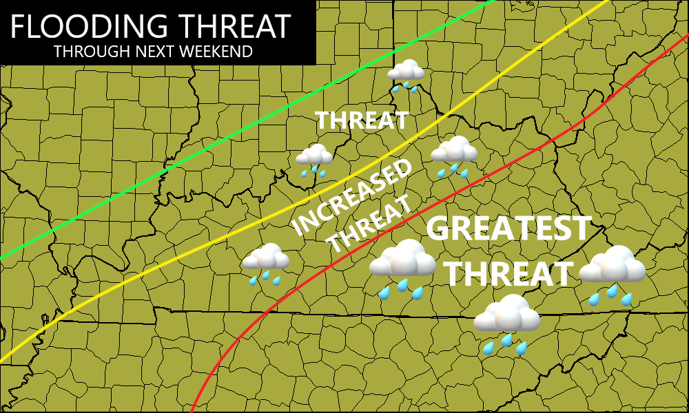
Given the state of the soaked ground and the upcoming storm tracks, here’s the area I’m highlighting for flash flooding and general flooding at various points over the next week…
I’ll be back with updates through the day and one of those will be a First Call For Snowfall.
Have a great Sunday and take care.

All the computer models are favoring the Chicago area for significant snows in the next week. Something to look forward to! Maybe we can double the anemic ten inches of snow we have seen so far this winter.
Mike, Here in Kentucky, we are more concerned about Flooding in parts of the state than accumulating Snows. My Snowfall total for the year is right at 6 inches, which occurred in January. They had some 15 inch Snow totals around the northern and northeastern parts of the state. I’m hopping Spring like weather will happen in about a month. I’m worried that we may have an active Tornado season, but I hope not.
Enjoy the Superbowl Mike and Everyone Else !