Good afternoon, everyone. Our Winter Storm THREAT continues Monday night through Tuesday night as the first in a series of storm systems pushes across the region. This will bring a swath of several inches of snow with it, but exactly where that shows up is still a bit of a question mark.
For those new to KWC, I put out a Winter Storm THREAT to heighten awareness to the possibility of snow and ice and that’s what we have here. As we get closer and confidence increases, we upgrade to a Winter Storm ALERT. That is likely to happen later tonight or Monday. If confidence goes the other way, we stand down and wait for the next one.
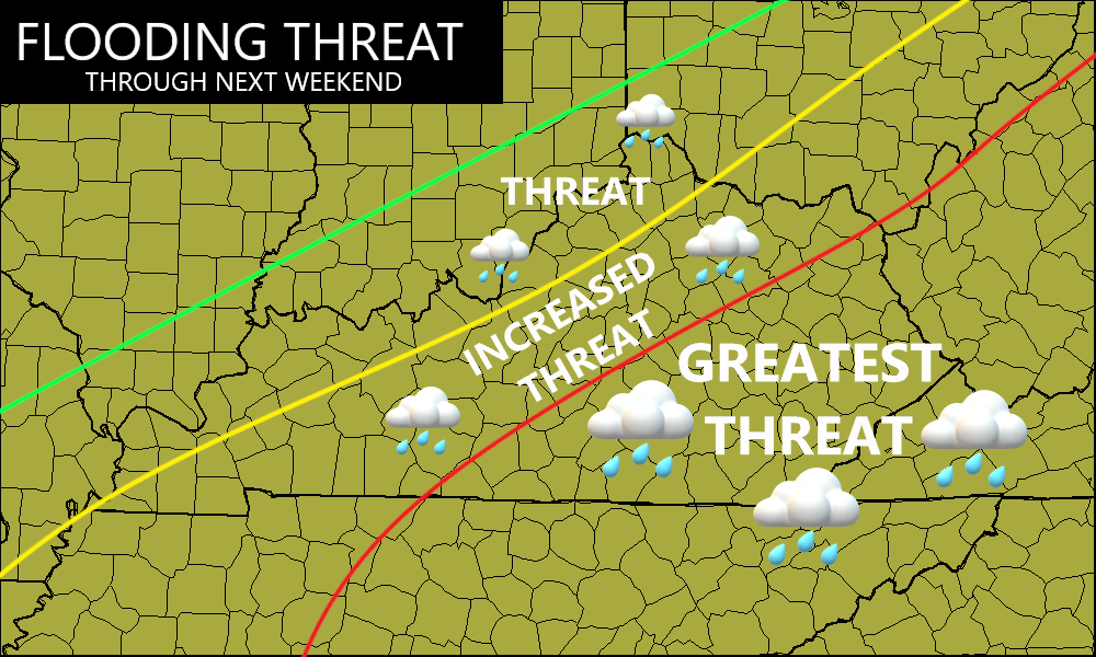
Listen, there’s nothing I’ve seen to make me change the overall threat map I made for you guys on Thursday…
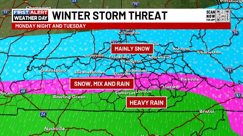
Here’s a breakdown:
- Low pressure rolls from the Mid-Mississippi River Valley on Monday to the Tennessee Valley late Tuesday.
- This brings a general west to east moving round of snow, rain and a touch of ice.
- The farther south you live, the biggest threat for this is flooding as another 1″-3″ of rain will be likely. Flooding is a big concern.
- Areas along and north of the BG parkway and the Mountain Parkway have the best chance of picking up on several inches of snow.
- A little bit of freezing rain and a mix will buffer the heavy rain zone with the heavy snow zone.
- I’m working on a First Call For Snowfall and I’ll have that out later today
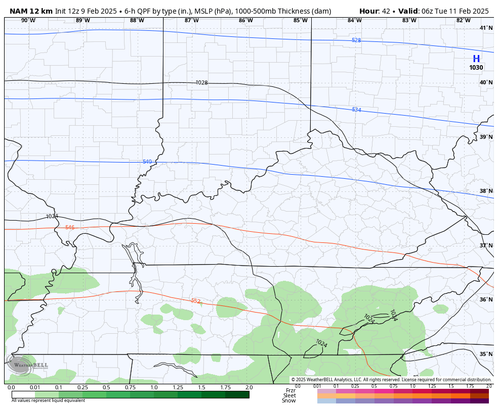
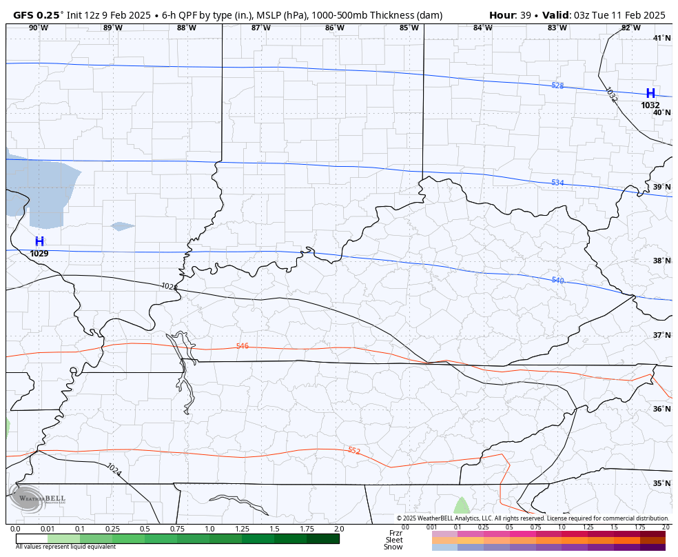
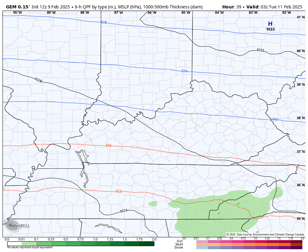
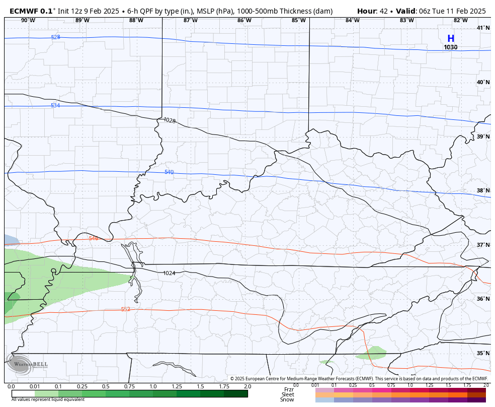
The models are coming into a pretty decent agreement and most of them look like my threat map.
Here’s the NAM…
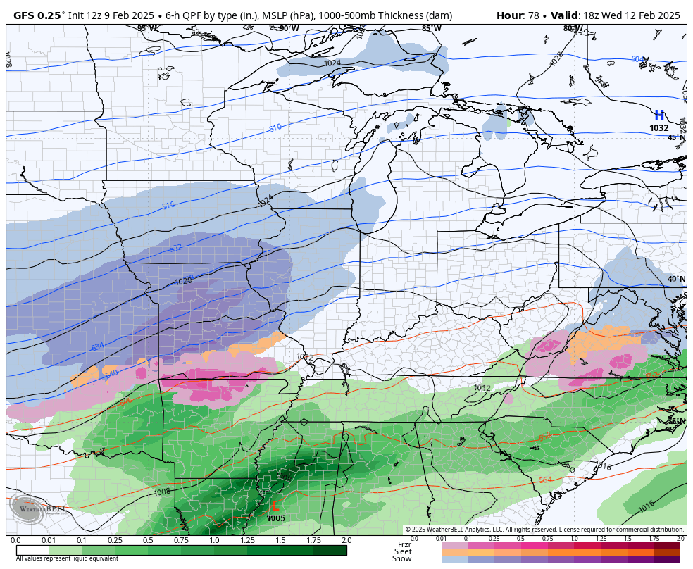
The GFS is still the farthest south but it’s slowly inching northward…
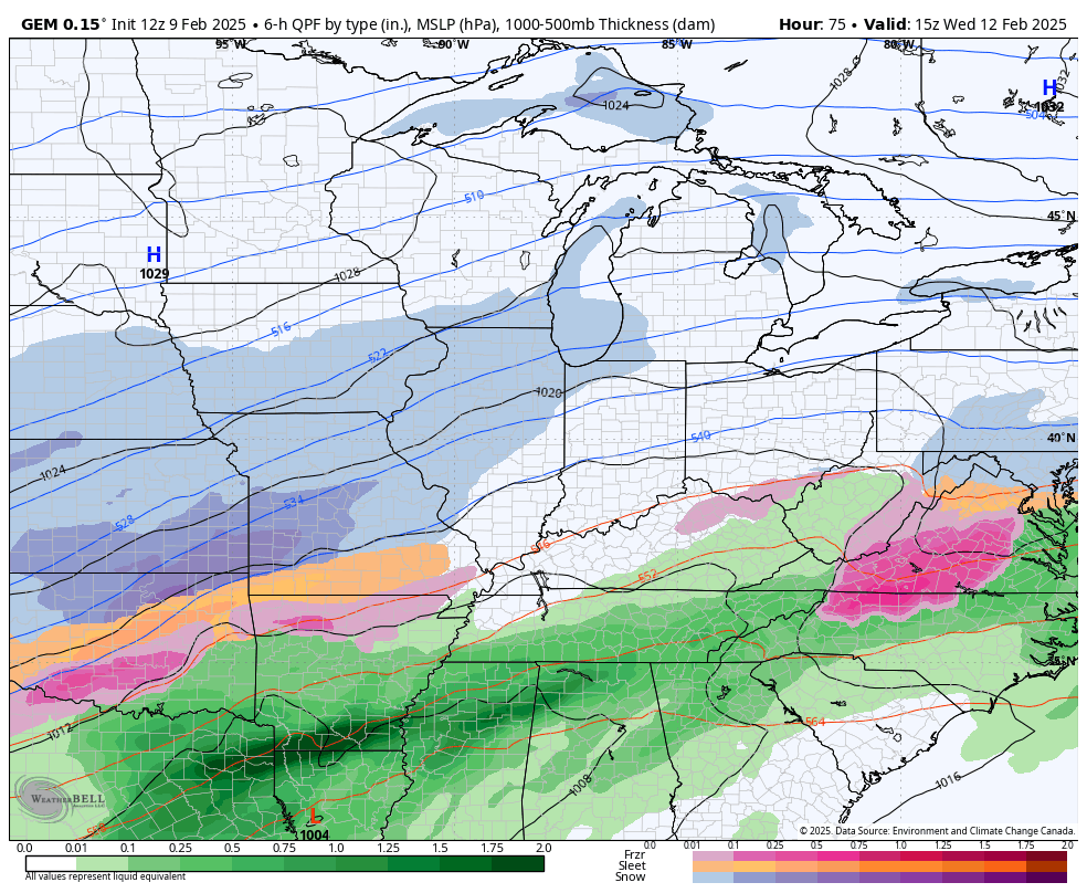
The Canadian is pretty steady…
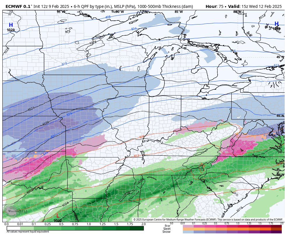
The EURO is also holding the line with prior runs…
Not everyone gets a lot of snow from this and not everyone is going to see snow. We good with that?
Two more storm systems will follow this up with the next arriving later Wednesday into Thursday. This looks like a rain maker that can cause high water issues once again. That may end as some snow on Thursday. From there, we wait for a much more potent setup for the weekend. This will be a strong system bringing a ton of rain that has an increasing chance to switch to a decent snow event.
The trend on the models is for this weekend storm to track farther southeast.
Here’s the EURO from Wednesday through Sunday night…
The Canadian during the same time…
The GFS has both of these systems and even tries to bridge the gap with a Friday storm system…
Again, flooding is a HUGE concern of mine over the next week as our ground is saturated and our waterways are already running high. The bar for any kind of flooding is now set VERY low, so it won’t take much to cause issues. Unfortunately, I can see some areas picking up 5″ or more of rain in the next 7 days.
Here’s the area we are focused on…
I’ll stop by with updates later today. Have a great Sunday and take care.
