Good evening, everyone. On this Super Bowl Sunday, Old Man Winter is getting ready to flex on our region as a developing winter storm targets this part of the country. A swath of heavy snow shows up Monday night through Tuesday night as we kick off another hyper-active period.
We continue with a Winter Storm Threat for this system with a likely upgrade later tonight or Monday. Without further ado, here’s your First Call For Snowfall…
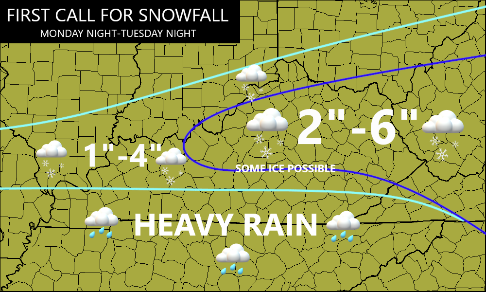
That’s just the first call and, likely, won’t be the last as this system comes into better focus tonight and Monday.
The NWS in Charleston, WV continues to be on top of their weather game compared to all other NWS offices that cover Kentucky. They are already out with a Winter Storm Watch for their 4 northeastern Kentucky counties…

Watch this system move in on the future radar from the Hi Res NAM. This animation goes from 1am Tuesday through 1am Wednesday…
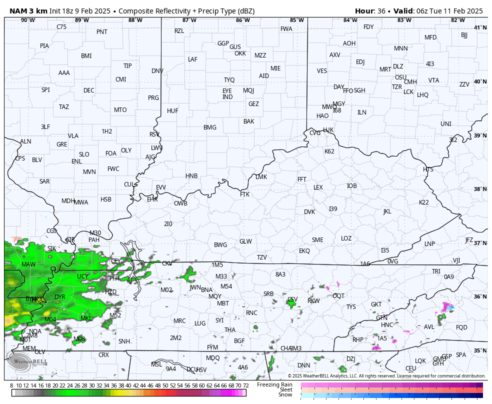
You can see the lines of heavy snow, mix and plain old heavy rain showing up very well there.
Many of the forecast models now have totals exceeding my forecast and that’s a trend to watch with the next few runs.
The Hi Res NAM snowfall has some hefty numbers…
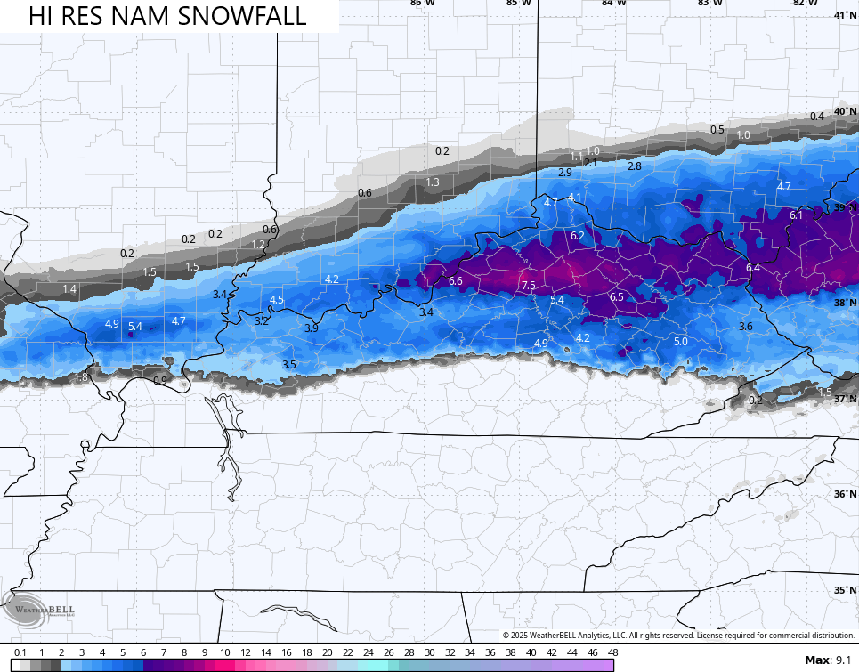
The NAM is above and beyond those numbers and likely overblown and too far north…
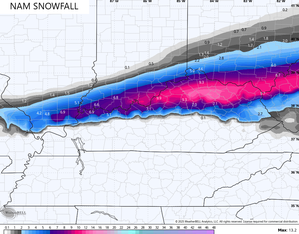
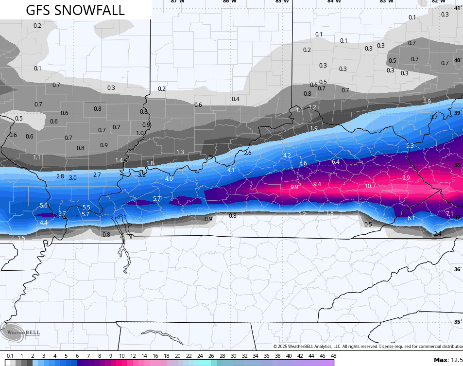
That said, the GFS has similar totals but is likely too far south…
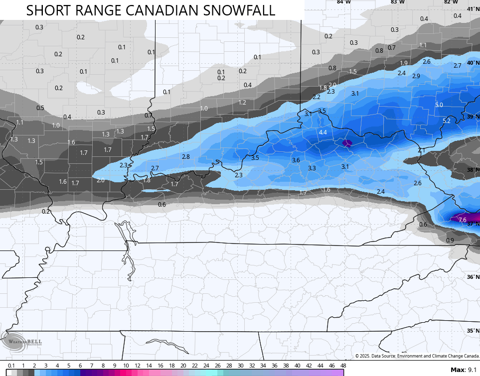
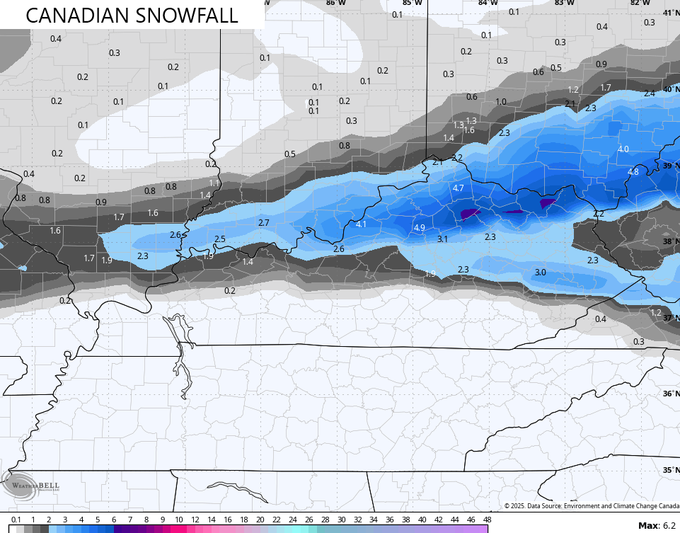
The Canadian models have been really good this winter and are way, way under what those models are showing…
The ICON has a similar line of thinking…
![]()
![]()
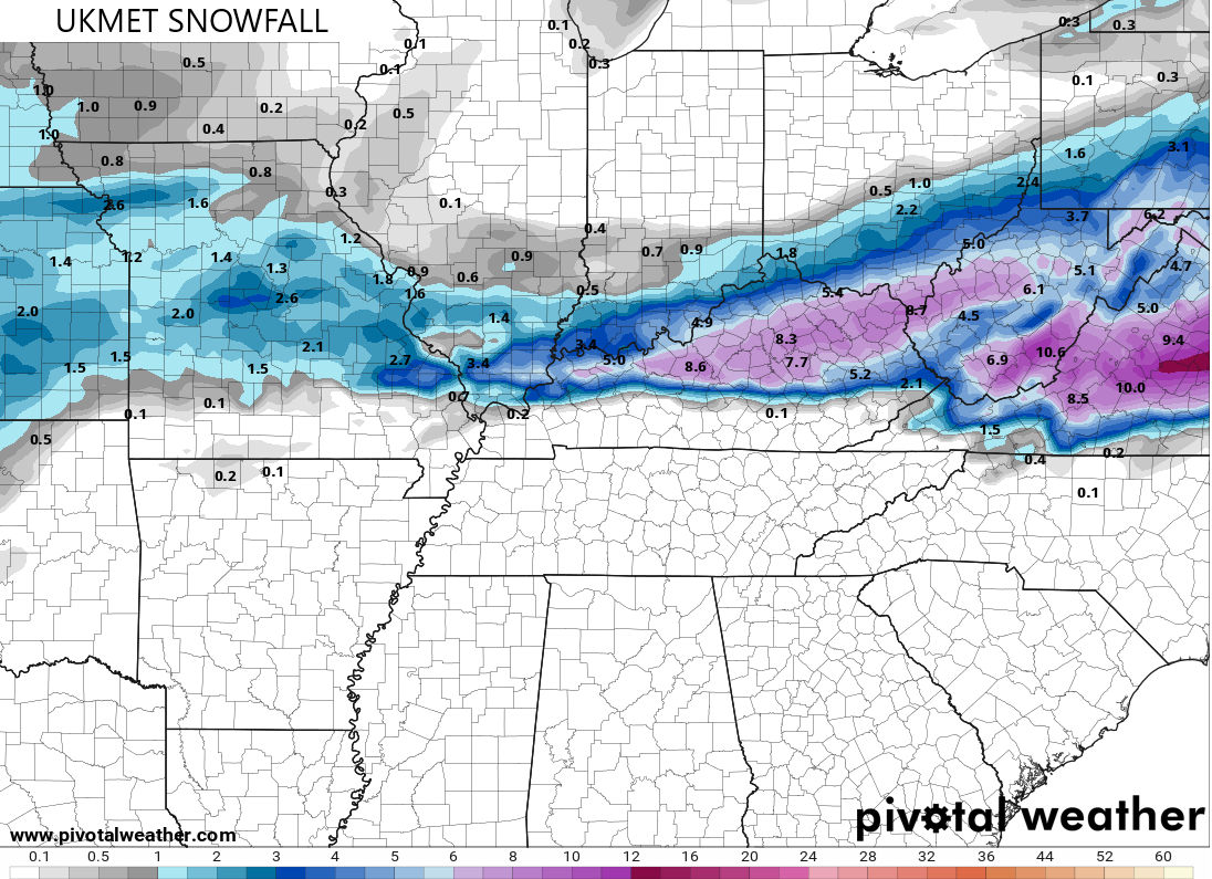
The UKMET, however, is more in line with the heavier snow numbers…
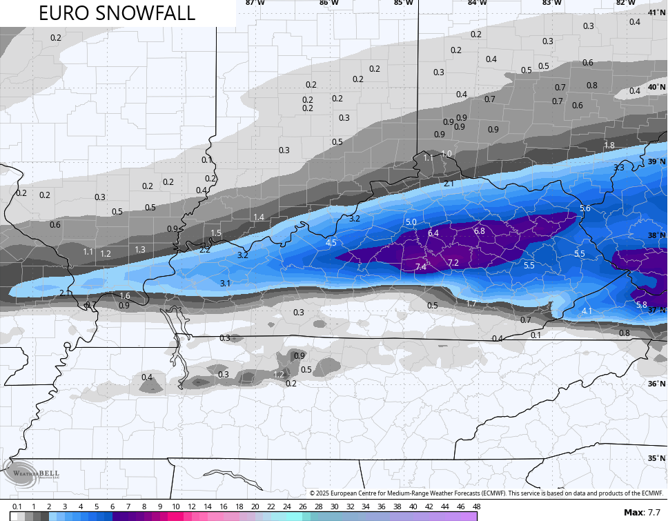
The latest EURO seems like a good compromise…
So, after looking at all available model data, why wouldn’t we have a Winter Storm Watch for more than just 4 counties in the northeast? I dunno.
Additional systems show up behind this with flooding rains a really possibility and I have no changes on the next week of flood potential…
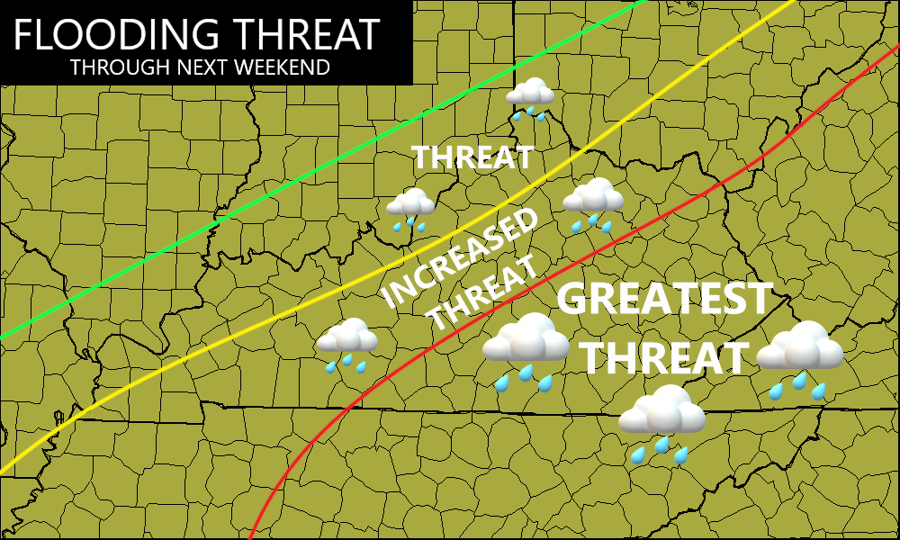
At this point, issue a Flood Watch from Tuesday and let it run through next weekend.
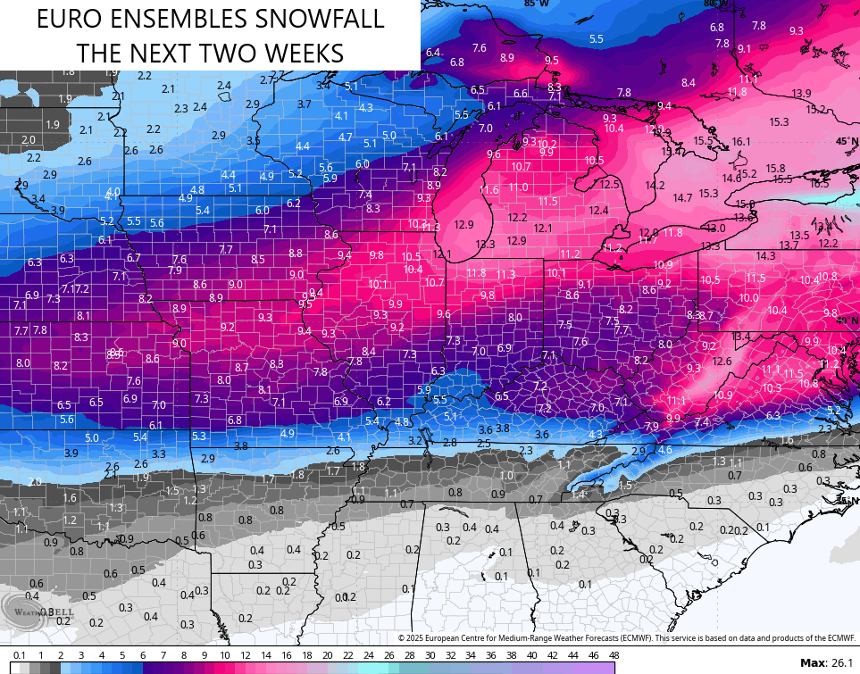
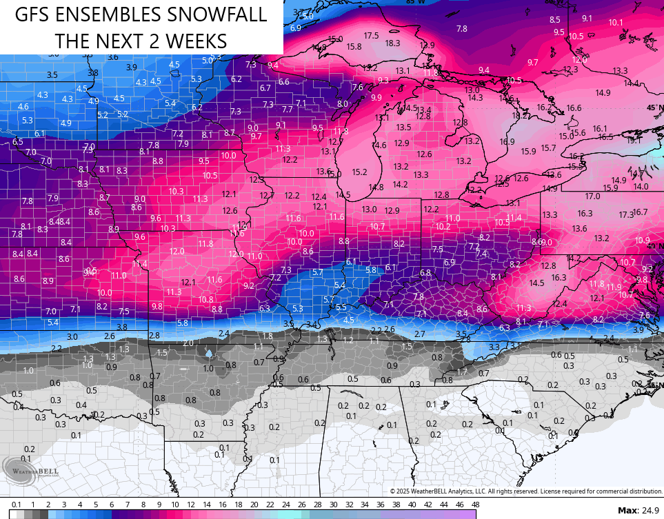
This active pattern rolls through the next two weeks with more heavy rain and winter weather chances. The Ensembles look show the additional snow threats…
I may drop by for another update after the Super Bowl. Enjoy the evening and take care.

Chris I hope I stay snow but doesn’t look like it for the duration. I am concerned for flooding our river is already up high from previous rain so any snow would help instead of all rain. I will be following you as always.